Categories
Carimbologia A-B

Amarante, Piauí (API-0010)

Atlas do Imperio do Brasil, 1868

Another name: São Gonçalo de Amarante

See also São Gonçalo (SPI-0199)

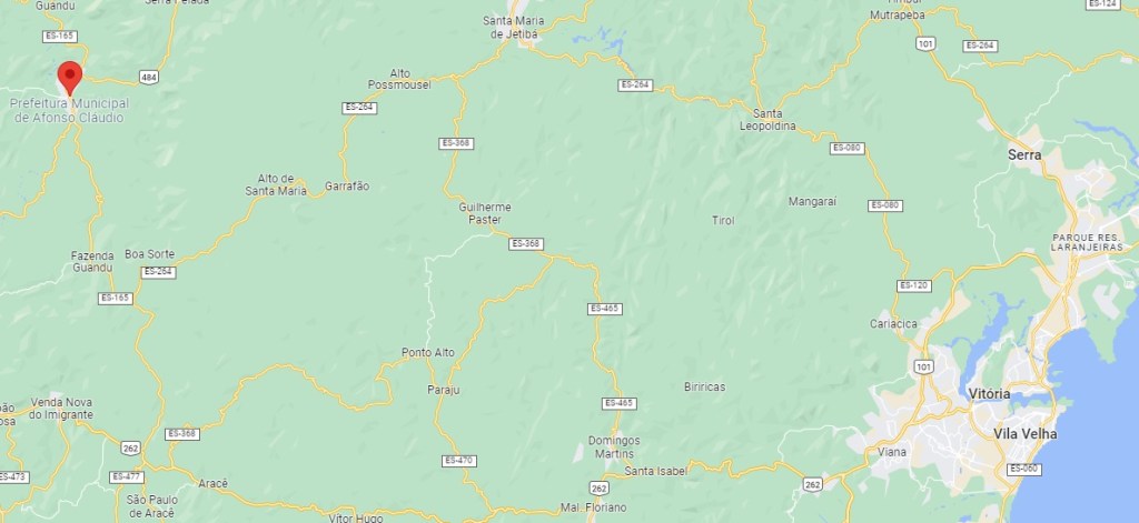
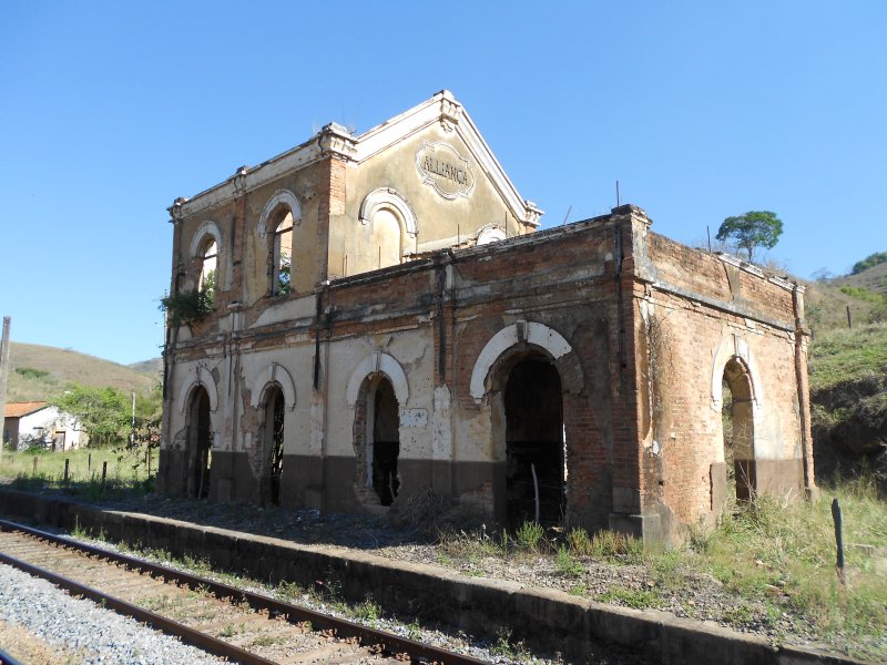
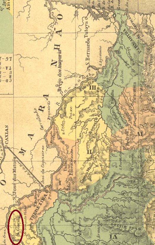
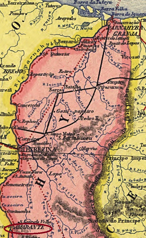
This villa has a long and confused history, which is directly connected both to the current city of Amarante and the old Villa of São Gonçalo. Both villages were one but were separated in 1861 when a large part of the local population, together with the administration, moved to an area closer to the River Parnaíba, located 160 km south of the provincial capital Teresina. The resettlement was called Amarante, and the former S. Gonçalo (S. Gonçalo Velho) became in August 1871 the district of São Gonçalo da Regeneração under Amarante.

As one reads in the Directory of Imperial Post Offices (Tabella das Agencias do Correio do Imperio, Rio de Janeiro, 1885), there had been a post office there since 1880. This date is likely to be a reopening, as the Imperial Postal Guide (Guia Postal do Império do Brazil, Rio de Janeiro, 1880) already listed the agency. Two postmarks were found for the imperial period. API-0010a (illustration from the Internet) is a simple double circle with the inscription AMARANTE at the top and dates in the middle between 1883 and 1892. API-0010b was already presented to us by Paulo Ayres (Catálogo de Carimbos Brasil-Império, S. Paulo, 1937, 1942) on p. 144:

API-0010b (P.A. p. 144)
Carta da Republica dos Estados Unidos do Brazil, 1892

Anderer Name: São Gonçalo de Amarante

Siehe auch São Gonçalo (SPI-0199)

Diese Villa hat eine lange und konfuse Geschichte, die direkt sowohl mit der aktuellen Stadt Amarante als auch mit der alten Villa von São Gonçalo verbunden ist. Beide Ortschaften waren eins, wurden aber 1861 getrennt, als ein Großteil der lokalen Bevölkerung, zusammen mit der Verwaltung, in ein Gebiet näher an den Fluss Parnaíba abzog, 160 km südlich der Provinzhauptstadt Teresina entfernt. Die Umsiedlung wurde Amarante genannt, und die ehemalige S. Gonçalo (S. Gonçalo Velho) wurde im August 1871 in Amarante der Distrikt von São Gonçalo da Regeneração.

Wie man im Verzeichnis der kaiserlichen Postämter (Tabella das Agencias do Correio do Imperio, Rio de Janeiro, 1885) liest, gab es dort ein Postamt seit 1880. Dieses Datum dürfte eine Wiedereröffnung sein, denn im kaiserlichen Postführer (Guia Postal do Império do Brazil, Rio de Janeiro, 1880) wurde die Agentur bereits aufgelistet. Zwei Poststempel wurden für die Kaiserzeit gefunden. API-0010a (Abb. aus dem Internet) ist ein einfacher Doppelkreis mit der Inschrift AMARANTE oben und Daten in der Mitte zwischen 1883 und 1892. API-0010b wurde uns schon von Paulo Ayres (Catálogo de Carimbos Brasil-Império, S. Paulo, 1937, 1942) auf S. 144 vorgestellt:

API-0010b (P.A. S. 144)
Categories
Carimbologia A-B

Alto – Mearim, Maranhão (AMA-0010)

Villiers de l’Ile Adam: Carta (…) da Provincia do Maranhão, 1850

Other names: S. Luiz Gonzaga do Alto Mearim, Ipixuna, S. Luis Gonzaga do Maranhão (1971)

See also São Luiz Gonzaga (SMA-0262)

The freguesia of S. Luiz Gonzaga was founded in August 1844, located in the Município of Itapecuru-Mirim on the east bank of the river Mearim, 250 km south of the provincial capital of São Luís do Maranhão. In June 1854, the village rose to the status of vila. Afterwards, the place name changed twice: in December 1943 to Ipixuna and in October 1971 to S. Luís Gonzaga do Maranhão, which is still current today. The word Ipixuna comes from the Tupi language and means dark waters.

The local post office was established in March 1859, as Nova Monteiro writes in Administrações e Agencias Postaes do Brasil Imperio (Brasil Filatelico/RJ, 1934-5; Reprint SPP 1994-1999). The date is confirmed by the postal report (Relatorio Postal) for 1887. Two postmarks were found for the Empire. AMA-0010a was used from 1859 to 1880 and is already known by Paulo Ayres (Catálogo de Carimbos Brasil-Império, S. Paulo, 1937, 1942) under no. 1195:

AMA-0010a (P.A. 1195)

It was followed by AMA-0010b (image from the internet): a double circle with the inscription ALTO-MEARIM at the top. The dates in the middle have so far been found within the period 1880-1887.

Atlas do Imperio do Brasil, 1868

Andere Namen: S. Luiz Gonzaga do Alto Mearim, Ipixuna, S. Luis Gonzaga do Maranhão (1971)

Siehe auch São Luiz Gonzaga (SMA-0262)

Die Freguesia von S. Luiz Gonzaga wurde im August 1844 gegründet und lag im Município von Itapecuru-Mirim am Ostufer des Flusses Mearim, 250 km südlich der Provinzhauptstadt São Luís do Maranhão entfernt. Im Juni 1854 stieg der Ort zur Vila auf. Danach änderte sich der Ortsname zweimal: im Dezember 1943 zu Ipixuna und im Oktober 1971 zum heute noch aktuellen S. Luís Gonzaga do Maranhão. Das Wort Ipixuna kommt aus der Tupi-Sprache und bedeutet dunkles Gewässer.

Das örtliche Postamt wurde im März 1859 ins Leben gerufen, wie Nova Monteiro in Administrações e Agencias Postaes do Brasil Imperio (Brasil Filatelico/RJ, 1934-5; Reprint SPP 1994-1999) schreibt. Das Datum wird durch den Postbericht (Relatorio Postal) für 1887 bestätigt. Zwei Poststempel wurden fürs Kaiserreich gefunden. AMA-0010a wurde von 1859 bis 1880 verwendet und ist bereits durch Paulo Ayres (Catálogo de Carimbos Brasil-Império, S. Paulo, 1937, 1942) unter Nr. 1195 bekannt geworden:

AMA-0010a (P.A. 1195)

Ihm folgte AMA-0010b (Abb. aus dem Internet): ein Doppelkreis mit der Inschrift ALTO-MEARIM oben. Die Daten in der Mitte wurden bisher innerhalb des Zeitraums 1880-1887 gefunden.

Categories
Carimbologia A-B

Alto Guandu, Espirito Santo (AES-0015)

Briguiet: Mappa do Espirito Santo, 1923

Another name: Afonso Claudio (1890)

The Freguesia of S. Sebastião do Alto Guandú was founded in September 1888, located in the Municipio of Cachoeiro de Sta. Leopoldina on the east bank of the Guandu River, 140 km west of the provincial capital Vitória. In November 1890, the place was declared a Vila with the name Affonso Claudio, in memory of Affonso Claudio de Freitas Rosa (1859-1934), the first Republican Governor of the State of Espirito Santo, who was born in the region. Afonso Claudio (as it is written today) has been a city since November 1907.

As Paulo Novaes writes in agenciaspostais.com.br, there had been a post office there since March 1885, but it did not start operating until August of that year, according to the Rio press:

Jornal do Commercio/RJ, 12.11.1885

The imperial postmark is AES-0015a (agenciaspostais.com.br): a double circle with the inscription CORRO DO ALTO GUANDU above and an ornament below formed by four dots, with internal dates from about 1885 to 1895.

Google Maps

Anderer Name: Afonso Claudio (1890)

Die Freguesia von S. Sebastião do Alto Guandú wurde im September 1888 gegründet und lag im Municipio von Cachoeiro de Sta. Leopoldina am Ostufer des Flusses Guandu, 140 km westlich der Provinzhauptstadt Vitória entfernt. Im November 1890 wurde der Ort zur Vila mit Namen Affonso Claudio erklärt, zum Andenken an Affonso Claudio de Freitas Rosa (1859-1934), dem ersten republikanischen Gouverneur des Staates Espirito Santo, der in der Region geboren war. Seit November 1907 ist Afonso Claudio (wie man es heute schreibt) eine Stadt.

Wie Paulo Novaes in agenciaspostais.com.br schreibt, gab es dort ein Postamt seit März 1885, der allerdings erst im August d.J. den Betrieb aufnahm, wie die Presse aus Rio berichtet:

Jornal do Commercio/RJ, 12.11.1885

Der kaiserliche Poststempel ist AES-0015a (agenciaspostais.com.br): ein Doppelkreis mit der Inschrift CORRO DO ALTO GUANDU oben und einem Ornament unten, das durch vier Punkte gebildet wird, mit internen Daten von ca. 1885 bis 1895.

Categories
Carimbologia A-B

Alto de Therezopolis, Rio de Janeiro (ARJ-2450)

Almanak Laemmert, 1866

Other names: Santo Antonio do Paquequer

See also Theresopolis (TRJ- 2275), Várzea de Theresopolis (VRJ-2275)

This village became the district of Santo Antonio do Paquequer near Magé in October 1855 and was located on the Paquequer River, barely 100 km north of the capital Rio de Janeiro. Around this time, the place name Theresopolis came into use – a homage to Empress Theresa Christina (1822-1889), the wife of D. Pedro II – although the official change of place name did not take place until May 1892 and thus already in the Republic. The place had already been a vila since July 1891 and became a town in January 1893.  Today Alto is a quarter of the town of Teresopolis. In older maps (see above and below), one finds the name Santo Antonio for Alto de Theresopolis in the south and Theresopolis for the Varzea in the north.

In the upper part of the town, a post office was opened in October 1874 under the name Alto de Theresopolis. The press announcement at the time seemed to foreshadow that there would be confusion between the two local agencies:

Diario do Rio de Janeiro, 03.10.1874

The confusion was probably the reason for changing the name of the older post office to Várzea de Theresopolis (Lower Theresopolis) towards the end of the Empire. Curiously, there seems to be no town cancel under the official name Santo Antonio do Paquequer.

The oldest postmark of Alto de Theresopolis is ARJ-2450a, in use between 1874 and 1889 and already made known by Paulo Ayres in Catálogo de Carimbos Brasil-Império (S. Paulo, 1937, 1942) under No. 1196:

ARJ-2450a (P.A. 1196)

It was followed by ARJ-2450b (agenciaspostais.com.br): a double circle with the inscription ALTO DE THERESOPOLIS above and an ornament in the shape of a hollow cross below. The dates in the centre have so far been found for the period 1889-1899. There is also a mute cancellation from 1889:

1889 (Collect. Fuad Ferreira Fo.)
Almanak Laemmert, 1892

Andere Namen: Santo Antonio do Paquequer

Siehe auch Theresopolis (TRJ- 2275), Várzea de Theresopolis (VRJ-2275)

Diese Ortschaft wurde ab Oktober 1855 der Distrikt von Santo Antonio do Paquequer bei Magé und lag am Fluss Paquequer, knapp 100 km nördlich der Hauptstadt Rio de Janeiro entfernt. Um diese Zeit kam auch der Ortsname Theresopolis zu Gebrauch – eine Hommage an die Kaiserin Theresa Christina (1822-1889), die Frau von D. Pedro II – obwohl der offizielle Ortsnamenswechsel erst im Mai 1892 und damit schon in der Republik stattfand. Da war der Ort bereits seit Juli 1891 eine Vila, und wurde im Januar 1893 eine Stadt. Heute ist Alto ein Stadtteil von Teresopolis. In den älteren Karten (s.o.) findet man den Namen Santo Antonio für Alto de Theresopolis im Süden und Theresopolis für die Varzea im Norden.

Im oberen Ortsteil wurde im Oktober 1874 ein Postamt unter dem Namen Alto de Theresopolis eröffnet. Die damalige Presseankündigung schien zu ahnen, dass es Verwechslungen zwischen beiden Agenturen vor Ort geben würde:

Diario do Rio de Janeiro, 03.10.1874

Die Verwechslungen waren gegen Ende des Kaiserreichs wohl der Anlass zur Namensänderung des älteren Postamts zu Várzea de Theresopolis (Unterer Theresopolis). Merkwürdigerweise scheint es keinen Ortsstempel mit dem offiziellen Namen Santo Antonio do Paquequer zu geben.

Der älteste Poststempel hier ist ARJ-2450a, der zwischen 1874 und 1889 Verwendung fand und bereits durch Paulo Ayres in Catálogo de Carimbos Brasil-Império (S. Paulo, 1937, 1942) unter der Nr. 1196 bekannt ist:

ARJ-2450a (P.A. 1196)

Ihm folgte ARJ-2450b (agenciaspostais.com.br): ein Doppelkreis mit der Inschrift ALTO DE THERESOPOLIS oben und einem Ornament in Form eines hohlen Kreuzes unten. Die Daten in der Mitte wurden bisher für den Zeitraum 1889-1899 gefunden. Aus 1889 kommt auch eine stumme Entwertung:

1889 (Samml. Fuad Ferreira Fo.)
Categories
Carimbologia A-B

Altinho, Pernambuco (APE-0040)

Atlas do Imperio do Brasil, 1868

The Freguesia of N. Sra. do Ó do Altinho was founded in June 1837 in the Município of Caruaru and located on the south bank of the Una River, 160 km southwest of the provincial capital Recife. The name Altinho refers to a hill where the first fazenda in the region was established. The place became a vila in May 1881 and a town in June 1899.

Two dates of origin have been found for the local post office: the year 1854 is given both in the Directory of Imperial Post Offices (Tabella das Agencias do Correio do Imperio, Rio de Janeiro, 1885) and in the Postal Report (Relatorio Postal) for 1887, while Nova Monteiro writes July 1855 for it in Administrações e Agencias Postaes do Brasil Imperio (Brasil Filatelico/RJ, 1934-5; Reprint SPP 1994-1999). Only one postmark was found for the 19th century, unfortunately not the first. APE-0040b (image from the internet) is a French type, with the inscription ALTINHO above and the star between brackets below. The only example so far has no date in the centre and was found on a stamp of the Southern Cross issue (1890).

Villiers de l’Ile Adam: Carta (…) das Provincias de Pernambuco, Alagoas e Sergipe, 1848

Die Freguesia von N. Sra. do Ó do Altinho wurde im Juni 1837 im Município von Caruaru gegründet und lag am Südufer des Flusses Una, 160 km südwestlich der Provinzhauptstadt Recife entfernt. Der Name Altinho bezieht sich auf einer Anhöhe, wo die erste Fazenda der Region entstanden ist. Der Ort wurde im Mai 1881 eine Vila und im Juni 1899 eine Stadt.

Fürs örtliche Postamt wurden zwei Entstehungsdaten gefunden: das Jahr 1854 wird sowohl im Verzeichnis der kaiserlichen Postämter (Tabella das Agencias do Correio do Imperio, Rio de Janeiro, 1885) als auch im Postbericht (Relatorio Postal) für 1887 angegeben, während Nova Monteiro dafür den Juli 1855 in Administrações e Agencias Postaes do Brasil Imperio (Brasil Filatelico/RJ, 1934-5; Reprint SPP 1994-1999) schreibt. Nur ein Poststempel wurde fürs 19. Jahrhundert gefunden, leider nicht der erste. APE-0040b (Abb. aus dem Internet) ist ein Französischer Typ, mit der Inschrift ALTINHO oben und dem Stern zwischen Klammern unten. Das bisher einzige Exemplar hat kein Datum in der Mitte und wurde auf eine Marke der Ausgabe Kreuz des Südens (1890) gefunden.

Categories
Carimbologia A-B

Almas, Goiás (AGO-0007)

Villiers de l’Ile Adam: Carta (…) da Provincia de Goyaz, 1849

Other name: S. Miguel e Almas

This place again poses a mystery to researchers. It was founded by gold miners in the 18th century and was located near the Vila of Natividade, 770 km northeast of the later provincial capital of Goyaz (now Goiás Velho). It came to a certain prosperity in the 19th century due to the gold and diamond deposits. When these mines were exhausted, an economic decay followed, which lasted until the new boom brought about by agribusiness. Since November 1958, Almas has been a município, and since October 1988, it belongs to the state of Tocantins.

So far, the date of origin of the local post office could not be found, but it is said not to have taken place before 1887. It is possible that the agency was only established in the early Republic. The first postmark is AGO-0007a, which is shown in Carimbos Postais – século XIX by Cícero A. Almeida (Rio de Janeiro, 1989) and mentioned in Catálogo de Carimbos Brasil-Império by P. Ayres (S. Paulo, 1937, 1942):

AGO-0007a (MPT 779)
Atlas do Imperio do Brasil, 1868

Anderer Name: S. Miguel e Almas

Dieser Ort stellt wieder ein Rätsel für die Forscher dar. Er wurde von Goldgräbern im 18. Jahrhundert gegründet und lag bei der Vila von Natividade, 770 km nordöstlich der späteren Provinzhauptstadt Goyaz (heute Goiás Velho) entfernt. Durch das Gold- und Diamantenaufkommen kam er im 19. Jahrhundert zu einem gewissen Wohlstand. Als diese Minen erschöpft waren, ein wirtschaftlicher Abstieg folgte, der bis zum Neuaufschwung durch den Agrobusiness andauerte. Seit November 1958 ist Almas ein Município, seit Oktober 1988 im Bundesstaat Tocantins.

Bisher konnte das Entstehungsdatum des örtlichen Postamts nicht gefunden werden, das soll aber nicht vor 1887 stattgefunden haben. Möglicherweise wurde die Agentur erst in der frühen Republik ins Leben gerufen. Der erste Poststempel ist AGO-0007a, der durch die Abbildung in Carimbos Postais – século XIX von Cícero A. Almeida (Rio de Janeiro, 1989) sowie durch eine Erwähnung in Catálogo de Carimbos Brasil-Império von P. Ayres (S. Paulo, 1937, 1942) bekannt ist:

AGO-0007a (MPT 779)

Categories
Carimbologia A-B

Almas, Bahia (ABA-0055)

Atlas do Imperio do Brasil, 1868

The Freguesia of N. Sra. da Boa Viagem e Almas (Our Lady of Good Voyage and Souls) was founded in December 1857 in the Município of Caetité, 710 km southwest of the provincial capital Salvador. The place was elevated to the status of Vila in June 1880, and since August 1902 the Município has been called Jacaracy (now spelled Jacaraci). The name is said to refer to a plant of the Mimosaceae family.

The local post office came into being in August 1881, according to the Rio press:

Jornal do Commercio/RJ, 15/08/1881

No imperial postmark from this place has been seen so far.

Mappa Geral do Brasil, 1911

Die Freguesia von N. Sra. da Boa Viagem e Almas (Unsere Liebe Frau der Guten Reise und Seelen) wurde im Dezember 1857 im Município von Caetité gegründet und lag 710 km südwestlich der Provinzhauptstadt Salvador entfernt. Der Ort wurde im Juni 1880 zur Vila erhoben, und seit August 1902 heißt der Município Jacaracy (heute Jacaraci geschrieben). Der Name soll eine Pflanze der Familie Mimosaceae bezeichnen.

Das örtliche Postamt entstand im August 1881, wie die Presse aus Rio mitteilte:

Jornal do Commercio/RJ, 15.08.1881

Bisher wurde kein kaiserlicher Poststempel aus diesem Ort gesehen.

Categories
Carimbologia A-B

Alliança (train station/Bahnhof), Rio de Janeiro (ARJ-0025)

Almanak Laemmert, 1892

Alliança station was inaugurated in September 1881 by the E.F. D. Pedro II railway company and located in the Município of Vassouras, 150 km north of the capital Rio de Janeiro. From October 1910, it belonged to the district of Commercio, which has been called Sebastião Lacerda since January 1931. The railway line changed hands in 1889 to the E.F. Central do Brasil and from 1975 until its closure in 1996 it belonged to Rede Ferroviária Federal S.A. (estacoesferroviarias.com.br). Today the rails are still there, but the station building is in ruins:

2012 (Photo: Ralph M. Giesbrecht in estacoesferroviarias.com.br)

As Paulo Novaes writes in agenciaspostais.com.br, there was a station post office also since September 1881. The imperial postmark is ARJ-0025a (image from the internet): a double circle with the inscription ALLIANÇA above and an ornament in lozenge below, formed by four small lozenges. The dates in the centre are from the period 1883-1895.

agenciaspostais.com.br

Der Bahnhof Alliança wurde im September 1881 durch die E.F. D. Pedro II Bahngesellschaft eingeweiht und lag im Município von Vassouras, 150 km nördlich der Hauptstadt Rio de Janeiro entfernt. Ab Oktober 1910 lag er im Distrikt von Commercio, der seit Januar 1931 Sebastião Lacerda heißt. Die Bahnlinie wechselte 1889 zur E.F. Central do Brasil und von 1975 bis zur Stilllegung 1996 gehörte sie der Rede Ferroviária Federal S.A. (estacoesferroviarias.com.br). Heute sind die Schienen noch da, aber das Bahnhofsgebäude ist eine Ruine:

2012 (Foto: Ralph M. Giesbrecht in estacoesferroviarias.com.br)

Wie Paulo Novaes in agenciaspostais.com.br schreibt, gab es ein Bahnhofspostamt ebenfalls seit September 1881. Der kaiserliche Poststempel ist ARJ-0025a (Abb. aus dem Internet): ein Doppelkreis mit der Inschrift ALLIANÇA oben und einem Ornament in Raute unten, das aus vier kleinen Rauten gebildet wird. Die Daten in der Mitte entstammen dem Zeitraum 1883-1895.

Categories
Carimbologia A-B

Allemão, Goiás (AGO-0005)

Atlas do Imperio do Brasil, 1868

Other names: Palmeiras, Mataúna, Palmeiras de Goiás (1947)

The Freguesia of S. Sebastião do Allemão (St. Sebastian of the German) was established in November 1857 and was located on the south bank of the Capivari River, about 150 km south of the former provincial capital of Goyaz (now Goiás Velho). The Alemão was not actually a German, but probably referred to a gold miner named Jonas Allemão who had settled there in 1794. The place continued to grow, becoming a villa in December 1887 and a town in July 1905. After that, the name changed three times: in June 1917 to Palmeiras, in December 1943 to Mataúnas and in July 1947 to Palmeiras de Goiás, which is still current today.

So far, the date of origin of the post office there could not be found. However, as it was not listed in the Directory of Imperial Post Offices (Tabella das Agencias do Correio do Imperio, Rio de Janeiro, 1885), it is likely to be 1885 or 1886, for an honorary postal agency (agencia não remunerada) with that name was mentioned in the Almanak de Goyaz for 1887:

Almanak de Goyaz, 1887

So far, no imperial postmark has been seen for this locality.

Carta da Republica dos Estados Unidos do Brazil, 1892

Andere Namen: Palmeiras, Mataúna, Palmeiras de Goiás (1947)

Die Freguesia von S. Sebastião do Allemão (Hl. Sebastian des Deutschen) entstand im November 1857  und lag am Südufer des Flusses Capivari, ca. 150 km südlich der ehemaligen Provinzhauptstadt Goyaz (heute Goiás Velho) entfernt. Der Alemão war eigentlich kein Teutone, sondern bezog sich vermutlich auf einen Goldgräber namens Jonas Allemão, der sich dort 1794 niedergelassen hatte. Der Ort wuchs weiter, wurde im Dezember 1887 zur Villa und im Juli 1905 zur Stadt. Danach wechselte der Name dreimal: im Juni 1917 zu Palmeiras, im Dezember 1943 zu Mataúnas und im Juli 1947 zum heute noch aktuellen Palmeiras de Goiás.

Bisher konnte das Entstehungsdatum des dortigen Postamts nicht ermittelt werden. Da es aber nicht im Verzeichnis der kaiserlichen Postämter (Tabella das Agencias do Correio do Imperio, Rio de Janeiro, 1885) aufgelistet wurde, dürfte es 1885 oder 1886 sein, da sie als eine ehrenamtliche Postagentur (agencia não remunerada) im Almanak de Goyaz für 1887 genannt wurde:

Almanak de Goyaz, 1887

Bisher wurde kein kaiserlicher Poststempel für diese Ortschaft gesehen.

Categories
Carimbologia A-B

Alhandra,  Paraiba/Pernambuco (APB-0020)

Villiers de l’Ile Adam: Carta (…) das Provincias do Rio Grande e Parahiba do Norte

It has not yet been possible to find out more about the origins of Alhandra. What is certain is that the place was already a villa in the province of Pernambuco in 1829, before it changed to the province of Parahyba do Norte in June 1843 and was 40 km south of these provincial capital. At the end of the Empire, Alhandra was then downgraded as a district of Conde, and around 1910 it belonged to the município of Parahyba. It was not until April 1959 that Alhandra became an independent município

It may be assumed that there were at least two periods of operation for the local post office, although it is not known exactly when each period began. In October 1829, there was already a postal route via Alhandra, as reported by the Pernambuco Press:

O Cruzeiro, 13.10.1829

The first Alhandra postal period ended in July 1847, according to a report from the Imperial Ministry:

Relatorio do Ministerio do Imperio, 1847

The second post office opening must have taken place by 1879, as the agency is listed in the Imperial Postal Guide (Guia Postal do Império do Brazil, Rio de Janeiro, 1880).  No imperial postmark from this place has been seen so far.

Atlas do Imperio do Brasil, 1868

Es war bisher nicht möglich, Genaueres über die Entstehung Alhandras zu erfahren. Sicher ist, dass der Ort bereits 1829 eine Villa in der Provinz Pernambuco war, bevor er im Juni 1843 zur Provinz Parahyba do Norte wechselte und 40 km südlich der Provinzhauptstadt Parahybas lag. Am Ende des Kaiserreichs wurde dann Alhandra als Distrikt von Conde herabgestuft, und um 1910 gehörte der Ort dem Município von Parahyba. Erst im April 1959 wurde Alhandra ein eigenständiger Município

Sicher scheint auch, dass es mindestens zwei Betriebsperioden fürs örtliche Postamt gab, wobei nicht bekannt ist, wann genau jede Periode begann. Im Oktober 1829 gab es bereits eine Postroute über Alhandra, wie die Pernambuco-Presse berichtet:

O Cruzeiro, 13.10.1829

Die erste Postperiode Alhandra endete im Juli 1847, wie aus einem Bericht des Kaiserlichen Ministeriums hervorgeht:

Relatorio do Ministerio do Imperio, 1847

Die zweite Postamteröffnung muss bis 1879 stattgefunden haben, da die Agentur im kaiserlichen Postführer (Guia Postal do Império do Brazil, Rio de Janeiro, 1880) geführt wird.  Bisher war kein kaiserlicher Poststempel aus diesem Ort zu sehen.