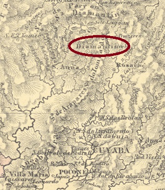
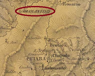
Other names: Arraial do Ouro, Félix, Alto Paraguai Diamantino
This town on the river of the same name had been since November 1811 a freguesia of the Vila de Cuiabá, which was 180 kilometres to the south. In November 1820, it was elevated to a Vila with the pompous name N. Sra. da Conceição do Alto Paraguai Diamantino. In April 1901 it was demoted to a district of Cuiabá, but Diamantino became a município again in August 1906 and a town in July 1918.
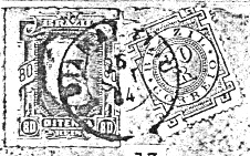
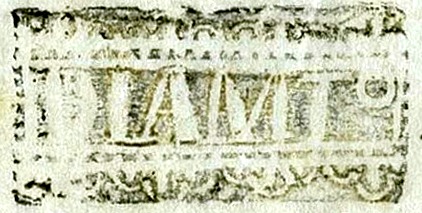
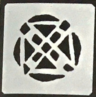
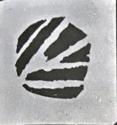
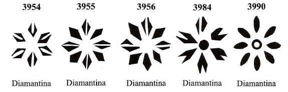
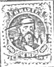
As Nova Monteiro writes in Administrações e Agencias Postaes do Brasil Imperio (Brasil Filatelico/RJ, 1934-5; reprint SPP 1994-1999), there had been a post office there since March 1829. The oldest postmark to date is the archaic-looking DMT-0020a (collect. Pablo Reim), which is also known in red and magenta on Bull’s-Eyes issues from 1843.
DMT-0020a (Pablo Reim) 1843ff-1848
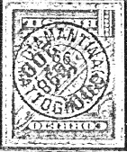
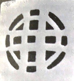
Since the following postmark DMT-0020b (fig. R. Koester, in Carimbologia XVI) is only known with dates from the 1880s, there may have been another postmark in between.
DMT-0020b (RK) 1880-1884
DMT-0020c was also found towards the end of the century (fig. R. Koester, op. cit.):
DMT-0020c (RK) 1899Villiers de l’Ile Adam: Carta (…) da Provincia do Matto Grosso, 1850
Andere Namen: Arraial do Ouro, Félix, Alto Paraguai Diamantino
Dieser Ort am gleichnamigen Fluss war seit November 1811 eine Freguesia der 180 km südlich gelegenen Vila de Cuiabá. Im November 1820 wurde sie zur Vila mit dem pompösen Namen N. Sra. da Conceição do Alto Paraguai Diamantino erhoben. Im April 1901 wurde sie zu einem Distrikt von Cuiabá degradiert, aber schon im August 1906 wurde Diamantino wieder ein Município und im Juli 1918 eine Stadt.
Wie Nova Monteiro in Administrações e Agencias Postaes do Brasil Imperio (Brasil Filatelico/RJ, 1934-5; Reprint SPP 1994-1999) schreibt, gab es dort ein Postamt seit März 1829. Der bisher älteste Poststempel ist der archaisch anmutende DMT-0020a (Samml. Pablo Reim), der auch in rot und magenta auf Ochsenauge von 1843 bekannt ist.
DMT-0020a (Pablo Reim) 1843ff-1848
Da der folgende Stempel DMT-0020b (Abb. R. Koester, in Carimbologia XVI) nur mit Daten aus den 80er Jahren bekannt ist, könnte es dazwischen noch einen weiteren Poststempel gegeben haben.
DMT-0020b (RK) 1880-1884
Gegen Ende des Jahrhunderts wurde auch DMT-0020c gefunden (Abb. R. Koester, op. cit.):
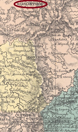
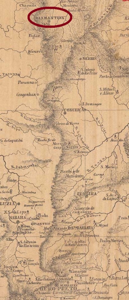
Arraial do Tejuco already existed from about 1729, it was a settlement of gold and diamond seekers located 380 km north of the future provincial capital of Ouro Preto. By royal decree (Alvará Régio), the place was promoted to freguesia in October 1819. In October 1831, already after Brazil’s independence, it became the Vila of Diamantina.
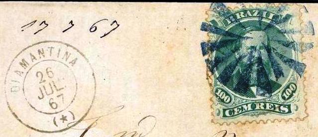
No less than four dates of creation of the local post office have been found, two of them by Paula Sobrinho in História Postal de Minas Gerais (Belo Horizonte, 1997): first in May 1809, then again in October 1833. Nova Monteiro in Administrações e Agencias Postaes do Brasil Imperio (Brasil Filatelico/RJ, 1934-5; reprint SPP 1994-1999) provided a date for the intermediate period, in March 1829. Finally, Reinhold Koester (Carimbologia XVI) writes October 1839, a sure indication of an eventful postal history of this place.
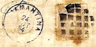
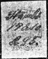
Until about 1836 the postmarks still had the place name Tejuco (see TMG-3740). The first postmark with Diamantina is VMG-3745a which has the no. 1524 under Paulo Ayres (Catálogo de Carimbos Brasil-Império, S. Paulo, 1937, 1942) and is listed in the RHM catalogue under P-MG-26:
VMG-3745a (P.A. 1524, RHM P-MG-26) 1836-1850ff
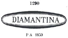
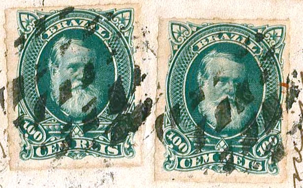
Its successor DMG-0995a is so like it that it could be a retouched version (the young city probably no longer wanted the V. of Vila in the stamp). In P. Ayres (op. cit.) it has no. 1290:
DMG-0995a (P.A. 1290) 1844ff-1877
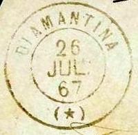
This was followed by the French type DMG-0995b (ill. from the Internet). This postmark was apparently used in two periods:
DMG-0995b (EB) 1867-1884, 1888ff-1892ff
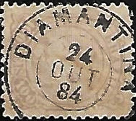
In between, DMG-0995c (ill. from the Internet) came into use:
DMG-0995c (EB) 1877-1886
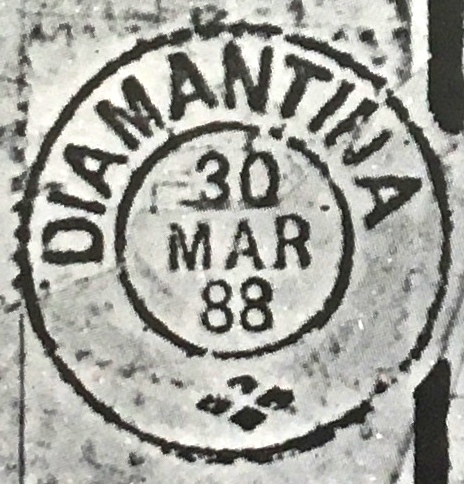
Finally, R. Koester in Diamantina- uma História Filatélica (Rio de Janeiro, 1881) has shown a last imperial cancellation from there: DMG-0995d was in use for a short time and is therefore rare:
DMG-0995d (RKD) 1887-1888
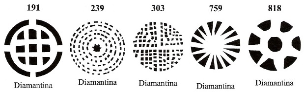
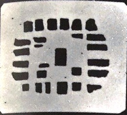
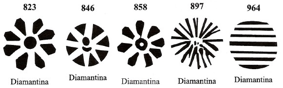
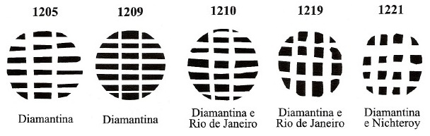
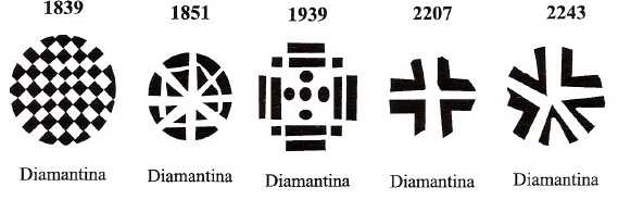
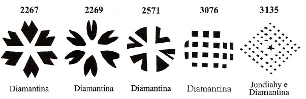
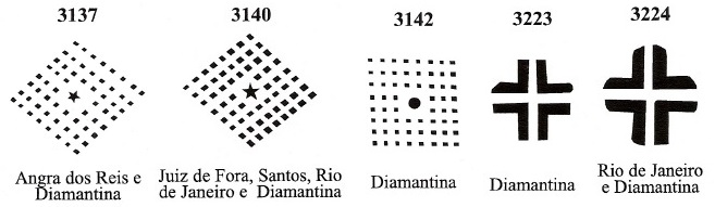
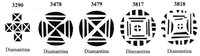
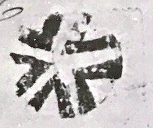
Diamantina produced an astonishing number of mute cancellations in the imperial period. No less than 54 were counted in Mute Cancellations of the Brazil Empire / Carimbos Mudos do Brasil Império (Brazil Philatelic Association, Rio de Janeiro, 2000), by James Dingler and Klerman W. Lopes:
In addition, nine further silent cancellations were found:
(EB) 1867-1877 (similar to BPA 897)(RKD) 1877ff(RKD) 1877ff(RKD) 1877ff(CO) 1879(CO) 1881(RKD) 1881(RKD) 1883(JLF) 1884-1886 (similar to BPA 1363)Provincia de Minas Geraes, 1873
Siehe auch Tejuco (TMG-3740)
Den Arraial do Tejuco gab es bereits ab ca. 1729, er war eine Siedlung von Gold- und Diamantensuchern, die 380 km nördlich der künftigen Provinzhauptstadt Ouro Preto entfernt lag. Durch königliche Verfügung (Alvará Régio) stieg der Ort im Oktober 1819 zur Freguesia auf. Im Oktober 1831, also bereits nach Brasiliens Unabhängigkeit, wurde daraus die Vila Diamantina.
Es wurden nicht weniger als vier Gründungsdaten fürs örtliche Postamt gefunden, zwei davon durch Paula Sobrinho in História Postal de Minas Gerais (Belo Horizonte, 1997) überliefert: erstmals im Mai 1809, dann wieder im Oktober 1833. Nova Monteiro lieferte in Administrações e Agencias Postaes do Brasil Imperio (in Brasil Filatelico/RJ, 1934-5; Reprint SPP 1994-1999) ein Datum für die Zwischenzeit, im März 1829. Und schließlich schreibt Reinhold Koester (Carimbologia XVI) noch den Oktober 1839. Ein sicheres Indiz für eine bewegte Postgeschichte dieses Orts.
Bis ca. 1836 hatten die Poststempel noch die Ortsbezeichnung Tejuco (siehe TMG-3740). Der erste Poststempel mit Diamantina ist VMG-3745a der unter Paulo Ayres (Catálogo de Carimbos Brasil-Império, S. Paulo, 1937, 1942) die Nr. 1524 hat und im RHM-Katalog unter P-MG-26 gelistet wird:
VMG-3745a (P.A. 1524, RHM P-MG-26) 1836-1850ff
Sein Nachfolger DMG-0995a ist ihm so ähnlich, dass er eine retuschierte Fassung (die junge Stadt wollte wohl nicht mehr die V. von Vila im Stempel haben) sein könnte. Im P. Ayres (op. cit.) trägt er Nr. 1290:
DMG-0995a (P.A. 1290) 1844ff-1877
Danach kam der französische Typ DMG-0995b (Abb. aus dem Internet). Dieser Poststempel wurde anscheinend in zwei Perioden benutzt:
DMG-0995b (EB) 1867-1884, 1888ff-1892ff
Zwischendurch kam DMG-0995c (Abb. aus dem Internet) in Gebrauch:
DMG-0995c (EB) 1877-1886
Schließlich hat R. Koester in Diamantina- uma História Filatélica (Rio de Janeiro, 1881) noch einen kaiserlichen Stempel von dort gezeigt: DMG-0995d war kurz in Verwendung und ist daher selten:
DMG-0995d (RKD) 1887-1888
Aus Diamantina kommt eine erstaunliche Menge an stummen Stempeln in der Kaiserzeit. Nicht weniger als 54 Stück zählte Mute Cancellations of the Brazil Empire / Carimbos Mudos do Brasil Império (Brazil Philatelic Association, Rio de Janeiro, 2000), von James Dingler und Klerman W. Lopes:
Estaçoes Ferroviarias (…) do Rio de Janeiro, São Paulo e Minas Geraes, 1880
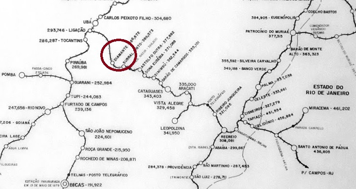
Other names: Diamante de Ubá (1953)
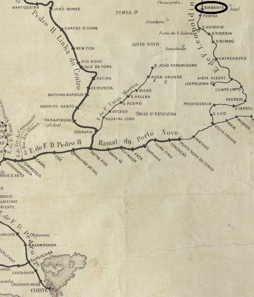
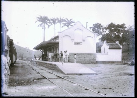
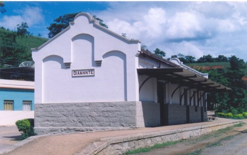
Diamante station was opened in August 1879 by the railway company E.F. Leopoldina (Central Line) and was located near Vila de Ubá, 170 km south-east of the provincial capital Ouro Preto. Diamante was the name of a small river along the railway line, which belonged to Rede Ferroviária Federal (estacoesferroviarias.com.br) from 1975 until its closure in 1996. Today, the tracks and the station building – apparently empty – still exist.
Around 1950 (on estacoesferroviarias.com.br)In December 2004 (photo: Gutierrez Coelho, on estacoesferroviarias.com.br)
The settlement around the railway station became the Distrito de Diamante de Ubá in December 1953.
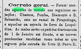
Two foundation dates have been found for the station post office. The first was in December 1879, as reported in the regional press:
O Apóstolo, 31/12/1879
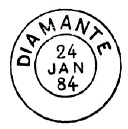
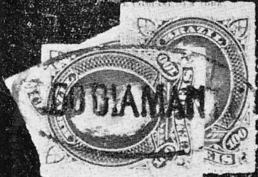
Then again in July 1881, according to Paula Sobrinho’s História Postal de Minas Gerais (Belo Horizonte, 1997). The oldest postmark is DMG-0990a (fig. R. Koester, in Carimbologia XVI):
DMG-0990a (RK) 1879ff
This was followed by the double circle DMG-0990b, illustrated on p. 121 in P. Ayres (Catálogo de Carimbos Brasil-Império, S. Paulo, 1937, 1942):
DMG-0990b (P.A. p. 121) 1882-1885
Koester (op. cit.) also shows a mute cancellation from this station post office:
1882 (RK)Estrada de Ferro Leopoldina
Andere Namen: Diamante de Ubá (1953)
Der Bahnhof Diamante wurde im August 1879 von der Eisenbahngesellschaft E.F. Leopoldina (Hauptstrecke) eröffnet und lag in der Nähe von Vila de Ubá, 170 km südöstlich der Provinzhauptstadt Ouro Preto. Diamante war der Name eines kleinen Flusses entlang der Bahnlinie, die von 1975 bis zu ihrer Stilllegung 1996 der Rede Ferroviária Federal (estacoesferroviarias.com.br) gehörte. Heute sind noch die Gleise und das Bahnhofsgebäude – scheinbar leer – vorhanden.
Um 1950 (auf estacoesferroviarias.com.br)Im Dezember 2004 (Foto: Gutierrez Coelho, auf estacoesferroviarias.com.br)
Die Siedlung um den Bahnhof wurde im Dezember 1953 zum Distrito de Diamante de Ubá.
Für das Bahnhofspostamt wurden zwei Gründungsdaten gefunden. Das erste im Dezember 1879, wie die regionale Presse berichtete:
O Apóstolo, 31.12.1879
Dann wieder im Juli 1881, wie aus Paula Sobrinhos História Postal de Minas Gerais (Belo Horizonte, 1997) hervorgeht. Der älteste Poststempel ist DMG-0990a (Abb. R. Koester, in Carimbologia XVI):
DMG-0990a (RK) 1879ff
Es folgte der Doppelkreis DMG-0990b, abgebildet auf S. 121 in P. Ayres (Catálogo de Carimbos Brasil-Império, S. Paulo, 1937, 1942):
DMG-0990b (P.A. S. 121) 1882-1885
Koester (op. cit.) zeigt auch einen stummen Stempel von diesem Bahnhofspostamt:
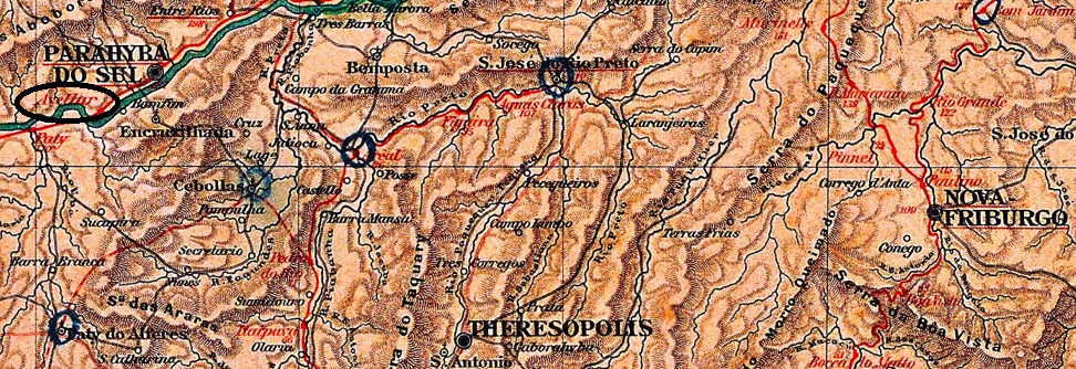
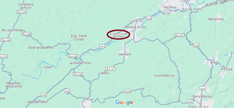
Other names: Parada do Barão, Est. Boa Vista, Avellar, Vieira Cortez (1924)
See also Avellar (train station, ARJ-0095)
A desvio can be a diversion, or simply a bend. This desvio was located directly at the Fazenda da Boa Vista, Freguesia of S. Pedro and S. Paulo in the Município of Parahyba do Sul on the north bank of the river of the same name, 140 kilometres north of the capital Rio de Janeiro. In 1924 the town was renamed Vieira Cortez, and since December 1951 Vieira Cortez has belonged to the Distrito de Werneck.
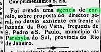
The post office was established in September 1884, according to the Rio press:
Gazeta da Tarde, 13/09/1884
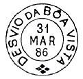
The imperial postmark is DRJ-0430a, which was already shown in P. Ayres’ (Catálogo de Carimbos Brasil-Império, S. Paulo, 1937, 1942):
DRJ-0430a (P.A. p. 121) 1885-1888
After the Avellar railway station opened in 1885, the old postmarks continued to be used. For postmarks with Avellar (from 1889) see ARJ-0095.
Google Maps
Andere Namen: Parada do Barão, Est. Boa Vista, Avellar, Vieira Cortez (1924)
Siehe auch Avellar (Bahnhof, ARJ-0095)
Ein Desvio kann ein Umweg, eine Umleitung oder auch einfach eine Kurve sein. Dieser Desvio lag direkt an der Fazenda da Boa Vista, Freguesia von S. Pedro und S. Paulo im Município von Parahyba do Sul am Nordufer des gleichnamigen Flusses, 140 km nördlich der Hauptstadt Rio de Janeiro. 1924 wurde der Ort zu Vieira Cortez umbenannt, seit Dezember 1951 gehört Vieira Cortez dem Distrito de Werneck.
Das Postamt wurde im September 1884 ins Leben gerufen, wie die Presse aus Rio mitteilte:
Gazeta da Tarde, 13.09.1884
Der kaiserliche Poststempel ist DRJ-0430a, der bereits in P. Ayres‘ (Catálogo de Carimbos Brasil-Império, S. Paulo, 1937, 1942) zu sehen war:
DRJ-0430a (P.A. S. 121) 1885-1888
Nach Inbetriebnahme der Bahnhofs Avellar 1885 wurden die alten Poststempel zunächst weiterverwendet. Für Poststempel mit Avellar (ab 1889) siehe ARJ-0095.
See also Vila Nova de Itambi (VRJ-1000); Itambi (R. Koester: Carimbologia XXIII); São Bernabé (SRJ-0913); São José d’El Rei (SRJ-1427)
In November 1759 the freguesia of Nossa Senhora do Desterro de Itamby was founded in the now extinct municipality of Santo Antonio de Sá, located under 50 km northeast of the imperial capital. In 1772 it became a villa called São José del Rei, that after a short decadence went in 1833 as the freguesia of São Bernabé to the municipality of São João de Itaborahy. This status remained until 1840, when São Bernabé merged with other localities into the Villa Nova de Itamby, which is now Itambi, in the outskirts of the town of Itaboraí. We don’t know the causes of such a turbulent history, whether they are political, economic, or ecological nature, or even a combination among them.
After the closure of the post offices of São José d’El Rei (1835) and São Bernabé (around 1842), the town remained without a postal agency for around 20 years. Nova Monteiro writes in Administrações e Agencias Postaes do Brasil Imperio (Brasil Filatelico/RJ, 1934-5; reprint SPP 1994-1999) that a postal agency was created in Desterro de “Ibambi” in October 1862.
R. Koester shows in Carimbologia XXIII a postmark and a handwritten cancellation, both bearing only the place name Itamby:
IRJ-1070a (RK) 1866ff1885 (RK)
The railway station of Villa Nova do Itamby was opened in November 1866 by the Estrada de Ferro do Cantagallo railway company. The station post office was established in 1873 or 1874, and it can be assumed that the old Itamby postmarks were still in use there until the end of the Empire.
For postmarks with Vila Nova de Itambi see VRJ-1000.
Almanak Laemmert, 1892
Andere Namen: Vila Nova de Itambi, Itambi
Siehe auch Vila Nova de Itambi (VRJ-1000); Itambi (R. Koester: Carimbologia XXIII); São Bernabé (SRJ-0913); São José d’El Rei (SRJ-1427)
Die Geschichte dieser Ortschaft begann im November 1759 mit der Gründung der Freguesia von Nossa Senhora do Desterro de Itamby im inzwischen ausgelöschten Município von Santo Antonio de Sá, knapp 50 km nordöstlich der kaiserlichen Hauptstadt Rio de Janeiro gelegen. 1772 wurde daraus die Villa von São José del Rei, die nach einem raschen Verfall im Jahr 1833 zur Freguesia von São Bernabé im Município von São João de Itaborahy abstieg. Dieser Status hielt bis 1840, als São Bernabé mit anderen Ortschaften zur Villa Nova de Itamby (heute Itambi) wurde, heute ein Vorort der Stadt Itaboraí. Wir wissen nicht die Gründe für eine solch turbulente Geschichte, ob sie politischer, wirtschaftlicher oder ökologischer Natur sind, oder auch eine Mischung davon.
Nach der Schließung der Postämter von São José d’El Rei (1835) und São Bernabé (ca. 1842) blieb der Ort etwa 20 Jahre ohne Postagentur. Nova Monteiro schreibt in Administrações e Agencias Postaes do Brasil Imperio (Brasil Filatelico/RJ, 1934-5; Reprint SPP 1994-1999), dass im Oktober 1862 eine Postagentur in Desterro de „Ibambi“ gegründet wurde.
R. Koester zeigt in Carimbologia XXIII einen Poststempel und eine handschriftliche Entwertung, die beide nur den Ortsnamen Itamby tragen:
IRJ-1070a (RK) 1866ff1885 (RK)
Der Bahnhof von Villa Nova do Itamby wurde im November 1866 von der Eisenbahngesellschaft Estrada de Ferro do Cantagallo eröffnet. Das Bahnhofspostamt wurde 1873 oder 1874 eingerichtet, und es ist anzunehmen, dass die alten Itamby-Poststempel noch bis zum Ende des Kaiserreichs dort weiterverwendet wurden.
Für Poststempel mit Vila Nova de Itambi siehe VRJ-1000.
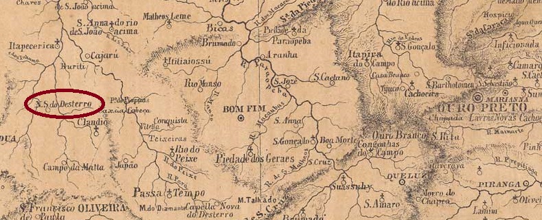
The Freguesia de N. Sra. do Desterro was founded in September 1870, it belonged to the Vila de S. Bento de Tamanduá and was located on the west bank of the Ribeirão Boa Vista, 230 km west of the provincial capital Ouro Preto. In October 1882, the freguesia became part of the Vila de Itapecerica and has been the Distrito de Marilândia since February 1935.
As Paula Sobrinho writes in História Postal de Minas Gerais (Belo Horizonte, 1997), there has been a post office there since November 1881. This is confirmed by the press in Rio:
Jornal do Commercio/RJ, 02/12/1881
No imperial postmark from N. Sra. do Desterro has yet been found.
Atlas do Imperio do Brasil, 1868
Andere Namen: Marilândia (1935)
Die Freguesia de N. Sra. do Desterro wurde im September 1870 gegründet, sie gehörte zur Vila de S. Bento de Tamanduá und lag am Westufer des Ribeirão Boa Vista, 230 km westlich der Provinzhauptstadt Ouro Preto. Im Oktober 1882 ging die Freguesia in die Vila de Itapecerica über und ist seit Februar 1935 der Distrito de Marilândia.
Wie Paula Sobrinho in História Postal de Minas Gerais (Belo Horizonte, 1997) schreibt, gab es dort seit November 1881 ein Postamt. Dies wird von der Presse in Rio bestätigt:
Jornal do Commercio/RJ, 02.12.1881
Bisher wurde noch kein kaiserlicher Poststempel aus N. Sra. do Desterro gefunden.
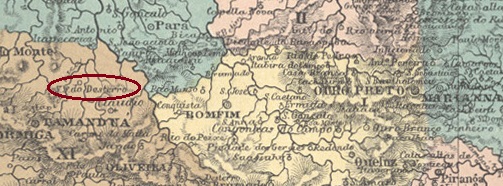
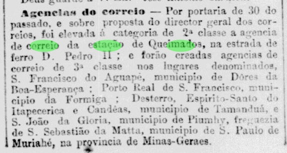
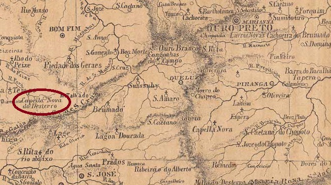
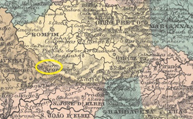
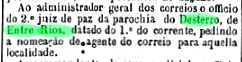
In the imperial province of Minas Gerais there were three places with a post office called Desterro (exile): The Freguesias N. Sra. do Desterro near Itapecerica (today Marilândia) and Mello de Desterro near Barbacena are discussed under DMG-0985 and MMG-1595 respectively. The third place discussed here is only 100 km away from Desterro de Itapecerica and is therefore often confused with it. Capella Nova do Desterro was a district of the Vila de Entre Rios, near the east bank of the Pará River, 120 km south-west of the provincial capital Ouro Preto. It became the Freguesia de N. Sra. do Desterro de Entre Rios in October 1882 and the Município de Desterro de Entre Rios in December 1953.
Paula Sobrinho writes in História Postal de Minas Gerais (Belo Horizonte, 1997) that there had been a post office since August 1891. This was a reopening, as a postal worker was already being sought for the local agency in July 1886, as reported in the regional press:
A União, 11/09/1886
No imperial postmark from Desterro de Entre Rios has yet been found.
Atlas do Imperio do Brasil, 1868
Andere Namen: Capella Nova do Desterro, Desterro
In der kaiserlichen Provinz Minas Gerais gab es drei Orte mit einem Postamt namens Desterro (Verbannung): Die Freguesias N. Sra. do Desterro bei Itapecerica (heute Marilândia) und Mello de Desterro bei Barbacena werden unter DMG-0985 bzw. MMG-1595 besprochen. Der dritte Ort, um den es hier geht, liegt nur 100 km von Desterro de Itapecerica entfernt und wird daher oft mit diesem verwechselt. Capella Nova do Desterro war ein Bezirk der Vila de Entre Rios, nahe dem Ostufer des Flusses Pará, 120 km südwestlich der Provinzhauptstadt Ouro Preto. Es wurde im Oktober 1882 zur Freguesia de N. Sra. do Desterro de Entre Rios und im Dezember 1953 zum Município de Desterro de Entre Rios.
Paula Sobrinho schreibt in História Postal de Minas Gerais (Belo Horizonte, 1997), dass es seit August 1891 ein Postamt gab. Es handelt sich um eine Wiedereröffnung, da bereits im Juli 1886 ein Postangestellter für die örtliche Agentur gesucht wurde, wie die regionale Presse berichtet:
A União, 11.09.1886
Bisher wurde kein kaiserlicher Poststempel aus Desterro de Entre Rios gefunden.
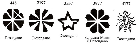
Other names: Juparanã, Barão de Juparanã (ca. 1952)
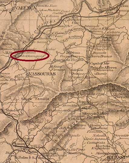
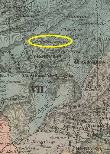
Desengano (also written Dezengano) was a settlement on the west bank of the river Paraíba do Sul, near the bridge Desengano Feliz (Happy Disappointment) around Vila de Valença, 150 kilometres northwest of the capital Rio de Janeiro. In May 1892, it was elevated to the status of a district, which was renamed Juparanã in December 1949 and shortly afterwards received the name Barão de Juparanã. The name commemorates Manuel Jacinto Carneiro Nogueira da Costa e Gama (Rio de Janeiro, 4 April 1830, Valença, 2 June 1876), landowner and regional politician.
As Nova Monteiro writes in Administrações e Agencias Postaes do Brasil Imperio (Brasil Filatelico/RJ, 1934-5; reprint SPP 1994-1999), there had been a post office there since August 1857, and when a luxurious railway station of the E.F.D. Pedro II (Central Line) was built in December 1865, the postal agency moved into the station building, as the station keeper was also the postal clerk.
Desengano Station, ca. 1881 (E.F. D. Pedro II, on estacoesferroviarias.com.br)
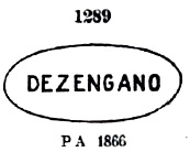
The oldest postmark to date is DRJ-0420a, which also existed in red and was already assigned the no. 1289 by P. Ayres in the Catálogo de Carimbos Brasil-Império (S. Paulo, 1937, 1942):
DRJ-0420a (P.A. 1289) 1866ff-1876ff
It was followed by DRJ-0420b (illustration from the Internet), which also occurs in dark violet:
DRJ-0420b (EB) 1876ff-1889
DRJ-0420c (illustration from the Internet) was also used in the late imperial period:
DRJ-0420c (EB) 1889-1891
R. Koester still shows the seal cancel DRJ-0420d in Carimbologia XVI, without further details:
DRJ-0420d (RK)
James Dingler and Klerman W. Lopes have shown in Mute Cancellations of the Brazil Empire / Carimbos Mudos do Brasil Império (Brazil Philatelic Association, Rio de Janeiro, 2000) no less than five mute cancellations from Desengano:
And from the Fuad Ferreira Fo. collection comes this handwritten cancellation:
1866ff (FF)Villiers de l’Ile Adam: Carta (…) da Provinica do Rio de Janeiro, 1850
Andere Namen: Juparanã, Barão de Juparanã (ca. 1952)
Desengano (auch Dezengano geschrieben) war eine Siedlung am Westufer des Flusses Paraíba do Sul, in der Nähe der Brücke Desengano Feliz (Glückliche Enttäuschung) im Gebiet von Vila de Valença, 150 km nordwestlich der Hauptstadt Rio de Janeiro. Im Mai 1892 wurde es zum Distrikt erhoben, der im Dezember 1949 in Juparanã umbenannt wurde und kurze Zeit später den Namen Barão de Juparanã erhielt.
Der Name erinnert an Manuel Jacinto Carneiro Nogueira da Costa e Gama (Rio de Janeiro, 4.4.1830, Valença, 2.6.1876), Großgrundbesitzer und Regionalpolitiker.
Wie Nova Monteiro in Administrações e Agencias Postaes do Brasil Imperio (Brasil Filatelico/RJ, 1934-5; Reprint SPP 1994-1999) schreibt, gab es dort seit August 1857 ein Postamt, und als im Dezember 1865 ein luxuriöser Bahnhof der E.F.D. Pedro II (Hauptlinie) gebaut wurde, zog die Postagentur in das Bahnhofsgebäude um, da der Bahnhofswärter auch der Postbeamte war.
Bahnhof Desengano, ca. 1881 (E.F. D. Pedro II, auf estacoesferroviarias.com.br)
Der bisher älteste Poststempel ist DRJ-0420a, den es auch in rot gab und der bereits von P. Ayres im Catálogo de Carimbos Brasil-Império (S. Paulo, 1937, 1942) mit der Nr. 1289 versehen wurde:
DRJ-0420a (P.A. 1289) 1866ff-1876ff
Ihm folgte DRJ-0420b (Abb. aus dem Internet), der auch in dunkelviolett vorkommt:
DRJ-0420b (EB) 1876ff-1889
In der späten Kaiserzeit wurde auch DRJ-0420c (Abb. aus dem Internet) verwendet:
DRJ-0420c (EB) 1889-1891
R. Koester zeigt in Carimbologia XVI noch den Siegelstempel DRJ-0420d, ohne weitere Angaben:
DRJ-0420d (RK)
James Dingler und Klerman W. Lopes haben in Mute Cancellations of the Brazil Empire / Carimbos Mudos do Brasil Império (Brazil Philatelic Association, Rio de Janeiro, 2000) nicht weniger als fünf stumme Stempel aus Desengano gezeigt:
Villiers de l’Ile Adam: Carta (…) da Provinica de Minas Gerais, 1849
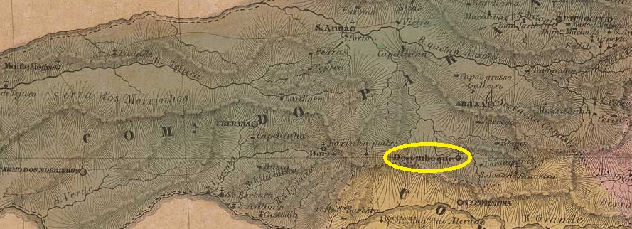
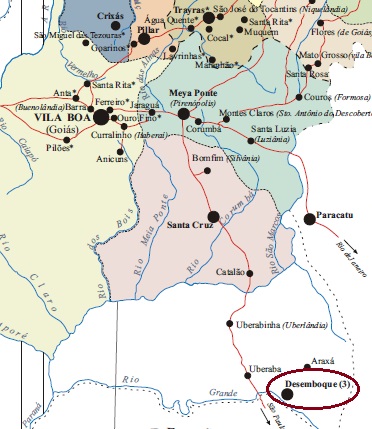
Other names: Desterro do Descoberto
Another forgotten place with a fascinating history. The settlement of Desterro do Descoberto was founded as early as 1743, at that time still in the Capitania de Goiás, on the south bank of the Araguari (formerly Rio das Velhas), 500 kilometres west of the later provincial capital of Ouro Preto. In April 1816, Arraial do Desemboque was assigned to the Vila de Paracatu and thus to the Capitania de Minas Gerais. In May 1850, it was elevated to Vila de N. Sra. do Desterro do Desemboque, but this was short-lived: in September 1870, Desemboque was demoted to the freguesia of the Vila de Santissimo Sacramento. The once proud village on the trade route had almost 4,000 inhabitants at the end of the empire; today there are just under 30.
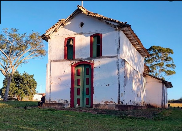
The village church (Photo: Tiago Giorgiani, Google Maps)
As Nova Monteiro writes in Administrações e Agencias Postaes do Brasil Imperio (Brasil Filatelico/RJ, 1934-5; reprint SPP 1994-1999), there had been a post office in Desemboque since September 1852, which was closed again around 1860 as it no longer appeared in the lists of imperial post offices. It was reopened in July 1892, as Paula Sobrinho (História Postal de Minas Gerais, Belo Horizonte, 1997) writes and the postal bulletin (Boletim Postal) of the following month confirms.
No imperial postmark of Desemboque has yet been seen.
Teixeira Neto, apud Silva e Souza: Capitania de Goiás, 1809
Andere Namen: Desterro do Descoberto
Ein weiterer vergessener Ort mit einer faszinierenden Geschichte. Die Siedlung Desterro do Descoberto entstand bereits 1743, damals noch in der Capitania de Goiás, am Südufer des Araguari (früher Rio das Velhas), 500 km westlich der späteren Provinzhauptstadt Ouro Preto. Im April 1816 wurde der Arraial do Desemboque der Vila de Paracatu und damit der Capitania de Minas Gerais zugeordnet. Im Mai 1850 erfolgte die Erhebung zur Vila de N. Sra. do Desterro do Desemboque, die jedoch nur von kurzer Dauer war: Im September 1870 wurde Desemboque zur Freguesia der Vila de Santissimo Sacramento degradiert. Der einst stolze Ort an der Handelsstraße zählte am Ende des Kaiserreichs fast 4.000 Einwohner, heute sind es noch knapp 30.
Die Dorfkirche (Foto: Tiago Giorgiani, Google Maps)
Wie Nova Monteiro in Administrações e Agencias Postaes do Brasil Imperio (Brasil Filatelico/RJ, 1934-5; Reprint SPP 1994-1999) schreibt, gab es in Desemboque seit September 1852 ein Postamt, das um 1860 wieder geschlossen wurde, da es nicht mehr in den Verzeichnissen der kaiserlichen Postämter auftauchte. Im Juli 1892 wurde es wieder eröffnet, wie Paula Sobrinho (História Postal de Minas Gerais, Belo Horizonte, 1997) schreibt und das Postbulletin (Boletim Postal) des folgenden Monats bestätigt.
Bisher wurde kein kaiserlicher Poststempel von Desemboque gesehen.
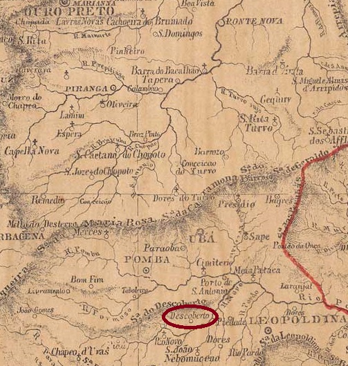
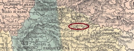
The chapel of Descoberto was built in June 1824. It belonged to the Freguesia do Rio Novo and was located on the southern slope of the Serra do Descoberto, 220 kilometres south-east of the provincial capital of Ouro Preto. In December 1865, the municipality was attached as a district to the Freguesia de S. João Nepomuceno, but returned to the Vila de Rio Novo as Freguesia da Santissima Trindade do Descoberto in December 1874, before being reattached to S. João Nepomuceno in November 1880. Descoberto has been a município since December 1953.
R. Koester (Carimbologia XVI) and Paula Sobrinho (História Postal de Minas Gerais, Belo Horizonte, 1997) also agree that the local post office was founded in November 1881. This is confirmed by the press in Rio:
Jornal do Commercio/RJ, 12/11/1881
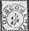
The oldest postmark to date is DMG-0965a (fig. R. Koester, op. cit.):
DMG-0965a (RK) 1887-1890
Towards the end of the 19th century, the peculiar DMG-0965b also appeared (ill. from the Internet):
DMG-0965b (EB) 1891ffAtlas do Imperio do Brasil, 1868
Die Kapelle von Descoberto wurde im Juni 1824 errichtet. Sie gehörte zur Freguesia do Rio Novo und lag am Südhang der Serra do Descoberto, 220 km südöstlich der Provinzhauptstadt Ouro Preto. Im Dezember 1865 wurde die Gemeinde als Distrikt an die Freguesia de S. João Nepomuceno angeschlossen, kehrte aber im Dezember 1874 als Freguesia da Santissima Trindade do Descoberto zur Vila de Rio Novo zurück, bevor sie im November 1880 wieder an S. João Nepomuceno angeschlossen wurde. Seit Dezember 1953 ist Descoberto ein Município.
R. Koester (Carimbologia XVI) und Paula Sobrinho (História Postal de Minas Gerais, Belo Horizonte, 1997) sind sich auch hier einig, dass das lokale Postamt im November 1881 gegründet wurde. Dies wird von der Presse in Rio bestätigt:
Jornal do Commercio/RJ, 12.11.1881
Der bisher älteste Poststempel ist DMG-0965a (Abb. R. Koester, op. cit.):
DMG-0965a (RK) 1887-1890
Gegen Ende des 19. Jahrhunderts erschien auch der eigentümliche DMG-0965b (Abb. aus dem Internet):