Categories
Carimbologia E-G

Gamelleira (train station/Bahnhof), Pernambuco (GPE-0765)

Carta Corographica da Provincia de Pernambuco, 1880

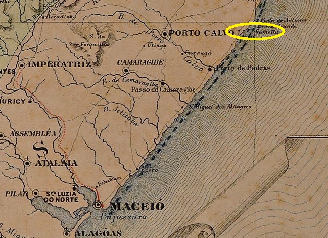
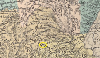
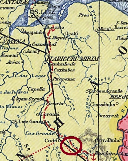
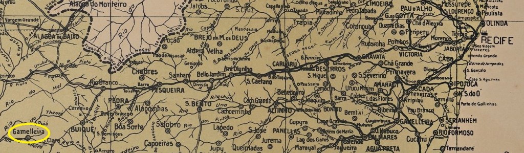
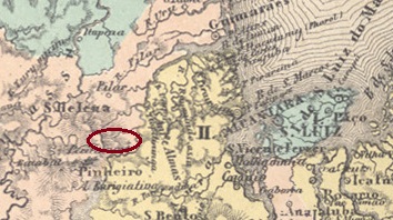
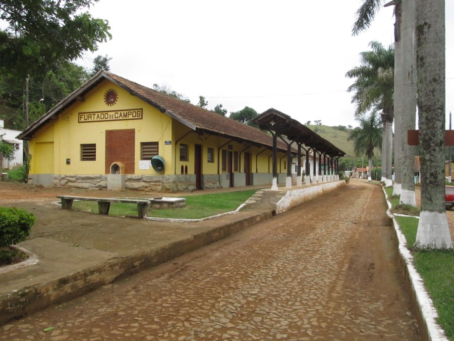
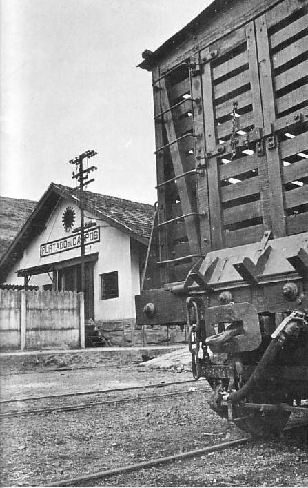
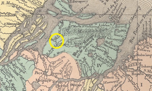
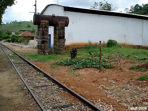
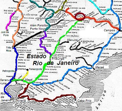
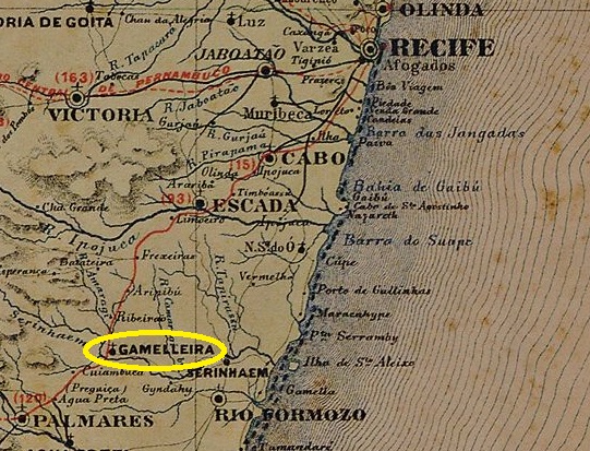
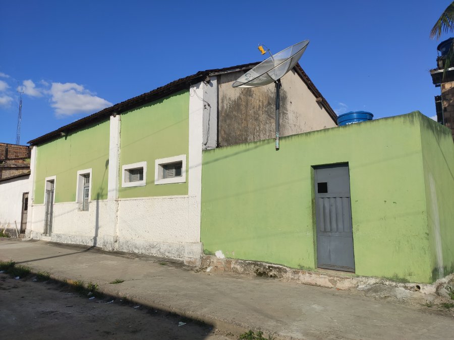
Gamelleira station was opened in May 1862 by the railway company E.F. do Recife ao S. Francisco (main line) in the Município de Serinhaém on the west bank of the river of the same name, 95 km south-west of the provincial capital Recife. The railway line was transferred to Great Western in 1901 and to Rede Ferroviaria do Nordeste in 1950 and was owned by Rede Ferroviária Federal S.A. from 1975 until it was closed in 1996 (estacoesferroviarias.com.br). Today the tracks are still there, the station building serves as a residential building.

Around 1950 (IBGE)
In November 2020 (Photo: Rodrigo Henrique, on estacoesferroviarias.com.br)

The settlement around the railway station grew rapidly and became a freguesia in June 1867 and a vila five years later.

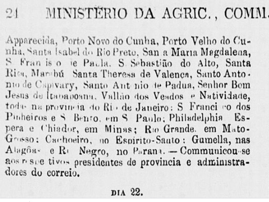
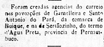
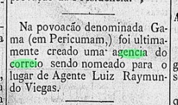
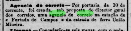
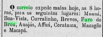
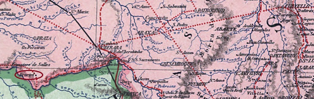
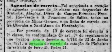
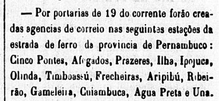
According to the Rio press, there had been a post office at the railway station since December 1864:

Constitucional/RJ, 24/12/1864

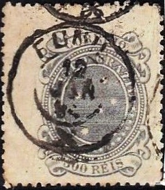
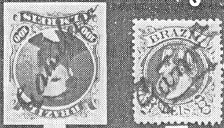
R. Koester shows in Carimbologia XX handwritten postmarks from around 1880 from this station:

1876ff-1882ff (RK)

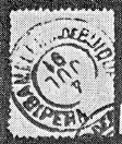
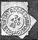
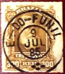
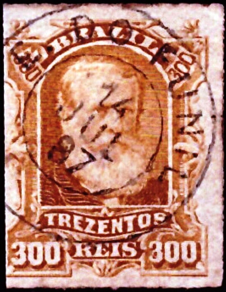
The oldest postmark to date is the French type GPE-0765a (ill. Marco Morel):

GPE-0765a (ME) 1883ff-1889

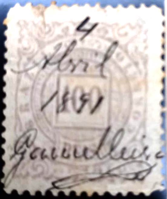
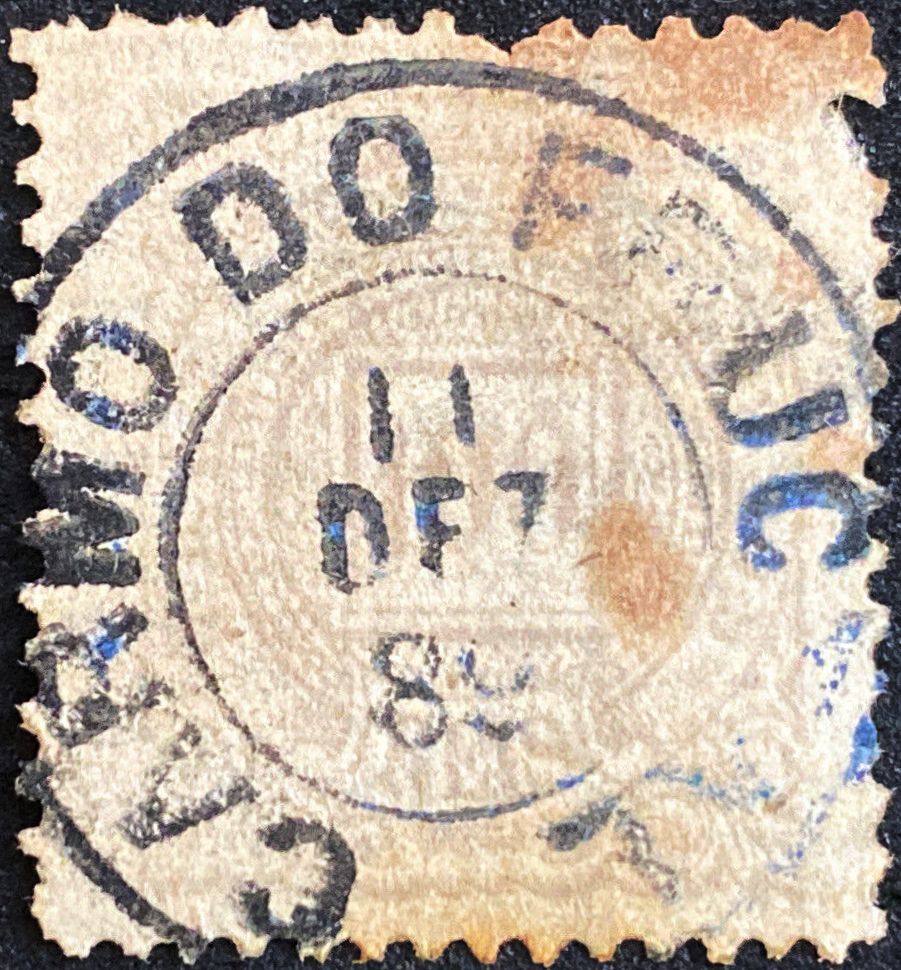
Another handwritten cancellation dates from the early days of the Republic, this time from the Fuad Ferreira Fo. collection:

1891 (FF)
Arthur D. Ribeiro: Estado de Pernambuco, 1924

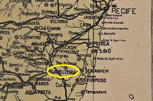
Der Bahnhof Gamelleira wurde im Mai 1862 von der Eisenbahngesellschaft E.F. do Recife ao S. Francisco (Hauptstrecke) eröffnet und lag im Município de Serinhaém am Westufer des gleichnamigen Flusses, 95 km südwestlich der Provinzhauptstadt Recife. Die Bahnlinie ging 1901 an die Great Western und 1950 an die Rede Ferroviaria do Nordeste über und war von 1975 bis zu ihrer Stilllegung 1996 im Besitz der Rede Ferroviária Federal S.A. (estacoesferroviarias.com.br). Heute sind die Gleise noch vorhanden, das Bahnhofsgebäude dient als Wohnhaus.

Um 1950 (IBGE)
Im November 2020 (Foto: Rodrigo Henrique, auf estacoesferroviarias.com.br)

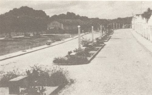
Die Siedlung um den Bahnhof wuchs schnell und wurde im Juni 1867 zur Freguesia und fünf Jahre später zur Vila.

Wie die Presse von Rio schreibt, gab es seit Dezember 1864 ein Postamt am Bahnhof:

Constitucional/RJ, 24.12.1864

R. Koester zeigt in Carimbologia XX handschriftliche Stempel von ca. 1880 von diesem Bahnhof:

1876ff-1882ff (RK)

Der bisher älteste Stempel ist der französische Typ GPE-0765a (Abb. Marco Morel):

GPE-0765a (ME) 1883ff-1889

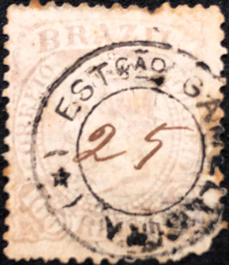
Aus der Anfangszeit der Republik stammt eine weitere handschriftliche Entwertung, diesmal aus der Sammlung Fuad Ferreira Fo:

1891 (FF)
Categories
Carimbologia E-G

Gamella, Alagoas (GAL-0065)

Carta Corographica da Provincia de Pernambuco, 1880

Other names: Villa Izabel, Maragogy (1876)

Gamela was an idyllic beachside settlement of the Vila de Porto Calvo near the provincial border with Pernambuco, 130 kilometres north-east of the capital Maceió. In April 1875, the village was renamed Villa Izabel, but in July 1876 it was renamed Vila de São Bento de Maragogy, which became the town of Maragogi in May 1892.

As Aureo G. Santos writes in Agências de Correio Criadas e Suprimidas 1851, 1855, 1856 e 1857 (Brasil Filatélico 181, Rio de Janeiro, 1977), there had been a post office there since December 1855, which was closed in June 1861, as can be seen from the minutes of the imperial ministry:

Expediente do Ministerio do Imperio, 21.06.1861

The postal agency was reopened in October 1876, as Aldo Cardoso reports in Contribuição para a História dos Correios de Alagoas (Maceió, 1969). If the postmarks were delivered on time, there were imperial postmarks with the place name Villa Isabel for 10 months.

Postmarks with Gamela have not yet been found, postmarks with Maragogy will be listed under MAL-0110.

Atlas do Imperio do Brasil, 1868

Andere Namen: Villa Izabel, Maragogy (1876)

Gamela war eine idyllisch am Strand gelegene Siedlung der Vila de Porto Calvo nahe der Provinzgrenze zu Pernambuco, 130 km nordöstlich der Hauptstadt Maceió. Im April 1875 wurde der Ort in Villa Izabel umbenannt, aber bereits im Juli 1876 erfolgte die Umbenennung in Vila de São Bento de Maragogy, aus der im Mai 1892 die Stadt Maragogi wurde.

Wie Aureo G. Santos in Agências de Correio Criadas e Suprimidas 1851, 1855, 1856 e 1857 (Brasil Filatélico 181, Rio de Janeiro, 1977) schreibt, gab es dort seit Dezember 1855 ein Postamt, das im Juni 1861 geschlossen wurde, wie aus den Protokollen des kaiserlichen Ministeriums hervorgeht:

Expediente do Ministerio do Imperio, 21.06.1861

Die Postagentur wurde im Oktober 1876 wieder eröffnet, wie Aldo Cardoso in Contribuição para a História dos Correios de Alagoas (Maceió, 1969) berichtet. Wenn die Poststempel rechtzeitig geliefert wurden, gab es also 10 Monate lang kaiserliche Stempel mit dem Ortsnamen Villa Isabel.

Stempel mit Gamela wurden bisher nicht gefunden, Stempel mit Maragogy werden unter MAL-0110 geführt.

Categories
Carimbologia E-G

Gameleira, Maranhão (GMA-0335)

Atlas do Imperio do Brasil, 1868

This Gameleira (also spelt Gamelleiras) in the imperial province of Maranhão is another place that no longer exists today. It was a landing stage on the north bank of the Itapecuru, probably at the mouth of the Gameleira above Codó, 310 kilometres south of the provincial capital of São Luís. Presumably there was a fazenda there in the 19th century whose owner was politically powerful enough to establish a post station at the harbour of his fazenda. The area later became known for the creation of a quilombo (refuge for escaped slaves) and is now part of the rural suburb of Bom Jesus near Codó.

Reinhold Koester writes in Carimbologia XX that there had been a post office there since October 1886. It was closed after 1894. A Fazenda Gameleira is last mentioned in the regional press in November 1923.

Folha do Povo, 01.11.1923

No imperial postmark from Gameleira has yet been found in Maranhão. It should be very rare.

Carta da Republica dos Estados Unidos do Brazil, 1892

Diese Gameleira (auch Gamelleiras geschrieben) in der kaiserlichen Provinz Maranhão ist ein weiterer Ort, der heute nicht mehr existiert. Sie war eine Anlegestelle am Nordufer des Itapecuru, wahrscheinlich an der Mündung des Gameleira oberhalb von Codó, 310 km südlich der Provinzhauptstadt São Luís. Vermutlich befand sich dort im 19. Jahrhundert eine Fazenda, deren Besitzer politisch mächtig genug war, um eine Poststation am Hafen seiner Fazenda zu errichten. Später wurde die Gegend durch die Entstehung eines Quilombos (Zufluchtsort für entflohene Sklaven) bekannt und gehört heute zum ländlichen Vorort Bom Jesus bei Codó.

Reinhold Koester schreibt in Carimbologia XX, dass es dort seit Oktober 1886 ein Postamt gab. Nach 1894 wurde es geschlossen. Eine Fazenda Gameleira wird in der regionalen Presse zuletzt im November 1923 erwähnt.

Folha do Povo, 01.11.1923

Bisher wurde noch kein kaiserlicher Poststempel aus Gameleira in Maranhão gefunden. Er dürfte sehr selten sein.

Categories
Carimbologia E-G

Gameleira de Buique, Pernambuco (GPE-0275)

Arthur D. Ribeiro: Estado de Pernambuco, 1924

Other names: Moxotó (1928)

Gameleira was a settlement in Vila Nova de Buíque, 320 kilometres west of the provincial capital Recife. It became a Distrito in January 1893 and the Município de Moxotó in September 1928. It lost this status in December 1948 when it became a distrito of the Município de Inajá. Since December 1963, Moxotó has been a distrito in the Município de Ibimirim.

R. Koester writes in Carimbologia XX that there had been a post office there since July 1885. This is confirmed by the press in Rio:

Diario do Brazil/RJ, 21/07/1885

The imperial postmark is GPE-0275a (fig. R. Koester, op. cit.):

GPE-0275a (RK) 1891
Google Maps

Andere Namen: Moxotó (1928)

Gameleira war eine Siedlung in Vila Nova de Buíque, 320 km westlich der Provinzhauptstadt Recife. Im Januar 1893 wurde es zum Distrito und im September 1928 zum Município de Moxotó. Diesen Status verlor es im Dezember 1948, als es ein Distrito des Município de Inajá wurde. Seit Dezember 1963 ist Moxotó ein Distrito im Município de Ibimirim.

R. Koester schreibt in Carimbologia XX, dass es dort seit Juli 1885 ein Postamt gab. Dies wird von der Presse in Rio bestätigt:

Diario do Brazil/RJ, 21.07.1885

Der kaiserliche Poststempel ist GPE-0275a (Abb. R. Koester, op. cit.):

GPE-0275a (RK) 1891
Categories
Carimbologia E-G

Gama, Maranhão (GMA-0123)

Atlas do Imperio do Brasil, 1868

Gama is another place in the Empire of Brazil that has now disappeared from the map. From July 1866, S. Joaquim do Gama was a settlement in the Distrito de Pericuman, which at the time belonged to Vila de Pinheiro and was located on the west bank of the Pericumã, around 150 kilometres west of the provincial capital of São Luís do Maranhão. Around 1890, Gama itself became a district, but lost this status again in 1919 at the latest. Gama was probably once a fazenda that was unable to keep pace with the changing times.

Even if there is no explanation for this today, there was a post office in the village around 1881, as reported in the regional press.

Pacotilha, 17.05.1881

The agency was active at least by the end of the empire:

Pacotilha, 09.01.1890

After that, every trace of postal activity is lost. No postmark from this town has been found to date, and it is probably very rare.

GoogleMaps

Gama ist ein weiterer Ort im Kaiserreich Brasilien, der heute von der Landkarte verschwunden ist. Seit Juli 1866 war S. Joaquim do Gama eine Siedlung im Distrito de Pericuman, die damals zur Vila de Pinheiro gehörte und am Westufer des Pericumã lag, etwa 150 km westlich der Provinzhauptstadt São Luís do Maranhão. Um 1890 wurde Gama selbst zum Distrikt, verlor diesen Status aber spätestens 1919 wieder. Vermutlich war Gama früher eine Fazenda, die mit dem Wandel der Zeit nicht Schritt halten konnte.

Auch wenn es heute keine Erklärung mehr dafür gibt, gab es um 1881 ein Postamt am Ort, wie die regionale Presse berichtete.

Pacotilha, 17.05.1881

Die Agentur war bis zum Ende des Kaiserreichs aktiv:

Pacotilha, 09.01.1890

Danach verliert sich jede Spur einer postalischen Tätigkeit. Bis heute wurde kein kaiserlicher Poststempel aus diesem Ort gefunden, er dürfte sehr selten sein.

Categories
Carimbologia E-G

Furtado de Campos (train station/Bahnhof), Minas Gerais (FMG-1210)

Estado de Minas Geraes, 1910

Furtado de Campos station was opened in June 1883 by the railway company E.F. União Mineira, Caratinga Line, in the Município de Rio Novo, 240 km south of the provincial capital Ouro Preto. The line became the property of E.F. Leopoldina in 1884 and belonged to Rede Ferroviária Federal S.A. from 1975 until its closure in 1996 (estacoesferroviarias.com.br). Today the tracks have been removed and the station building serves as a municipal library.

In 1970 (From the magazine REFESA, apud estacoesferroviarias.com.br)
In June 2021 (Photo: Julio Alves, on estacoesferroviarias.com.br)

As the Rio press reported, there had been a post office at the railway station since May 1883:

Jornal do Commercio/RJ, 31/05/1883

The imperial postmark is FMG-1210a (fig. R. Koester, in Carimbologia XIX):

FMG-1210a (RK) 1885-1891
Estrada de Ferro Leopoldina

Der Bahnhof Furtado de Campos wurde im Juni 1883 von der Eisenbahngesellschaft E.F. União Mineira, Caratinga-Linie, eröffnet und liegt im Município de Rio Novo, 240 km südlich der Provinzhauptstadt Ouro Preto. Die Strecke ging 1884 in den Besitz der E.F. Leopoldina über und gehörte von 1975 bis zu ihrer Stilllegung 1996 der Rede Ferroviária Federal S.A. (estacoesferroviarias.com.br). Heute sind die Gleise entfernt, das Bahnhofsgebäude dient als Gemeindebibliothek.

1970 (Aus der Zeitschrift REFESA, apud estacoesferroviarias.com.br)
Im Juni 2021 (Foto: Julio Alves, auf estacoesferroviarias.com.br)

Wie die Presse in Rio berichtete, gab es seit Mai 1883 ein Postamt am Bahnhof:

Jornal do Commercio/RJ, 31.05.1883

Der kaiserliche Poststempel ist FMG-1210a (Abb. R. Koester, in Carimbologia XIX):

FMG-1210a (RK) 1885-1891
Categories
Carimbologia E-G

Furo do Breu, Pará (FPA-0105)

Atlas do Imperio do Brasil, 1868

Here we have another place that has now disappeared from the map. Furo do Breu literally means Bitumen Hole, but the word furo is still used today in the state of Pará to mean waterway. So the place name can be translated as Dark Waterway. Anyway, from November 1886, Furo do Breu was a small settlement of the then newly founded Vila de Anajás, which was located in the western part of the island of Marajó, around 250 kilometres west of the provincial capital of Belém. Obviously, the village was located on an important waterway to the north of the large island. Today, only a few houses remain at three points on the lower Anajás River, which together have fewer than 100 inhabitants.

The local post office was probably built between the end of 1886 and the beginning of 1887. At the beginning of 1886, the regional press mentioned the application to set up a postal agency with a provisional local postman:

A Constituição, 20/01/1886

In February 1887, the mail was already travelling through Furo do Breu:

O Liberal do Pará, 10/02/1887

The post station was still in operation in March 1888, after which all trace of service is lost. No imperial postmarks from Furo do Breu in the province of Pará are known to date. If they exist, they are extremely rare.

Carta da Republica dos Estados Unidos do Brazil, 1892

Hier haben wir wieder einen Ort, der heute von der Landkarte verschwunden ist. Furo do Breu bedeutet wörtlich Pechloch, aber das Wort Furo wird im Bundesstaat Pará noch heute für Wasserstraße verwendet. So kann man den verschwundenen Ortsnamen mit Dunkle Wasserstraße übersetzen. Jedenfalls war Furo do Breu seit November 1886 eine kleine Siedlung der damals neu gegründeten Vila de Anajás, die im westlichen Teil der Insel Marajó, etwa 250 km westlich der Provinzhauptstadt Belém, lag. Offensichtlich lag der Ort damals an einem wichtigen Wasserweg in den Norden der großen Insel. Heute sind nur noch wenige Häuser an drei Stellen des unteren Anajás-Flusses erhalten, die zusammen weniger als 100 Einwohner zählen.

Das örtliche Postamt wurde wahrscheinlich zwischen Ende 1886 und Anfang 1887 errichtet. Zu Beginn des Jahres 1886 wurde in der regionalen Presse der Antrag auf Einrichtung einer Postagentur mit einem provisorischen örtlichen Postbediensteten erwähnt:

A Constituição, 20.01.1886

Im Februar 1887 ging die Post bereits durch Furo do Breu verschifft:

O Liberal do Pará, 10.02.1887

Die Poststation war noch im März 1888 in Betrieb, danach verliert sich jede Spur des Postbetriebs. Bisher sind keine kaiserlichen Poststempel aus Furo do Breu in der Provinz Pará bekannt. Wenn sie existieren, sind sie äußerst selten.

Categories
Carimbologia E-G

Funil (train station/Bahnhof), Rio de Janeiro (FRJ-0565)

Almanak Laemmert 1892

Text update on January 31, 2025

Funil station (= funnel, not to be confused with Cachoeira do Funil, CRJ-0240) was opened in December 1881 by the railway company E.F. Sto. Antonio de Padua (Campos-Miracema Line) on the north bank of the Pomba River in the Município de S. Fidelis, 250 kilometres north-east of the capital Rio de Janeiro. The line then changed hands three times: in 1884 to E.F. Macaé e Campos, in 1887 to E.F. Leopoldina and in 1975 to Rede Ferroviária Federal S.A., where it remained until its closure in 1996 (estacoesferroviarias.com.br). Today, the tracks are still there, but from the former station building only the remains of a water reservoir can be seen:

In October 2006 (photo: Carlos Latuff, on estacoesferroviarias.com.br)

The railway station was in the Vila de Monte Verde from May 1891, in the Distrito do Funil from November 1916 and in the Município de Cambuci from October 1918.

As Paulo Novaes writes on agenciaspostais.com.br, there had been a post office at the railway station since February 1882. The oldest postmark to date is FRJ-0565a (Fig. Fuad Ferreira Fo.):

FRJ-0565a (FF) 1884-1889

It was followed by FRJ-0565b (fig. Claudio Coelho):

FRJ-0565b (CC) 1887

The following FRJ-0565c (image from the Internet) is probably already republican:

FRJ-0565c (EB) 1891-1892

Postmarks with L. DO FUNIL come from Lavras do Funil in Minas Gerais (LMG-3370). Thanks to the philatelist Márcio Protzner de Oliveira for this information.

agenciaspostais.com.br

Textaktualisierung am 31. Januar 2025

Der Bahnhof Funil (= Trichter, nicht zu verwechseln mit Cachoeira do Funil, CRJ-0240) wurde im Dezember 1881 von der Eisenbahngesellschaft E.F. Sto. Antonio de Padua (Strecke Campos-Miracema) am Nordufer des Pomba im Município de S. Fidelis, 250 km nordöstlich der Hauptstadt Rio de Janeiro, eröffnet. Danach wechselte die Strecke dreimal den Besitzer: 1884 an E.F. Macaé e Campos, 1887 an E. F. Leopoldina und 1975 an die Rede Ferroviária Federal S.A., wo sie bis zu ihrer Stilllegung 1996 verblieb (estacoesferroviarias.com.br). Heute sind die Gleise noch vorhanden, vom ehemaligen Bahnhofsgebäude sind nur noch die Reste eines Wasserreservoirs zu sehen:

Im Oktober 2006 (Foto: Carlos Latuff, auf estacoesferroviarias.com.br).

Der Bahnhof befand sich ab Mai 1891 in der Vila de Monte Verde, ab November 1916 im Distrito do Funil und ab Oktober 1918 im Município de Cambuci.

Wie Paulo Novaes auf agenciaspostais.com.br schreibt, gab es ein Postamt am Bahnhof seit Februar 1882. Der bisher älteste Poststempel ist FRJ-0565a (Abb. Fuad Ferreira Fo.):

FRJ-0565a (FF) 1884-1889

Gefolgt von FRJ-0565b (Claudio Coelho):

FRJ-0565b (CC) 1887

Der folgende FRJ-0565c (Abbildung aus dem Internet) ist vermutlich bereits republikanisch:

FRJ-0565c (EB) 1891-1892

Stempel mit L. DO FUNIL kommen aus Lavras do Funil in Minas Gerais (LMG-3370). Danke an den Philatelisten Márcio Protzner de Oliveira für diese Information.

Categories
Carimbologia E-G

Fructal, Minas Gerais (FMG-1200)

Villiers de l’Ile Adam: Carta (…) da Provincia de Minas Geraes, 1849

Other names: Carmo dos Morrinhos

See also Carmo do Fructal (CMG-0670)

The Freguesia de N. Sra. do Carmo do Fructal was founded in September 1870, belonged to the Vila de Uberaba and was located on the east bank of the Frutal, 800 km west of the provincial capital Ouro Preto. In October 1885, it was elevated to a Vila and two years later to a town, which has borne the simplified name Frutal since September 1923.

As Paula Sobrinho writes in História Postal de Minas Gerais (Belo Horizonte, 1997), there has been a post office there since January 1882, although R. Koester (Carimbologia IX) gives a date exactly one month later. A recently discovered note from the Rio press confirms the date in January 1882:

Jornal do Commercio/RJ, 11/01/1882

Koester also mentions the double circle CMG-0670a as the first postmark (image: Luiz C. Fritzen), which presents dates from 1885 to 1889.

CMG-0670a (LCF) 1885-1889
Carta da Republica dos Estados Unidos do Brazil, 1892

Andere Namen: Carmo dos Morrinhos

Siehe auch Carmo do Fructal (CMG-0670)

Die Freguesia de N. Sra. do Carmo do Fructal wurde im September 1870 gegründet, gehörte zur Vila de Uberaba und lag am Ostufer des Frutal, 800 km westlich der Provinzhauptstadt Ouro Preto. Im Oktober 1885 wurde es zur Vila und zwei Jahre später zur Stadt erhoben, die seit September 1923 den vereinfachten Namen Frutal trägt.

Wie Paula Sobrinho in História Postal de Minas Gerais (Belo Horizonte, 1997) schreibt, gibt es dort seit Januar 1882 ein Postamt, wobei R. Koester (Carimbologia IX) ein genau einen Monat späteres Datum angibt. Eine neuentdeckte Pressemeldung aus Rio bestätigt das Datum im Januar 1882:

Jornal do Commercio/RJ, 11.01.1882

Koester nennt auch als ersten Poststempel den Doppelkreis CMG-0670a (Abb. Luiz C. Fritzen) der bisher mit Daten von 1885 bis 1889 zu sehen war.

CMG-0670a (LCF) 1885-1889
Categories
Carimbologia E-G

Freguezia, Município Neutro (FMN-0100)

Mappa do Municipio Neutro, ca. 1880

The history of the Freguesia de N. Sra. da Ajuda is quickly told: It was founded in 1710 on the eastern tip of Governor’s Island (Ilha do Governador), 25 km north of the city centre of Rio de Janeiro, and has been a quarter of the administrative district (Região Administrativa) of Ilha do Governador since July 1981.

As Paulo Novaes writes in agenciaspostais.com.br, there had been a post office there since June 1875, but it was closed shortly after 1879. No imperial postmarks from this freguesia are known to date.

Atlas do Imperio do Brasil, 1868

Die Geschichte der Freguesia de N. Sra. da Ajuda ist schnell erzählt: Sie wurde 1710 an der Ostspitze der Gouverneursinsel (Ilha do Governador), 25 km nördlich des Stadtzentrums von Rio de Janeiro, gegründet und ist seit Juli 1981 ein Stadtteil des Verwaltungsbezirks (Região Administrativa) Ilha do Governador.

Wie Paulo Novaes in agenciaspostais.com.br schreibt, gab es dort seit Juni 1875 ein Postamt, das aber kurz nach 1879 geschlossen wurde. Bisher sind keine kaiserlichen Poststempel aus dieser Freguesia bekannt.