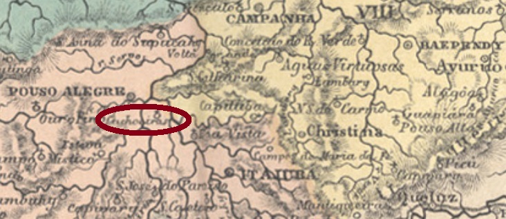
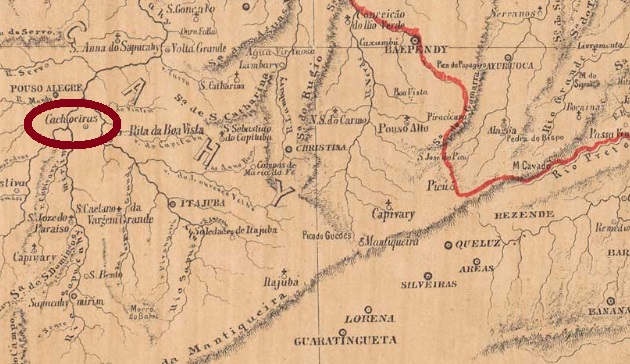
Other names: Cachoeiras, Catadupas, Cachoeira de Minas (1948)
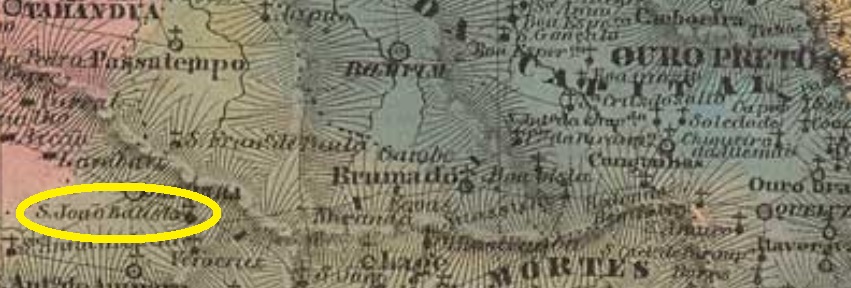
From June 1854, São João Baptista das Cachoeiras was a district in the municipality of Sao José do Paraíso, about 450 km southwest of the provincial capital Ouro Preto. In September 1923, it rose to a villa in own municipality, called Cachoeiras. After that, the municipality changed its name twice: in December 1943 to Catadupas and five years later to the current Cachoeira de Minas.
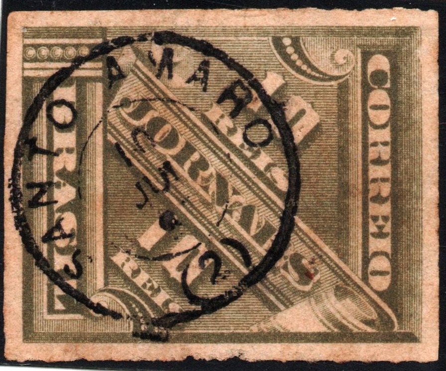
As Paula Sobrinho writes in Historia Postal de Minas Gerais (Belo Horizonte, 1997), there has been a post office there since December 1879. The only imperial cancel so far is SMG-2355a (Coll. José A. Junges): a double circle with the inscription S. JOĀO BAPTA. DAS CACHOEIRAS on top and an ornament at the bottom that looks like a four-petal flower. The data at the centre date back to the period 1889-1906.
Provincia de Minas Geraes, 1873
Andere Namen: Cachoeiras, Catadupas, Cachoeira de Minas (1948)
São João Baptista das Cachoeiras war ab Juni 1854 ein Distrikt im Município von São José do Paraíso, der ca. 450 km südwestlich der Provinzhauptstadt Ouro Preto entfernt lag. Im September 1923 stieg er zur Villa im Município von Cachoeiras auf. Danach wechselte der Gemeindename zweimal: im Dezember 1943 zu Catadupas und fünf Jahre später zum aktuellen Cachoeira de Minas.
Wie Paula Sobrinho im Historia Postal de Minas Gerais (Belo Horizonte, 1997) schreibt, gibt es dort ein Postamt seit Dezember 1879. Der bisher einzige kaiserliche Stempel ist SMG-2355a (Samml. José A. Junges): ein Doppelkreis mit der Inschrift S. JOĀO BAPTA. DAS CACHOEIRAS oben und einem Ornament unten, das wie eine vierblättrige Blume aussieht. Die Daten in der Mitte entstammen dem Zeitraum 1889-1906.
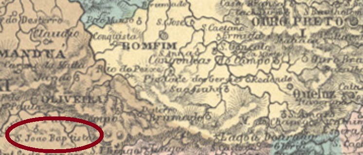
Other names: São João Baptista de Bom Successo, Morro do Ferro (1943)
Among the 4 localities in the province of Minas Gerais, which were named after St. John Baptist in the 1880 Postal Guide (Guia Postal do Império), this was probably the smallest. It was a curato in the municipality of Oliveira, about 160 km southwest of the capital Ouro Preto. In November 1842, the settlement was elevated to a district, and in September 1871 to a freguesia in the municipality of Bom Successo. However, it returned as a district of Oliveira in November 1923, and since December 1943, the district has been called Morro do Ferro (= Iron Mountain), named after the great hematite occurrence of the region.
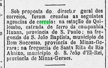
According to Paula Sobrinho (História Postal de Minas Gerais, Belo Horizonte, 1997), there has been a post office there since October 1885. This can be ratified by a press note from Rio:
Gazeta de Noticias/RJ, October 31, 1885
No imperial cancel could be safely identified for this locality, so far.
Villiers de l’Ile Adam: Carta (…) da Provincia de Minas Geraes, 1849
Andere Namen: São João Baptista de Bom Successo, Morro do Ferro (1943)
Unter den 4 Ortschaften der Provinz Minas Gerais, die 1880 nach St. Johannes Baptist im Postführer (Guia Postal do Império) genannt wurden, diese war wohl die kleinste. Sie war ab Juli 1832 ein Curato im Município von Oliveira, über 160 km südwestlich der Hauptstadt Ouro Preto gelegen. Im November 1842 wurde der Ort zum Distrikt erhoben, und im September 1871 zu einer Freguesia von Bom Successo. Allerdings kehrte S. João Baptista im November 1923 als Distrikt zu Oliveira zurück und heißt seit Dezember 1943 Morro do Ferro (= Eisenberg), genannt nach dem großen Hämatit-Vorkommen der Region.
Laut Paula Sobrinho (História Postal de Minas Gerais, Belo Horizonte, 1997) gibt es dort ein Postamt seit Oktober 1885. Das bestätigt die Presse aus Rio:
Gazeta de Noticias/RJ, 31. Oktober 1885
Bisher konnte kein kaiserlicher Stempel zweifelsfrei diesem Ort zugeordnet werden.
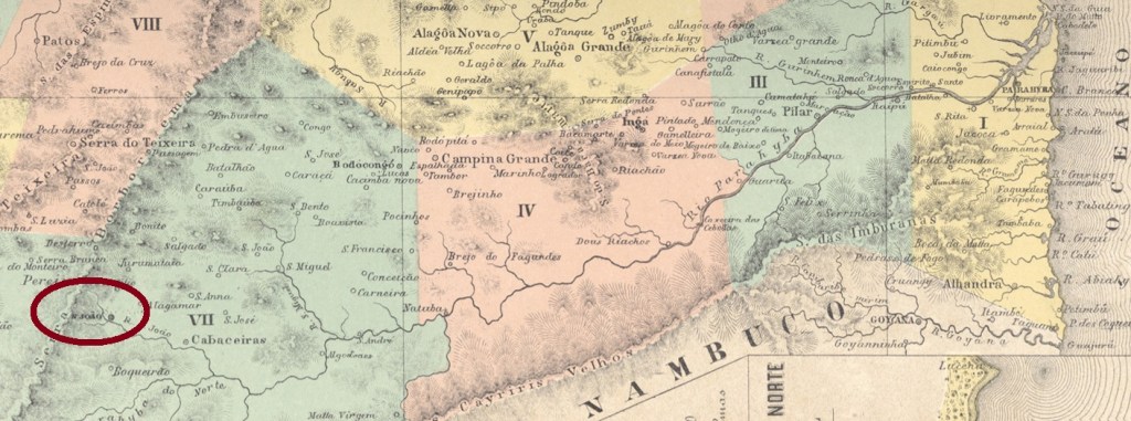
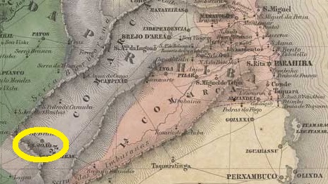
Other names: Nossa Senhora dos Milagres, Sao João do Cariri
The long list of imperial post offices in the Carimbologia S2 volume, which will be published in 2021, starts with the town of Sao João in the province of Paraíba (then Parahyba do Norte). This village was called Freguesia de Nossa Senhora dos Milagres (= Our Lady of Wonders) since 1750 and was located more than 200 km west of the provincial capital Parahyba do Norte (today João Pessoa). In May 1803, it rose to a villa called São João do Cariri. In November 1921 it became a town. Cariri was an Indian tribe in northeastern Brazil, which later named almost the entire hinterland of the region.
According to Nova Monteiro (Administrações e Agencias Postaes do Brasil Imperio, in Brasil Filatelico/RJ, 1934-5; Reprint SPP 1994-1999) there is a post office there since May 1829. Only one cancel of the imperial period could be identified, certainly not the oldest, since its dates remain between 1887 and 1889. SPB-0205b (Coll. José A. Junges) has a simple double circle with the inscription S. JOAO above and the date at the centre.
Villiers de l’Ile Adam: Carta (…) das Provincias do Rio Grande do Norte e Parahyba, 1848
Andere Namen: Nossa Senhora dos Milagres, São João do Cariri
Mit São João in der Provinz Paraíba (damals Parahyba do Norte geschrieben) startet die lange Liste der kaiserlichen Postämter im Band Carimbologia S2, der in 2021 erscheinen wird. Diese Ortschaft hieß seit 1750 Freguesia de Nossa Senhora dos Milagres (= Unsere Liebe Frau der Wunder) und lag über 200 km westlich der Provinzhauptstadt Parahyba do Norte (heute João Pessoa). Im Mai 1803 stieg sie zu einer Villa namens São João do Cariri. Im November 1921 wurde daraus eine Stadt. Cariri war ein Indianerstamm im Nordosten Brasiliens, der später fast das gesamte Hinterland der Region genannt hat.
Laut Nova Monteiro (Administrações e Agencias Postaes do Brasil Imperio, in Brasil Filatelico/RJ, 1934-5; Reprint SPP 1994-1999) gibt es dort ein Postamt seit Mai 1829. Nur ein Stempel der Kaiserzeit konnte identifiziert werden, bestimmt nicht der älteste, da seine Daten zwischen 1887 und 1889 liegen. SPB-0205b (Samml. José A. Junges) hat einen einfachen Doppelkreis mit der Inschrift S. JOAO oben und dem Datum in der Mitte.
This post deals among others with all unsolved cases related to post offices within Carimbologia volume S1 (i.e. between Sabará/MG and São Jeronymo/RS). One can find here alternative toponyms, unknown localities, and eventually also mysterious cancels to be identified, listed alphabetically.
Diese Post soll unter anderem alle unerledigten Fälle bei den Postämtern auflisten, die im Bereich vom Carimbologia S1 (d.h. zwischen Sabará/MG und São Jeronymo/RS) liegen. Hier werden alternative Ortsnamen, unbekannte Ortschaften und eventuell auch rätselhafte Stempel vorgestellt, alles in alphabetischer Folge.
S (Município Neutro): see/siehe Rio de Janeiro (from/ab 2023)
Sabão, Rua do (Município Neutro): see/siehe Rio de Janeiro (from/ab 2023)
Sacco d’Orelha CE: uncertain/unbestätigt
Salomé AL: uncertain/unbestätigt
Salto do Macuco SP: see/siehe São Francisco do Salto do Macuco (SSP-1805)
Salvador BA: see/siehe Bahia (from/ab 2023)
Santa Bárbara de Curumatahy/de Diamantina MG: see/siehe SMG-2802
Santa Bárbara do Rio Preto SP: uncertain/unbestätigt
Santa Cruz de Corumbá MT: see/siehe Corumbá (Koester, Carimbologia XIV)
Santa Cruz dos Mendes RJ: see/siehe Mendes (Koester, Carimbologia XXVII)
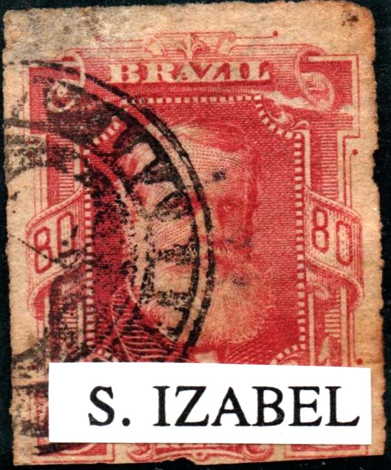
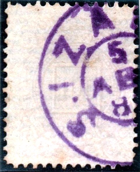
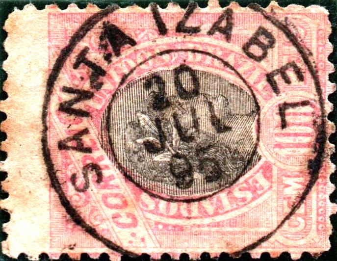
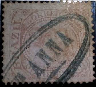
Santa Isabel/Izabel: still to identify/noch zu bestimmen
1844ff (Coll./Samml. José A. Junges)1878ff (Coll./Samml. José A. Junges)1880ff-1885ff (Coll./Samml. José A. Junges)1880-1895 (Coll./Samml. José A. Junges)
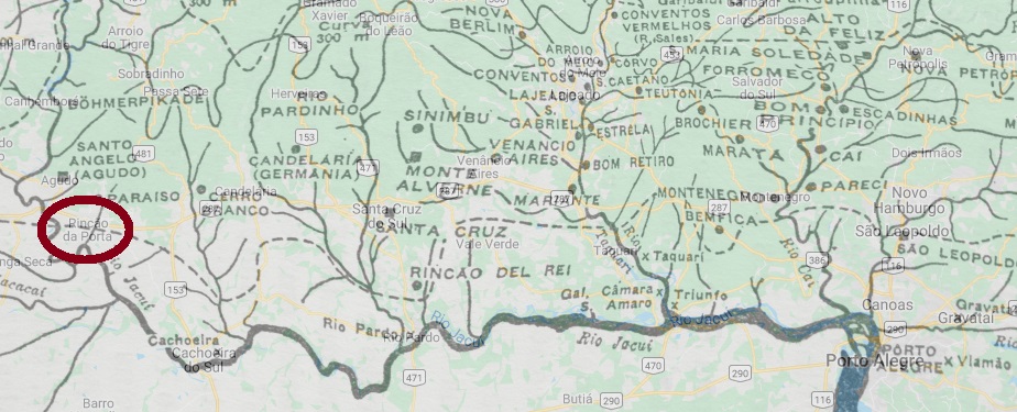
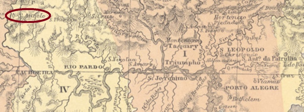
Other names: Rincão da Porta, Marupiara, Vila Paraíso, Paraíso do Sul (1988)
This other Santo Angelo in the province of Rio Grande do Sul was from about 1857 on a colonist settlement near Cachoeira, which was located on the north bank of the Jacuhy River, about 230 km west of the provincial capital Porto Alegre. It was not until December 1963 that it became the district of Rincão da Porta, and in May 1988 it was granted the status of an independent municipality, under the name of Paraíso do Sul.
The local post office was only established in October 1889, shortly before the end of the Empire, as reported in the postal newsletter (Boletim Postal) of November 1889:
Boletim Postal 1889/7 (November 1889)
So far, no imperial postmark of this place could be found.
Atlas do Imperio do Brasil, 1868
Andere Namen: Rincão da Porta, Marupiara, Vila Paraíso, Paraíso do Sul (1988)
Dieser andere Santo Angelo in der Provinz Rio Grande do Sul war ab ca. 1857 eine Kolonistensiedlung bei Cachoeira, die am Nordufer des Jacuhy-Flusses lag, ca. 230 km westlich der Provinzhauptstadt Porto Alegre enfernt. Erst im Dezember 1963 wurde daraus der Distrikt von Rincão da Porta, und im Mai 1988 erhielt der Ort den Status eines selbständigen Municípios, unter dem Namen Paraíso do Sul.
Das örtliche Postamt entstand erst im Oktober 1889, kurz vor dem Ende des Kaiserreichs, wie im postalischen Newsletter (Boletim Postal) vom November 1889 angemerkt:
Boletim Postal 1889/7 (November 1889)
Bisher konnte kein kaiserlicher Poststempel dieses Orts gefunden werden.
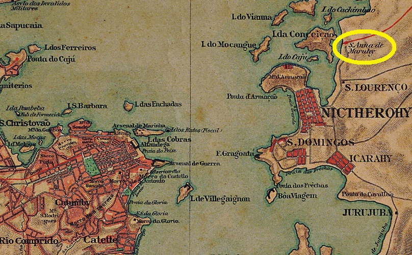
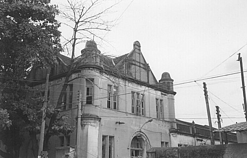
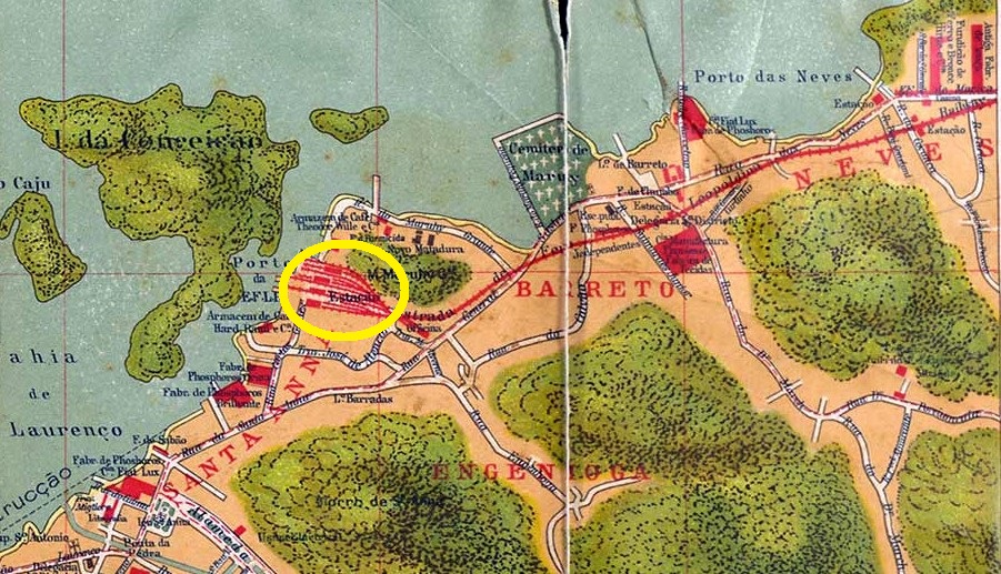
The station was built in 1871 by the railway company Cia. Ferro-Carril Nictheroiense in the so-called Coastline (Linha do Litoral) and was located in Niterói directly on the Maruhy mountain, close to the ferries to Rio de Janeiro, where today the bridge over Guanabara Bay lands in Niterói. In 1887, the line passed to E. F. Leopoldina, in 1975 to the Rede Ferroviária Federal S.A. and from 1996 to operation end in 2007, to Flumitrens/Central. Now the rails have been removed and the station building has been abandoned (estacoesferroviarias.com.br).
In 2002 (Photo: Marco A. Dantas, in estacoesferroviarias.com.br)
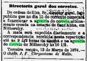
As Paulo Novaes reports (agenciaspostais.com.br), there was a station post office from March 1874 to about 1880. Its start of operations was announced by the Rio press:
Diario do Rio de Janeiro, 15 March 1874
So far, no imperial postmark for this station has been found.
Carlos Aenishänslin, 1914
Andere Namen: Sant’Anna, Maruí
Der Bahnhof wurde 1871 durch die Bahngesellschaft Cia. Ferro-Carril Nictheroiense in der so genannten Küstenlinie (Linha do Litoral) eingeweiht und lag bei Niterói direkt am Maruhy-Berg, nah an der Anlagestelle zur Fähre nach Rio de Janeiro, wo heute die Brücke über der Guanabara-Bucht in Niterói landet. 1887 ging die Bahnlinie zur E. F. Leopoldina über, 1975 zur Rede Ferroviária Federal S.A. und von 1996 bis Betriebsende 2007, zur Flumitrens/Central. Nun wurden die Schienen entfernt, und das Bahnhofsgebäude ist verlassen (estacoesferroviarias.com.br).
In 2002 (Photo Marco A. Dantas, in estacoesferroviarias.com.br)
Wie Paulo Novaes berichtet (agenciaspostais.com.br), gab es dort ein Bahnhofpostamt vom März 1874 bis ca. 1880. Dessen Betriebsbeginn wurde in der Rio-Presse angekündigt:
Diario do Rio de Janeiro, 15. März 1874
Bisher konnte kein kaiserlicher Poststempel für diesen Bahnhof gefunden werden.
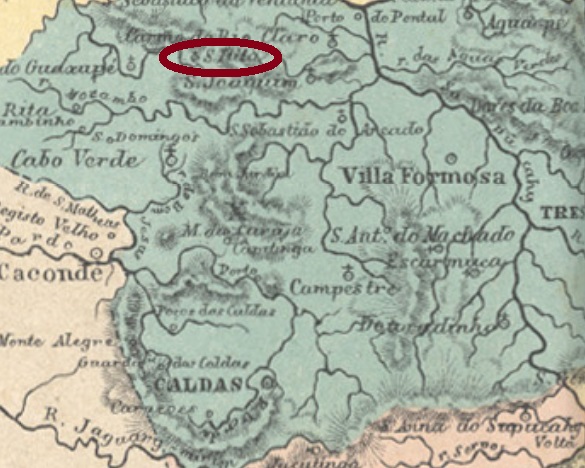
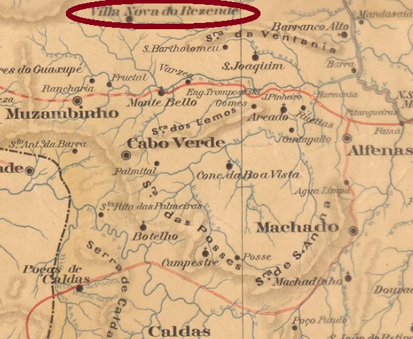
Other names: Villa Nova de Resende, Nova Resende (1923)
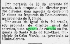
As one can expect, this Santa Rita do Rio Claro was very often confused with the other place of the same name in the province of Minas Gerais (see SMG-2935). To increase this confusion, both villages are only about 140 km apart. This Santa Rita do Rio Claro was from January 1841 a chapel in the municipality of Jacuhy, which was located about 450 km west of the provincial capital Ouro Preto. After being elevated to a district in October 1866, it changed the municipality four times – in 1870 to Passos, in 1875 to Carmo do Rio Claro, in 1878 to Cabo Verde, and again to Passos in 1888 – until political independence was acquired in January 1901 under the name Villa Nova de Resende. Since September 1923, this municipality has been called Nova Resende.
The post office there was built in July 1881, according to Paula Sobrinho (História Postal de Minas Gerais, Belo Horizonte, 1997). However, the correct date is more probably a month later, as the Rio press reports:
Diario de Noticias/RJ, August 11, 1881
So far, no imperial postmark from this place has been seen.
Mappa de Minas Geraes, 1910
Andere Namen: Villa Nova de Resende, Nova Resende (1923)
Wie man sich vorstellen kann, wurde diese Santa Rita do Rio Claro sehr oft mit dem anderen Ort gleichen Namens in der Provinz Minas Gerais (siehe SMG-2935) verwechselt. Um die Verwechslungsgefahr noch zu erhöhen, liegen beide Ortschaften nur ca. 140 km voneinander entfernt. Diese Santa Rita do Rio Claro war ab Januar 1841 eine Kapelle im Município von Jacuhy, die ca. 450 km westlich der Provinzhauptstadt Ouro Preto lag. Nachdem der Ort im Oktober 1866 zum Distrikt erhoben wurde, wechselte er gleich viermal die Zuständigkeit – 1870 zu Passos, 1875 zu Carmo do Rio Claro, 1878 zu Cabo Verde und 1888 nochmals zu Passos – bis die politische Selbständigkeit im Januar 1901 unter dem Namen Villa Nova de Resende erlangt wurde. Dieser Município heißt seit September 1923 Nova Resende.
Das Postamt dort entstandt laut Paula Sobrinho (História Postal de Minas Gerais, Belo Horizonte, 1997) im Juli 1881. Allerdings dürfte das richtige Datum ein Monat später liegen, wie aus der Rio-Presse hervorgeht:
Diario de Noticias/RJ, 11. August 1881
Bisher war kein kaiserlicher Poststempel aus diesem Ort zu sehen.
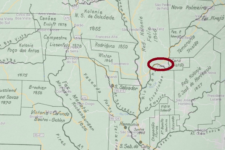
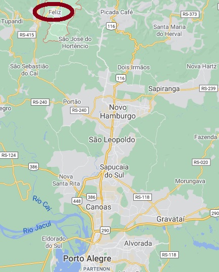
Santa Catharina da Feliz was a district in the municipality of São Sebastião do Cahy, located about 90 km north of the provincial capital Porto Alegre. In October 1903, the district was renamed after Júlio de Castilhos, in memory of the late politician Júlio Prates de Castilhos. The name Feliz returned in March 1938, and since February 1959 Feliz has been an independent municipality.
As can be seen from the Post-Newsletter (Boletim Postal) of November 1889, there has been a post office there since October of the year, i.e. just over two weeks before the end of the Empire:
Boletim Postal 7/1889 (November 1889)
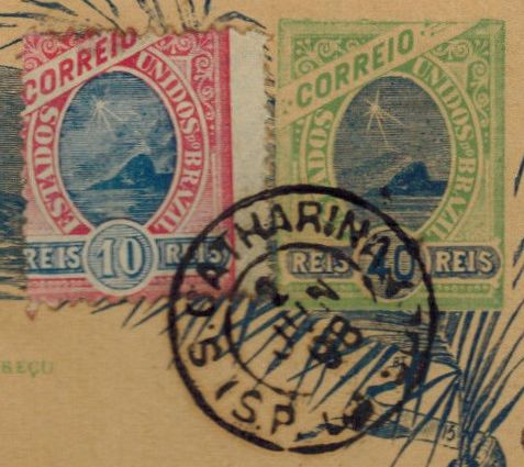
An early postmark could be found, dated 1898:
SRS-0383a (Coll. FM)Google Maps
Andere Namen: Júlio de Castilhos, Feliz (1938)
Santa Catharina da Feliz war ab Mai 1875 ein Distrikt im Município von São Sebastião do Cahy, der knapp 90 km nördlich der Provinzhauptstadt Porto Alegre entfernt lag. Im Oktober 1903 wurde der Distrikt nach Júlio de Castilhos umbenannt, im Andenken an den gerade verstorbenen Politiker Júlio Prates de Castilhos. Der Name Feliz kehrte doch im März 1938 wieder zurück, und seit Februar 1959 ist Feliz ein selbständiger Município.
Wie aus dem Post-Newsletter (Boletim Postal) von November 1889 hervorgeht, gibt es dort ein Postamt seit Oktober des Jahres, also gut zwei Wochen vor dem Ende des Kaiserreichs:
Boletim Postal 7/1889, November 1889
Ein früher Poststempel war noch zu finden, datiert 1898:
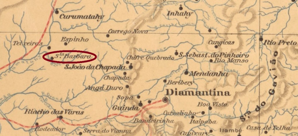
Before Carimbologia S2 begins – with post offices from Sao João (PB) to Suruhy (RJ) – a few agencies discovered after the editorial deadline of Carimbologia S1 will be presented, as well as a summary of all remaining problem cases. We begin with Santa Barbara near Diamantina, a post office that was still considered as uncertain in the Carimbologia print version.
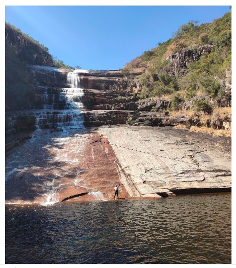
This Santa Barbara in the province of Minas Gerais was a small settlement near Curimatahy in the municipality of Diamantina, located about 360 km north of the provincial capital Ouro Preto. In December 1938, it became a part of the new district of Augusto Lima in the municipality of Buenopolis. It remained so when Augusto Lima rose to a municipality in December 1962. Santa Bárbara is the name of the small river that flows through the village, and whose waterfalls are still a tourist magnet today (see above).
According to Paula Sobrinho (História Postal de Minas Gerais, Belo Horizonte, 1997), the local post office was established in September 1889, as reported in the Postal Newsletter (Boletim Postal) of October that year:
Boletim Postal, 6/1889
So far, no postmark of the Empire has been seen. Is there one at all?
Mappa de Minas Geraes, 1910
Bevor die Carimbologia S2 – mit den Postämtern von São João (PB) bis Suruhy (RJ) – beginnt, werden noch ein Paar Agenturen vorgestellt, die nach Redaktionsschluss von Carimbologia S1 entdeckt wurden, sowie eine Zusammenfassung aller verbliebenen Problemfälle präsentiert. Den Anfang macht Santa Barbara bei Diamantina, ein Postamt, das noch in der Carimbologia-Druckfassung als fraglich galt.
Diese andere Santa Barbara in der Provinz Minas Gerais war eine kleine Siedlung bei Curimatahy im Município von Diamantina, die gut 360 km nördlich der Provinzhauptstadt Ouro Preto entfernt lag. Im Dezember 1938 wurde sie ein Ortsteil des neuen Distrikts von Augusto Lima im Município von Buenópolis. Dabei blieb es, als Augusto Lima im Dezember 1962 zum Município aufstieg. Santa Bárbara heißt auch der kleine Fluss, der durch den Ort fließt, und dessen Wasserfälle heute noch ein Touristenmagnet sind (s. oben).
Laut Paula Sobrinho (História Postal de Minas Gerais, Belo Horizonte, 1997) entstand das örtliche Postamt im September 1889, wie auch im Newsletter der Post (Boletim Postal) vom Oktober d.J. berichtet wird:
Boletim Postal, 6/1889
Bisher war kein Poststempel des Kaiserreichs zu sehen. Ob es einen überhaupt gibt?
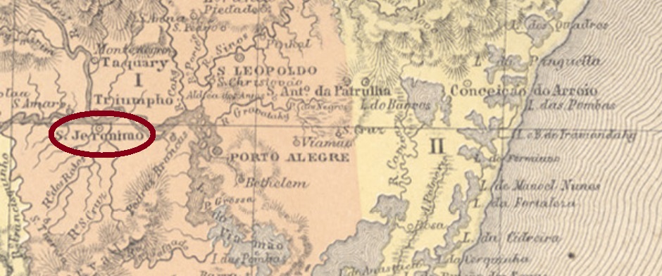
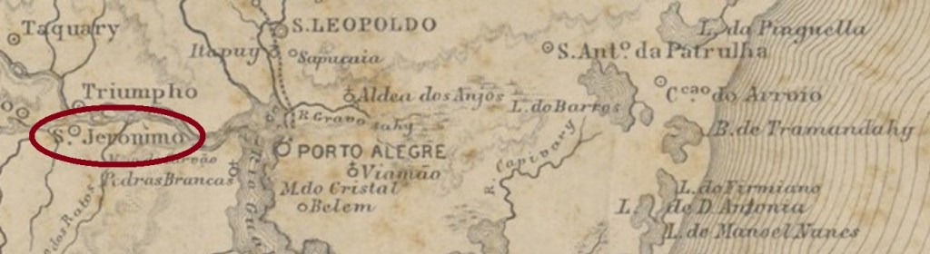
A former district of Bom Jesus do Triumpho, São Jeronymo was located less than 70 km west of the provincial capital of Porto Alegre. In September 1861, it received the political emancipation as a villa in his own municipality.
As Nova Monteiro in Administrações e Agencias Postaes do Brasil Imperio (Brasil Filatelico/RJ, 1934-5; Reprint SPP 1994-1999) reports, there is a post office there since September 1862. Two earlier stamps have been found, which are probably not the oldest. SRS-0320b (Coll. José A. Junges) occurs in black and blue and has a double circle with inscription S. JERONYMO. The dates at the centre were found for the period 1878-1886. SRS-0320c (Coll. José A. Junges) is almost identical to his predecessor, but here there is also a cross-like ornament at the bottom between the circles, which is formed by small branches. One only copy seen, in blue, dated 1890.
Provincia de São Pedro do Rio Grande do Sul, 1877
Anderer Name: Passo das Tropas
São Jeronymo war ein früherer Distrikt von Bom Jesus do Triumpho, der knapp 70 km westlich der Provinzhauptstadt Porto Alegre entfernt lag. In September 1861 erhielt er seine politische Emanzipation als Villa im eigenen Município.
Wie Nova Monteiro in Administrações e Agencias Postaes do Brasil Imperio (Brasil Filatelico/RJ, 1934-5; Reprint SPP 1994-1999) berichtet, gibt es dort ein Postamt seit September 1862. Zwei frühere Abstempelungen wurden gefunden, die wohl nicht die ältesten sind. SRS-0320b (Samml. José A. Junges) kommt in schwarz und blau vor und hat einen Doppelkreis mit Inschrift S. JERONYMO. Die Daten in der Mitte wurden für den Zeitraum 1878-1886 gefunden. SRS-0320c (Samml. José A. Junges) ist fast identisch mit seinem Vorgänger, hier gibt es aber zusätzlich ein Ornament in Kreuzform unten zwischen den Kreisen, das aus kleinen Zweigen formiert wird. Das einzig gesichtete Exemplar ist in blauer Farbe, datiert 1890.