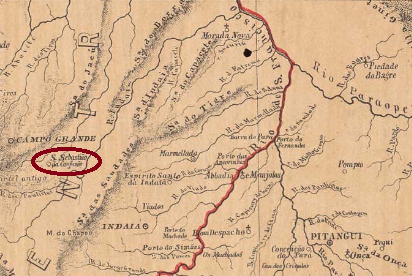
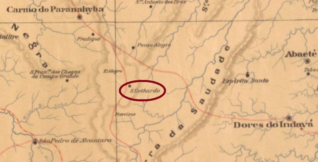
Other names: São Sebastião da Confusão, São Sebastião de Pouso Alegre
See also São Sebastião de Pouso Alegre (SMG-2247)
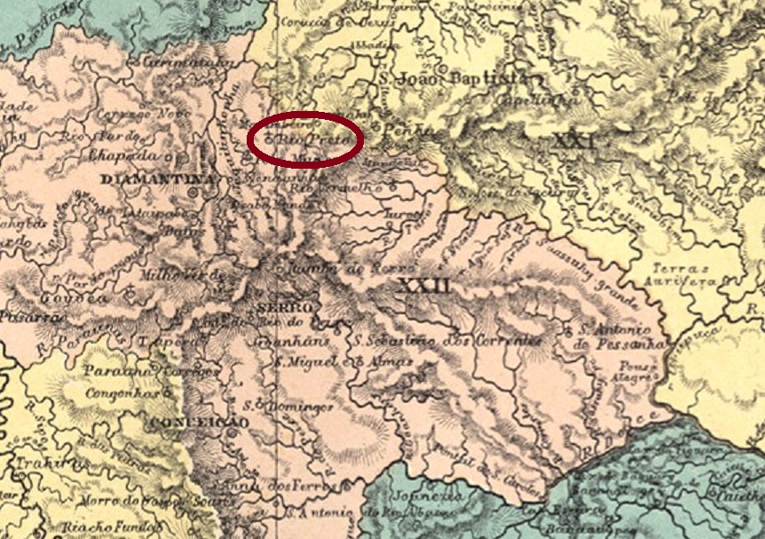
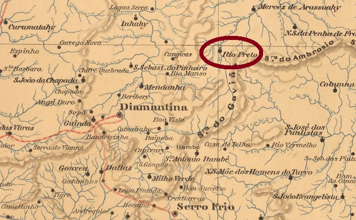
São Gothardo (today written Gotardo) was the third name of this village in the province of Minas Gerais, located near Pitangui, about 400 km west of the capital Ouro Preto. At the beginning, the Arraial (settlement) was called S. Sebastião da Confusão, i.e. Saint Sebastian of Confusion. Such a name was apparently too bizarre for the authorities, so in May 1852 the place was officially renamed to São Sebastião de Pouso Alegre, although the old name remained in use. In July 1868, the town changed to the new municipality of Dores do Indayá, and it was not until August 1885 that it was called São Gothardo. After that, it changed the municipality twice: in November 1890 to Carmo do Paranahyba, and in August 1911 to Rio Paranahyba. Since September 1914, São Gotardo has been an independent municipality.
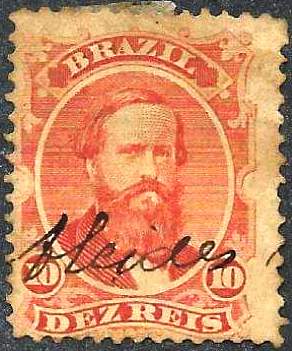
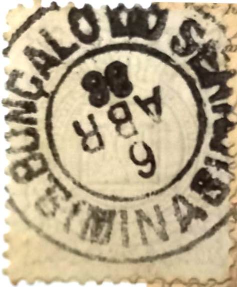
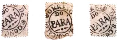
According to Paula Sobrinho (História Postal de Minas Gerais, Belo Horizonte, 1997), there has been a post office there since November 1883, at a time when the place was still called São Sebastião de Pouso Alegre. Since postmarks with S. SEBASTIÃO DE POUSO ALEGRE with dates from 1887 to 1896 have been found so far, we must fear that all São Gothardo cancels are Republican. Anyway, the oldest among them is SMG-2340a (Coll. Dieter Kerkhoff): a double circle with the inscriptions S. GOTHARDO above and (MINAS) below. The dates seen so far go from 1897 to 1902.
Andere Namen: São Sebastião da Confusão, São Sebastião de Pouso Alegre
Siehe auch São Sebastião de Pouso Alegre (SMG-2247)
São Gothardo (heute Gotardo geschrieben) war der dritte Name dieser Ortschaft der Provinz Minas Gerais, die bei Pitangui, knapp 400 km westlich der Hauptstadt Ouro Preto entfernt lag. Zu Beginn hieß der Arraial (Siedlung) São Sebastião da Confusão, also Heiliger Sebastian der Verwirrung. Solcher Name war der Obrigkeit offenbar zu bunt, also wurde der Ort im Mai 1852 offiziell zu São Sebastião de Pouso Alegre umbenannt, obwohl der alte Name weiterhin in Gebrauch blieb. Im Juli 1868 wechselte der Ort zum neuen Municipio von Dores do Indayá, und erst im August 1885 hieß er dann São Gothardo. Er wechselte noch zweimal seine Zuständigkeit: im November 1890 zu Carmo do Paranahyba, und im August 1911 zu Rio Paranahyba. Seit September 1914 ist São Gotardo ein eigenständiger Município.
Laut Paula Sobrinho (História Postal de Minas Gerais, Belo Horizonte, 1997) gibt es dort ein Postamt seit November 1883, also zu einer Zeit, als der Ort noch São Sebastião de Pouso Alegre hieß. Da bisher Poststempel mit S. SEBASTIÃO DE POUSO ALEGRE mit Daten von 1887 bis 1896 gefunden wurden, müssen wir befürchten, dass alle São Gothardo-Stempel republikanisch sind. Wie es dem auch sei, ist der älteste davon SMG-2340a (Samml. Dieter Kerkhoff): ein Doppelkreis mit den Inschriften S. GOTHARDO oben und (MINAS) unten. Die bisher gesehenen Daten entstammen dem Zeitraum 1897-1902.