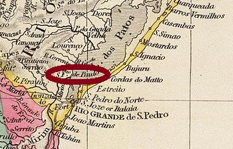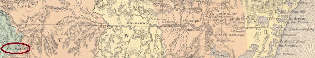
The parish of São Gabriel was situated in the municipality of Cachoeira, more than 300 km west of the provincial capital Porto Alegre. In December 1837, during the Farroupilha Revolution, it became a district and in April 1846, a villa. Since December 1859, São Gabriel has the town status.
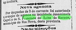
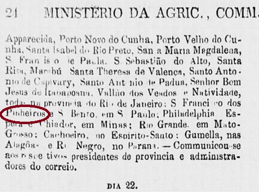
According to Nova Monteiro (Administrações e Agencias Postaes do Brasil Imperio, in Brasil Filatelico/RJ, 1934-5; Reprint SPP 1994-1999) there is a post office there since October 1831. However, it may have been closed during the Revolution (1835-1845), for an agency reopening is reported in the Yearbook for Politics, History and Statistics of Brazil for 1846:
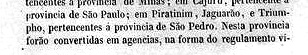

The year is confirmed by the Imperial Mail Register (Tabella das Agencias do Correio do Imperio) of 1885. The pre-philatelic cancel SRS-0315a may have been in use both in the first and the beginning of the second operating period (until at least 1866). It was presented in the RHM catalogue as P-RS-26, but a point after the S is missing, as can be seen in the following illustrations:

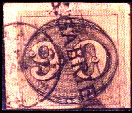
It was followed by SRS-0315b, a handwritten cancellation that was used in some variants from ca. 1850 until the 1876 D. Pedro issue:
SRS-0315c (Coll. José A. Junges) is again a “normal” cancel: a double circle with inscription SAO GABRIEL above. The dates at the centre are from the period approx. 1876-1879. SRS-0315d (Coll. Dieter Kerkhoff) is also available in green. Here the double circle is slightly larger, the inscription is now S. GABRIEL above, and below you can see a diamond-shaped ornament consisting of four small leaflets. Dated 1883-1890ff at the centre. SRS-0315e (Coll. José A. Junges) resembles a seal: a black double circle with inscriptions in negative: S. GABRIEL above and S.P. DO SUL below. The centre has remained free, without dates. Found on issues from 1884 to 1889. Finally, SRS-0315f (Coll. José A. Junges) is likely to be Republican, as it dates so far from 1892 on. Here the upper inscription in the double circle is S. GABRIEL, below one reads (S. PEDRO DO SUL), with date at the centre.
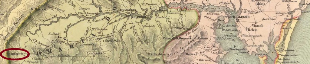
São Gabriel war eine Pfarrei im Município von Cachoeira, die über 300 km westlich der Provinzhauptstadt Porto Alegre entfernt lag. Im Dezember 1837 – also mitten in der Farroupilha-Revolution – wurde daraus ein Distrikt und im April 1846 eine Villa. Seit Dezember 1859 ist São Gabriel eine Stadt.
Laut Nova Monteiro (Administrações e Agencias Postaes do Brasil Imperio, in Brasil Filatelico/RJ, 1934-5; Reprint SPP 1994-1999) gibt es dort ein Postamt seit Oktober 1831. Allerdings durfte es während des Aufstands (1835-1845) geschlossen gewesen zu sein, denn im Jahrbuch für Politik, Geschichte und Statistik Brasiliens für 1846 wird über eine Wiedereröffnung des Postamts berichtet:

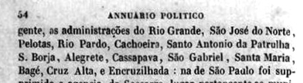
Diese Jahresangabe wird durch das Verzeichnis der kaiserlichen Postämter (Tabella das Agencias do Correio do Imperio) von 1885 bestätigt. Der Vorphila-Stempel SRS-0315a dürfte sowohl in der ersten als auch am Anfang der zweiten Betriebsperiode (bis mindestens 1866) im Gebrauch gewesen sein. Er wurde im RHM-Katalog als P-RS-26 vorgestellt, allerdings fehlt ein Punkt nach dem S, wie man auf der darauffolgenden Abbildung sehen kann:


Ihm folgte SRS-0315b, eine handschriftliche Entwertung, die ab der Zifferausgabe vom 1850 bis zur D. Pedro-Ausgabe von 1876 in einigen Varianten benutzt wurde:

SRS-0315c (Samml. José A. Junges) ist wieder ein „normaler“ Stempel: ein Doppelkreis mit Inschrift SAO GABRIEL oben. Die Daten in der Mitte entstammen dem Zeitraum ca. 1876-1879. SRS-0315d (Samml. Dieter Kerkhoff) gibt es auch in grün. Hier ist der Doppelkreis etwas größer, die Inschrift lautet nun S. GABRIEL oben, und unten sieht man ein rautenförmiges Ornament, das aus vier kleinen Zweigen besteht. Datiert 1883-1890ff in der Mitte. SRS-0315e (Samml. José A. Junges) sieht eher wie ein Siegel aus: ein schwarzer Doppelkreis mit Inschriften im Negativ: S. GABRIEL oben und S.P. DO SUL unten. Die Mitte ist frei geblieben, ohne Datumsangaben. Angetroffen auf Ausgaben von 1884 bis 1889. Und SRS-0315f (Samml. José A. Junges) dürfte bereits republikanisch sein, da die bisherigen Daten ab 1892 aufweisen. Hier lautet die obere Inschrift im Doppelkreis S. GABRIEL, unten liest man (S. PEDRO DO SUL), dazu Datum in der Mitte.