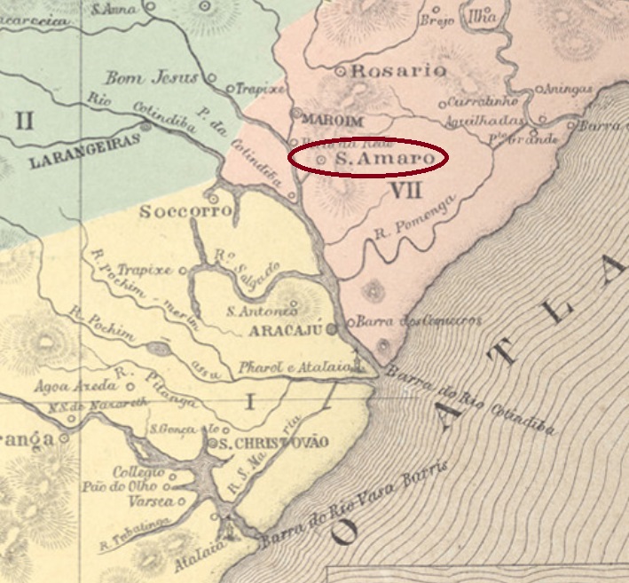
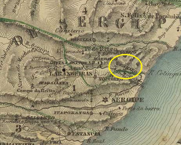
The freguesia of Santo Amaro das Brotas (or simply Santo Amaro) was founded in November 1783 on the north bank of the Sergipe River, over 50 km north of the later provincial capital São Christovão. It became a district of the municipality of Maroim in February 1835 and ascended to a villa in own municipality six months later. In 1911 the toponym was officially simplified to Santo Amaro, but the additional das Brotas returned in December 1943.
Villiers de l’Ile Adam (Carta (…) das Provincias de Pernambuco, Alagoas e Sergipe, 1848
Die Freguesia von Santo Amaro das Brotas (oder einfach Santo Amaro) wurde im November 1783 am Nordufer des Flusses Sergipe gegründet und lag über 50 km nördlich der künftigen Provinzhauptstadt São Christovão entfernt. Sie wurde ein Distrikt im Município von Maroim im Februar 1835 und stieg sechs Monate später zur Villa im eigenen Município auf. 1911 wurde der Ortsname zu Santo Amaro vereinfacht, aber der Zusatz das Brotas kehrte ab Dezember 1943 zurück.
Das örtliche Postamt wurde durch Nova Monteiro (Administrações e Agencias Postaes do Brasil Imperio, in Brasil Filatelico/RJ, 1934-5; Reprint SPP 1994-1999) mit Entstehungsdatum im Oktober 1864 angegeben. Kein Poststempel der Kaiserzeit konnte bisher sicherlich identifiziert werden.
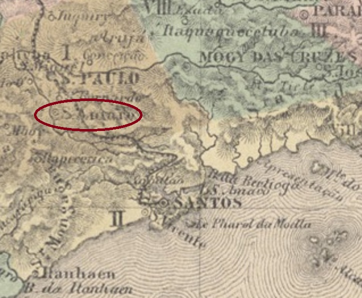
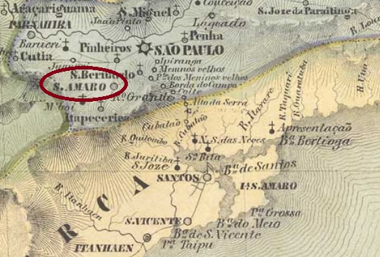
The Santo Amaro in the São Paulo province was already a villa in own municipality as early as July 1832. Situated ca. 16 km southwest of the provincial capital, it was absorbed by it in February 1935, then receiving the actual district status.
One imperial cancel could be safely identified: SSP-1310a (Coll. José A. Junges) has a double circle with the inscriptions STO. AMARO above and (S. PAULO) below. The date found at the centre was of 1887.
Villiers de l’Ile Adam: Carta (…) da Provincia de São Paulo, 1847
Dieser Santo Amaro in der Provinz São Paulo war bereits im Juli 1832 eine Villa im eigenen Município. Die Nähe zur Provinzhauptstadt – es sind lediglich 16 km nach Südwesten – wurde der Gemeinde doch zum Verhängnis: im Februar 1935 wurde Santo Amaro als Distrikt der Metropole eingemeindet.
Laut Verzeichnis der kaiserlichen Postämter (Tabella das Agencias do Correio do Imperio) von 1885 gibt es dort ein Postamt seit 1876. Der Postbetrieb fing wohl erst Anfang 1877 an, wie die Lokalpresse berichtet:
Correio Paulistano, 28. Januar 1877
Ein Stempel des Kaiserreichs konnte zweifelsfrei ermittelt werden: SSP-1310a (Samml. José A. Junges) hat einen Doppelkreis mit den Inschriften STO. AMARO oben und (S. PAULO) unten. Das Datum in der Mitte entstammt dem Jahr 1887.
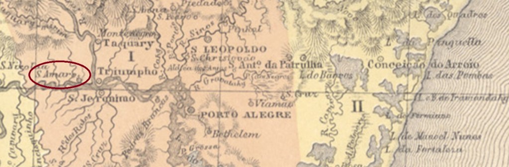
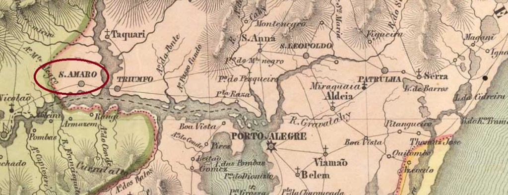
This Santo Amaro in the São Pedro do Rio Grande province was founded in the late 18th century and became in April 1809 a district of the municipality of Rio Pardo. It was situated on the north bank of the Jacuhy River, nearly 100 km west of the provincial capital Porto Alegre, and passed later to the newly created municipalities of Triumpho (1831) and Taquary (1849), before emancipating as a villa in May 1881. The construction of the Margem train station at the conjunction of the Taquary and Jacuhy Rivers in 1883 caused the decadence of Santo Amaro, which has continuosly shrunk in population and importance since then. Since July 1939 it is the district of Santo Amaro do Sul, in the municipality of General Câmara, a town that originated from the Margem station.
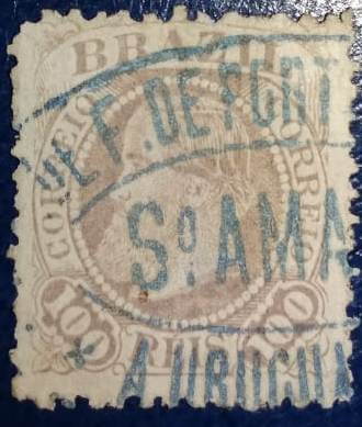
According to the Imperial Mail Register / Verzeichnis der kaiserlichen Postämter (Tabella das Agencias do Correio do Imperio) of 1885, the local post office was created in 1881. Two imperial cancels were found: SRS-0410a (Coll. José A. Junges) was found in black and violet with dates between 1887 and 1897 at the centre. In the double circle there is the inscription S. AMARO above and a diamond ornament below, which is formed by four small diamonds. SRS-0410b (Coll. Fuad Ferreira Fo.) is a train station cancel, used from ca. 1883 on. Since it was found after the printing of Carimbologia S1, so it will be shown here:
SRS-0410b (Coll. Fuad Ferreira Fo.)Villiers de l’Ile Adam: Carta (…) da Província de S. Pedro do Sul, 1847
Anderer Name: Santo Amaro do Sul (1939)
Dieser Santo Amaro in der Provinz São Pedro do Rio Grande wurde im späten 18. Jahrhundert gegründet und im April 1809 als Distrikt des Município von Rio Pardo eingemeindet. Er lag am Nordufer des Flusses Jacuhy, fast 100 km westlich der Provinzhauptstadt Porto Alegre entfernt, und ging später an anderen Gemeinden über, je nachdem sie selbständig wurden : Triumpho (1831) und Taquary (1849). Im Mai 1881 wurde dann aus Santo Amaro eine Villa im eigenen Município. Der Bau des Bahnhofs Margem 1883 an der Mündung des Flusses Taquary in den Jacuhy leitete die Dekadenz von Santo Amaro ein, der seitdem kontinuierlich an Population und Wirtschaftskraft verlor. Seit Juli 1939 ist er der Distrikt von Santo Amaro do Sul im Município von General Câmara, eine Stadt, die aus dem Margem-Bahnhof entstanden ist.
Laut Verzeichnis der kaiserlichen Postämter (Tabella das Agencias do Correio do Imperio) von 1885 gibt es das Postamt dort seit 1881. Zwei Stempel aus dem Kaiserreich sind bekannt: SRS-0410a (Samml. José A. Junges) wurde in schwarz und violett gefunden, mit Daten zwischen 1887 und 1897 in der Mitte. Im Doppelkreis liest man die Inschrift S. AMARO oben; unten befindet sich ein rautenförmiges Ornament, das aus vier kleinen Rauten besteht. SRS-0410b (Samml. Fuad Ferreira Fo.) ist ein Bahnhofsstempel, der ab ca. 1883 verwendet wurde. Da dieser Stempel nach dem Redaktionsschluss von Carimbologia S1 auftauchte, wird er hier abgebildet:
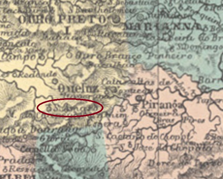
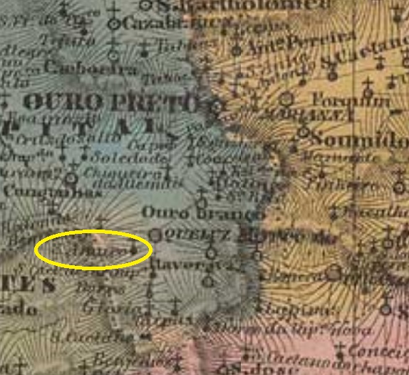
This Santo Amaro do Camapuã in the Minas Gerais province was since 1858 a district of the municipality of Queluz (today Conselheiro Lafaiete), situated on the east bank of the Paraopeba River, over 70 km southwest of the capital Ouro Preto. In December 1943 the name was changed to Queluzita, a tribute to a stone found abundantly in the region. In December 1962 the locality ascended to a municipality, which in December 1991 got the toponym masculinized to Queluzito. Nevertheless, in everyday life both old and new names continue to be used apparently at random.
According to Paula Sobrinho (História Postal de Minas Gerais, Belo Horizonte, 1997), there is a local post office since February 1885. One early cancel was found, displaying the late year 1899 inside: SMG-2960a (Coll. Márcio Protzner) has a double circle with the inscriptions STO. AMARO above and (MINAS) below.
Villiers de l’Ile Adam, Carta (…) da Provincia de Minas Geraes, 1849
Andere Namen: Queluzita, Queluzito (1991)
Dieser Santo Amaro do Camapuã in der Provinz Minas Gerais war ab 1858 ein Distrikt im Município von Queluz (heute Conselheiro Lafaiete), der am Ostufer des Flusses Paropeba lag, über 70 km südwestlich der Hauptstadt Ouro Preto entfernt. Im Dezember 1943 wurde der Ort zu Queluzita umbenannt, nach einem in der Gegend häufig vorkommenden Gestein. Im Dezember 1962 bekam er den Verwaltungsstatus eines Município, dessen Namen seit Dezember 1991 die männliche Form Queluzito erhielt. Dennoch scheinen heutzutage beide Schreibweisen, alt und neu, friedlich durcheinander in Gebrauch zu sein.
Paula Sobrinho berichtet uns in seiner História Postal de Minas Gerais (Belo Horizonte, 1997), dass es dort ein Postamt seit Februar 1885 gibt. Ein früher Stempel war zu finden, der allerdings den späteren Jahrgang 1899 im Inneren vorweist: SMG-2960a (Samml. Márcio Protzner) hat einen Doppelkreis mit den Inschriften STO. AMARO oben und (MINAS) unten.
Another name: Nossa Senhora da Purificação e Santo Amaro
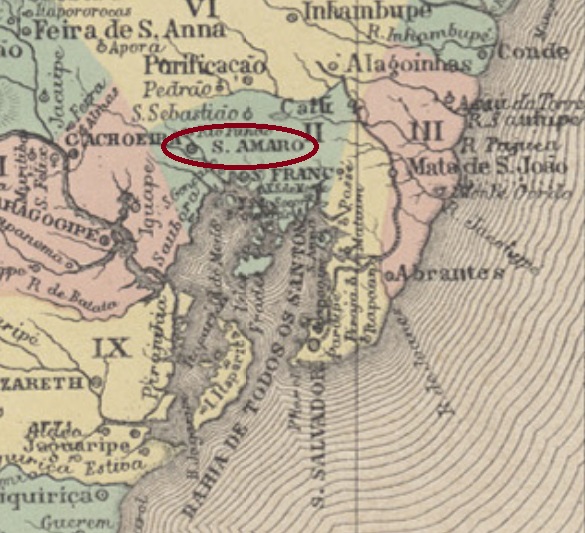
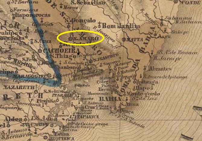
This Santo Amaro is a quite old locality in Brazilian terms. It was already in January 1727 the Villa de Nossa Senhora da Purificação e Santo Amaro (= Our Lady of the Purification and St. Amaro), situated at the north end of the All Saints Bay, round 80 km away from the provincial capital Salvador da Bahia. Since March 1837 it is the town of Santo Amaro.
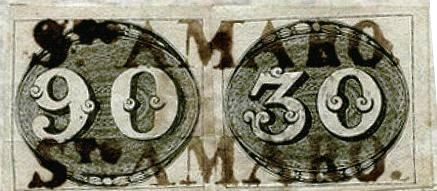
There are two different dates for the creation of the postal office. Consequently, it must have been closed in the meantime. Nova Monteiro (Administrações e Agencias Postaes do Brasil Imperio, in Brasil Filatelico/RJ, 1934-5; Reprint SPP 1994-1999) writes May 1832, while the Imperial Mail Register (Tabella das Agencias do Correio do Imperio) of 1885 lists the agency from 1855 on. The three cancels which were found belong apparently to the first period. SBA-0680a was already presented by the RHM catalogue and can be found around 1835:
SBA-0680a (RHM)
The following cancels SBA-0680b and SBA-0680c were used from the thirties until the Bull-Eyes era (1843ff), as depicted by Henrique B. Ferreira (Catálogo ilustrado dos carimbos sobre os olhos-de-boi, Porto Alegre, 2017):
SBA-0680bSBA-0680c
Later cancels are still to be identified through disambiguation among further Santo Amaro localities in other Brazilian provinces.
Villiers de l’Ile Adam, Carta (…) da Provincia da Bahia, 1848
Anderer Name: Nossa Senhora da Purificação e Santo Amaro
Dieser Santo Amaro ist für brasilianische Verhältnisse eine ziemlich alte Ortschaft. Bereits im Januar 1727 stand die Villa de Nossa Senhora da Purificação e Santo Amaro (= Unsere Liebe Frau der Purifikation und St. Amaro) an der Nordspitze der Allerheiligenbucht, rund 80 km von der Provinzhauptstadt Salvador da Bahia entfernt. Seit März 1837 ist es eine Stadt, die den vereinfachten Namen Santo Amaro trägt.
Zwei verschiedene Daten zur Entstehung des Postamtes sind überliefert. Also war dieses in der Zwischenzeit mal geschlossen. Nova Monteiro (Administrações e Agencias Postaes do Brasil Imperio, in Brasil Filatelico/RJ, 1934-5; Reprint SPP 1994-1999) schreibt dafür den Mai 1832, während das Verzeichnis der kaiserlichen Postämter (Tabella das Agencias do Correio do Imperio) von 1885 listet die Agentur ab 1855 auf. Die drei Stempel, die man zweifelsfrei dieser Ortschaft zuordnen kann, stammen wohl alle aus der ersten Betriebszeit. SBA-0680a wurde bereits durch den RHM-Katalog vorgestellt und kommt in der Vorphila-Zeit vor:
SBA-0680a (RHM)
Die folgenden Stempel SBA-0680b and SBA-0680c waren ab den 30er-Jahren bis zur Zeit der Ochsenaugen (1843ff) in Gebrauch, wie von Henrique B. Ferreira in seinem Catálogo ilustrado dos carimbos sobre os olhos-de-boi (Porto Alegre, 2017) abgebildet:
SBA-0680bSBA-0680c
Spätere Entwertungen konnten noch nicht zweifelsfrei unter weiteren Santo Amaro-Ortschaften in anderen Provinzen ermittelt werden.
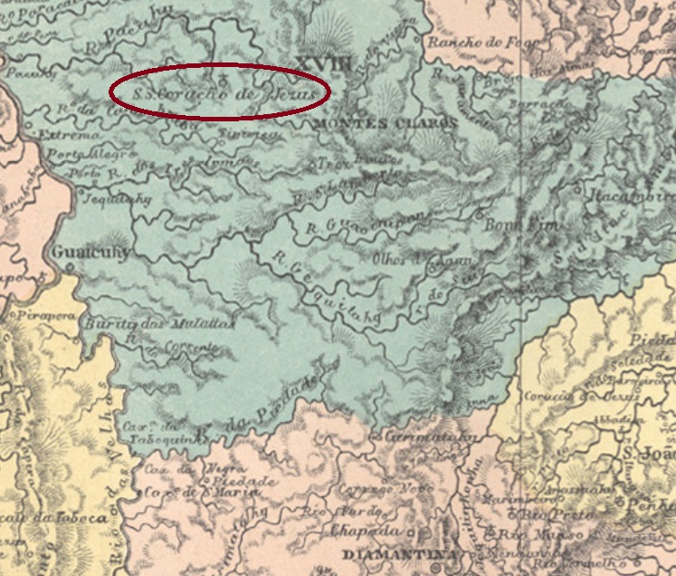
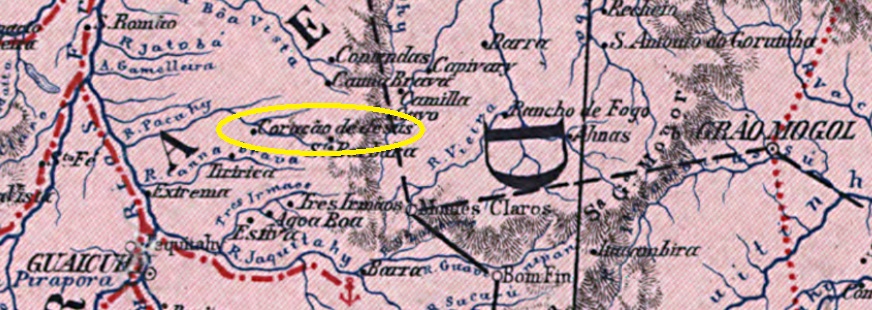
Other names: Inconfidência, Coração de Jesus (1928)
Santíssimo Coração de Jesus (=Jesus’ Holiest Heart) was since July 1832 a district in the municipality of Montes Claros, situated round 550 km north of the provincial capital Ouro Preto. In August 1911 it ascended to a Villa named Inconfidência, as a tribute to the Minas Conjuration, a movement that planned the Brazilian independence from Portugal in the late 18th century. In September 1925 the locality was declared a town, which changed the name to Coração de Jesus three years later.
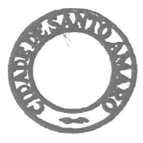
According to Paula Sobrinho (História Postal de Minas Gerais, Belo Horizonte, 1997), the local post office was created in September 1877. One imperial cancel is known: SMG-2955a (Coll. José A. Junges) has a double circle with the inscriptions S.S. CORAÇÃO DE JESUS above and (MINAS) below. The dates at the centre were found for the period 1889-1894.
Carta da República dos Estados Unidos do Brazil, 1892
Andere Namen: Inconfidência, Coração de Jesus (1928)
Santíssimo Coração de Jesus (= Heiligstes Herz Jesus’) war ab Juli 1832 ein Distrikt im Município von Montes Claros, der rund 550 km nördlich der Provinzhauptstadt Ouro Preto entfernt lag. Im August 1911 wurde daraus eine Villa namens Inconfidência, nach der Inconfidência Mineira, eine Beschwörung in der Provinz Minas Gerais am Ende des 18. Jahrhunderts, die die Unabhängigkeit Brasiliens anstrebte. Im September 1925 wurde die Ortschaft eine Stadt, deren Name drei Jahre später zu Coração de Jesus wechselte.
Wie Paula Sobrinho in seiner História Postal de Minas Gerais (Belo Horizonte, 1997) berichtet, gibt es dort ein Postamt seit September 1877. Ein Stempel der Kaiserzeit ist überliefert: SMG-2955a (Samml. José A. Junges) hat einen Doppelkreis mit den Inschriften S.S. CORAÇÃO DE JESUS oben und (MINAS) unten. Die Daten in der Mitte wurden bisher für den Zeitraum 1889-1894 gefunden.
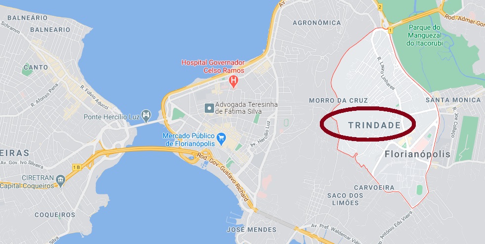
The district of Santissima Trindade (=Holiest Trinity) was created in March 1853 in the municipality of the provincial capital Desterro on the Santa Catharina Island. In March 1938 the name was simplified to Trindade, which is since December 1943 an urban quarter of the capital Florianópolis. This new name was given to Desterro as a tribute to Brazil’s second president, the Marshall Floriano Peixoto (1839-1895), who had ordered a sanguinary combat to the local revolutionists in 1894.
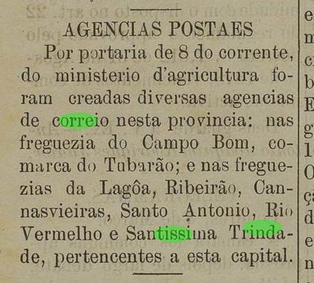
The local post office was created in March 1884, as reported by the local press:
Jornal do Commercio, March 14, 1884
No imperial cancel has been found until now.
GoogleMaps
Anderer Name: Trindade (1938)
Der Distrikt von Santissima Trindade (=Heiligste Dreifaltigkeit) wurde im März 1853 im Município der Provinzhauptstadt Desterro auf der Insel Santa Catharina gegründet. Im März 1938 wurde der Name zu Trindade vereinfacht, seit Dezember 1943 ein Teil der Stadt Florianópolis. Der neue Name von Desterro war eine Hommage an Brasiliens zweiten Präsidenten, den Marschall Floriano Peixoto (1839-1895), der eine blutige Bekämpfung der Revolutionäre auf der Insel beim Aufstand von 1894 befohlen hatte.
Das örtliche Postamt gibt es seit März 1884, wie die Lokalpresse berichtet:
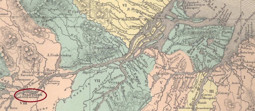
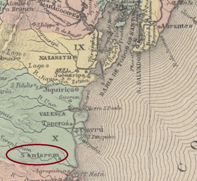
Santarém is a very old location in Pará, situated over thousand km west of the province capital Belém. It was declared a villa already in June 1755 and ascended to a town as soon as October 1848.
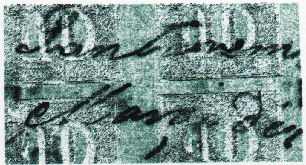
SPA-0235b (Coll. José A. Junges) is the manuscript cancellation, which can be found on numeral issues of 1844 until ca. 1855:
SPA-0235b (JJ)
SPA-0235c (image from the internet) has an uncertain attribution, for it could also refer to the Santarém in the Bahia province (SBA-0675). It shows a double circle with the inscription SANTAREM above and (I) below. Found on a stamp dated 1884. And SPA-0235d (coll. José A. Junges) could be already republican, for it was found with a date of 1890: a double circle with the inscriptions SANTAREM above and (PARÁ) below.
Villiers de l’Ile Adam, Carta (…) da Provincia da Bahia, 1850
Santarém ist eine für brasilianische Verhältnisse sehr alte Ortschaft in der Provinz Pará, die über tausend km westlich der Provinzhauptstadt Belém entfernt liegt. Sie wurde eine Villa im Juni 1755 und stieg zur Stadt bereits im Oktober 1848 auf.
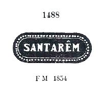
Laut Nova Monteiro (Administrações e Agencias Postaes do Brasil Imperio, in Brasil Filatelico/RJ, 1934-5; Reprint SPP 1994-1999) existiert das örtliche Postamt seit März 1829. Drei Stempel und eine handschriftliche Entwertung wurden gefunden, wobei bei einem der Stempel die Zuordnung noch unsicher ist. SPA-0235a kommt auch in rot vor und wurde zumindest seit den Ziffernausgaben von 1850 bis ca. 1855 verwendet, er wurde bereits durch Paulo Ayres in seinem Catálogo de Carimbos Brasil-Império (S. Paulo, 1937, 1942) unter Nr.1488 vorgestellt:
SPA-0235a, P.Ayres Nr. 1488
SPA-0235b (Samml. José A. Junges) ist die Handentwertung, die auf den Ziffernausgaben von 1844 (Inclinados) bis ca. 1855 vorkommt:
SPA-0235b (JJ)
SPA-0235c (Abb. aus dem Internet) könnte auch aus dem anderen Santarém in der Provinz Bahia sein (SBA-0675). Hier gibt es einen Doppelkreis mit der Inschrift SANTAREM oben und eine (I) unten. Gefunden mit Datum 1884 auf einer Marke. SPA-0235d (Samml. José A. Junges) könnte bereits republikanisch sein, denn er wurde auf einer Marke mit Datum 1890 gefunden: ein Doppelkreis mit den Inschriften SANTAREM oben und (PARÁ) unten.
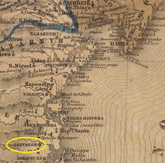
Other names: Santo André de Santarém, Serinhaém, Ituberá (1944)
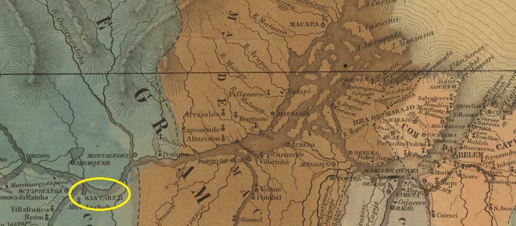
This Santarém in the Bahia province was already a villa in September 1758 and kept this status until August 1909, when it ascended to a town. It was located on the Serinhaem (now Santarém) River, some 170 km south of the provincial capital Salvador. In December 1943 the municipality was renamed Serinhaem, but this name lasted only six months, changing to the actual Ituberá in June 1944, probably due to the existence of another Serinhaem in Pernambuco.
According to Nova Monteiro (Administrações e Agencias Postaes do Brasil Imperio, in Brasil Filatelico/RJ, 1934-5; Reprint SPP 1994-1999), the local post office was created in March 1863. Three early cancels were found, the second of which still awaits confirmation, for it could also refer to the other Santarém in the Pará province. SBA-0675a (Coll. José A. Junges) was seen only partially on a single D. Pedro issue of 1866: it has a double circle with an inscription containing SANTAREM in quite irregular capital letters. SBA-0675b (Coll. José A. Junges) imitates a French-style cancel: a double circle with the inscription SANTAREM above and a star between parentheses below, dated 1885 at the centre. SBA-0675c (image from the internet) is similar to the former, but here both letters and star are bigger, the parentheses seem to have disappeared.
Villiers de l’Ila Adam: Carta (…) da Provincia da Bahia, 1848
Andere Namen: Santo André de Santarém, Serinhaém, Ituberá (1944)
Dieses Santarém in der Provinz Bahia war bereits eine Villa im September 1758 und blieb so bis August 1909, als daraus eine Stadt wurde. Der Ort lag am Fluss Serinhaem (heute Santarém), etwa 170 km südlich der Provinzhauptstadt Salvador entfernt. Im December 1943 der Município bekam den Namen Serinhaém verpasst, aber schon sechs Monate später, im Juni 1944, wechselte der Ortsname wieder, zum aktuellen Ituberá, wohl um Verwechslungen mit dem Serinhaém in Pernambuco zu vermeiden.
Wie Nova Monteiro (Administrações e Agencias Postaes do Brasil Imperio, in Brasil Filatelico/RJ, 1934-5; Reprint SPP 1994-1999) berichtet, entstand das örtliche Postamt im März 1863. Drei frühe Stempel waren zu finden, wobei der zweite noch nicht endgültig bestätigt ist, da dieser auch dem Santarém in der Provinz Pará zugewiesen werden könnte. SBA-0675a (Samml. José A. Junges) wurde leider nur einmal und unvollständig gesehen, auf einer D. Pedro-Ausgabe von 1866: der Stempel besteht aus einem Doppelkreis mit einer Inschrift, die SANTAREM in ziemlich unregelmäßigen Großbuchstaben enthält. SBA-0675b (Samml. José A. Junges) macht einem Stempel französischen Typs nach: ein Doppelkreis mit der Inschrift SANTAREM oben und einem Stern zwischen Klammern unten, dazu ein Datum aus 1885 in der Mitte. SBA-0675c (Abb. aus dem Internet) ist ähnlich wie zuvor, doch hier sind Buchstaben und Stern größer, und die Klammern unten scheinen verschwunden zu sein.
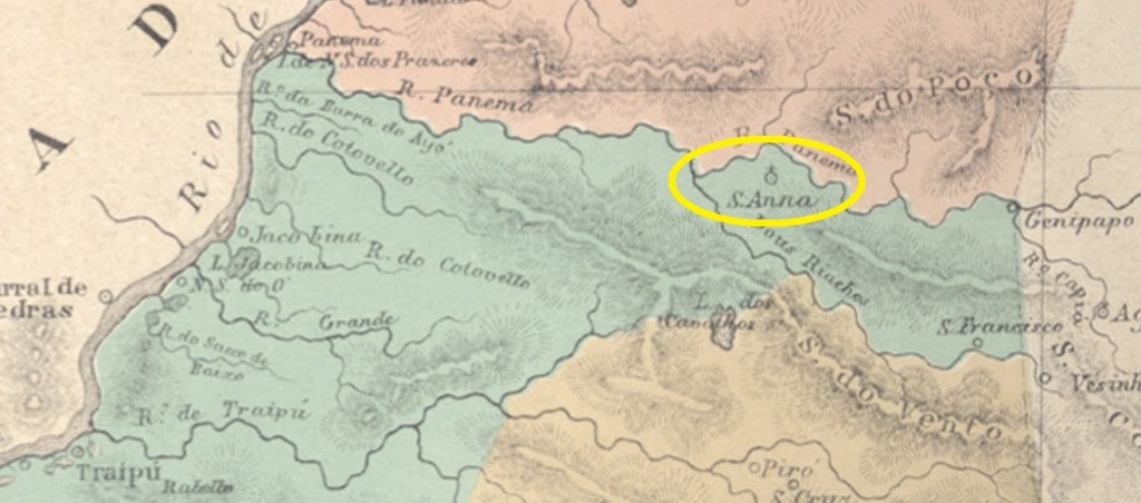
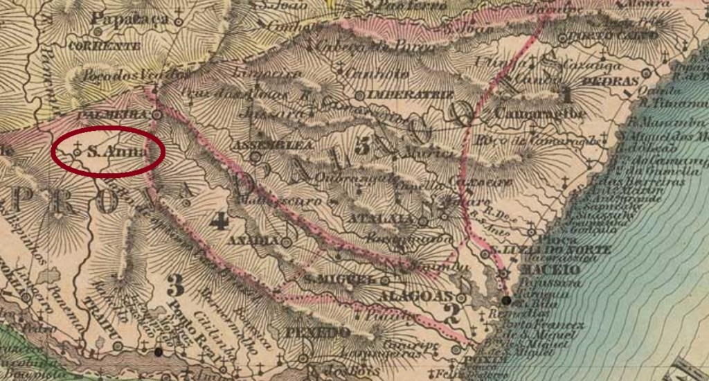
Sant’Anna do Ypanema was since February 1836 a district in the municipality of Traipu, situated on the north bank of the Panema River, over 200 km west of the province capital Alagoas (now Marechal Deodoro). In April 1875 it ascended to a villa.
According to the Imperial Mail Register (Tabella das Agencias do Correio do Imperio) of 1885, the local post office was created in July 1869, although Aldo Cardoso (Contribuição para a História dos Correios de Alagoas, Maceió, 1969) asserts it took place in September 1870. Only one imperial cancel was found: SAL-0230a (Coll. Karlheinz Wittig) has a double circle with the inscription YPANEMA above and STA. ANNA below. The dates at the centre originate from the period 1886-1891.
Villiers de l’Ile Adam, Carta (…) das Provincias de Pernambuco, Alagoas und Sergipe, 1848
Sant’Anna do Ypanema war ab Februar 1836 ein Distrikt im Município von Traipu, der am Nordufer des Flusses Panema lag, über 200 km westlich der Provinzhauptstadt Alagoas (heute Marechal Deodoro) entfernt. Im April 1875 stieg er zur Villa auf.
Laut Verzeichnis der kaiserlichen Postämter (Tabella das Agencias do Correio do Imperio) von 1885 entstand das örtliche Postamt im Juli 1869, obwohl Aldo Cardoso (Contribuição para a História dos Correios de Alagoas, Maceió, 1969) behauptet, dies fand erst im September 1870 statt. Nur ein Stempel der Kaiserzeit war zu finden: SAL-0230a (Samml. Karlheinz Wittig) hat einen Doppelkreis mit der Inschrift YPANEMA oben und STA. ANNA unten. Die Daten in der Mitte entstammen dem Zeitraum 1886-1891.