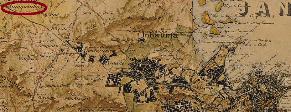
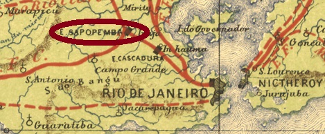
This station was inaugurated as early as March 1859 by the Estrada de Ferro D. Pedro II railway company and was located on the main line (Linha do Centro), less than 30 km west of the centre of Rio de Janeiro. With the Republic, the railway operator changed to E.F. Central do Brasil. Two more changes followed: in 1975 to Rede Ferroviária Federal S.A. and in 1997 to the current Supervia. Since 1908, the station has been called Deodoro, in honour of Marshal Deodoro da Fonseca (1827-1892), Brazil’s first president.
Paulo Novaes writes in agenciaspostais.com.br that there has been a station post office on place since August 1865. Two postmarks were found for the 19th century. SMN-2255a (Coll. José A. Junges) is a double ellipse with the inscriptions A. DO C. above and SAPOPEMBA below. Found on a D. Pedro issue from 1866. SMN-2255b (Coll. José A. Junges) is your double circle with the inscription SAPOPEMBA above and an 8-pointed star below. Dated in the centre from 1894 to 1895, so far.
E. F. Central do Brasil, 1890
Anderer Name: Est. Deodoro (1910)
Dieser Bahnhof wurde bereits im März 1859 durch die Estrada de Ferro D. Pedro II Bahngesellschaft eingeweiht und lag an der Hauptstrecke (Linha do Centro), knapp 30 km westlich der Stadtmitte von Rio de Janeiro. Mit der Republik änderte sich der Bahnbetreiber zu E.F. Central do Brasil. Zwei weitere Änderungen folgten: 1975 zur Rede Ferroviária Federal S.A. und 1997 zur aktuellen Supervia. Seit 1908 heißt der Bahnhof Deodoro, zu Ehren von Marschall Deodoro da Fonseca (1827-1892), Brasiliens erster Präsident.
Paulo Novaes schreibt in agenciaspostais.com.br, dass es dort seit August 1865 ein Bahnhofspostamt gibt. Zwei Poststempel wurden für den 19. Jahrhundert gefunden. SMN-2255a (Samml. José A. Junges) ist eine Doppelellipse mit den Inschriften A. DO C. oben und SAPOPEMBA unten. Gessehen auf einer D. Pedro-Ausgabe von 1866. SMN-2255b (Samml. José A. Junges) ist ein Doppelkreis mit der Inschrift SAPOPEMBA oben und einem 8-zackigen Stern unten. Bisherige Daten in der Mitte: von 1894 bis 1895.
Other names: Nossa Senhora das Dores do Sapé, Bariri (1890).
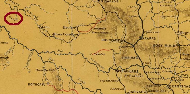
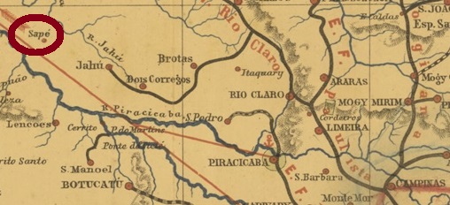
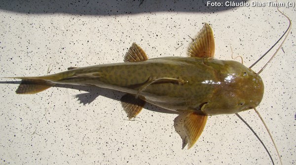
This locality was the district of Nossa Senhora das Dores do Sapé (Our Lady of Sorrows of Sapé) from May 1877, in the municipality of Jahú, which was close to the south bank of the Jahú River, more than 300 km northwest of the provincial capital of São Paulo. Sapé is a type of reed that was used as roofing in rural Brazil, and Jahú (now spelled Jaú) is a large catfish (Zungaro zungaro, Humboldt & Valenciennes, 1821), but it is not so common in the area today:
Zungaro zungaro (Photo: Claudio D. Timm)
In June 1890 the place rose to a villa called Bariri. Bariri has been a town since December 1906. The Indian language word means noisy rapids.
As can be read in the Imperial Mail Register (Tabella das Agencias do Correio do Imperio, Rio de Janeiro, 1885), there has been a post office there since 1881. The only imperial-era postmark found so far is the French type SSP-1355a (Coll. José A. Junges): a double circle with the inscription SAPE DO JAHU above and the typical star in brackets below. The copies found so far are all dated 1889 in the centre.
Provincia de São Paulo, 1886
Andere Namen: Nossa Senhora das Dores do Sapé, Bariri (1890)
Diese Ortschaft war ab Mai 1877 der Distrikt von Nossa Senhora das Dores do Sapé (Unsere Liebe Frau der Schmerzen von Sapé) in der Gemeinde von Jahú, der nah am Südufer des Flusses Jahú lag, über 300 km nordwestlich der Provinzhauptstadt São Paulo entfernt. Sapé ist eine Schilfart, die im ländlichen Brasilien als Dachabdeckung gebraucht wurde, und Jahú (heute Jaú geschrieben) ist ein großer Wels (Zungaro zungaro, Humboldt & Valenciennes, 1821), der heute aber nicht mehr so häufig in dieser Gegend vorkommt:
Zungaro zungaro (Foto: Claudio D. Timm)
Der Ort stieg im Juni 1890 zu einer Villa auf, die Bariri genannt wurde. Seit Dezember 1906 ist Bariri eine Stadt. Das Wort der Indianersprache bedeutet laute Stromschnellen. Wie im Verzeichnis der kaiserlichen Postämter (Tabella das Agencias do Correio do Imperio, Rio de Janeiro, 1885) zu lesen ist, gibt es dort ein Postamt seit 1881. Der einzige bisher gefundene Poststempel der Kaiserzeit ist der Französischer Typus SSP-1355a (Samml. José A. Junges): ein Doppelkreis mit der Inschrift SAPE DO JAHU oben und dem typischen Stern in Klammern unten. Die bisher gefundenen Exemplare sind allesamt 1889 in der Mitte datiert.
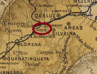
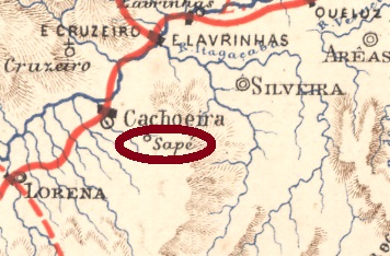
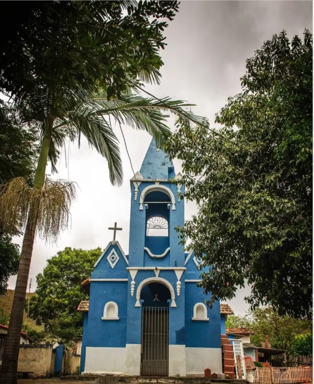
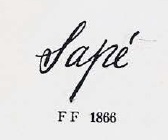
With Sapé, we finally leave the long line of Brazilian localities with saint’s names in the empire. The old village was a freguesia of Silveiras from April 1857, close to the south bank of the Rio Paraíba, more than 200 km northeast of the provincial capital São Paulo. With coffee cultivation came prosperity; the decline of this culture in the region was followed by decadence. So, in April 1887, the place became an independent município called Jatahy. The Indian word denotes both a plant of the Faseolaceae family (also called Butiá) and a variety of bee. At the end of the Empire, over three thousand people lived there. In May 1934, the place descended to the district of Cachoeira, and today it is a sparsely inhabited rural suburb of Cachoeira Paulista. Only the church of N. Sa. da Piedade reminds us of the old days:
Photo: Paulo Pontes
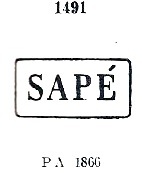
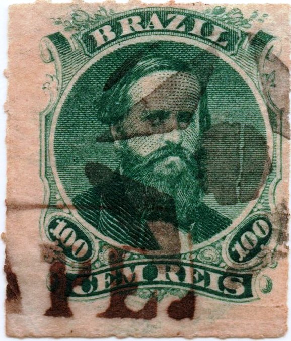
As Nova Monteiro writes in Administrações e Agencias Postaes do Brasil Imperio (in Brasil Filatelico/RJ, 1934-5; reprint SPP 1994-1999), there was a post office there from October 1861. At the beginning there were two postmarks, which are very similar. SSP-1350b also occurs in brown and red and was already presented by Paulo Ayres in Catálogo de Carimbos Brasil-Império, (S. Paulo, 1937, 1942) under no. 1491:
SSP-1350b (P.A. 1491) 1866ff-1869
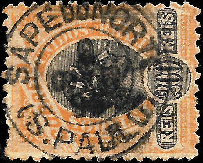
Even older seems to be the variant SSP-1350a (Coll. José A. Junges), which shows a dot after the E and thus has a somewhat larger frame. Later, the cancel in the double circle SSP-1350c (Coll. José A. Junges) was added: here, one reads only the inscription SAPÉ at the top, and the dates (from 1881 to 1887) in the middle.
Paulo Ayres (op.cit. p.147) shows us another handwritten cancellation from Sapé, and from the Junges’ collection we also know a mute stamp:
P. Ayres (op.cit) 1866ff1876ff (Coll. José A. Junges)
Although the change of place name to Jatahy took place already in 1887, R. Koester does not mention a cancel under this name in his Carimbologia. Instead, one can find the rare cancel with Sapé do Norte in the early Republic:
1896 (image from the Internet)E.F. Central do Brasil, 1890
Andere Namen: Sapé do Norte, Jatahy (1887)
Mit Sapé verlassen wir endlich die lange Reihe der brasilianischen Ortschaften mit Heiligennamen im Kaiserreich. Die alte Ortschaft war schon ab April 1857 eine Freguesia bei Silveiras, die nah am Südufer des Rio Paraíba lag, über 200 km nordöstlich der Provinzhauptstadt São Paulo entfernt. Mit dem Kaffeeanbau kam der Wohlstand, dem Niedergang dieser Kultur in der Region folgte die Dekadenz. So wurde der Ort im April 1887 zum selbständigen Município namens Jatahy. Das indianische Wort bezeichnet sowohl eine Pflanze der Fam. Faseolaceae (auch Butiá genannt) als auch eine Bienensorte. Am Ende des Kaiserreichs wohnten dort über dreitausend Menschen. Im Mai 1934 stieg der Ort zum Distrikt von Cachoeira ab, und heute ist es ein wenig bewohnter ländlicher Vorort von Cachoeira Paulista. Nur die Kirche von N. Sa. da Piedade erinnert noch an die alten Zeiten:
Foto: Paulo Pontes
Wie Nova Monteiro inAdministrações e Agencias Postaes do Brasil Imperio (in Brasil Filatelico/RJ, 1934-5; Reprint SPP 1994-1999) schreibt, gab es dort ein Postamt ab Oktober 1861. Zu Beginn gab es zwei Poststempel, die sehr ähnlich sind. SSP-1350b kommt auch in braun und rot vor und wurde bereits durch Paulo Ayres im Catálogo de Carimbos Brasil-Império, (S. Paulo, 1937, 1942) unter Nr. 1491 vorgestellt:
SSP-1350b (P.A. 1491) 1866ff-1869
Noch älter scheint die Variante SSP-1350a (Samml. José A. Junges) zu sein, die einen Punkt nach dem E zeigt und dadurch einen etwas größeren Rahmen hat. Hier gehen die Daten sogar bis mindestens 1876. Später kam der Stempel im Doppelkreis SSP-1350c (Samml. José A. Junges) dazu: hier liest man nur die Inschrift SAPÉ oben, und die Daten (v. 1881 bis 1887) in der Mitte.
Paulo Ayres (op.cit. S.147) zeigt uns noch eine handschriftliche Entwertung aus Sapé, und aus der Junges’ Sammlung kennen wir auch einen stummen Stempel:
P. Ayres (op.cit.) 1866ff1876ff (Samml. José A. Junges)
Obwohl der Ortsnamenwechsel zu Jatahy bereits 1887 erfolgte, nennt R. Koester keinen Stempel unter diesem Namen in seiner Carimbologia. Stattdessen sieht man den seltenen Stempel mit Sapé do Norte in der frühen Republik:
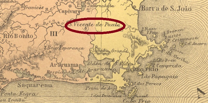
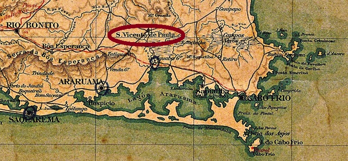
Other names: São Vicente de São Paulo, São Vicente
This locality has been a district of Araruama since February 1859, located on the east bank of the Rio Una, 130 km east of the capital Rio de Janeiro. As the Brazilian Geography and Statistics Agency (IBGE) informs us, the place was originally called São Vicente de São Paulo and only received its current name around 1938.
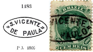
Paulo Novaes writes on his website agenciaspostais.com.br that there has been a post office there since December 1876. It is therefore somewhat surprising that there are so many postmarks with the Dom Pedro issue from 1866, when the following issue from 1876 was already available when the agency opened. Anyway, the oldest cancel is SRJ-1510a, which can be seen by Paulo Ayres in his Catálogo de Carimbos Brasil-Império (S. Paulo, 1937, 1942) under No. 1483 with PAULA instead of PAULO):
SRJ-1510a (P.A. 1483 recte/JJ) 1876ff
Its successor SRJ-1510b was also presented by P. Ayres:
SRJ-1510b (P.A. p/S. 126) 1879
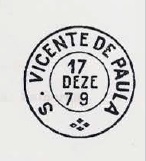
It was followed by SRJ-1510c (Coll. José A. Junges): a double circle with the above inscription S. V. DE PAULA. One copy found, dated 1879 in the centre. Then came SRJ-1510d (Coll. Paulo Novaes); this one should already be Republican: in the double circle one reads S. VICENTE DE PAULA above, below there is an ornament in cross.
Three different mute cancels were used in connection with SRJ-1510a:
(RHM)Almanak Laemmert, 1892
Andere Namen: São Vicente de São Paulo, São Vicente
Diese Ortschaft ist seit Februar 1859 ein Distrikt von Araruama, der am Ostufer des Rio Una liegt, 130 km östlich der Hauptstadt Rio de Janeiro entfernt. Wie die brasilianische Geografie- und Statistikbehörde (IBGE) informiert, hie der Ort ursprünglich São Vicente de São Paulo und erst um 1938 erhielt den aktuellen Namen.
Paulo Novaes schreibt auf seiner Website agenciaspostais.com.br, dass es dort seit Dezember 1876 ein Postamt gibt. Es ist daher etwas verwunderlich, dass es so viele Stempel mit der Dom-Pedro-Ausgabe von 1866 gibt, wenn die folgende Ausgabe aus 1876 bei der Agentureröffnung bereits erhältlich war. Wie es dem auch sei, der älteste Stempel ist SRJ-1510a, der durch Paulo Ayres in seinem Catálogo de Carimbos Brasil-Império (S. Paulo, 1937, 1942) unter Nr. 1483 mit PAULA statt eigentlich PAULO) zu sehen ist:
SRJ-1510a (P.A. 1483 recte/JJ) 1876ff
Sein Nachfolger SRJ-1510b wurde ebenfalls durch P. Ayres vorgestellt:
SRJ-1510b (P.A. p/S. 126) 1879
Ihm folgte SRJ-1510c (Samml. José A. Junges): ein Doppelkreis mit der obigen Inschrift S. V. DE PAULA. Ein Exemplar gefunden, datiert 1879 in der Mitte. Danach kam SRJ-1510d (Samml. Paulo Novaes); dieser dürfte bereits republikanisch sein: im Doppelkreis liest man S. VICENTE DE PAULA oben, unten ist ein Ornament in Kreuz.
Drei verschiedene „stummen“ Stempel wurden in Zusammenhang mit SRJ-1510a verwendet:
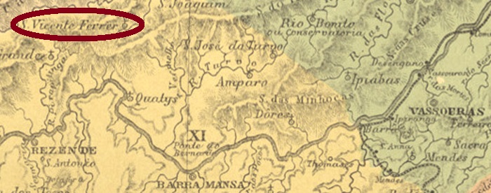
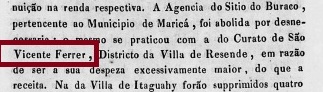
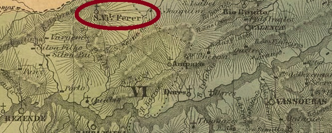
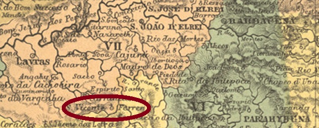
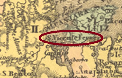
This fourth São Vicente Ferrer in Imperial Brazil was a district of Arraial de Campo Alegre (now Resende) from May 1843, located close to the provincial border with Minas Gerais, over 180 km northwest of the capital Rio de Janeiro. In December 1938, the place name changed to Fumaça. This actually means smoke, but here it probably means water vapour, rising either from the river or from the nearby mountainside.
It has not yet been determined when the local post office first opened. However, it closed around 1833, as can be seen from the report of the imperial ministry from that year:
Relatorio do Ministério do Império, 1833
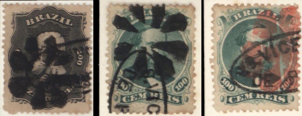
The postal agency did not reopen until 1872, as can be read in the Imperial Mail Register (Tabella das Agencias do Correio do Imperio, Rio de Janeiro, 1885). The earliest postmark so far is SRJ-1515b (Coll. Paulo Daróz): a double circle with the inscriptions S. VICENTE FERRER above and (REZENDE) below. The dates in the middle have so far been found for the period 1894-1906.
Villiers de l’Ile Adam: Carta (…) da Provincia do Rio de Janeiro, 1850
Anderer Name: Fumaça (1938)
Dieser vierte São Vicente Ferrer im kaiserlichen Brasilien war ab Mai 1843 ein Distrikt vom Arraial de Campo Alegre (heute Resende), der nah an der Provinzgrenze zu Minas Gerais lag, über 180 km nordwestlich der Hauptstadt Rio de Janeiro entfernt. Im Dezember 1938 wechselte der Ortsname zu Fumaça. Das bedeutet eigentlich Rauch, meint hier wohl Wasserdampf, der entweder vom Fluss oder vom nahen Berghang steigt.
Wann das örtliche Postamt erstmals eröffnet hat, konnte bisher nicht ermittelt werden. Dieses aber schloss ca. 1833, wie aus dem Bericht vom kaiserlichen Ministerium aus diesem Jahr hervorgeht:
Relatorio do Ministério do Império, 1833
Die Postagentur eröffnete erst wieder 1872, wie im Verzeichnis der kaiserlichen Postämter (Tabella das Agencias do Correio do Imperio, Rio de Janeiro, 1885) zu lesen ist. Der bisher früheste Poststempel ist SRJ-1515b (Samml. Paulo Daróz): ein Doppelkreis mit den Inschriften S. VICENTE FERRER oben und (REZENDE) unten. Die Daten in der Mitte wurden bisher für den Zeitraum 1894-1906 gefunden.
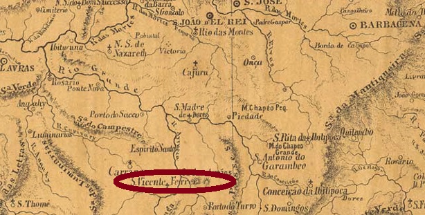
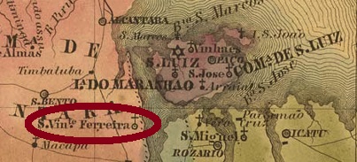
Other names: São Vicente Ferrer do Turvo, Francisco Sales, São Vicente de Minas (1953).
This locality was a district of Turvo from May 1856, located on the north bank of the Rio Grande and thus on the provincial border with São Paulo, more than 240 km southwest of the provincial capital Ouro Preto. In December 1938, it became the Município of Francisco Sales, but five years later the municipality was renamed São Vicente de Minas.
As Paula Sobrinho writes in História Postal de Minas Gerais (Belo Horizonte, 1997), there has been a post office there since April 1873. The first postmark has not yet been identified beyond doubt. SMG-2670b (Coll. Márcio Protzner) was its successor: a double circle with the inscriptions S. VICENTE FERRER above and (MINAS) below. The only copy seen so far bears a date of 1906 in the centre.
Provincia de Minas Geraes, 1873
Andere Namen: São Vicente Ferrer do Turvo, Francisco Sales, São Vicente de Minas (1953)
Diese Ortschaft war ab Mai 1856 ein Distrikt von Turvo, der am Nordufer des Rio Grande und damit an der Provinzgrenze zu São Paulo lag, über 240 km südwestlich der Provinzhauptstadt Ouro Preto entfernt. Im Dezember 1938 wurde daraus der Município von Francisco Sales, aber fünf Jahre später wurde die Gemeinde zu São Vicente de Minas umbenannt.
Wie Paula Sobrinho in História Postal de Minas Gerais (Belo Horizonte, 1997) schreibt, gibt es dort ein Postamt seit April 1873. Der erste Poststempel konnte bisher nicht zweifelsfrei identifiziert werden. SMG-2670b (Samml. Márcio Protzner) war sein Nachfolger: ein Doppelkreis mit den Inschriften S. VICENTE FERRER oben und (MINAS) unten. Das einzig bisher gesehene Exemplar trägt ein Datum von 1906 in der Mitte.
Following the 2019 and 2020 editions with the agencies from initial Q to São Jeronymo (RS), ArGe Brasilien is proud to present the next volume of Carimbologia do Brasil Clássico, a philatelic documentation project conceived and initiated by Reinhold Koester (1911-1994), which had been interrupted since 1992. According to the original editorial line, with the listing in alphabetical order of the Brazilian postal agencies from 1798 to approximately 1889, we present in this work stamps of the imperial postal agencies from São João (PB) to Suruby (RJ), in their original spelling.
What’s new in this edition? In addition to the improvements already introduced in the previous edition (S1, 2020), we have here three final appendices that aim to facilitate consultation. Appendix I brings ten agencies that were missing from the previous volume, either through forgetfulness or because they were discovered later. Appendix II shows comparative tables for stamps of some toponyms that are repeated in several provinces (e.g. São José, São Pedro). And Appendix III presents alternative spellings for some toponyms, as well as still doubtful cases.
The complementary texts of each entry, with updates and corrections, are available free of charge and indefinitely in three languages on the websites
Nach den Fortsetzungen 2019 und 2020 mit den Postämtern von Quarahy (RS) bis São Jeronymo (RS) ist die ArGe Brasilien im BDPh stolz darauf, den nächsten Band der Carimbologia do Brasil Clássico vorzustellen, einem von Reinhold Koester (1911-1994) konzipierten und initiierten philatelistischen Dokumentationsprojekt, das seit 1992 brach lag. Der ursprünglichen redaktionellen Linie folgend, mit der Auflistung in alphabetischer Reihenfolge der brasilianischen Postagenturen von 1798 bis ca. 1889, präsentieren wir in diesem Werk Poststempel der kaiserlichen Agenturen von São João (PB) bis Suruby (RJ), in der damaligen Schreibweise.
Was ist neu in dieser Ausgabe? Zusätzlich zu den Verbesserungen, die bereits in der vorherigen Ausgabe (S1, 2020) eingeführt wurden, gibt es hier drei abschließende Anhänge, die die Suche erleichtern sollen. In Anhang I sind zehn Agenturen aufgeführt, die im vorigen Band fehlten, entweder weil sie vergessen oder weil sie später entdeckt wurden. Anhang II enthält Vergleichstabellen für Briefmarken einiger Toponyme, die sich in mehreren Provinzen wiederholen (z. B. São José, São Pedro). Anhang III zeigt alternative Schreibweisen für einige Toponyme sowie noch zweifelhafte Fälle.
Die ergänzenden Texte jedes Eintrags, mit Aktualisierungen und Korrekturen, sind kostenlos und auf unbestimmte Zeit in drei Sprachen auf den folgenden Websites verfügbar:
This village was a suburb of São Bento dos Perizes from November 1805, located over 160 km southwest of the future provincial capital São Luís. In August 1856 it became a villa, but just five years later it was relegated back to the district. Only in June 1864 did the final ascent to independent municipality take place.
As the postal report (Relatório Postal) for 1886 shows, there had been a post office there since February 1875. So far, no postmark from the Empire could be assigned to this municipality with certainty.
Villier de l’Ile Adam: Carta (…) da Provincia do Maranhão 1850
Anderer Name: São Vicente Ferrer de Cajapió
Diese Ortschaft war ab November 1805 ein Vorort von São Bento dos Perizes, der über 160 km südwestlich der künftigen Provinzhauptstadt São Luís entfernt lag. Im August 1856 wurde daraus eine Villa, aber gleich fünf Jahre später erfolgte der Abstieg zurück zum Distrikt. Erst im Juni 1864 fand der endgültige Aufstieg zur selbständigen Gemeinde statt.
Wie aus dem Postbericht (Relatório Postal) für 1886 hervorgeht, gab es dort ein Postamt seit Februar 1875. Bisher konnte kein Poststempel aus dem Kaiserreich dieser Gemeinde mit Sicherheit zugeordnet werden.
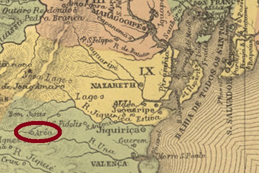
Other names: Jequiriçá, São Vicente Ferrer de Arêa, Areia, Ubaíra (1943)
See also Area/BA (R. Koester: Carimbologia II) and Jequiriçá (R. Koester: Carimbologia XXV)
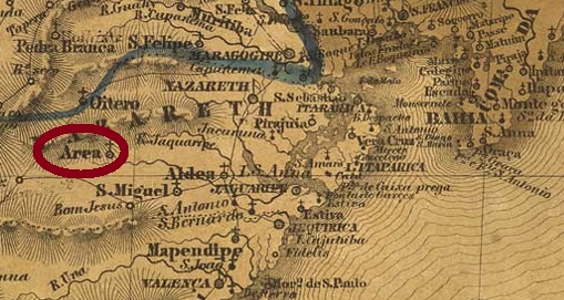
This locality was the early freguesia of Arêa, which belonged to the municipality of Valença and was situated on the south bank of the river Jequiriçá, 270 km southwest of the provincial capital Salvador da Bahia. In June 1868, it rose to become a villa under the name of São Vicente Ferrer de Arêa. Eight years later, the place name was shortened to São Vicente Ferrer. The place became a town called Arêa or Areia in June 1891, and since December 1943 the municipality has been called Ubaíra, which in the Indian language Tupi-guarani means honey from the tree.
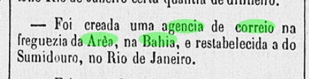
Two foundation dates for the local post office were found. Reinhold Koester (Carimbologia II) writes 7 February 1862, while Nova Monteiro (Administrações e Agencias Postaes do Brasil Imperio, in Brasil Filatelico/RJ, 1934-5; Reprint SPP 1994-1999) gives this date exactly one year later. A report in the Rio press confirms the latter:
Constitucional/RJ, 17 February 1863
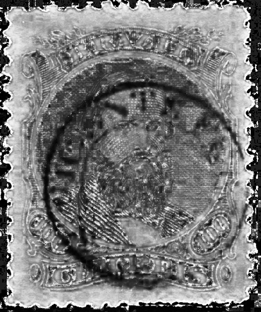
The earliest postmark so far could be identified by its similarity to another contemporary postmark of the same province: SBA-0635 (Col. José A. Junges) is not shown in the printed version of Carimbologia S2, therefore it is reproduced here:
SBA-0635a (JJ) 1866ff
The next cancel already bears a date from 1901: SBA-0635b (Coll. Paulo Daróz) is a double circle with the inscriptions S. VICENTE FERRER at the top and (BAHIA) at the bottom, plus the date at the centre.
Villiers de l’Ile Adam: Carta (…) da Provincia da Bahia, 1848
Aktualisierung der Printversion, am 08. Oktober 2021
Andere Namen: Jequiriçá, São Vicente Ferrer de Arêa, Areia, Ubaíra (1943)
Siehe auch Area/BA (R. Koester: Carimbologia II) und Jequiriçá (R. Koester: Carimbologia XXV)
Diese Ortschaft war die frühe Freguesia von Arêa, die zur Gemeinde Valença gehörte und am Südufer des Flusses Jequiriçá lag, 270 km südwestlich der Provinzhauptstadt Salvador da Bahia entfernt. Im Juni 1868 stieg sie zur Villa unter dem Namen São Vicente Ferrer de Arêa. Acht Jahre später wurde der Ortsname zu São Vicente Ferrer gekürzt. Der Ort wurde eine Stadt namens Arêa oder auch Areia im Juni 1891. Und seit Dezember 1943 heißt die Gemeinde Ubaíra, was in der Indianersprache Tupi-guarani Honig aus dem Baum bedeuten soll.
Zwei Gründungsdaten fürs örtliche Postamt wurden gefunden. Reinhold Koester (Carimbologia II) schreibt dafür den 7. Februar 1862, während Nova Monteiro (Administrações e Agencias Postaes do Brasil Imperio, in Brasil Filatelico/RJ, 1934-5; Reprint SPP 1994-1999) dieses Datum genau ein Jahr später angibt. Eine Meldung der Presse aus Rio gibt Letzterem Recht:
Constitucional/RJ, 17. Februar 1863
Der bisher früheste Poststempel konnte durch seine Ähnlichkeit mit anderer zeitgenössischen Ortsstempel derselben Provinz identifiziert werden: SBA-0635 (Samml. José A. Junges) ist nicht in der Printversion von Carimbologia S2 zu sehen, darum wird er hier abgebildet:
SBA-0635a (JJ) 1866ff
Der nächste Stempel trägt bereits ein Datum aus 1901: SBA-0635b (Samml. Paulo Daróz) ist ein Doppelkreis mit den Inschriften S. VICENTE FERRER oben und (BAHIA) unten, dazu Datum in der Mitte.
Carta da Republica dos Estados Unidos do Brazil, 1892
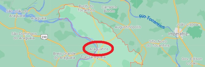
Another name: Araguatins (1946)
This locality was a district in the município of Boa Vista do Tocantins from 1872, close to the provincial borders with Pará and Maranhão, over 1300 km north of the former provincial capital Goyaz (now Goiás Velho). In June 1913, it became an independent município, which has been called Araguatins since January 1948. The name is apparently a construct of Araguaya and Tocantins, the two imposing rivers that meet in the area.
In the Almanac for the Province of Goiás for 1887, one reads that there was a post office there whose clerk was a volunteer. However, since this agency was not listed in the Imperial Mail Register (Tabella das Agencias do Correio do Imperio, Rio de Janeiro, 1885), we can assume that it opened in 1885 or 1886.
Unfortunately, no imperial postmark from this place has been found so far.
Google Maps
Anderer Name: Araguatins (1946)
Diese Ortschaft war ab 1872 ein Distrikt im Município von Boa Vista do Tocantins, der nah an den Provinzgrenzen zu Pará und Maranhão lag, über 1300 km nördlich der ehemaligen Provinzhauptstadt Goyaz (heute Goiás Velho). Im Juni 1913 wurde daraus ein eigenständiger Município, der seit Januar 1948 Araguatins heißt. Der Name ist offenbar ein Konstrukt aus Araguaya und Tocantins, den zwei imposanten Flüssen, die sich in der Gegend treffen.
Im Almanak für die Provinz Goiás für 1887 liest man, das es dort ein Postamt gab, dessen Mitarbeiter ehrenamtlich beschäftigt war. Da aber diese Agentur im Verzeichnis der kaiserlichen Postämter (Tabella das Agencias do Correio do Imperio, Rio de Janeiro, 1885) nicht aufgelistet war, können wir annehmen, dass sie 1885 oder 1886 eröffnet wurde.
Bisher war leider kein kaiserlicher Poststempel aus diesem Ort zu finden.