Other names: Petrópolis, S. João de Petrópolis (1906)
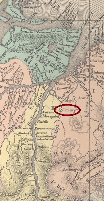
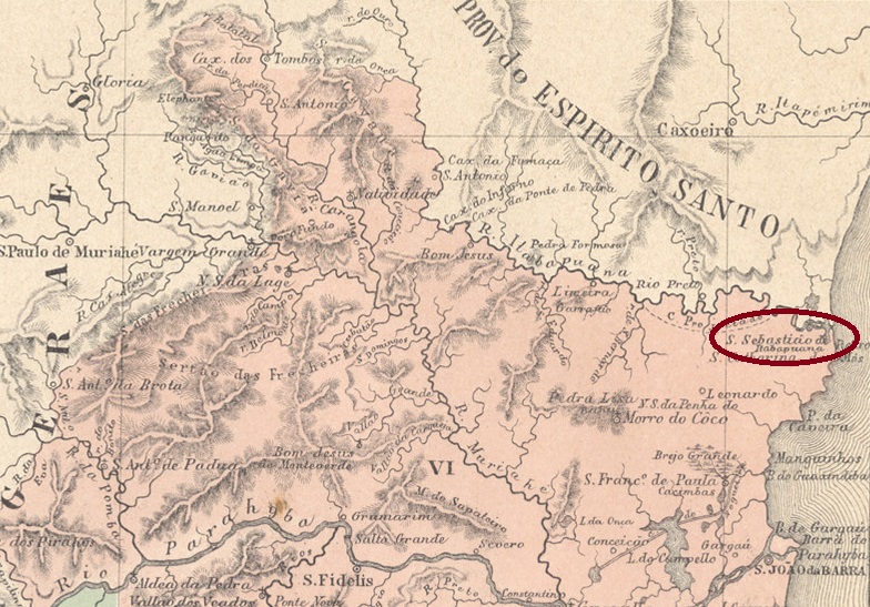
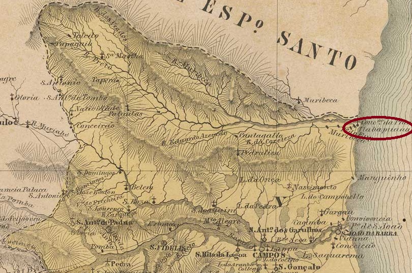
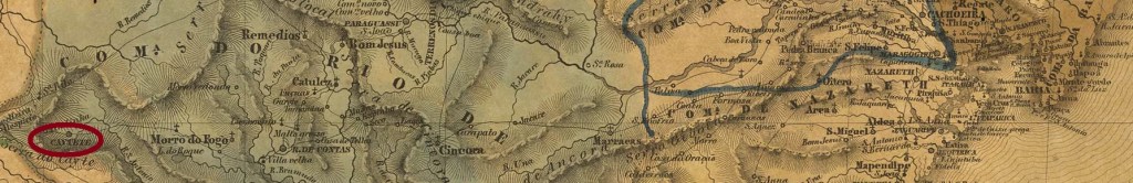
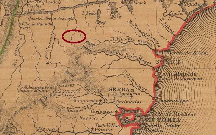
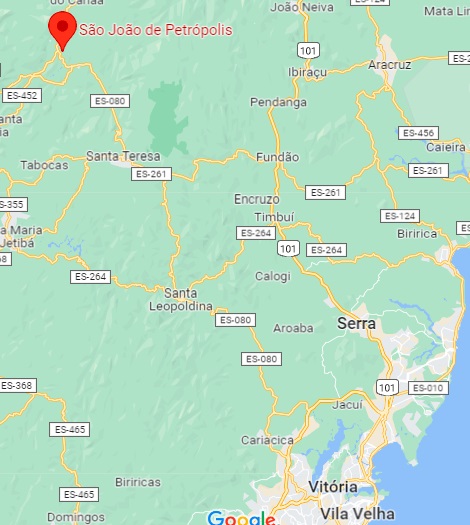
This is another village with a convoluted history. As early as 1874, there is said to have been a Barracão de S. João Baptista de Petrópolis on the eastern bank of the Santa Maria do Doce, 100 km northwest of the provincial capital of Vitória, which belonged to the Vila de Cachoeiro de Sta. Leopoldina. However, the arraial was called simply Barracão or also Cajá and passed into the administration of the Freguesia of Santa Teresa in August 1888. Santa Teresa became a vila in November 1890 and Cajá became its district in December 1895, called also de facto S. João de Petrópolis since then.
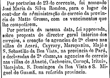
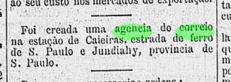
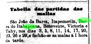
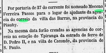
As the place became an important port of call for many colonist families from Italy, it was also called Estação (station) Cajá, although there was no railway station there. In April 1881, the decision was made to establish a post office, as the Rio press reported, despite the wrong place name:
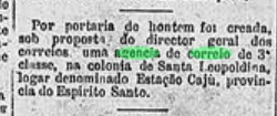
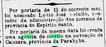
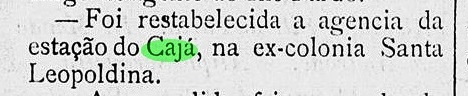
However, since no Cajá post office is listed in the Directory of Imperial Post Offices (Tabella das Agencias do Correio do Imperio, Rio de Janeiro, 1885), it is assumed that it was not put into operation until later. It was closed in April 1890 and reopened in February the following year, as reported in the regional press:
No imperial postmarks are known from Cajá so far.
Andere Namen: Petrópolis, S. João de Petrópolis (1906)
Dies ist eine weitere Ortschaft mit verworrener Geschichte. Bereits 1874 soll ein Barracão de S. João Baptista de Petrópolis am Ostufer des Santa Maria do Doce, 100 km nordwestlich der Provinzhauptstadt Vitória, bestanden haben, der zur Vila de Cachoeiro de Sta. Leopoldina gehörte. Der Arraial wurde jedoch nur Barracão oder auch Cajá genannt und ging im August 1888 in die Verwaltung der Freguesia von Santa Teresa über. Santa Teresa wurde im November 1890 zur Vila und Cajá im Dezember 1895 zu ihrem Distrikt, der seitdem auch de facto S. João de Petrópolis heißt.
Da der Ort für viele Kolonistenfamilien aus Italien ein wichtiger Anlaufpunkt wurde, nannte man ihn auch Estação (Station) Cajá, obwohl es dort keinen Bahnhof gab. Im April 1881 fiel die Entscheidung für ein eigenes Postamt, wie die Presse in Rio berichtete, allerdings mit dem falschen Ortsnamen:

Da aber im Verzeichnis der kaiserlichen Postämter (Tabella das Agencias do Correio do Imperio, Rio de Janeiro, 1885) kein Postamt Cajá verzeichnet ist, wird vermutet, dass es erst später in Betrieb genommen wurde. Es wurde im April 1890 geschlossen und im Februar des folgenden Jahres wiedereröffnet, wie die regionale Presse berichtete:

Aus Cajá sind bisher keine kaiserlichen Poststempel bekannt.