Another name: Pinheiro Machado (1915)
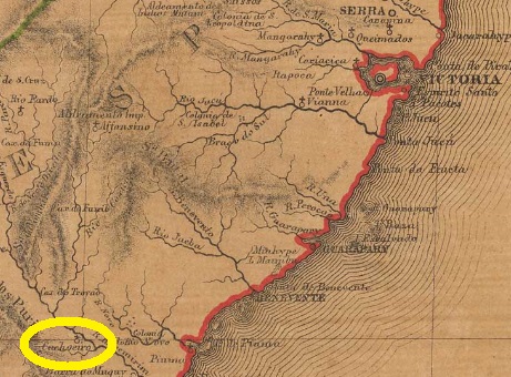
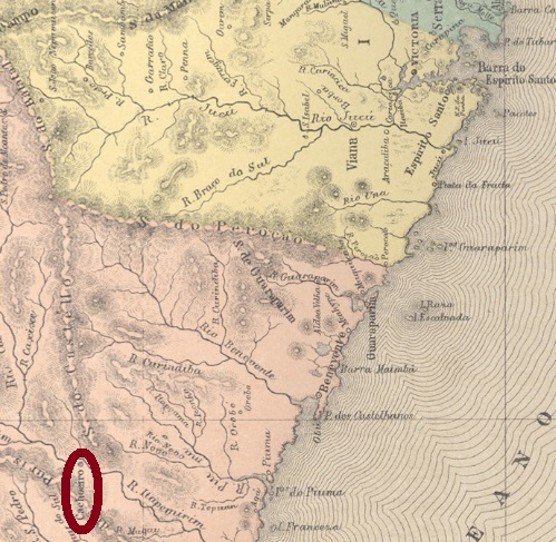
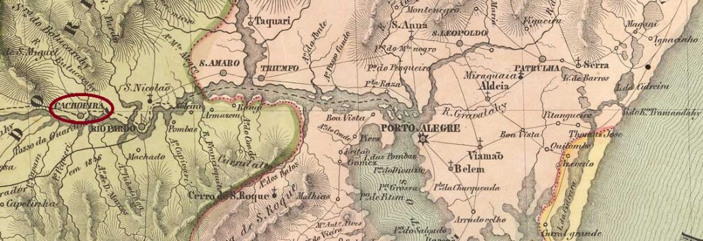
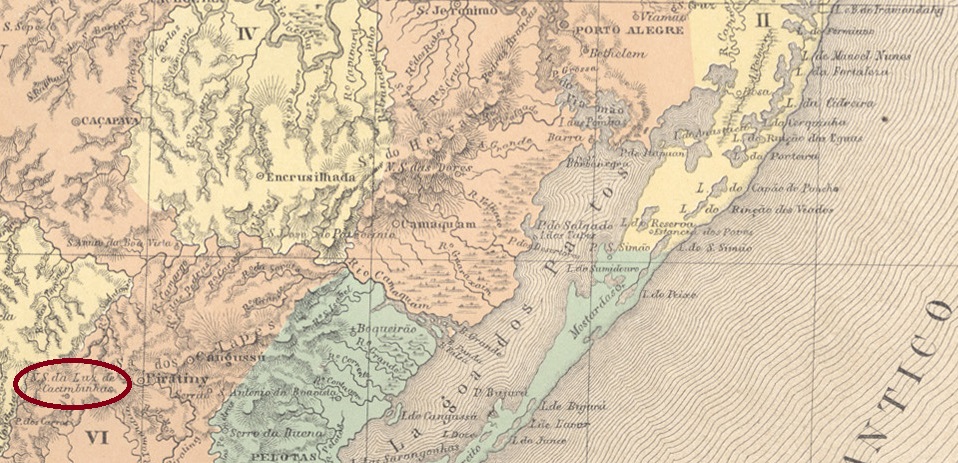
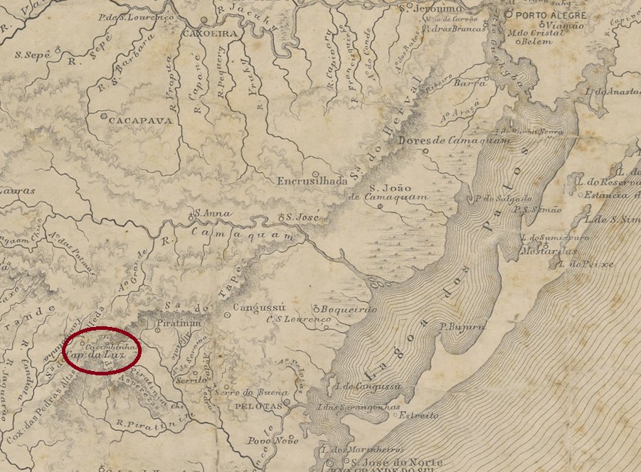
Portuguese settlement in the region began around 1765 by families from the Azores and the village initially belonged to the vila of Rio Grande. One of the first fazendeiros was José Dutra de Andrade. A local legend tells that he went blind for unknown reasons. In his despair, he washed only with water from the local watering holes (cacimbas). And lo and behold, he was soon able to see again and, out of gratitude, had a chapel built in honour of Nossa Senhora da Luz (“Our Lady of Light”).
N. Sra. da Luz de Cacimbinhas became curato, i.e. parish, in November 1851, now in the Município Piratini. In January 1857, the village was elevated to freguesia status and in May 1878 was granted political autonomy as a villa in its own município.
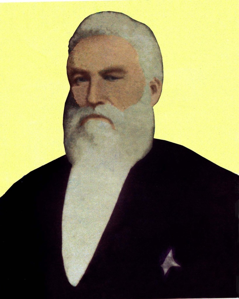
On 8 September 1915, in a luxury hotel in Rio de Janeiro, the influential senator José Gomes Pinheiro Machado, who was a grey eminence of the early republic, died by a stab in the back:
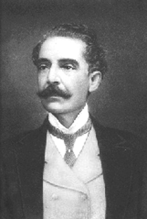
His murderer was the Cacimbinhas-born political activist Francisco Manço de Paiva Coimbra. As a result, the designated Intendente (mayor) of Cacimbinhas ordered the renaming of the municipality that same month, and it has been called Pinheiro Machado ever since.
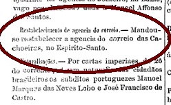
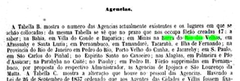
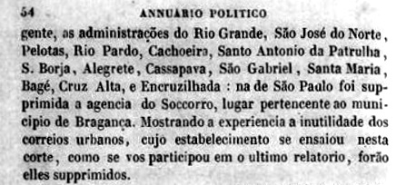
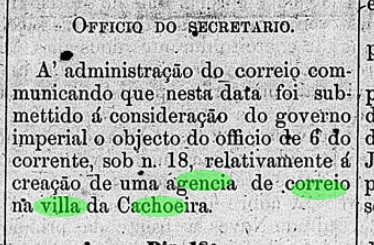
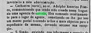
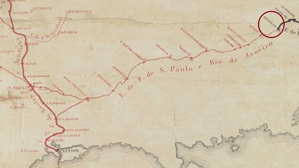
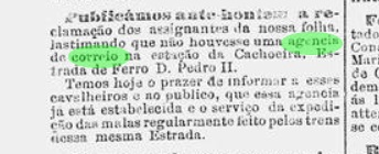
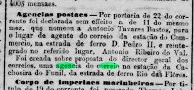
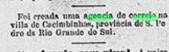
As can be seen from the Directory of Imperial Post Offices (Tabella das Agencias do Correio do Imperio, Rio de Janeiro, 1885), there had been a post office there since 1880, but in March of the following year, the Rio press again announced the creation of the agency:

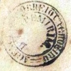
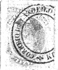
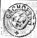
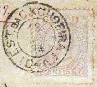
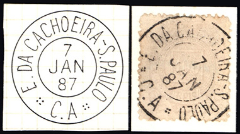
R. Koester describes the first postmark CRS-0060a as a double circle with the dates 1886 and 1887 in the centre. Its successor CRS-0060b (ill. Claudio Coelho) is a circle cancel in negative form with the inscriptions CACIMBINHA (sic) at the top and S.P. DO SUL between five-pointed stars at the bottom. The date in the centre is missing and the stamp has so far been found on issues from 1890.
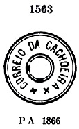
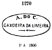
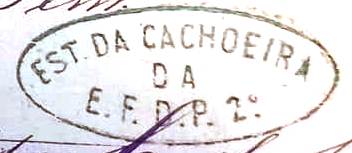
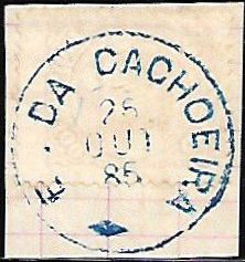
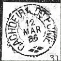
The cancel CRS-0060c has already been presented by Paulo Ayres in Catálogo de Carimbos Brasil-Império (S. Paulo, 1937, 1942):
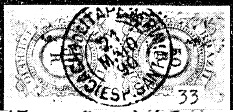
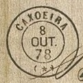
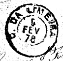
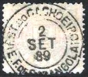
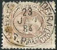
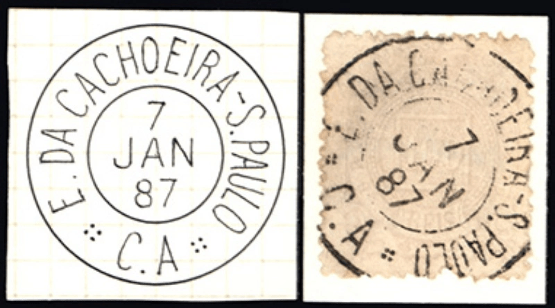
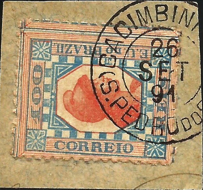
The last postmark of the 19th century could already be Republican, as CRS-0060d (Fig. Felipe Piccinini) presents dates from 1891-1894:
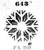
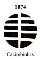
James Dingler and Klerman W. Lopes have also shown a mute cancellation of Cacimbinhas under no. 1074 in Mute Cancellations of the Brazil Empire / Carimbos Mudos do Brasil Império (Brazil Philatelic Association, Rio de Janeiro, 2000):
Anderer Name: Pinheiro Machado (1915)
Die portugiesische Besiedlung der Region begann um 1765 durch Familien von den Azoren und der Ort gehörte zunächst zur Gemeinde Rio Grande. Einer der ersten Fazendeiros war José Dutra de Andrade. Eine lokale Legende erzählt, dass dieser aus unbekannten Gründen erblindete. In seiner Verzweiflung wusch er sich fortan nur noch mit dem Wasser der örtlichen Wasserstellen (cacimbas). Und siehe da, bald darauf konnte er wieder sehen und ließ aus Dankbarkeit eine Kapelle zu Ehren von Nossa Senhora da Luz („Unsere Liebe Frau des Lichts“) errichten.
N. Sra. da Luz de Cacimbinhas wurde im November 1851 Curato, d.h. Pfarrei, nun im Município von Piratini. Im Januar 1857 wurde der Ort zur Freguesia erhoben und erhielt im Mai 1878 die politische Autonomie als Villa in einem eigenen Município.
Am 8. September 1915 starb in einem Luxushotel in Rio de Janeiro durch einen Dolchstoß in den Rücken der einflussreiche Senator José Gomes Pinheiro Machado, der als graue Eminenz der frühen Republik nicht nur Freunde hatte:

Sein Mörder war der in Cacimbinhas geborene politische Aktivist Francisco Manço de Paiva Coimbra. Daraufhin verfügte der designierte Intendente (Bürgermeister) von Cacimbinhas noch im selben Monat die Umbenennung der Gemeinde, die seitdem Pinheiro Machado heißt.
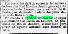
Wie aus dem Verzeichnis der kaiserlichen Postämter (Tabella das Agencias do Correio do Imperio, Rio de Janeiro, 1885) hervorgeht, gab es dort seit 1880 ein Postamt, doch im März des folgenden Jahres wurde in der Presse von Rio erneut die Gründung der Agentur angekündigt:
R. Koester beschreibt den ersten Poststempel CRS-0060a als Doppelkreis mit den Jahreszahlen 1886 und 1887 in der Mitte. Sein Nachfolger CRS-0060b (Abb. Claudio Coelho) ist ein Kreisstempel in Negativform mit den Inschriften CACIMBINHA (sic) oben und S.P. DO SUL zwischen fünfzackigen Sternen unten. Das Datum in der Mitte fehlt, und der Stempel wurde bisher auf Ausgaben von 1890 gefunden.
Der Stempel CRS-0060c wurde bereits von Paulo Ayres in Catálogo de Carimbos Brasil-Império (S. Paulo, 1937, 1942) vorgestellt:

Der letzte Poststempel des 19. Jahrhunderts könnte bereits republikanisch sein, da CRS-0060d (Abb. Felipe Piccinini) Daten von 1891-1894 zeigt:

James Dingler und Klerman W. Lopes haben in Mute Cancellations of the Brazil Empire / Carimbos Mudos do Brasil Império (Brazil Philatelic Association, Rio de Janeiro, 2000) unter Nr. 1074 auch eine stumme Entwertung von Cacimbinhas gezeigt: