Other names: Bom Jesus dos Limões, Anchieta, Piatã (1943)
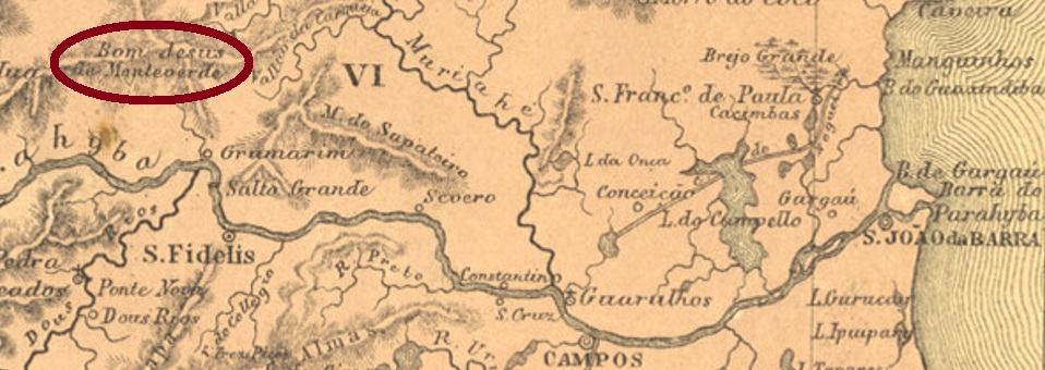
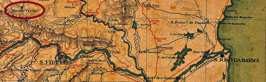
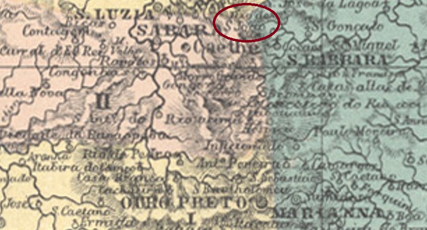
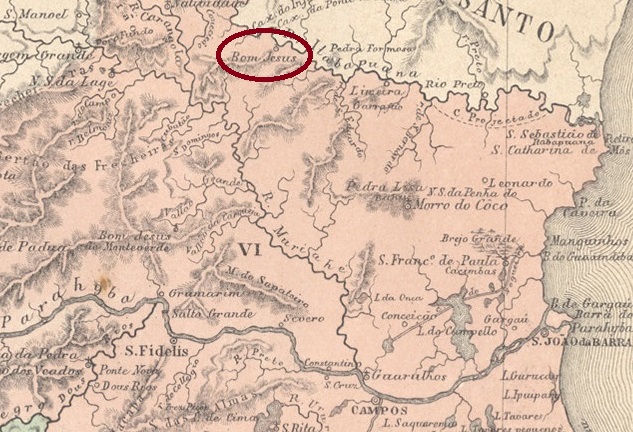
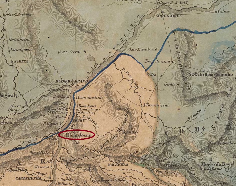
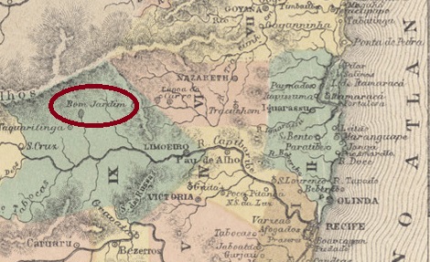
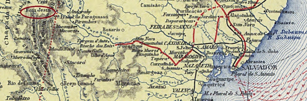
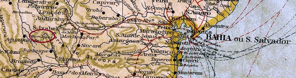
The parish of Senhor Bom Jesus was established in May 1842 under the Vila of Minas do Rio de Contas and was located on the east bank of the Rio de Contas, 540 km west of the provincial capital Salvador da Bahia. The village rose to the status of Vila in July 1878, after which there were two changes in the place name: in June 1931 to Anchieta and in December 1943 to Piatã. This name is still valid today.
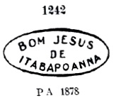
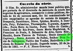
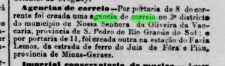
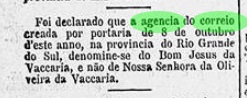
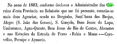
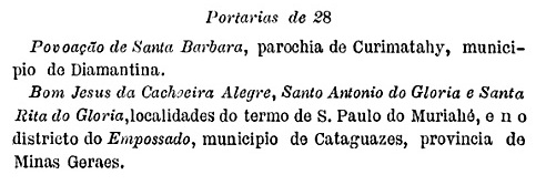
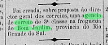
Reinhold Koester writes in Carimbologia V that the local post office was created in September 1882, which is also confirmed by the Directory of Imperial Post Offices (Tabella das Agencias do Correio do Imperio, Rio de Janeiro, 1885). On the other hand, a report of the Provincial President gives the year of creation as 1883:

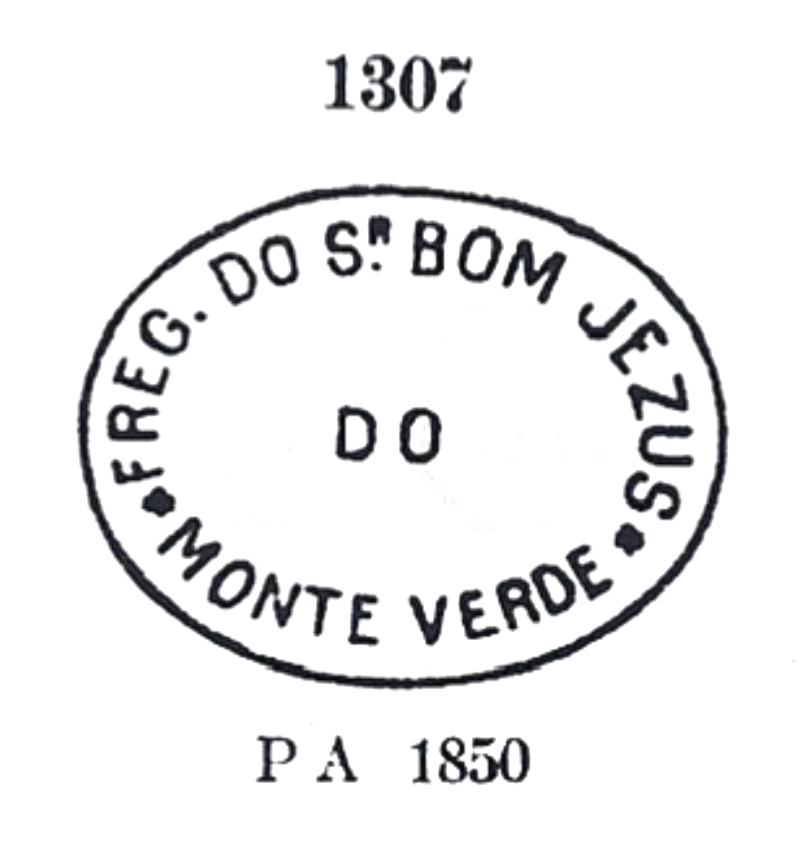
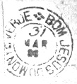
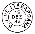
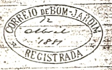
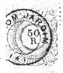
The last date could be that of the commissioning of the agency. A postmark was found for the 19th century: BBA-0140a (Coll. José A. Junges) is a double circle with the inscription BOM JESUS R.C. above and a star-shaped ornament below. The dates in the centre so far go from 1890 to 1897.
Andere Namen: Bom Jesus dos Limões, Anchieta, Piatã (1943)
Die Pfarrei von Senhor Bom Jesus wurde im Mai 1842 unter der Vila von Minas do Rio de Contas errichtet und lag am Ostufer des Rio de Contas, 540 km westlich der Provinzhauptstadt Salvador da Bahia entfernt. Die Ortschaft stieg im Juli 1878 zur Vila, danach gab es zwei Änderungen im Ortsnamen: im Juni 1931 zu Anchieta und im Dezember 1943 zu Piatã. Dieser Name ist noch heute gültig.
Reinhold Koester schreibt in Carimbologia V, dass das örtliche Postamt im September 1882 entstanden ist, was auch vom Verzeichnis der kaiserlichen Postämter (Tabella das Agencias do Correio do Imperio, Rio de Janeiro, 1885) bestätigt wird. Dagegen nennt der Bericht des Provinzpräsidenten das Enstehungsjahr 1883:

Letzter Termin könnte der von der Inbetriebnahme der Agentur sein. Ein Poststempel wurde für das 19. Jahrhundert gefunden: BBA-0140a (Samml. José A. Junges) ist ein Doppelkreis mit der Inschrift BOM JESUS R.C. oben und einem sternförmigen Ornament unten. Die Daten in der Mitte gehen bisher von 1890 bis 1897.