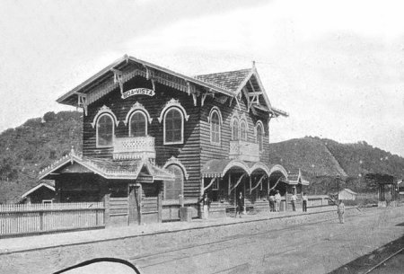
Another name: Engenheiro Passos (1894)
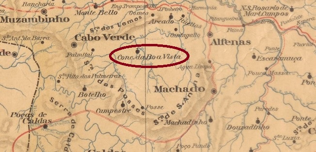
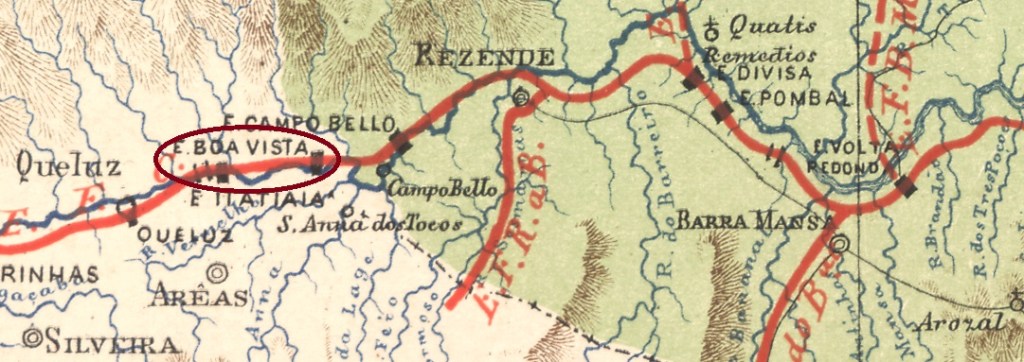
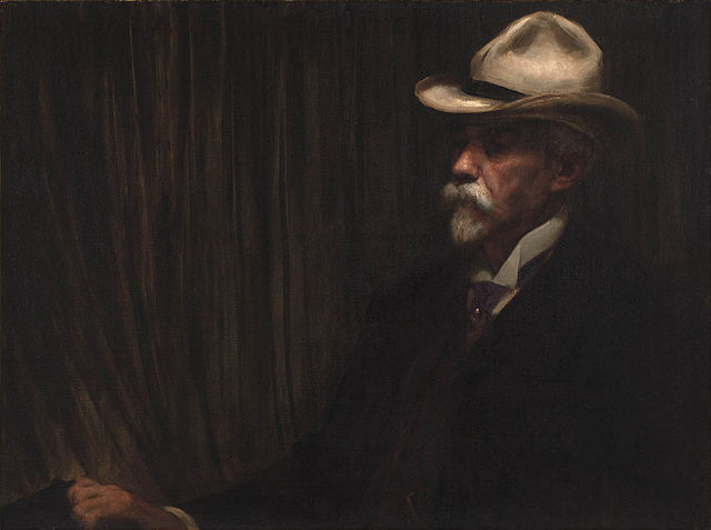
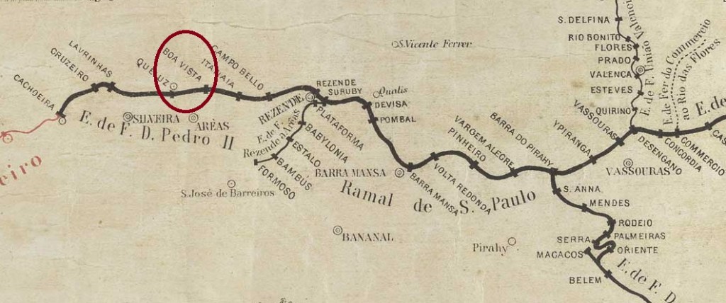
Boa Vista station was inaugurated in June 1873 by the E.F. D. Pedro II railway company (São Paulo line) in the Município of Resende, just before the provincial border with São Paulo, 200 km west of the capital Rio de Janeiro. The railway line went to the E.F. Central do Brasil in 1889 and from 1975 until its closure in 1996 it belonged to Rede Ferroviária Federal S.A. (estacoesferroviarias.com.br). In 1894 the station was renamed Engenheiro Francisco Pereira Passos. The name commemorates the engineer and politician (1836-1913) who undertook extensive urban redevelopment as mayor of Rio de Janeiro (1902-1906).
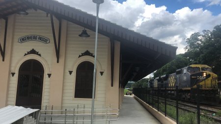
The area around the station became the district of Engenheiro Passos in September 1952. The station building was restored in 2020 and now stands as an empty tourist attraction next to the noisy highway.


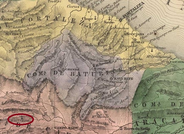
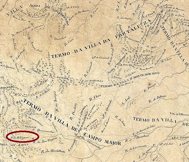
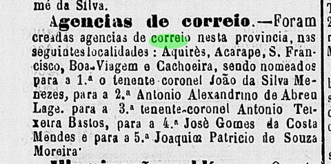
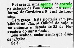
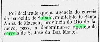
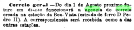
The station post office had existed since 1873, as reported in the capital’s press:
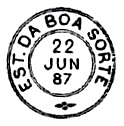
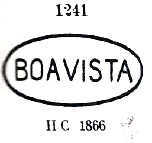
The first station postmark is BRJ-0190a, already presented by Paulo Ayres in Catálogo de Carimbos Brasil-Império (S. Paulo, 1937, 1942) under No. 1241:
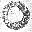
Paulo Ayres also shows us the seal stamp BRJ-0190b, unfortunately without further information:

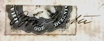
From the Fuad Ferreira Fo. collection comes a handwritten cancellation from there:

Anderer Name: Engenheiro Passos (1894)
Der Bahnhof Boa Vista wurde im Juni 1873 durch die Bahngesellschaft E.F. D. Pedro II (São Paulo-Linie) eingeweiht und lag im Município von Resende, kurz vor der Provinzgrenze zu São Paulo, 200 km westlich der Hauptstadt Rio de Janeiro entfernt. Die Bahnlinie ging 1889 zur E.F. Central do Brasil und von 1975 bis zur Stilllegung 1996 gehörte sie der Rede Ferroviária Federal S.A. (estacoesferroviarias.com.br). 1894 wurde der Bahnhof zu Engenheiro Francisco Pereira Passos umbenannt. Der Name erinnert an den Ingenieur und Politiker (1836-1913), der sich als Prefeito von Rio de Janeiro (1902-1906) eine ausführliche Stadtsanierung vornahm.

Das Gebiet um den Bahnhof wurde der Distrikt von Engenheiro Passos im September 1952. Das Bahnhofsgebäude wurde 2020 auswendig restauriert und nun steht als leere touristische Attraktion neben der lauten Autobahn.
Das Bahnhofspostamt gab es seit 1873, wie die Hauptstadtpresse berichtete:

Das erste Bahnhofsstempel ist BRJ-0190a, der bereits durch Paulo Ayres in Catálogo de Carimbos Brasil-Império (S. Paulo, 1937, 1942) unter Nr. 1241vorgestellt wurde:

Paulo Ayres zeigt uns auch den Siegelstempel BRJ-0190b, leider ohne weitere Information:

Aus der Sammlung Fuad Ferreira Fo. kommt auch eine handschriftliche Entwertung von dort: