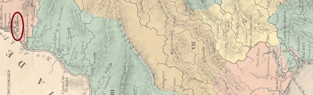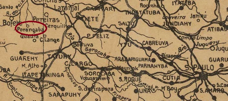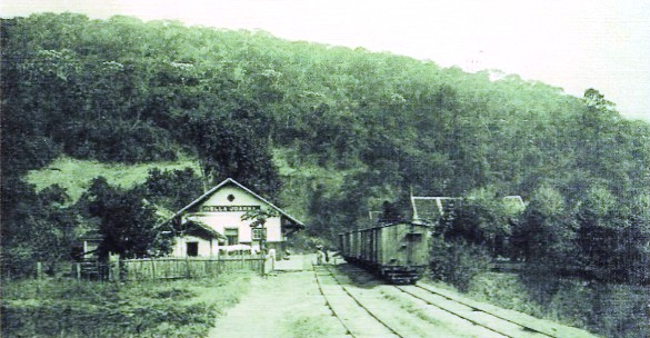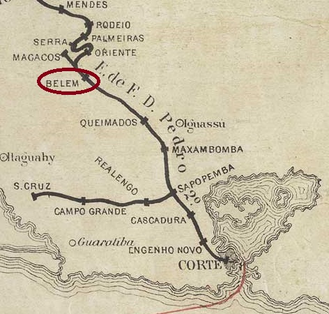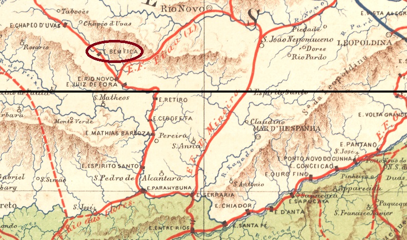
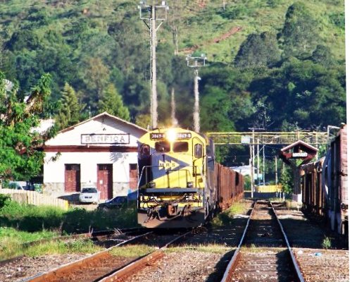
Bemfica station was inaugurated in February 1877 by the E.F. Dom Pedro II Railway Company (Central Line) on the west bank of the Paraibuna River, in the Município of Juiz de Fora, 200 km south of the provincial capital Ouro Preto. The railway line went to E.F. Central do Brasil in 1889 and belonged to Rede Ferroviária Federal S.A. from 1975 until its closure in 1996 (estacoesferroviarias.com.br). Today the rails are still there, the station building serves as a workroom for the goods train company MRS Logística S.A.
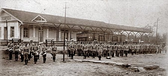

The settlement around the station continued to grow and became a district in August 1911; since September 1968 it has been a quartier of Juiz de Fora.
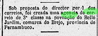
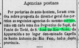
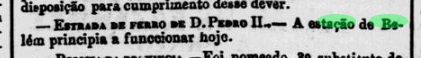
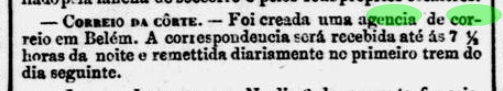
Two dates of origin for the station post office have been found. The first was in February 1877 – shortly after the inauguration of the station, according to the Rio press:

The second date was in July 1881, as both the postal report (Relatorio Postal) of 1886 and Paula Sobrinho write in História Postal de Minas Gerais (Belo Horizonte, 1997). Paulo Novaes (agenciaspostais.com.br) suggests this is when the station jurisdiction changed from the province of Rio de Janeiro to Minas Gerais.
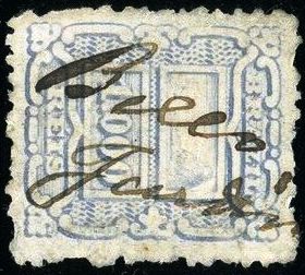
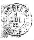
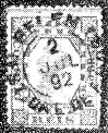
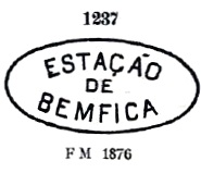
Two postmarks have been found from this station: the first one, BMG-0280a, was in use from the beginning, having been already presented by Paulo Ayres in Catálogo de Carimbos Brasil-Império (S. Paulo, 1937, 1942) under no. 1237:
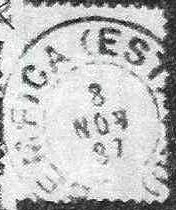
Its successor BMG-0280b was introduced by R. Koester in Carimbologia IV:
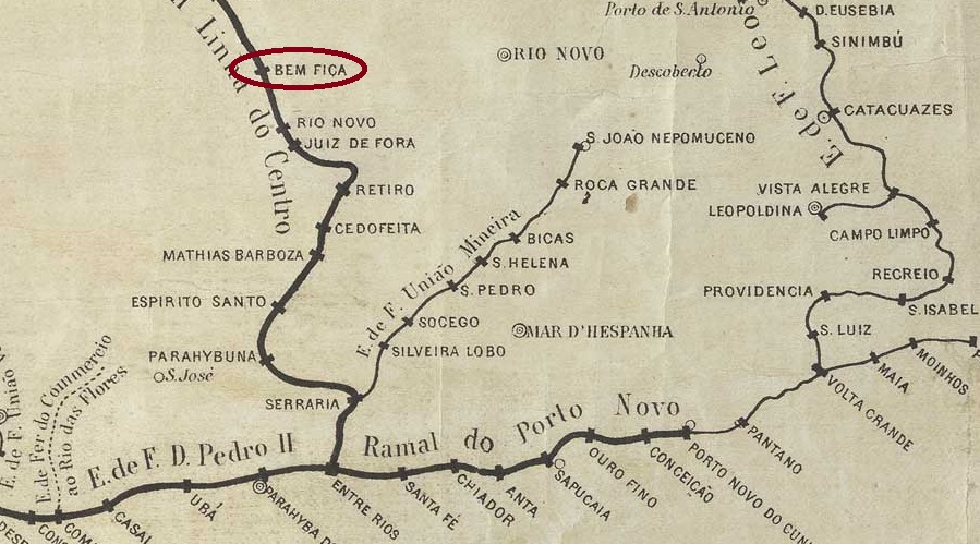
Der Bahnhof Bemfica wurde im Februar 1877 durch die E.F. Dom Pedro II Bahngesellschaft (Hauptlinie) eingeweiht und lag am Westufer des Flusses Paraibuna, im Município von Juiz de Fora, 200 km südlich der Provinzhauptstadt Ouro Preto entfernt. Die Bahnlinie ging 1889 zur E.F. Central do Brasil und gehörte vom 1975 bis zur Stilllegung 1996 der Rede Ferroviária Federal S.A. (estacoesferroviarias.com.br). Heute sind die Schienen noch da, das Bahnhofsgebäude dient als Arbeitsraum für die Güterzugsgesellschaft MRS Logística S.A.

Die Siedlung um den Bahnhof wuchs weiter und wurde im August 1911 zum Distrikt; seit September 1968 ist sie ein Stadtteil von Juiz de Fora.
Zwei Entstehungstermine fürs Bahnhofspostamt wurden gefunden. Erstmals im Februar 1877 – also kurz nach der Bahnhofseinweihung, wie die Presse aus Rio mitteilte:
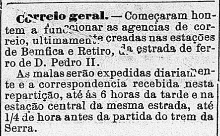
O Globo/RJ 23.02.1877
Der zweite Termin fand im Juli 1881, wie sowohl im Postbericht (Relatorio Postal) von 1886 zu lesen ist, als auch Paula Sobrinho im História Postal de Minas Gerais (Belo Horizonte, 1997) schreibt. Paulo Novaes (agenciaspostais.com.br) meint, dieser wäre der Zeitpunkt, als die Bahnhofszuständigkeit von der Provinz Rio de Janeiro zu Minas Gerais wechselte.
Aus zwei Poststempel aus diesem Bahnhof wurden gefunden: der erste, BMG-0280a, war von Beginn an in Verwendung und wurde bereits durch Paulo Ayres in Catálogo de Carimbos Brasil-Império, (S. Paulo, 1937, 1942) unter der Nr. 1237 vorgestellt:

Sein Nachfolger BMG-0280b wurde durch R. Koester in Carimbologia IV bekannt gemacht: