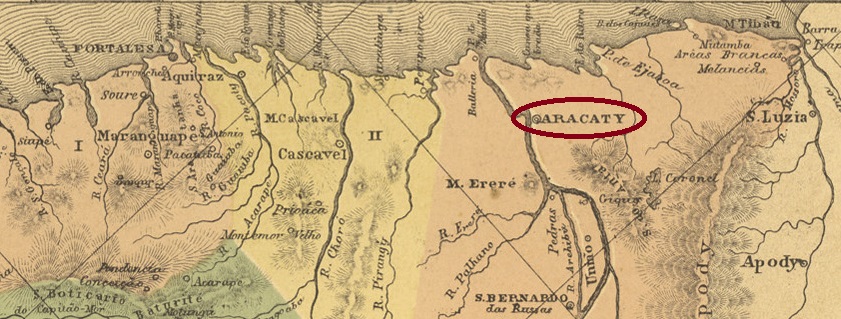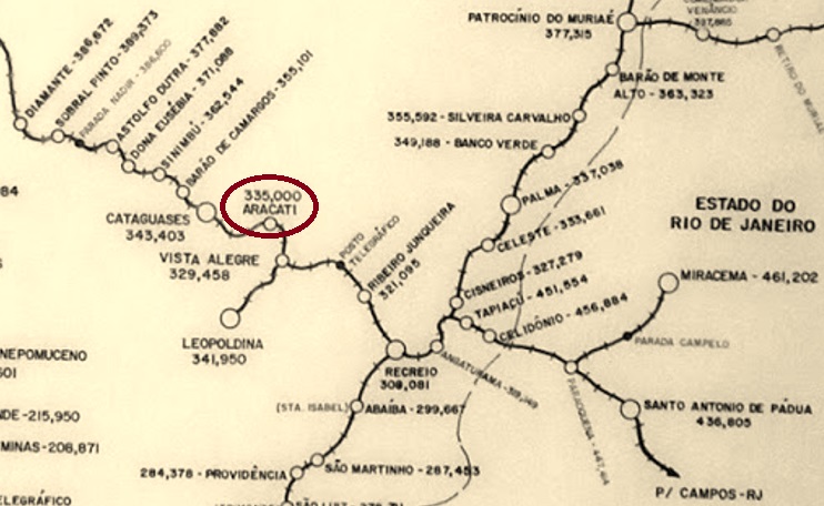
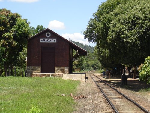
Aracaty station was inaugurated in September 1885 by the E.F. Leopoldina Railway Company and was located on the main line in the Município of Cataguazes, on the north bank of the Pomba River, 250 km southeast of the provincial capital Ouro Preto. The line belonged to Rede Ferroviaria Federal S.A. from 1975 to 1996 and today it is used only for freight transport of bauxite between Minas Gerais and Rio de Janeiro. The station building seems quite well preserved (estacoesferroviarias.com.br):

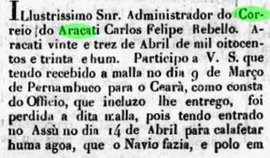
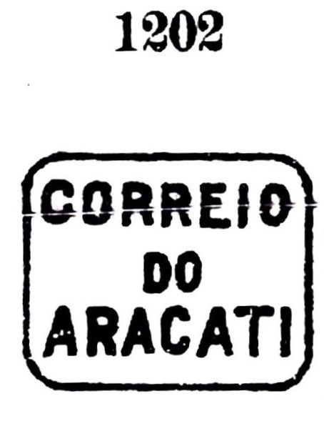
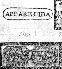
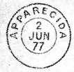
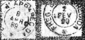
Around the station grew the settlement that is now called Aracati de Minas and belongs to the município of Cataguases (in their current spellings). The station post office was established in January 1886, according to the Postal Report (Relatorio Postal) for 1887. Paula Sobrinho, in Historia Postal de Minas Gerais (Belo Horizonte, 1997), gives the same date within the year 1883, which is probably a transcription error. The imperial postmark from this station is AMG-0100a (image from the internet): a double circle with the inscriptions EST. DE ARACATY above and (MINAS) below. The dates in the centre go from 1887 to at least 1894.
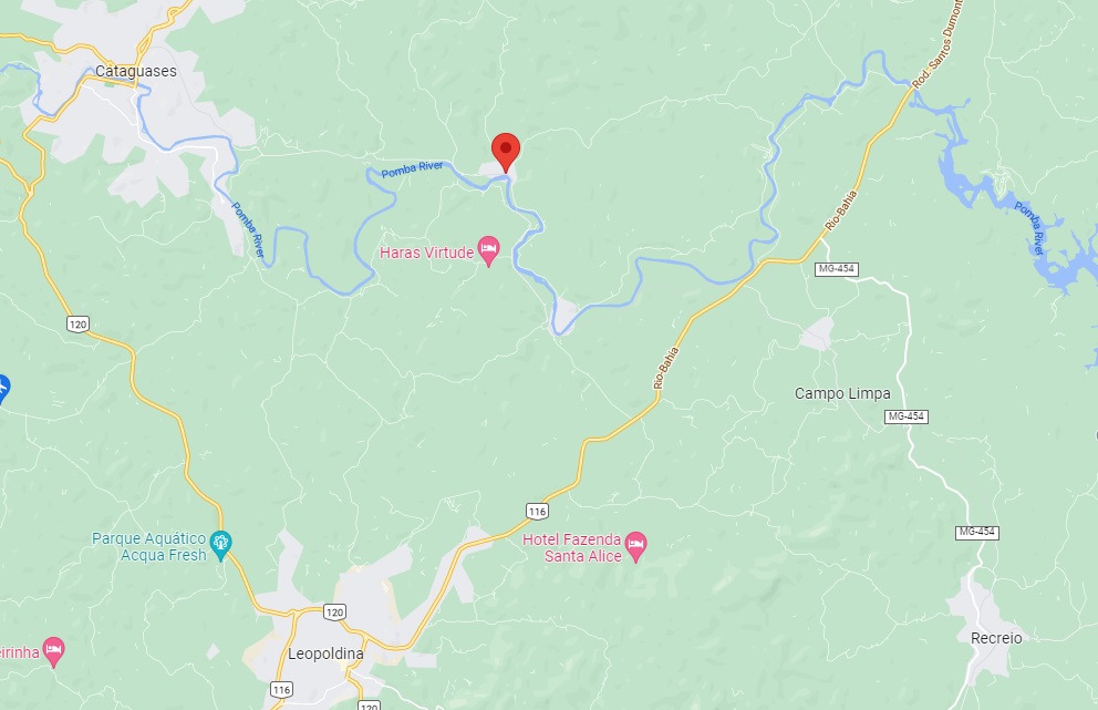
Der Bahnhof Aracaty wurde im September 1885 durch die E.F. Leopoldina Bahngesellschaft eingeweiht und lag auf der Hauptlinie im Município von Cataguazes, am Nordufer des Flusses Pomba, 250 km südöstlich der Provinzhauptstadt Ouro Preto entfernt. Die Linie gehörte von 1975 bis 1996 der Rede Ferroviária Federal S.A. und heute dient sie nur der Frachtbeförderung von Bauxit zwischen Minas Gerais und Rio de Janeiro. Das Bahnhofsgebäude scheint gut erhalten zu sein (estacoesferroviarias.com.br):
Rund um den Bahnhof wuchs die Siedlung, die heute Aracati de Minas heißt und dem Município von Cataguases (in der jeweils heutigen Schreibweise) angehört. Das Bahnhofspostamt wurde im Januar 1886 ins Leben gerufen, wie aus dem Postbericht (Relatorio Postal) für 1887 hervorgeht. Paula Sobrinho gibt in História Postal de Minas Gerais (Belo Horizonte, 1997) das gleiche Datum aus dem Jahr 1883, was ein Abschreibfehler sein dürfte. Der kaiserliche Poststempel aus diesem Bahnhof ist AMG-0100a (Abb. aus dem Internet): Ein Doppelkreis mit den Inschriften EST. DE ARACATY oben und (MINAS) unten. Die Daten in der Mitte gehen von 1887 bis mindestens 1894.