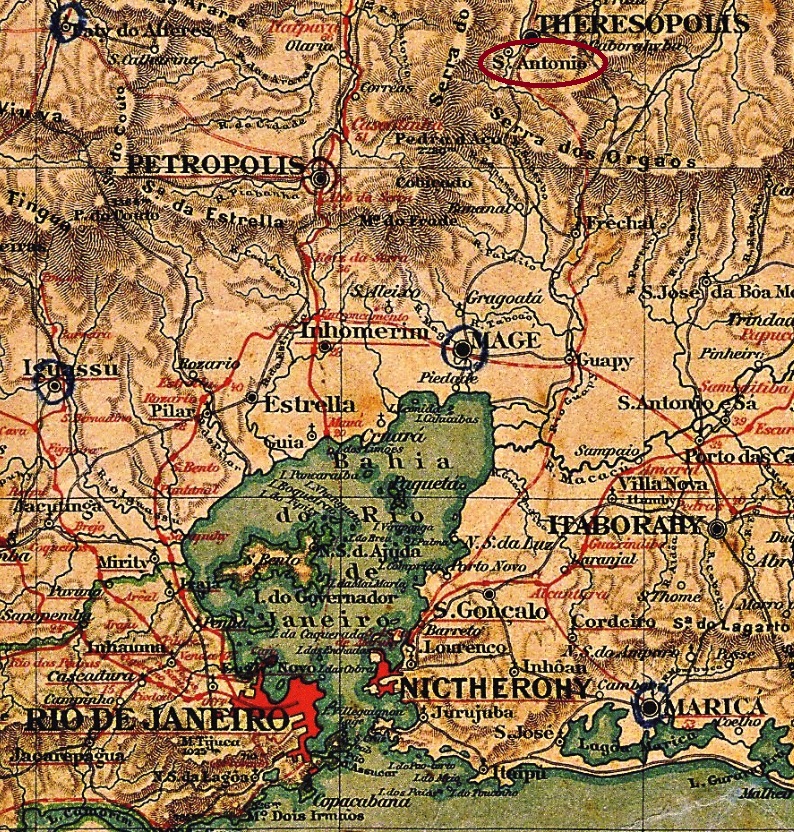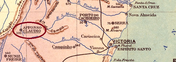
Another name: Afonso Claudio (1890)
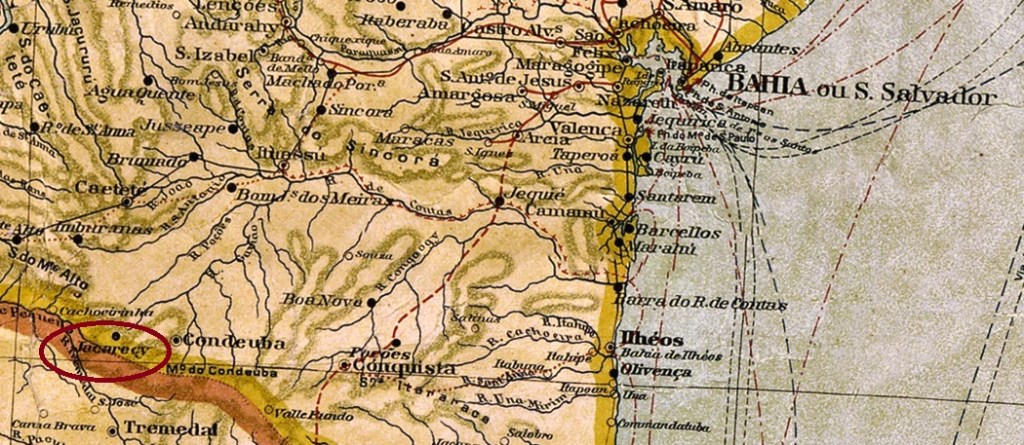
The Freguesia of S. Sebastião do Alto Guandú was founded in September 1888, located in the Municipio of Cachoeiro de Sta. Leopoldina on the east bank of the Guandu River, 140 km west of the provincial capital Vitória. In November 1890, the place was declared a Vila with the name Affonso Claudio, in memory of Affonso Claudio de Freitas Rosa (1859-1934), the first Republican Governor of the State of Espirito Santo, who was born in the region. Afonso Claudio (as it is written today) has been a city since November 1907.
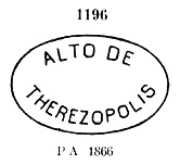
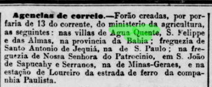
As Paulo Novaes writes in agenciaspostais.com.br, there had been a post office there since March 1885, but it did not start operating until August of that year, according to the Rio press:

The imperial postmark is AES-0015a (agenciaspostais.com.br): a double circle with the inscription CORRO DO ALTO GUANDU above and an ornament below formed by four dots, with internal dates from about 1885 to 1895.
Anderer Name: Afonso Claudio (1890)
Die Freguesia von S. Sebastião do Alto Guandú wurde im September 1888 gegründet und lag im Municipio von Cachoeiro de Sta. Leopoldina am Ostufer des Flusses Guandu, 140 km westlich der Provinzhauptstadt Vitória entfernt. Im November 1890 wurde der Ort zur Vila mit Namen Affonso Claudio erklärt, zum Andenken an Affonso Claudio de Freitas Rosa (1859-1934), dem ersten republikanischen Gouverneur des Staates Espirito Santo, der in der Region geboren war. Seit November 1907 ist Afonso Claudio (wie man es heute schreibt) eine Stadt.
Wie Paulo Novaes in agenciaspostais.com.br schreibt, gab es dort ein Postamt seit März 1885, der allerdings erst im August d.J. den Betrieb aufnahm, wie die Presse aus Rio berichtet:
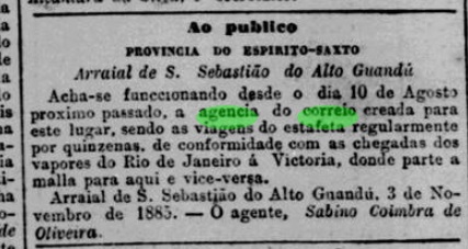
Der kaiserliche Poststempel ist AES-0015a (agenciaspostais.com.br): ein Doppelkreis mit der Inschrift CORRO DO ALTO GUANDU oben und einem Ornament unten, das durch vier Punkte gebildet wird, mit internen Daten von ca. 1885 bis 1895.