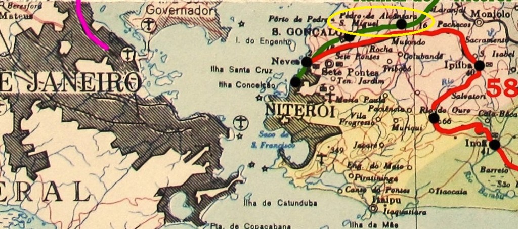
Other names: São Pedro da Aldeia (see also SRJ-0020), Sapiatiba
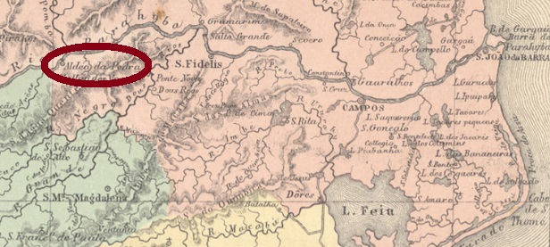
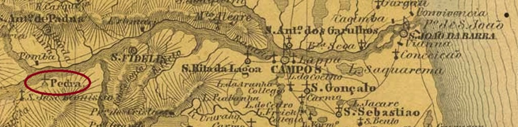
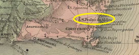
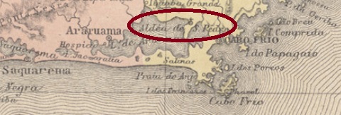
The history of this settlement, which is very old by Brazilian standards, began as early as May 1617, when the Aldeia de São Pedro was founded on the northeastern shore of Lake Araruama near Cabo Frio, about 140 east of the future capital Rio de Janeiro. In December 1795, it became a freguesia, which rose to become a villa called Sapiatiba in September 1890. However, the Tupi word meaning rich in clay did not find favour, and a good two years later the old place name returned. São Pedro da Aldeia has been a town since December 1929.
There are two dates for the origin of the local post office. The Imperial Mail Register (Tabella das Agencias do Correio do Imperio) of 1885 gives the year 1820 for it, while Nova Monteiro (Administrações e Agencias Postaes do Brasil Imperio, in Brasil Filatelico/RJ, 1934-5; Reprint SPP 1994-1999) lists the agency from June 1829.
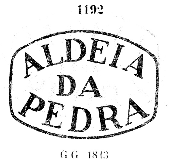
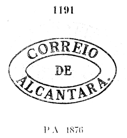
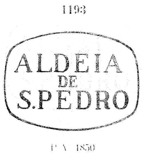
Both postmarks of the imperial period found so far bear the place name Aldeia de S. Pedro and were already rpesented under SRJ-0020. They are also presented here. ARJ-0020a/SRJ-0200a also occurs in blue, was in use from about 1829 to 1884 and was already presented by Paulo Ayres (Catálogo de Carimbos Brasil-Império, S. Paulo, 1937, 1942) under no. 1193:
ARJ-0020b/SRJ-0200b (agenciaspostais.com.br) is a simple double circle with the inscription A. DE S. PEDRO at the top. The only known copy is dated 1884 in the centre.
Andere Namen: Aldeia de São Pedro, Sapiatiba
Die Geschichte dieser für brasilianische Verhältnisse sehr alten Siedlung fing bereits im Mai 1617 an, als die Aldeia de São Pedro am Nordostufer des Araruama-Sees bei Cabo Frio gegründet wurde, ca. 140 östlich der künftigen Hauptstadt Rio de Janeiro entfernt. Im Dezember 1795 wurde daraus eine Freguesia, die im September 1890 zu einer Villa namens Sapiatiba aufstieg. Das Tupi-Wort, das reich an Lehm bedeutet, fand jedoch kein Gefallen, und gut zwei Jahre später kam der alte Ortsname zurück. Seit Dezember 1929 ist São Pedro da Aldeia eine Stadt.
Hier gibt es zwei Jahresangaben für die Entstehung des örtlichen Postamts. Das Verzeichnis der kaiserlichen Postämter (Tabella das Agencias do Correio do Imperio) von 1885 nennt dafür das Jahr 1820, während Nova Monteiro (Administrações e Agencias Postaes do Brasil Imperio, in Brasil Filatelico/RJ, 1934-5; Reprint SPP 1994-1999) die Agentur ab dem Juni 1829 auflistet.
Beide bisher gefundenen Poststempel der Kaiserzeit tragen den Ortsnamen Aldeia de S. Pedro und wurden bereits unter São Pedro da Aldeia (SRJ-0020) besprochen. Sie werden hier nochmals vorgestellt. ARJ-0020a/SRJ-0200akommt auch in blau vor, war von ca. 1829 bis 1884 in Gebrauch und wurde bereits durch Paulo Ayres(Catálogo de Carimbos Brasil-Império, S. Paulo, 1937, 1942) unter Nr. 1193 bekannt gemacht:

ARJ-0020b/SRJ-0200b (agenciaspostais.com.br) ist ein einfacher Doppelkreis mit der Inschrift A. DE S. PEDRO oben. Das einzige Exemplar ist 1884 in der Mitte datiert.