Text update of December 25, 2025
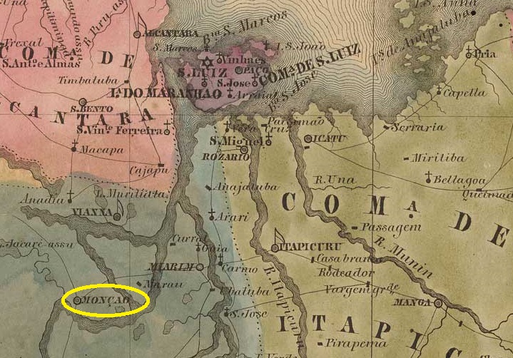
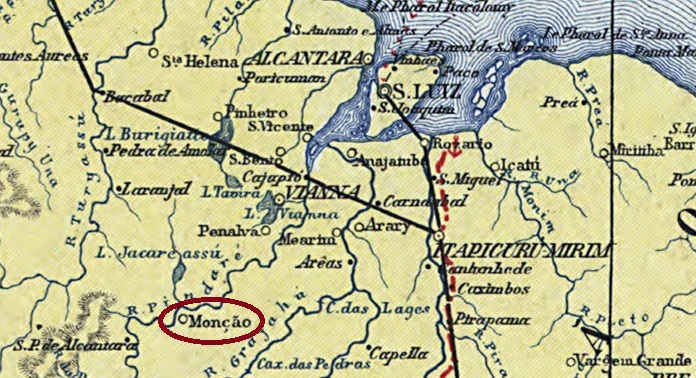
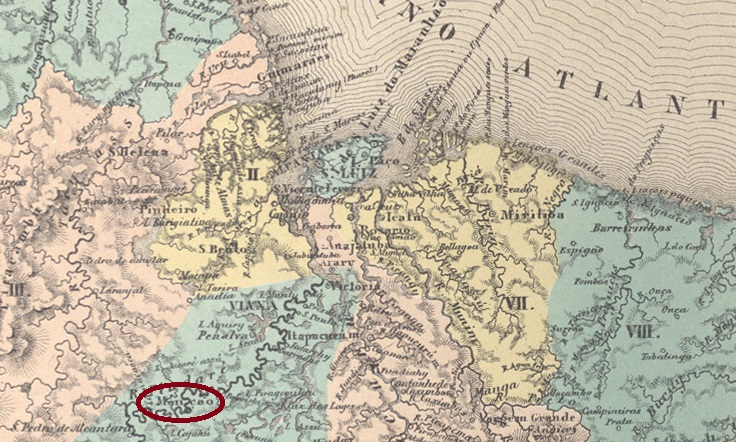
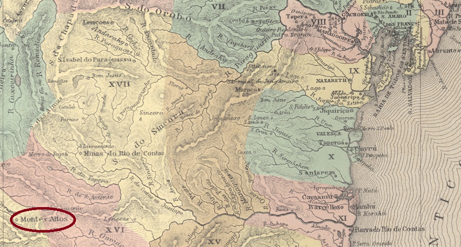
Other names: Montes Altos, Palmas de Monte Alto (1943)
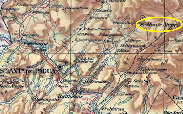
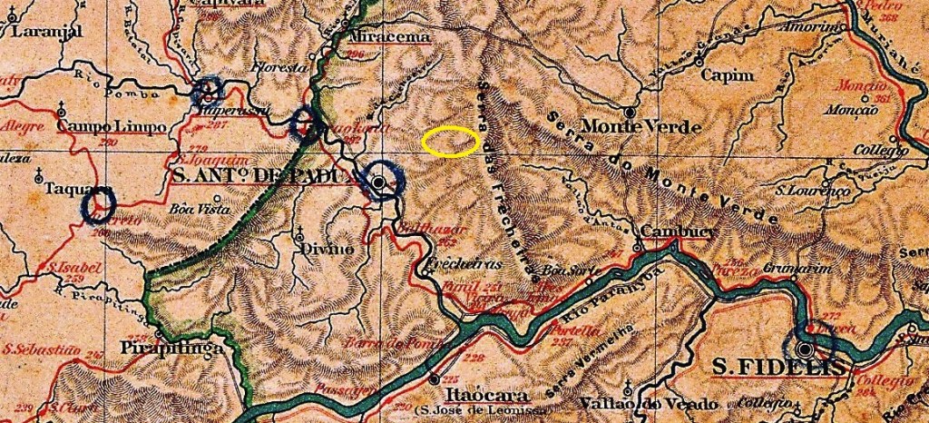
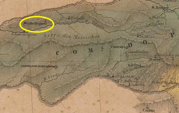
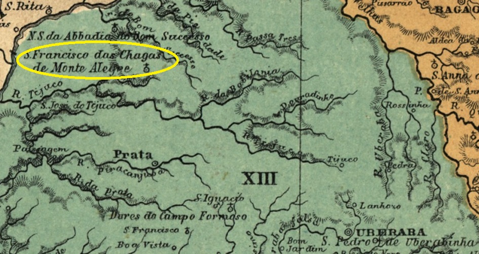
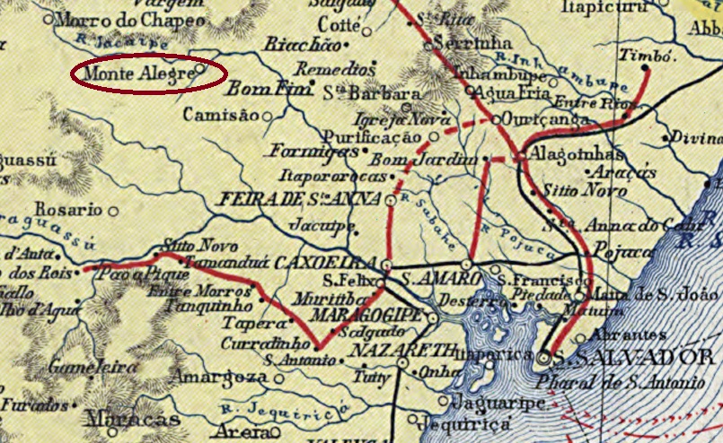
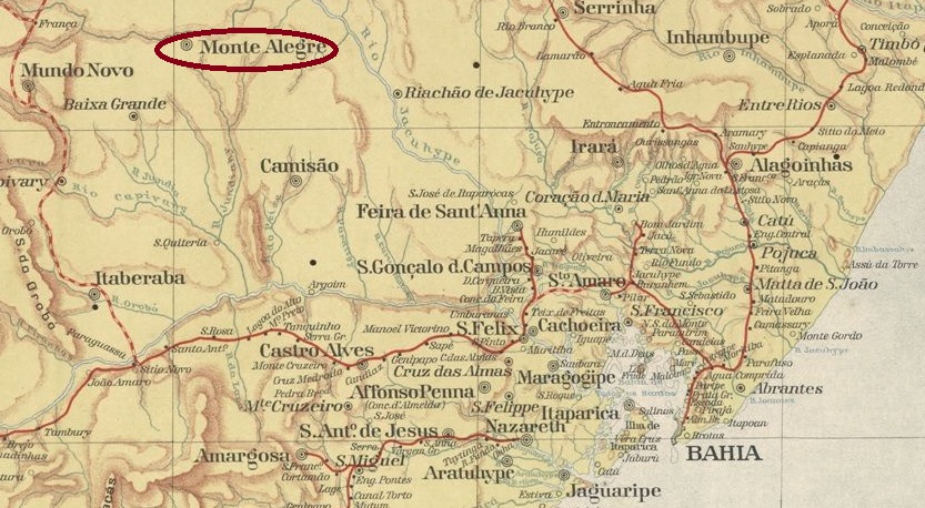
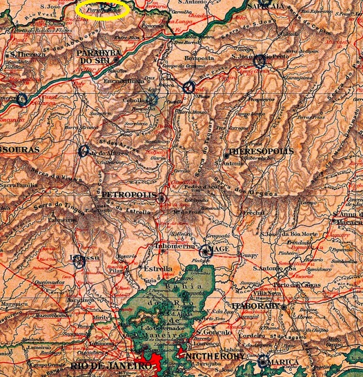
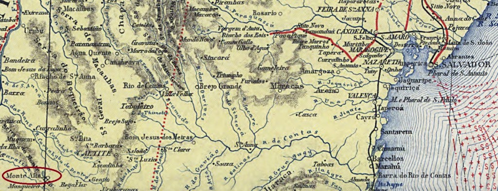
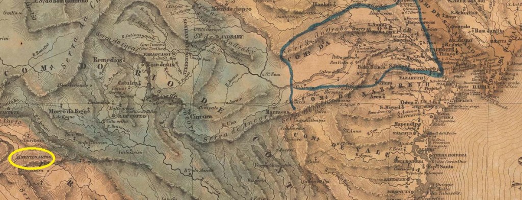
The settlement of Praia das Palmas de Monte Alto was located 680 km west of the colonial capital Salvador da Bahia and had existed since 1742. In May 1840, it became the Freguesia de Nossa Senhora da Mãe de Deus e dos Homens de Monte Alto and, at the same time, the Vila de Monte Alto. In July 1918, it was granted city status. In July 1931, Monte Alto was downgraded to a district of the Município de Guanambi, but regained its independence in May 1933. Since December 1943, the municipality has been called Palmas de Monte Alto.
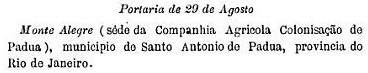
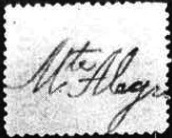
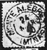
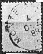
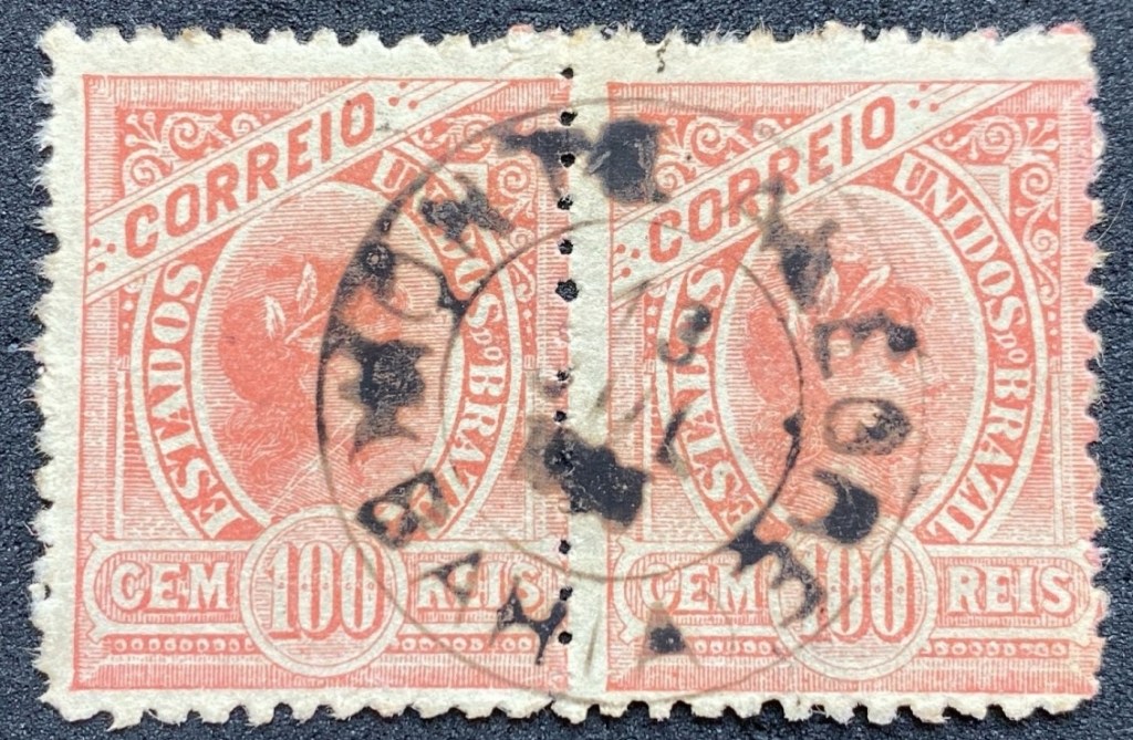
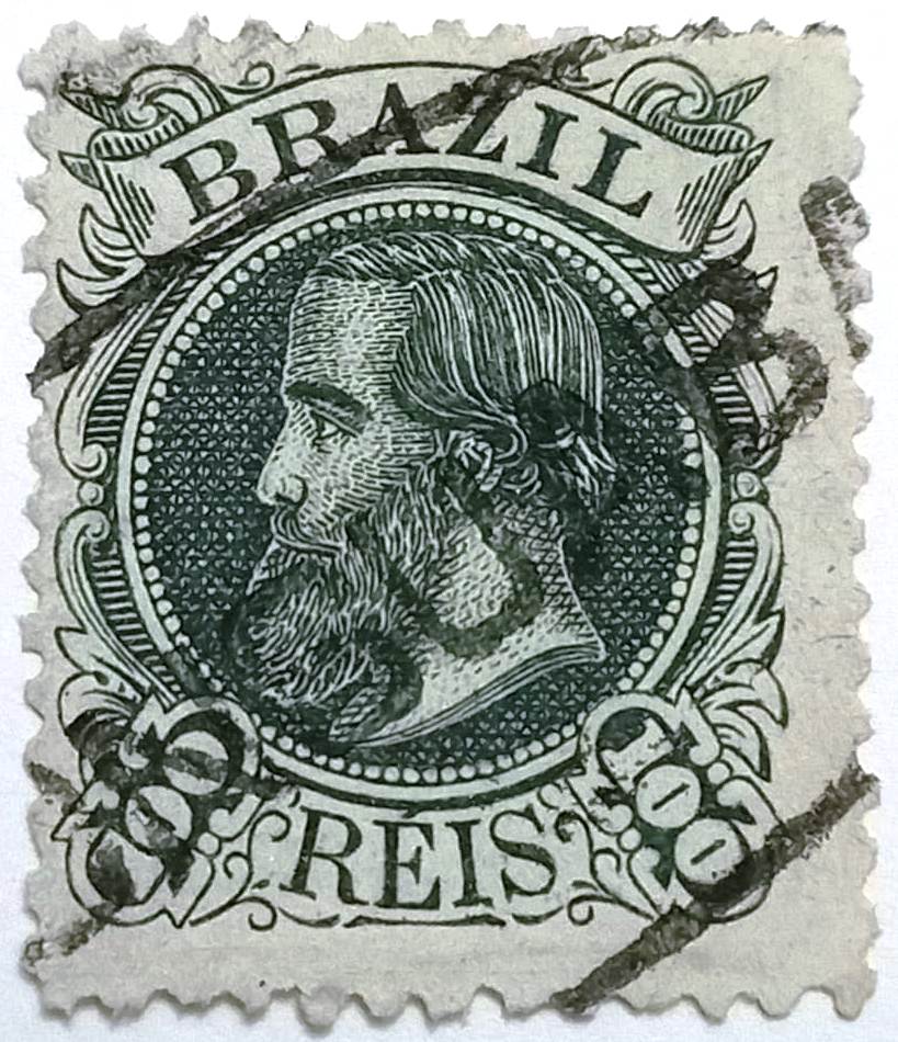
R. Koester writes in Carimbologia XXVII that there had been a post office there since March 1864. However, this was a reopening, as the Monte Alto post office had already been created in May 1852, as announced by the press in Rio de Janeiro.
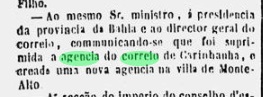
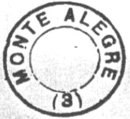
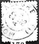
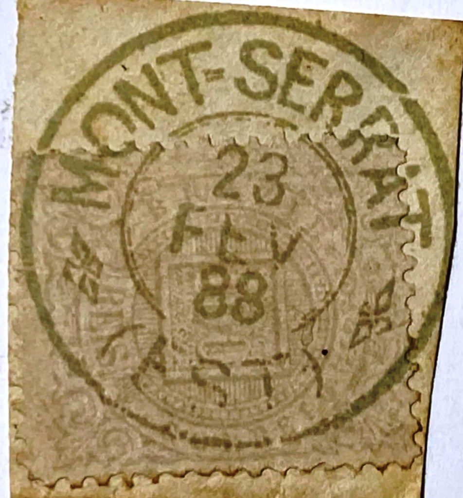
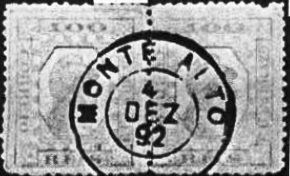
It was closed by the end of 1856, as the agency is not listed in the ‘Guia do Correio do Brasil’ (Rio de Janeiro, 1857). The only imperial postmark to date is MBA-0490b (Fig. Koester, op. cit.):

Outros nomes: Montes Altos, Palmas de Monte Alto (1943)
O povoado Praia das Palmas de Monte Alto ficava a 680 km a oeste da capital colonial Salvador da Bahia e existia desde 1742. Em maio de 1840, tornou-se a Freguesia de Nossa Senhora da Mãe de Deus e dos Homens de Monte Alto e, ao mesmo tempo, a Vila de Monte Alto. Em julho de 1918, recebeu o status de cidade. Em julho de 1931, Monte Alto foi rebaixada a distrito do município de Guanambi, mas recuperou sua autonomia em maio de 1933. Desde dezembro de 1943, o município se chama Palmas de Monte Alto.
R. Koester escreve em Carimbologia XXVII que havia uma agência dos correios no local desde março de 1864. No entanto, trata-se de uma reabertura, pois já em maio de 1852 fora criada a agência postal de Monte Alto, conforme divulgado pela imprensa do Rio de Janeiro.

Ela foi fechada até o final de 1856, pois a agência não consta mais no “Guia do Correio do Brasil” (Rio de Janeiro, 1857). O único carimbo postal imperial conhecido até o momento é o MBA-0490b (fig. Koester, op. cit.):
Textaktualisierung am 25. Dezember 2025
Andere Namen: Montes Altos, Palmas de Monte Alto (1943)
Die Siedlung Praia das Palmas de Monte Alto lag 680 km westlich der Kolonialhauptstadt Salvador da Bahia und existierte seit 1742. Im Mai 1840 wurde sie zur Freguesia de Nossa Senhora da Mãe de Deus e dos Homens de Monte Alto und gleichzeitig zur Vila de Monte Alto. Im Juli 1918 erhielt sie den Stadtstatus. Im Juli 1931 wurde Monte Alto zum Distrikt des Município de Guanambi herabgestuft, erhielt jedoch im Mai 1933 die Selbstständigkeit zurück. Seit Dezember 1943 heißt der Munizip Palmas de Monte Alto.
R. Koester schreibt in Carimbologia XXVII, dass es dort seit März 1864 ein Postamt gab. Hierbei handelt es sich jedoch um eine Wiedereröffnung, denn bereits im Mai 1852 wurde beschlossen, eine Postagentur Monte Alto einzurichten, wie die Presse aus Rio de Janeiro bekannt gab.

Das Postamt wurde vor dem Ende des Jahres 1856 geschlossen, da es im „Guia do Correio do Brasil” (Rio de Janeiro, 1857) nicht aufgeführt wird. Der bisher einzige kaiserliche Poststempel ist MBA-0490b (Abb. Koester, op. cit.):