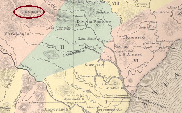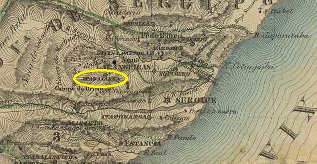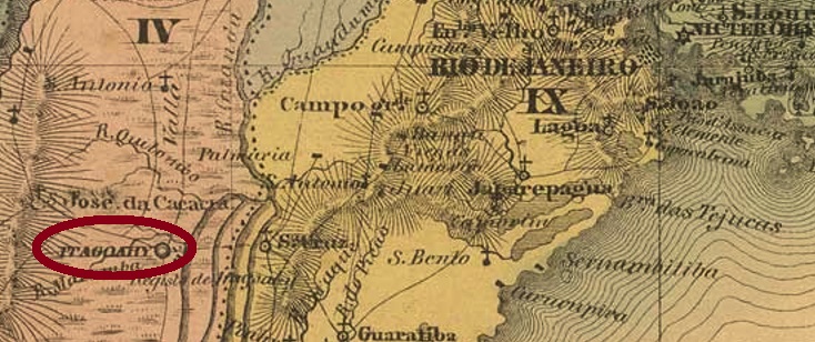
See also Tacoahy (TRJ-1600)
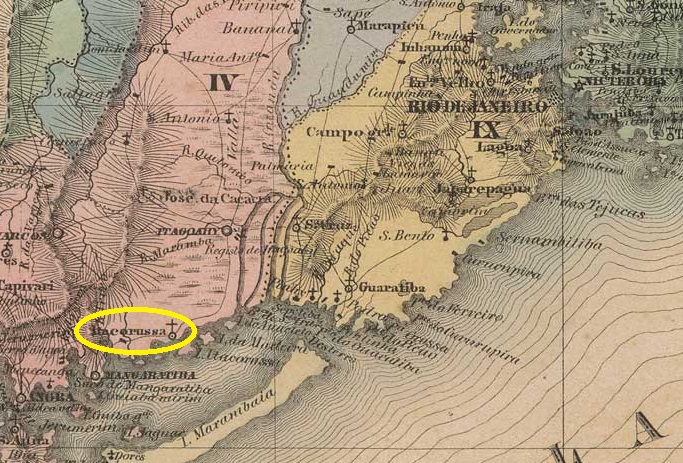
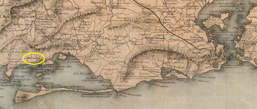
The parish of São Francisco Xavier de Tagoahy (or Tacoahy) was established in December 1795 by royal decree (Ordem Régia) 70 km west of the colonial capital Rio de Janeiro. The word Taguahy comes from the Tupi-Guarani language, means something like waters with yellow mud and names the river in the area that flows into the Sepetiba Bay. In 1818, the place was declared a vila for five months before being reclassified as a district in November of that year. In 1819 it became a vila again, and since June 1892 Itaguaí (as it is now spelled) has been a town in its own municipal charter.
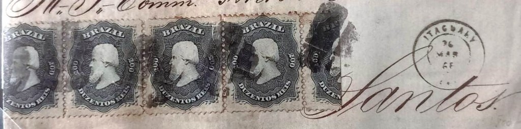
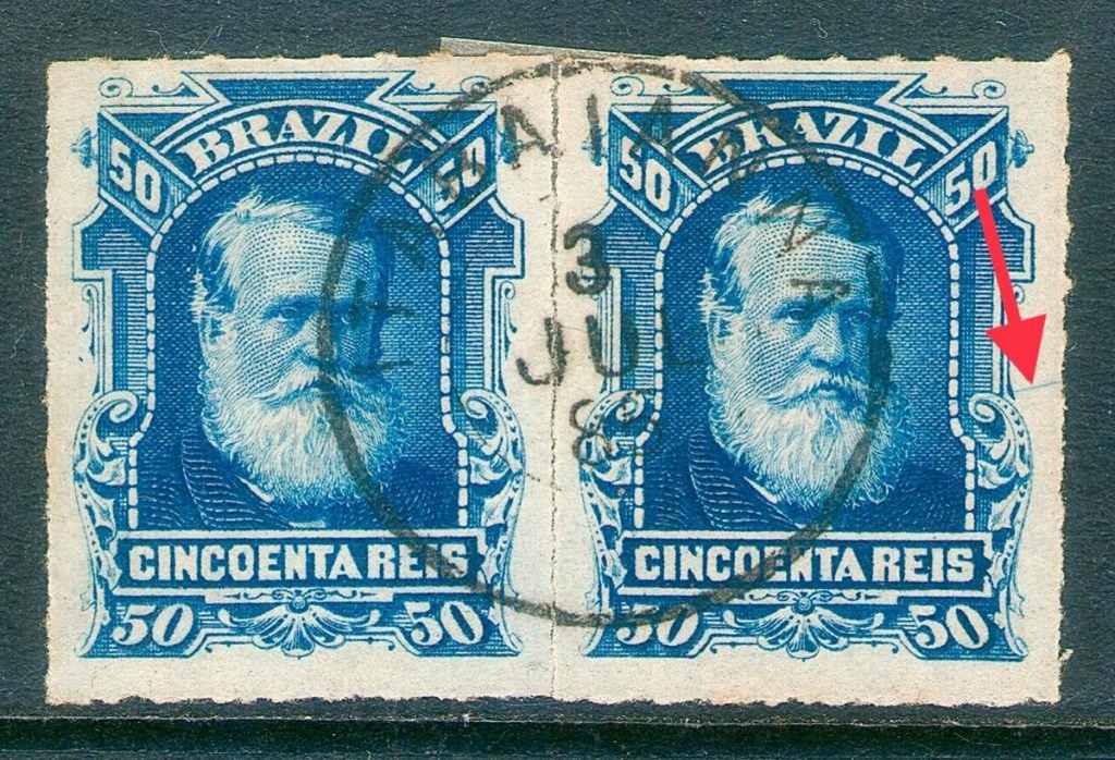
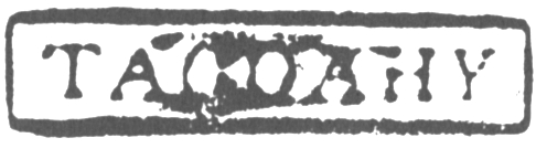
Nova Monteiro (Administrações e Agencias Postaes do Brasil Imperio, in Brasil Filatelico/RJ, 1934-5; Reprint SPP 1994-1999) and Reinhold Koester (Carimbologia XXIII) agree that there was a post office there from May 1829. The first local postmark is also the only one with Tagoahy so far. TRJ-1600a has already been presentsed by Cicero A. Almeida under No. 380 in Carimbos Postais – século XIX (Rio de Janeiro, 1989):
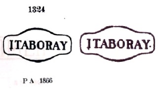
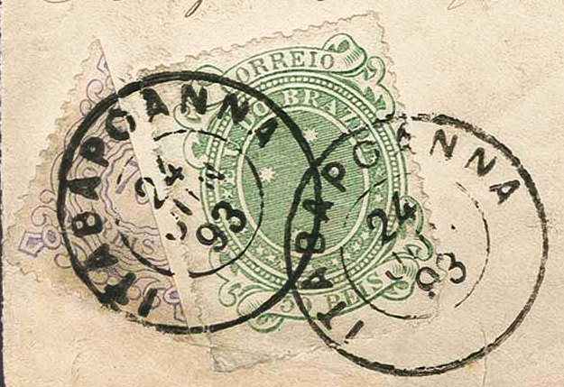
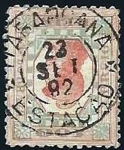
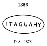
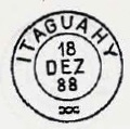
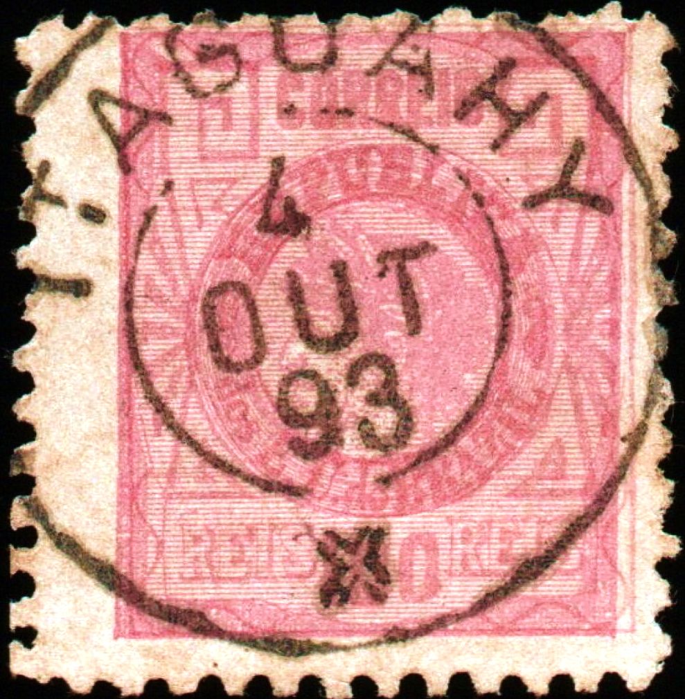
This was followed by local cancellations with the spelling Itaguahy, beginning with IRJ-0675a, which also exists in red and dark violet and which received the no. 1326 in P. Ayres Catálogo de Carimbos Brasil-Império (S. Paulo, 1937, 1942):
Then came the very rare French type IRJ-0675b (collect. Fuad Ferreira Fo.):

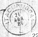
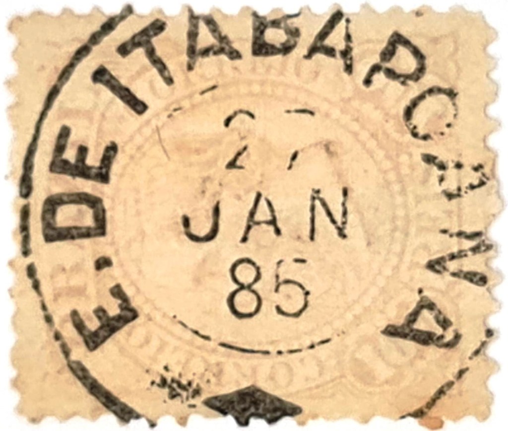
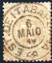
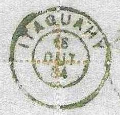
Its successor IRJ-0675c (fig. agenciaspostais.com.br), on the other hand, is more common:
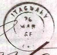
The following cancels were also used in the Republic, starting with IRJ-0675d, which is also included in P. Ayres (op. cit.):


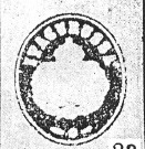
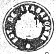
A mute cancellation from Itaguahy was registered by James Dingler and Klerman W. Lopes as no. 3567 in Mute Cancellations of the Brazil Empire / Carimbos Mudos do Brasil Império (Brazil Philatelic Association, Rio de Janeiro, 2000):

We can present three more cancellations of this type:


Siehe auch Tacoahy (TRJ-1600)
Die Pfarrei São Francisco Xavier de Tagoahy (oder Tacoahy) wurde im Dezember 1795 durch königliche Verfügung (Ordem Régia) 70 km westlich der Kolonialhauptstadt Rio de Janeiro errichtet. Das Wort Taguahy kommt aus der Tupi-Guarani-Sprache, bedeutet etwa Gewässer mit gelbem Schlamm und benennt auch den Fluss der Gegend, der in die Bucht von Sepetiba mündet. 1818 wurde der Ort fünf Monate lang als Vila erklärt, bevor im November des Jahres die Rückstufung als Distrikt erfolgte. 1819 wurde daraus wieder eine Vila, und seit Juni 1892 ist Itaguaí (wie es heute geschrieben wird) eine Stadt im eigenen Gemeindesitz.
Nova Monteiro (Administrações e Agencias Postaes do Brasil Imperio, in Brasil Filatelico/RJ, 1934-5; Reprint SPP 1994-1999) und Reinhold Koester (Carimbologia XXIII) sind sich darüber einig, dass es dort seit Mai 1829 ein Postamt gab. Der erste lokale Poststempel ist auch bisher der einzige mit der Ortsbezeichnung Tagoahy. TRJ-1600a wurde bereits durch Cicero A. Almeida unter Nr. 380 in Carimbos Postais – século XIX (Rio de Janeiro, 1989) vorgestellt:

Es folgten Ortsstempel mit der Schreibweise Itaguahy, beginnend mit IRJ-0675a, den es auch in rot und dunkelviolett gibt und der in P. Ayres Catálogo de Carimbos Brasil-Império (S. Paulo, 1937, 1942) die Nr. 1326 erhielt:

Dann kam der sehr seltene französische Typ IRJ-0675b (Samml. Fuad Ferreira Fo.):
Sein Nachfolger IRJ-0675c (Abb. agenciaspostais.com.br) ist dagegen häufiger anzutreffen:

Die folgenden Stempel wurden auch in der Republik verwendet, beginnend mit IRJ-0675d, der auch in P. Ayres (op. cit.) enthalten ist:

Ein stummer Stempel aus Itaguahy wurde von James Dingler und Klerman W. Lopes als Nr. 3567 in Mute Cancellations of the Brazil Empire / Carimbos Mudos do Brasil Império (Brazil Philatelic Association, Rio de Janeiro, 2000) registriert:

Wir können noch drei weitere Stempel dieser Art vorstellen: