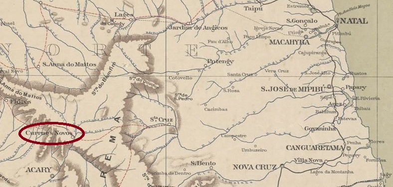
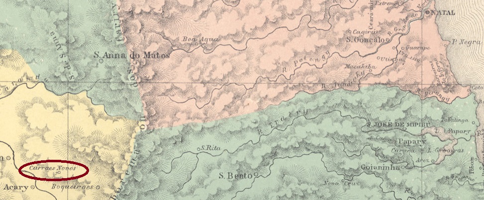
In 1754, a certain Cipriano L. Galvão owned a fazenda called Currais Novos, 180 kilometres west of the later provincial capital of Natal. In July 1788, a village had already been established there, which belonged to the Vila de Caicó. It was elevated to a freguesia in February 1884, when the settlement belonged to the Vila de N. Sra. da Guia de Acary. In October 1890, the Vila de Sant’Anna dos Curraes Novos was founded, which became a town in November 1920.
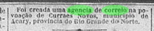
According to the Rio press, there had been a post office there since November 1887:
Cidade do Rio/RJ, 09/11/1887
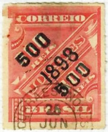
The oldest postmark to date is CRN-0060a (image from the Internet)
CRN-0060a (EB) 1898ffAtlas do Imperio do Brasil, 1868
1754 besaß ein gewisser Cipriano L. Galvão eine Fazenda namens Currais Novos, 180 km westlich der späteren Provinzhauptstadt Natal. Im Juli 1788 war dort bereits ein Dorf entstanden, das zur Vila de Caicó gehörte. Die Erhebung zur Freguesia erfolgte im Februar 1884, danach gehörte die Siedlung zur Vila de N. Sra. da Guia de Acary. Im Oktober 1890 wurde die Vila de Sant’Anna dos Curraes Novos gegründet, die im November 1920 zur Stadt erhoben wurde.
Wie aus der Presse von Rio hervorgeht, gab es dort seit November 1887 ein Postamt:
Cidade do Rio/RJ, 09.11.1887
Der bisher älteste Poststempel ist CRN-0060a (Bild aus dem Internet)
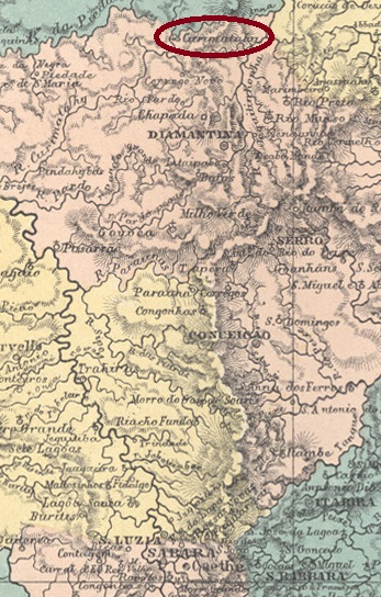
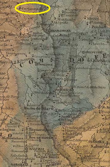
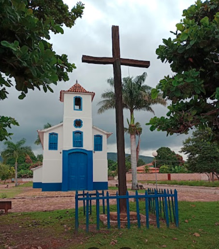
Curimatahy (for the name see Corumbatahy, CSP-0385) was a parish of the Vila de Diamantina on the south bank of the Curimataí, 410 km north of the provincial capital Ouro Preto, from July 1832. In 1861 it became the Freguesia de N. Sra da Conceição do Curimatahy, and since December 1938 it has been a district of the Município de Buenópolis.
Google Maps (Photo: Flávio Almeida)
According to the Rio de Janeiro press, there has been a post office there since November 1881:
Jornal do Commercio/RJ, 12/11/1881
Paula Sobrinho writes in História Postal de Minas Gerais (Belo Horizonte, 1997) that the post office was closed in July 1939. No imperial postmark from Curimatahy in the province of Minas has yet been seen.
Villiers de l’Ile Adam: Carta (…) da Provincia de Minas Geraes, 1849
Curimatahy (zum Namen siehe Corumbatahy, CSP-0385) war seit Juli 1832 eine Pfarrei der Vila de Diamantina am Südufer des Curimataí, 410 km nördlich der Provinzhauptstadt Ouro Preto. 1861 wurde sie zur Freguesia de N. Sra da Conceição do Curimatahy, seit Dezember 1938 ist sie ein Distrikt des Município de Buenópolis.
Google Maps (Foto: Flávio Almeida)
Wie aus der Presse von Rio de Janeiro hervorgeht, gab es dort seit November 1881 ein Postamt:
Jornal do Commercio/RJ, 12.11.1881
Paula Sobrinho schreibt in História Postal de Minas Gerais (Belo Horizonte, 1997), dass das Postamt im Juli 1939 geschlossen wurde. Bisher wurde kein kaiserlicher Poststempel aus Curimatahy in der Provinz Minas gesehen.
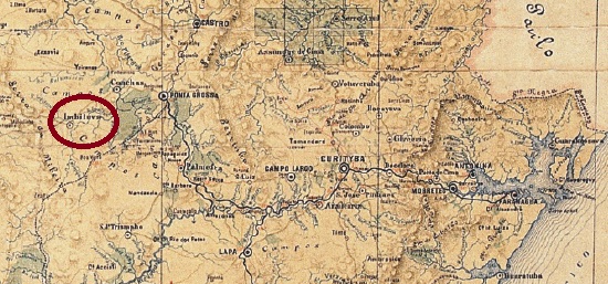
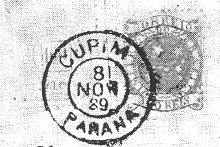
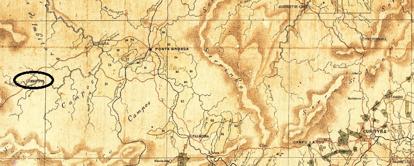
Other names: Santo Antonio de Imbituva, Imbituva (1929)
The Freguesia de Campo do Cupim (Termite Field) was founded in February 1876 and belonged to the Vila de Ponta Grossa, 180 kilometres west of the provincial capital Curitiba. In March 1881 it became the Vila de Sto. Antonio de Imbituva, a town since April 1910 and simply Imbituva since April 1929. The name is of Indian origin and means “many lianas”.
As can be seen from the list of imperial post offices (Tabella das Agencias do Correio do Imperio, Rio de Janeiro, 1885), there had been a post office there since 1874. The only imperial postmark to date is CPR-0075b (fig. R. Koester, in Carimbologia XV), which still shows the old place name eight years after it was renamed Imbituva:
CPR-0075b (RK) 1889-1890Estado do Paraná, 1892
Andere Namen: Santo Antonio de Imbituva, Imbituva (1929)
Die Freguesia de Campo do Cupim (Termitenfeld) wurde im Februar 1876 gegründet und gehörte zur Vila de Ponta Grossa, 180 km westlich der Provinzhauptstadt Curitiba. Im März 1881 wurde sie zur Vila de Sto. Antonio de Imbituva, seit April 1910 Stadt und seit April 1929 einfach Imbituva. Der Name ist indianischen Ursprungs und bedeutet „viele Lianen“.
Wie aus dem Verzeichnis der kaiserlichen Postämter (Tabella das Agencias do Correio do Imperio, Rio de Janeiro, 1885) hervorgeht, gab es dort seit 1874 ein Postamt. Der bisher einzige kaiserliche Poststempel ist CPR-0075b (Abb. R. Koester, in Carimbologia XV), der acht Jahre nach der Umbenennung in Imbituva noch den alten Ortsnamen zeigt:
Villiers de l’Ile Adam: Carta (…) da Provincia de São Paulo, 1847
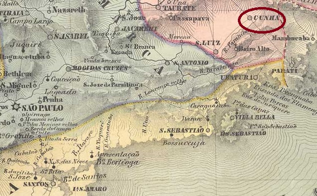
Other names: Falcão
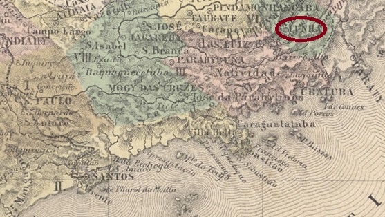
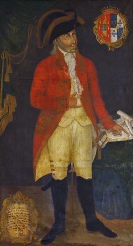
The Freguesia de Falcão was founded in 1736, belonged to the Vila de Guaratinguetá and was located near the border with the later province of Rio de Janeiro, 230 kilometres east of the capitany capital São Paulo. In September 1785, it was elevated to Vila de N. Sra. da Conceição do Cunha. The name was intended to commemorate Francisco de Cunha e Meneses (1747-1812), who was Capitão-Mor of colonial São Paulo from 1782 to 1786. Cunha has been a town since April 1858.
Francisco da Cunha e Meneses (Archaeological Survey of India, Goa)
Previous research has revealed three periods for the operation of the local post office. The first began at the latest in 1838, the year of a letter with the postmark CSP-0415a described in the RHM catalogue:
CSP-0415a (RHM P-SP-10) 1838
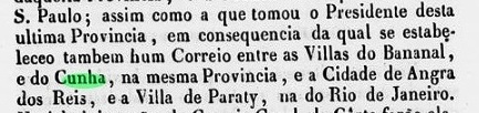
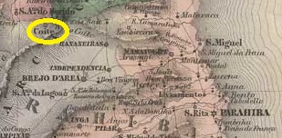
The existence of a postal line at that time via Bananal/SP to Paraty and Angra dos Reis in the province of Rio also speaks in favour of postal operations in Cunha in 1838:
Relatorio do Ministerio do Imperio/RJ, 1839
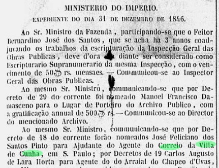
According to the list of imperial post offices (Tabella das Agencias do Correio do Imperio, Rio de Janeiro, 1885), the postal agency in Cunha was reopened in 1847. A postal agent had already been appointed there in December 1846:
Gazeta Official, 11 Jan. 1847
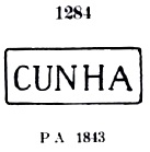
According to the Catálogo Enciclopédico RHM (S. Paulo, 1999), the third opening of a post office in Cunha is said to have taken place in October 1858. Before that, the postmark CSP-0415b (P.A. 1284), which also exists in blue, was already in use:
CSP-0415b (P.A. 1284) 1843ff-1866ff
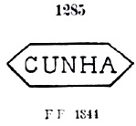
The Catálogo de Carimbos Brasil-Império by P. Ayres (S. Paulo, 1937, 1942) also lists the variant CSP-0415c under no. 1285, but R. Koester (Carimbologia XV) doubts its authenticity:
CSP-0415c (P.A. 1285) 1844ff
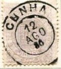
The French type postmark CSP-0415d (fig. R. Koester, op.cit.), on the other hand, is beyond doubt. It also exists in blue:
CSP-0415d (RK) 1884-1886
Towards the end of the Empire, CSP-0415e also appeared (illustration from the Internet):
CSP-0415e (EB) 1886-1900Atlas do Imperio do Brasil, 1868
Andere Namen: Falcão
Die Freguesia de Falcão wurde 1736 gegründet, gehörte zur Vila de Guaratinguetá und lag nahe der Grenze zur späteren Provinz Rio de Janeiro, 230 km östlich der Hauptstadt der Capitania de São Paulo. Im September 1785 wurde sie zur Vila de N. Sra. da Conceição do Cunha erhoben. Der Name sollte an Francisco de Cunha e Meneses (1747-1812) erinnern, der von 1782 bis 1786 Capitão-Mor des kolonialen São Paulo war. Seit April 1858 ist Cunha eine Stadt.
Francisco da Cunha e Meneses (Archaeological Survey of India, Goa)
Bisherige Forschungen haben drei Entstehungen für das örtliche Postamt ergeben. Die erste begann spätestens 1838, dem Jahr eines im RHM-Katalog beschriebenen Briefes mit dem Poststempel CSP-0415a:
CSP-0415a (RHM P-SP-10) 1838
Für einen Postbetrieb in Cunha im Jahr 1838 spricht auch die Existenz einer damaligen Postlinie über Bananal/SP nach Paraty und Angra dos Reis in der Provinz Rio:
Relatorio do Ministerio do Imperio/RJ, 1839
Nach dem Verzeichnis der kaiserlichen Postämter (Tabella das Agencias do Correio do Imperio, Rio de Janeiro, 1885) wurde die Postagentur in Cunha 1847 wieder eröffnet. Bereits im Dezember 1846 war dort ein Postagent ernannt worden:
Gazeta Official, 11.01.1847
Nach dem Catálogo Enciclopédico RHM (S. Paulo, 1999) soll die dritte Eröffnung eines Postamtes in Cunha im Oktober 1858 stattgefunden haben. Zuvor wurde bereits der Poststempel CSP-0415b (P.A. 1284) verwendet, der auch in blau existiert:
CSP-0415b (P.A. 1284) 1843ff-1866ff
Im Catálogo de Carimbos Brasil-Império von P. Ayres (S. Paulo, 1937, 1942) ist unter Nr. 1285 auch die Variante CSP-0415c aufgeführt, deren Echtheit jedoch von R. Koester (Carimbologia XV) angezweifelt wird:
CSP-0415c (P.A. 1285) 1844ff
Der Poststempel französischen Typs CSP-0415d (Abb. R. Koester, op.cit.) steht dagegen außer Zweifel. Er existiert auch in blau:
CSP-0415d (RK) 1884-1886
Gegen Ende des Kaiserreichs erschien auch CSP-0415e (Abb. aus dem Internet):
Other names: Borborema, Serra do Cuité, Cuité (1938)
There are two versions of the origins of the Freguesia de N. Sra. das Mercês de Cuité. According to the first, it was founded in 1800, i.e. during the colonial period. The second date is later and more precise: 15 October 1827. Cuité was in any case 220 km north-west of the provincial capital Paraíba do Norte (today: João Pessoa). In May 1854, the first elevation to a Vila took place, followed by others in 1900 and in December 1936 (this time as Município de Serra do Cuité). In the meantime, Cuité was downgraded twice to a district of the Vila de Picuí: in 1891 and 1904. Since November 1938, the município has been called Cuité again.
Nova Monteiro writes in Administrações e Agencias Postaes do Brasil Imperio (Brasil Filatelico/RJ, 1934-5; reprint SPP 1994-1999) that there had been a post office there since October 1858. This date is confirmed by the postal report (Relatório Postal) for 1887. The only imperial postmark to date is CPB-0125b (fig. Jorge L. Pedreira):
CPB-0125b (JP) 1881Villiers de l’Ile Adam: Carta (…) das Provincias do Rio Grande do Norte e Parahiba
Andere Namen: Borborema, Serra do Cuité, Cuité (1938)
Über die Entstehung der Freguesia de N. Sra. das Mercês de Cuité gibt es zwei Versionen. Nach der ersten wurde sie im Jahre 1800 gegründet, also bereits in der Kolonialzeit. Das zweite Datum ist später und genauer: 15.10.1827. Cuité lag jedenfalls 220 km nordwestlich der Provinzhauptstadt Paraíba do Norte (heute: João Pessoa). Im Mai 1854 erfolgte die erste Erhebung zur Vila, weitere folgten 1900 und im Dezember 1936 (diesmal als Município de Serra do Cuité). In der Zwischenzeit wurde Cuité zweimal zum Distrikt der Vila de Picuí herabgestuft: 1891 und 1904. Seit November 1938 heißt der Município wieder Cuité.
Nova Monteiro schreibt in Administrações e Agencias Postaes do Brasil Imperio (Brasil Filatelico/RJ, 1934-5; Reprint SPP 1994-1999), dass es dort seit Oktober 1858 ein Postamt gab. Dieses Datum wird durch den Postbericht (Relatório Postal) für 1887 bestätigt. Der bisher einzige kaiserliche Poststempel ist CPB-0125b (Abb. Jorge L. Pedreira):
Carta da Republica dos Estados Unidos do Brazil, 1892
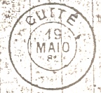
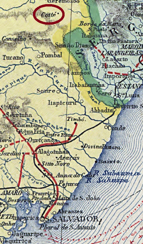
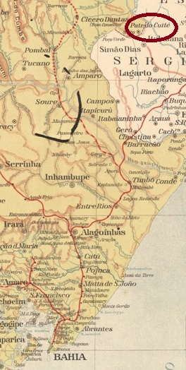
Other names: Coité, Patrocínio do Coité, Paripiranga (1931)
The Freguesia de N. Sra. do Patrocinio do Coité was founded in May 1871 and belonged to the Vila de Geremoabo on the provincial border with Sergipe, 320 kilometres north of the provincial capital Salvador da Bahia. In May 1886 it was elevated to the status of a Vila and since March 1931 it has been the Município de Paripiranga. The Indian name means red earth.
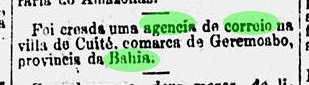
According to the Rio de Janeiro press, there has been a post office there since July 1887:
O Paiz/RJ, 31/07/1887
No imperial postmark from Cuité has yet been seen.
Estado da Bahia, 1913
Andere Namen: Coité, Patrocínio do Coité, Paripiranga (1931)
Die Freguesia de N. Sra. do Patrocinio do Coité wurde im Mai 1871 gegründet, sie gehörte der Vila de Geremoabo und lag an der Provinzgrenze zu Sergipe, 320 km nördlich der Provinzhauptstadt Salvador da Bahia. Im Mai 1886 erfolgte die Erhebung zur Vila und seit März 1931 ist der Ort Município de Paripiranga. Der indianische Name bedeutet rote Erde.
Wie der Presse von Rio de Janeiro zu entnehmen ist, gab es dort seit Juli 1887 ein Postamt:
O Paiz/RJ, 31.07.1887
Bisher wurde kein kaiserlicher Poststempel aus Cuité gesehen.
Villiers de l’Ile Adam: Carta (…) da Provincia de Minas Geraes, 1849
Other names: Degredo, Cuieté, Cuyethi, Cuité, Barra do Cuieté, Cuieté Velho (1953)
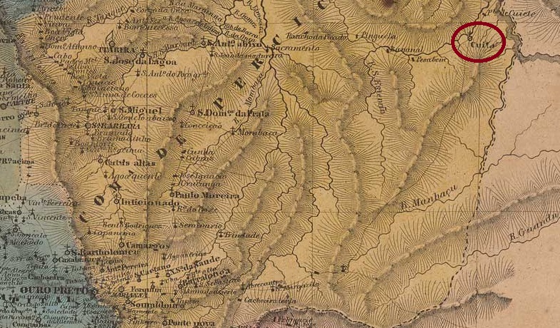
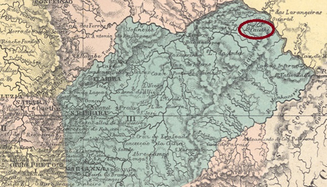
The Freguesia de N. Sra. da Conceição do Cuiethé was founded in 1824 on the south bank of the Cuieté (now Caratinga) in the Vila de Manhuaçu, 350 kilometres north-east of the provincial capital Ouro Preto. The Indian name means “vessel” and the place originated as a prison, hence the original name Degredo (exile).
Cuiethé became a district of Vila de Caratinga in February 1890 and as such went to the Município de Itanhomi in September 1923. There were then two name changes: in December 1938 to Barra do Cuieté (then in the Município de Conselheiro Pena) and five years later to Cuieté Velho.
Both R. Koester in Carimbologia XV and Paula Sobrinho in História Postal de Minas Gerais (Belo Horizonte, 1997) agree that there has been a post office there since October 1881. The imperial postmark is CMG-0920a (fig. Koester, op. cit.):
CMG-0920a (RK) 1885-1890Atlas do Imperio do Brasil, 1868
Andere Namen: Degredo, Cuieté, Cuyethi, Cuité, Barra do Cuieté, Cuieté Velho (1953)
Die Freguesia de N. Sra. da Conceição do Cuiethé wurde 1824 gegründet und lag am Südufer des Cuieté (heute Caratinga-Fluss) im Gebiet der Vila de Manhuaçu, 350 km nordöstlich der Provinzhauptstadt Ouro Preto. Der indianische Name bedeutet “Gefäß” und der Ort entstand als Gefängnis, daher der ursprüngliche Name Degredo (Verbannung).
Cuiethé wurde im Februar 1890 zum Bezirk der Vila de Caratinga und wechselte als solcher im September 1923 zum Município de Itanhomi. Danach gab es zwei Namensänderungen: im Dezember 1938 in Barra do Cuieté (dann im Município de Conselheiro Pena) und fünf Jahre später in Cuieté Velho.
Sowohl R. Koester in Carimbologia XV als auch Paula Sobrinho in História Postal de Minas Gerais (Belo Horizonte, 1997) sind sich einig, dass es dort seit Oktober 1881 ein Postamt gab. Der kaiserliche Poststempel ist CMG-0920a (Abb. Koester, op. cit.):
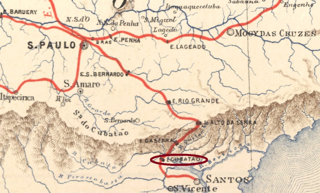
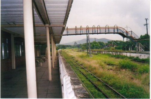
Cubatão station was opened in February 1867 by the São Paulo Railway (Main Line) on the south bank of the Cubatão in the Município de Santos, 70 km south of the provincial capital of São Paulo. The line was handed over to E.F. Santos a Jundiaí in 1946 and belonged to Rede Ferroviária Federal S.A. from 1975 until its closure in 1996 (estacoesferroviarias.com.br). Today, the tracks still exist and the station building houses the municipality’s tourist office.
Around 1920 (photo Cacilda Costa, on estacoesferroviarias.com.br)In 2003 (photo Luiz Rafael de Souza, on estacoesferroviarias.com.br)
The area around the railway station became a district in December 1922 and the Município de Cubatão in December 1948.
As R. Koester writes in Carimbologia XV, there had been a post office at the station since February 1883, but no imperial postmark of Cubatão has been seen so far.
Estações (…) do Rio de Janeiro, São Paulo e Minas Geraes, 1880
Der Bahnhof Cubatão wurde im Februar 1867 von der Bahngesellschaft São Paulo Railway (Hauptlinie) eröffnet und lag am Südufer des Cubatão im Município de Santos, 70 km südlich der Provinzhauptstadt São Paulo. Die Strecke wurde 1946 an die E.F. Santos a Jundiaí übergeben und gehörte von 1975 bis zu ihrer Stilllegung 1996 der Rede Ferroviária Federal S.A. (estacoesferroviarias.com.br). Heute sind die Gleise noch vorhanden, das Bahnhofsgebäude beherbergt das Tourismusbüro der Gemeinde.
Um 1920 (Foto Cacilda Costa, auf estacoesferroviarias.com.br)2003 (Foto Luiz Rafael de Souza, auf estacoesferroviarias.com.br)
Das Gebiet um den Bahnhof wurde im Dezember 1922 zum Distrikt und im Dezember 1948 zum Município de Cubatão.
Wie R. Koester in Carimbologia XV schreibt, gab es am Bahnhof seit Februar 1883 ein Postamt, aber bisher wurde kein kaiserlicher Poststempel von Cubatão gesehen.
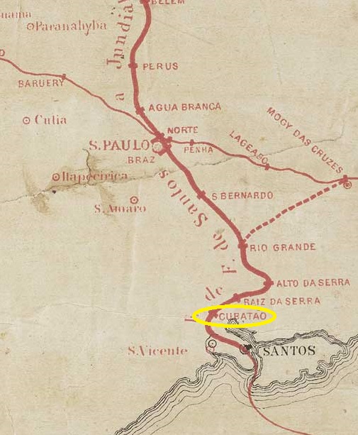
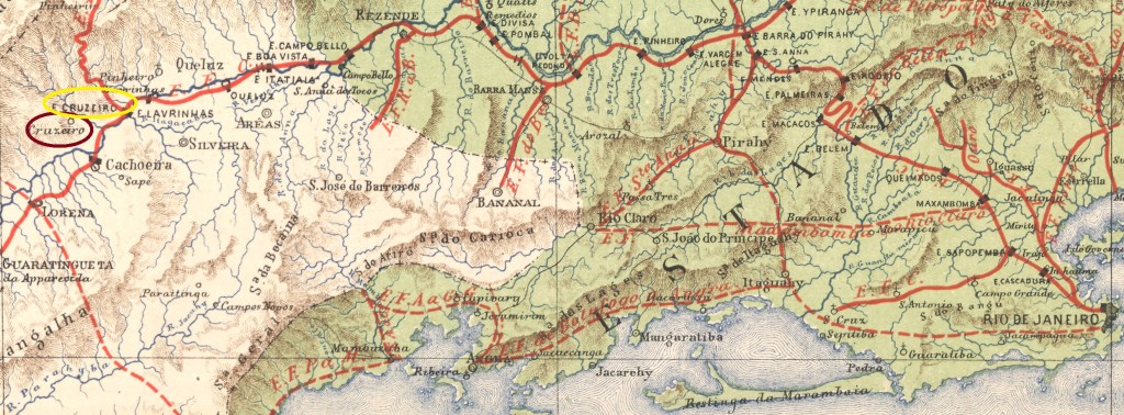
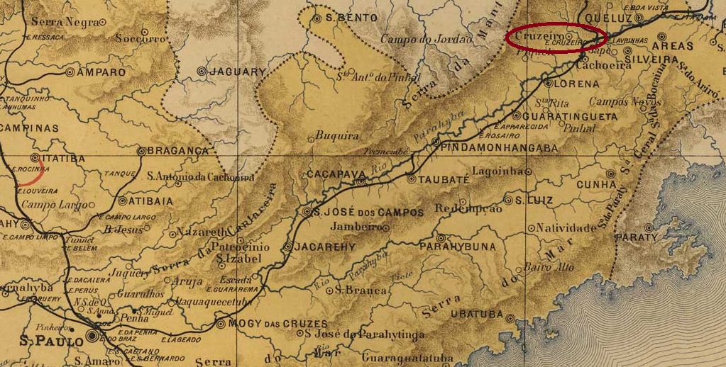
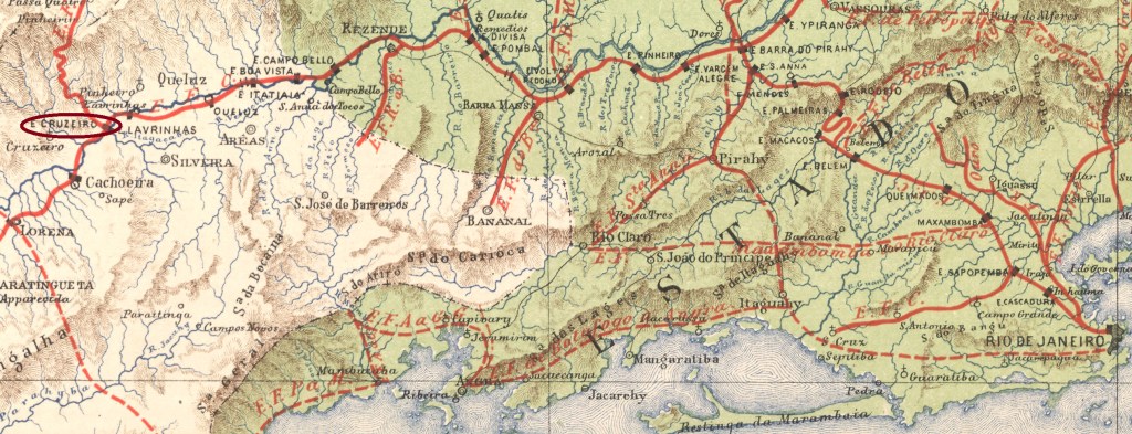
The Freguesia de N. Sra. da Conceição do Embaú was founded in February 1846 and belonged to the Vila de Lorena, 210 kilometres north-east of the provincial capital of São Paulo. As an important station on the old Estrada Real, it was elevated to Vila de Conceição do Cruzeiro in March 1871.
With the inauguration of the Cruzeiro railway station in September 1878, around 10 km east of Paraíba do Sul, the decline of the old Vila began. In June 1891, it became a district of the Município de Vila Novais (ex-Cruzeiro railway station, see CSP-0406). The renaming of the new Município in October 1901 to Cruzeiro (or Estação do Cruzeiro, depending on the source) led to a long period of confusion with the District de Conceição do Cruzeiro, which only ended in November 1903 when the district returned to its old name of Embaú.
The decline was unstoppable: Embaú lost its district status in December 1936 and was incorporated into the Município Cachoeira as a rural suburb barely two years later. This in turn was renamed twice: in 1944 to Valparaíba and in 1948 to what is now Cachoeira Paulista.
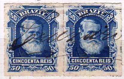
According to the regional press, there was a post office there from November 1876:
Correio Paulistano, 18/12/1876
The stamps were initially cancelled by hand, as the official postmark apparently did not arrive in time:
1877ff (EB)
Later the French cancellation CSP-0405a was used, which also exists in blue (coll. Fuad Ferreira Fo.):
CSP-0405a (FF) 1884-1885
R. Koester showed in Carimbologia XIV the postmark CSP-0405b, whose attribution is still to be confirmed:
CSP-0405b (RK)
In contrast, CSP-0405c (fig. R. Koester, op. cit.) can be clearly assigned to this vila:
CSP-0405c (RK) 1887-1889J.M.Ribeiro Lisboa: Provincia de São Paulo, 1884
Andere Namen: Conceição do Embaú, Embaú (1903)
Siehe auch Cruzeiro/Bahnhof (CSP-0406)
Die Freguesia de N. Sra. da Conceição do Embaú wurde im Februar 1846 gegründet und gehörte zur Vila de Lorena, 210 km nordöstlich der Provinzhauptstadt São Paulo. Da sie eine wichtige Station der alten Estrada Real war, wurde sie im März 1871 zur Vila de Conceição do Cruzeiro erhoben.
Mit der Einweihung des Bahnhofs von Cruzeiro im September 1878, etwa 10 km östlich von Paraíba do Sul, begann der Niedergang der alten Vila. Sie wurde im Juni 1891 als Distrikt dem Município de Vila Novais (ex-Bahnhof Cruzeiro, siehe CSP-0406) unterstellt. Die Umbenennung des neuen Município im Oktober 1901 in Cruzeiro (oder Estação do Cruzeiro, je nach Quelle) führte zu einer langen Verwechslung mit dem Distrikt de Conceição do Cruzeiro, die erst im November 1903 endete, als der Distrikt zu seinem alten Namen Embaú zurückkehrte.
Der Niedergang war nicht aufzuhalten: Im Dezember 1936 verlor Embaú seinen Distriktstatus und wurde knapp zwei Jahre später als ländlicher Vorort in das Município de Cachoeira eingegliedert. Dieses wiederum wurde zweimal umbenannt: 1944 in Valparaíba und 1948 in das heutige Cachoeira Paulista.
Aus der regionalen Presse geht hervor, dass es dort ab November 1876 ein Postamt gab:
Correio Paulistano, 18.12.1876
Die Briefmarken wurden zunächst von Hand entwertet, da der amtliche Poststempel anscheinend nicht rechtzeitig eintraf:
1877ff (EB)
Später kam der französische Stempel CSP-0405a, den es auch in blau gibt (Samml. Fuad Ferreira Fo.):
CSP-0405a (FF) 1884-1885
R. Koester zeigte in Carimbologia XIV den Stempel CSP-0405b, dessen Zuordnung noch zu bestätigen ist:
CSP-0405b (RK)
Dagegen ist CSP-0405c (Abb. R. Koester, op. cit.) eindeutig dieser Vila zuzuordnen:
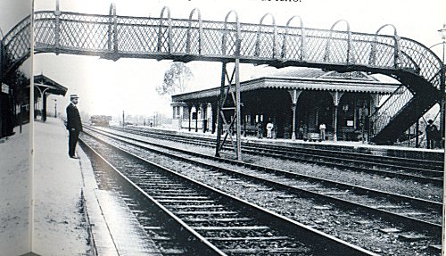
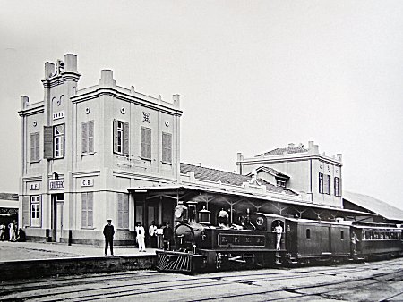
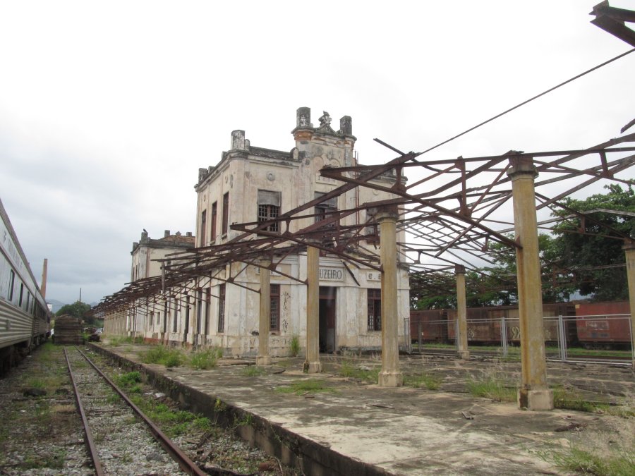
Although the Cruzeiro railway station originally belonged to the Vila de Conceição do Cruzeiro, the two post offices are shown separately as they now belong to two different municípios. The station was opened in September 1878 by the railway company E.F.D. Pedro II, S. Paulo line, and was located on the west bank of the river Paraíba do Sul, 220 km north-east of the provincial capital São Paulo. The line was transferred to E.F. Central do Brasil in 1889 and belonged to Rede Ferroviária Federal S.A. from 1975 until its closure in 1998 (estacoesferroviarias.com.br). The tracks are still there today, but the station building is closed.
1895 (Photo: N.N. on estacoesferroviarias.com.br)2020 (Photo: N.N. on estacoesferroviarias.com.br)
The settlement around the railway station grew very quickly and became the Distrito de Estação do Cruzeiro in March 1891, the Município de Vila Novais three months later and the Município de Cruzeiro in October 1901, which was elevated to the status of a town in December 1906.
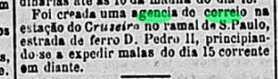
As the Rio press reported, there had been a post office at the railway station since November 1878:
Gazeta de Noticias/RJ, 13/11/1878
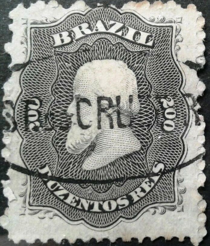
The first postmark is CSP-0406a (coll. FM):
CSP-0406a (FM) 1878-1882
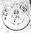
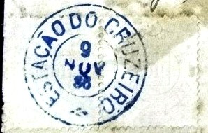
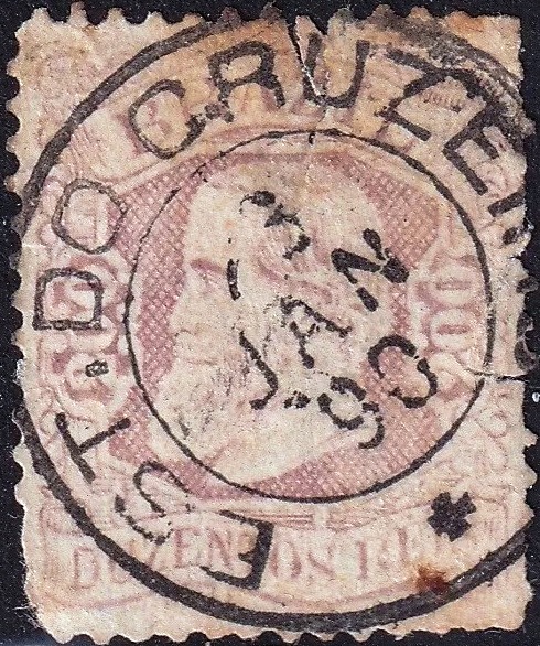
This was followed by the double circle CSP-0406b (fig. R. Koester, in Carimbologia XIV)
CSP-0406b (RK) 1881-1890
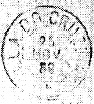
CSP-0406c (ill. Luiz C. Fritzen), which also exists in blue, appeared shortly afterwards:
CSP-0406c (LCF) 1883-1897
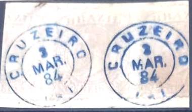
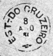
And at the end of the Empire came CSP-0406d (ill. Felipe Piccinini):
CSP-0406d (FP) 1890
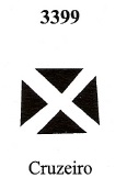
The following mute cancellation has the no. 3399 in Mute Cancellations of the Brazil Empire / Carimbos Mudos do Brasil Império, by James Dingler and Klerman W. Lopes (Brazil Philatelic Association, Rio de Janeiro, 2000). According to R. Koester (op. cit.) it also belongs to the Cruzeiro station:
BPA 3399 (P.A. 114) 1878ffEstrada de Ferro Central do Brasil, 1890
Textaktualisierung vom 9. Oktober 2024
Siehe auch Cruzeiro (CSP-0405)
Obwohl der Bahnhof Cruzeiro ursprünglich zur Vila de Conceição do Cruzeiro gehörte, werden die beiden Postämter getrennt dargestellt, da sie heute zu zwei verschiedenen Municípios gehören. Der Bahnhof wurde im September 1878 von der Eisenbahngesellschaft E.F. D. Pedro II, S. Paulo-Linie, eröffnet und lag am Westufer des Flusses Paraíba do Sul, 220 km nordöstlich der Provinzhauptstadt São Paulo. Die Strecke ging 1889 an die E.F. Central do Brasil über und gehörte von 1975 bis zu ihrer Stilllegung 1998 der Rede Ferroviária Federal S.A. (estacoesferroviarias.com.br). Heute sind die Gleise noch vorhanden, das Bahnhofsgebäude ist geschlossen.
1895 (Foto: N.N. auf estacoesferroviarias.com.br)2020 (Foto: N.N. auf estacoesferroviarias.com.br)
Die Siedlung um den Bahnhof wuchs sehr schnell und wurde im März 1891 zum Distrito de Estação do Cruzeiro, drei Monate später zum Município de Vila Novais und im Oktober 1901 zum Município de Cruzeiro, das im Dezember 1906 zur Stadt erhoben wurde.
Wie die Presse von Rio berichtete, gab es seit November 1878 ein Postamt am Bahnhof:
Gazeta de Noticias/RJ, 13.11.1878
Der erste Stempel ist CSP-0406a (Samml. FM):
CSP-0406a (FM) 1878-1882
Es folgte der Doppelkreis CSP-0406b (Abb. R. Koester, in Carimbologia XIV):
CSP-0406b (RK) 1881-1890
Kurz darauf erschien auch CSP-0406c (Abb. Luiz C. Fritzen), den es auch in blau gibt:
CSP-0406c (LCF) 1883-1897
Und am Ende des Kaiserreichs kam noch CSP-0406d (Abb. Felipe Piccinini):
CSP-0406d (FP) 1890
Der folgende stumme Stempel hat die Nr. 3399 in Mute Cancellations of the Brazil Empire / Carimbos Mudos do Brasil Império, von James Dingler und Klerman W. Lopes (Brazil Philatelic Association, Rio de Janeiro, 2000). Nach R. Koester (op. cit.) gehört er auch zum Bahnhof Cruzeiro: