Categories
Carimbologia T-Z

Traipu, Alagoas (TAL-0250)

Villiers de l’Ile Adam: Carta (…) das Provincias de Pernambuco, Alagoas e Sergipe, 1848

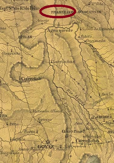
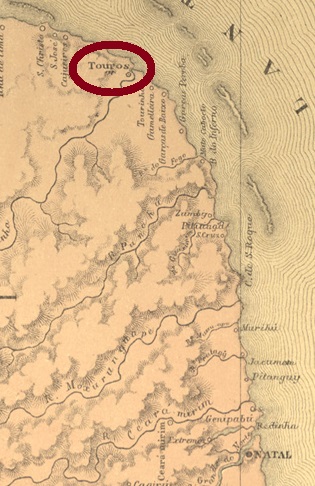
See also Porto da Folha/SE (R. Koester: Carimbologia XXXII)

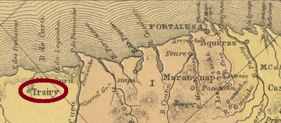
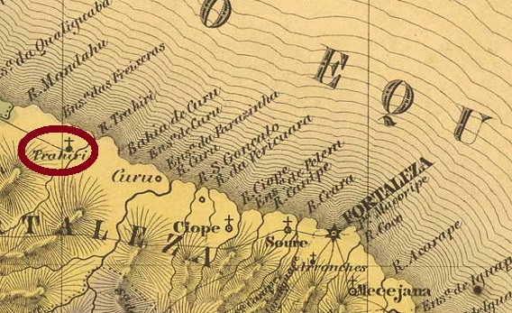
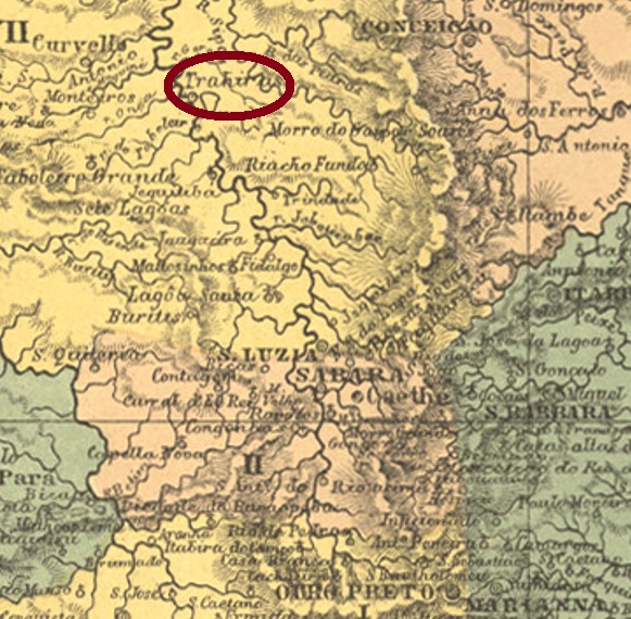
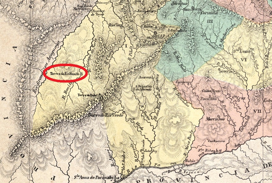
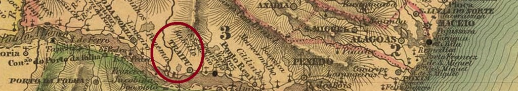
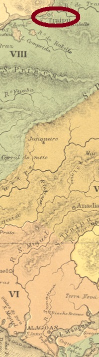
With Traipu in the province of Alagoas, we have another locality with a complicated history in northeastern Brazil. For this place was located at the mouth of the Rio Traipu into the Rio São Francisco, more than 180 km southwest of the provincial capital Maceió, and was called Porto da Folha until 1870. However, there was also a Porto da Folha in neighbouring Sergipe, to which a tributary of the São Francisco is also assigned, and with almost eight thousand inhabitants it also had a post office around 1880.

The old freguesia of Porto da Folha in the province of Alagoas became a vila in April 1835, before receiving the place name Traipu exactly 35 years later. Traipu has been a city since May 1892.

The postal history here is also somewhat confused. Four creation dates for the post office were found here. However, it could be that the last three are related to one another. Furthermore, Reinhold Koester in Carimbologia XXXII seems to have confused the two Portos da Folha, as he did not mention the place in the Alagoas. 

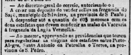
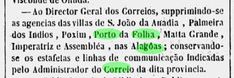
The first post office opening took place before 1843, as Aldo Cardoso writes in Contribuição para a História dos Correios de Alagoas (Maceió, 1969). The post office was closed in October 1847, according to a press report from Rio:

Gazeta Official/RJ 13/10/1847

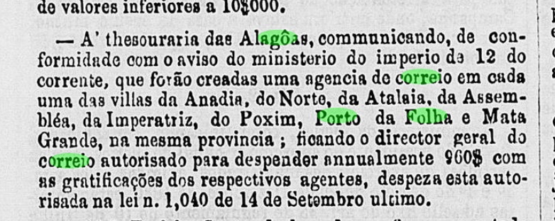
The agency probably remained closed for over 10 years as a cholera epidemic ravaged the region. For the reopening, Nova Monteiro noted June 1859 in Administrações e Agencias Postaes do Brasil Imperio (in Brasil Filatelico/RJ, 1934-5; reprint SPP 1994-1999), while a ministerial report and the postal report wrote November of that year for it:

Boletim do Ministerio do Imperio/14.11.1859

The Directory of Imperial Post Offices (Tabella das Agencias do Correio do Imperio, Rio de Janeiro, 1885) lists the postal agency from 1860. This could be the year of its commissioning. Two postmarks in double circle were found for the imperial period. TAL-0250a (Coll. José A. Junges) has the inscription CORREIO DE TRAIPU on top and a blank inner circle in the only example seen so far, on a Dom Pedro issue of 1866. TAL-0250b (Coll. José A. Junges) shows only TRAIPU on top. The dates in the middle go from 1887 to 1890.

Atlas do Imperio do Brasil, 1868

Siehe auch Porto da Folha/SE (R. Koester: Carimbologia XXXII)

Mit Traipu in der Provinz Alagoas haben wir eine weitere Ortschaft mit komplizierter Geschichte im Nordosten Brasiliens. Denn dieser Ort lag an der Mündung des Rio Traipu in den Rio São Francisco, über 180 km südwestlich der Provinzhauptstadt Maceió, und hieß bis 1870 Porto da Folha. Allerdings gab es benachbarten Sergipe ebenfalls einen Porto da Folha, dem auch ein Zufluss des São Francisco zugeordnet wird, und mit fast achttausend Einwohnern um 1880 auch ein Postamt hatte.

Die alte Freguesia von Porto da Folha in der Provinz Alagoas wurde im April 1835 zur Vila, bevor sie genau 35 Jahre später den Ortsnamen Traipú erhielt. Seit Mai 1892 ist Traipu eine Stadt.

Auch die Postgeschichte ist hier etwas verworren. Denn hier wurden vier Gründungsdaten fürs Postamt gefunden. Es könnte aber sein, dass die letzten drei im Zusammenhang stehen. Darüber hinaus scheint Reinhold Koester im Carimbologia XXXII die beiden Portos da Folha verwechselt zu haben, da er den Ort im Alagoas offenbar nicht kannte. 

Die erste Posteröffnung fand bereits vor 1843 statt, wie Aldo Cardoso in Contribuição para a História dos Correios de Alagoas (Maceió, 1969) schreibt. Das Postamt wurde im Oktober 1847 geschlossen, laut einer Pressenachricht aus Rio:

Gazeta Official/RJ 13.10.1847

Wahrscheinlich blieb die Agentur über 10 Jahre geschlossen, als eine Choleraepidemie in der Region grassierte. Für die Wiedereröffnung notierte Nova Monteiro in Administrações e Agencias Postaes do Brasil Imperio (in Brasil Filatelico/RJ, 1934-5; Reprint SPP 1994-1999) den Juni 1859, während ein Ministerialbericht und der Postbericht den November des Jahres dafür schrieben:

Boletim do Ministerio do Imperio/14.11.1859

Das Verzeichnis der kaiserlichen Postämter (Tabella das Agencias do Correio do Imperio, Rio de Janeiro, 1885) listet die Postagentur ab 1860 auf. Dies könnte der Zeitpunkt deren Inbetriebnahme sein. Zwei Poststempel in Doppelkreis wurden für die Kaiserzeit gefunden. TAL-0250a (Samml. José A. Junges) hat die Inschrift CORREIO DE TRAIPU oben und einen leeren Innenkreis im einzigen bisher gesehenen Beispiel, auf einer Dom-Pedro-Ausgabe von 1866. TAL-0250b (Samml. José A. Junges) zeigt lediglich TRAIPU oben. Die Daten in der Mitte gehen von 1887 bis 1890.

Categories
Carimbologia T-Z

Trahiry, Ceará (TCE-0340)

Atlas do Imperio do Brasil, 1868

Another name: Paracuru

In Trahiry we have another locality with an eventful history. It began in March 1842, with the creation of the district of Paracuru on the north bank of the river Trahiry (river of the Traíras, in the Tupi language), more than 120 km northwest of the provincial capital, Fortaleza. The village rose to the status of Vila in November 1863 and was renamed Nossa Senhora do Livramento de Trahiry in August 1874. A year later, the place name shortened to Trahiry. In the 20th century, the village shrank so much that in May 1931 it was demoted as a district in the Município of Paracuru. This município, in turn, subsequently changed its name twice: in August 1935 to São Gonçalo and in December 1943 to Anacetaba. Since November 1951, Trairi, as it is written today, has been an independent município.

As one can read in the Directory of Imperial Post Offices (Tabella das Agencias do Correio do Imperio, Rio de Janeiro, 1885), there had been a post office there since 1874. However, this could be a reopening, because as early as 1865 there were postal routes that passed through Trahiry twice a month and were run by relays:

Relatorio do Presidente da Provincia/CE, July 1865

So far, no imperial-era postmark has been found from this place.

Villiers de l’Ile Adam: Carta (…) da Provincia do Ceará, 1849

Anderer Name: Paracuru

In Trahiry haben wir eine weitere Ortschaft mit bewegter Geschichte. Diese fing im März 1842 an, mit der Gründung des Distrikts von Paracuru am Nordufer des Flusses Trahiry (Fluss der Traíras, in der Tupi-Sprache), über 120 km nordwestlich der Provinzhauptstadt Fortaleza entfernt. Die Ortschaft stieg zur Vila im November 1863 auf, die im August 1874 zu Nossa Senhora do Livramento de Trahiry umbenannt wurde. Ein Jahr später verkürzte sich der Ortsname zu Trahiry. Im 20. Jahrhundert schrumpfte der Ort derart, dass er im Mai 1931 als Distrikt im Municipio von Paracuru degradiert wurde. Dieser Município wiederum wechselte anschließend zweimal den Namen: im August 1935 zu São Gonçalo und im Dezember 1943 zu Anacetaba. Seit November 1951 ist Trairi, wie es heute geschrieben wird, ein eigenständiger Município.

Wie man im Verzeichnis der kaiserlichen Postämter (Tabella das Agencias do Correio do Imperio, Rio de Janeiro, 1885) lesen kann, gab es dort ein Postamt seit 1874. Diese könnte aber eine Wiedereröffnung sein, denn bereits 1865 gab es Postrouten, die zweimal im Monat durch Trahiry gingen und durch Stafetten gelaufen sind:

Relatorio do Presidente da Provincia/CE, Juli 1865

Bisher wurde kein Poststempel der Kaiserzeit aus diesem Ort gefunden.

Categories
Carimbologia T-Z

Trahyras, Minas Gerais (TMG-3210)

Atlas do Imperio do Brasil, 1868

Another name: Santana de Pirapama (1943)

The district of Sant’Anna de Trahyras was founded in June 1850 at Curvello and was located on the north bank of the Rio das Velhas, barely 250 km north of the provincial capital of Ouro Preto. In December 1938, the town changed as a district to the município of Cordisburgo and was renamed Santana de Pirapama in December 1943. Since December 1948, Santana de Pirapama has been an independent municipio.

There was a post office there since November 1881, as Paula Sobrinho writes in História Postal de Minas Gerais (Belo Horizonte, 1997). This is confirmed by the Rio press:

Jornal do Commercio/RJ, 12.11.1881

The local postmark of the imperial period is TMG-3210a (Coll. José A. Junges): a double circle with the inscriptions TRAHYRAS above and (MINAS) below. The dates in the middle have so far been found for the period ca. 1887-1900.

Provincia de Minas Geraes, 1873

Anderer Name: Santana de Pirapama (1943)

Der Distrikt von Sant’Anna de Trahyras wurde im Juni 1850 bei Curvello gegründet und lag am Nordufer des Rio das Velhas, knapp 250 km nördlich der Provinzhauptstadt Ouro Preto entfernt. Im Dezember 1938 wechselte der Ort als Distrikt zum Município von Cordisburgo und wurde im Dezember 1943 zu Santana de Pirapama umbenannt. Seit Dezember 1948 ist Santana de Pirapama ein eigenständiger Municipio.

Dort gab es ein Postamt seit November 1881, wie Paula Sobrinho in História Postal de Minas Gerais (Belo Horizonte, 1997) schreibt. Das wird durch die Rio-Presse bestätigt:

Jornal do Commercio/RJ, 12.11.1881

Der lokale Poststempel der Kaiserzeit ist TMG-3210a (Samml. José A. Junges): ein Doppelkreis mit den Inschriften TRAHYRAS oben und (MINAS) unten. Die Daten in der Mitte wurden bisher für den Zeitraum ca. 1887-1900 gefunden.

Categories
Carimbologia T-Z

Trahiras, Goiás (TGO-0280)

Atlas do Imperio do Brasil, 1868

Another name: Tupiraçaba (1943)

Traíra is the common folk term for the South American tiger tetra (Hoplias malabaricus, Bloch 1794), which is popularly fished and eaten throughout the continent:

J.F. Hennig: Bibliothèque Nationale de France

Trahiras was also the name of the village founded by gold miners, which was elevated to a villa as early as around 1740 and was located on the west bank of the Traíras River, 340 km northeast of the provincial capital Goyaz (today Goiás Velho). When precious metal could no longer be found, the village shrank from 18,000 to about 1000 inhabitants. It became a district of São José de Tocantins in April 1833 and changed to the newly founded Município of Niquelândia in December 1943 under the toponym Tupiraçaba. Tupiraçaba had only about 120 inhabitants around 2007.

Two periods of operation have been identified for the local post office. The first was from March 1829, as Nova Monteiro writes in Administrações e Agencias Postaes do Brasil Imperio (Brasil Filatelico/RJ, 1934-5; Reprint SPP 1994-1999). This first period ended in January 1851, as reported by Aureo G. Santos in Agências de Correio Criadas e Suprimidas 1851, 1855, 1856 e 1857 (in Brasil Filatélico 181, Rio de Janeiro, 1977):

Aureo G. Santos (op. cit.)

Of the second period of operation, we only know that it went from about 1855 to before 1875. Unfortunately, no imperial postmark from this locality has been seen so far.

Villiers de l’Ile Adam: Carta (…) da Provincia de Goyaz, 1849

Anderer Name: Tupiraçaba (1943)

Traíra ist der allgemeine Volksbegriff für den südamerikanischer Tigersalmler (Hoplias malabaricus, Bloch 1794), der gern im ganzen Kontinent geangelt und gegessen wird:

J.F. Hennig: Bibliothèque Nationale de France

Trahiras hieß auch die von Goldgräbern gegründete Ortschaft, die bereits um ca. 1740 zur Villa erhoben wurde und am Westufer des Flusses Traíras lag, 340 km nordöstlich der Provinzhauptstadt Goyaz (heute Goiás Velho) entfernt. Als dann kein Edelmetall mehr zu finden war, schrumpfte der Ort von 18.000 zu ca. 1000 Einwohnern. Er wurde im April 1833 ein Distrikt von São José de Tocantins und wechselte im Dezember 1943 unter dem Ortsnamen Tupiraçaba zum neu gegründeten Município von Niquelândia. Tupiraçaba zählte um 2007 lediglich ca. 120 Einwohner.

Es wurden zwei Betriebsperioden fürs örtliche Postamt ermittelt. Erstmals ab März 1829, wie Nova Monteiro in Administrações e Agencias Postaes do Brasil Imperio (Brasil Filatelico/RJ, 1934-5; Reprint SPP 1994-1999) schreibt. Diese erste Periode endete im Januar 1851, wie Aureo G. Santos in Agências de Correio Criadas e Suprimidas 1851, 1855, 1856 e 1857, (in Brasil Filatélico 181, Rio de Janeiro, 1977) berichtet:

Aureo G. Santos (op. cit.)

Von der zweiten Betriebsperiode wissen wir nur, dass sie von ca. 1855 bis vor 1875 ging. Bisher wurde leider kein kaiserlicher Poststempel aus dieser Ortschaft gesehen.

Categories
Carimbologia T-Z

Tracunhaem, Pernambuco (TPE-0650)

Atlas do Imperio do Brasil, 1868

Tracunhaem was already a freguesia near Nazareth (later: Nazaré da Mata) around 1840, located 60 km northwest of the provincial capital Recife. The place was elevated to a district around 1868 and has been an independent município since December 1963.

As can be read in the Directory of Imperial Post Offices (Tabella das Agencias do Correio do Imperio, Rio de Janeiro, 1885), there was a post office there since 1873. Three postmarks have been found for the 19th century, all in the José A. Junges collection. TPE-0650a is a single circle with the inscription TRACUNHAEM on top, found on a numeral issue of 1888. TPE-0650b is now a double circle with the same inscription, but the letters here (especially letter T) are larger and wider. The only specimen so far bears a date from 1889 in the centre. TPE-0650c is a double circle now with the inscription TRACUNHAEM CORREIO. The only specimen so far bears a handwritten date from 1890 in its centre.

Carta Corographica da Provincia de Pernambuco, 1880

Tracunhaem war schon um 1840 eine Freguesia bei Nazareth (später: Nazaré da Mata), die 60 km nordwestlich von der Provinzhauptstadt Recife entfernt lag. Der Ort wurde um 1868 zum Distrikt erhoben und ist seit Dezember 1963 ein eigenständiger Município.

Wie im Verzeichnis der kaiserlichen Postämter (Tabella das Agencias do Correio do Imperio, Rio de Janeiro, 1885) zu lesen ist, gab es dort ein Postamt seit 1873. Drei Poststempel wurden für den 19. Jahrhundert gefunden, alle in der Sammlung José A. Junges. TPE-0650a ist ein einfacher Kreis mit der Inschrift TRACUNHAEM oben, gefunden auf einer Ziffer-Ausgabe von 1888. TPE-0650b ist nun ein Doppelkreis mit gleicher Inschrift, allerdings sind die Buchstaben hier (besonders Buchstabe T) größer und breiter. Das bisher einzige Exemplar trägt ein Datum aus 1889 in der Mitte. TPE-0650c ist ein Doppelkreis nun mit der Inschrift TRACUNHAEM CORREIO. Das bisher einzige Exemplar trägt ein handgeschriebenes Datum aus 1890 in seiner Mitte.

Categories
Carimbologia T-Z

Touros, Rio Grande do Norte (TRN-0165)

Villiers de l’Ile Adam: Carta (…) das Provincias do Rio Grande do Norte e Parahiba, 1848

Touros was already a district in the município of Ceará-Mirim from September 1823, located 90 km north of the provincial capital Natal. In April 1833, the town was elevated to the status of a vila.

Two opening years for the local post office were identified. First in 1830, as Nova Monteiro writes in Administrações e Agencias Postaes do Brasil Imperio (in Brasil Filatelico/RJ, 1934-5; Reprint SPP 1994-1999). Then again in 1836, as can be read in the Directory of Imperial Post Offices (Tabella das Agencias do Correio do Imperio, Rio de Janeiro, 1885).

The only postmark of the imperial period so far is TRN-0165b (Coll. José A. Junges): a double circle with a doubled outer circle, the inscription TOUROS at the top and an ornament in lozenge at the bottom formed by four small lozenges. The dates in the centre are from the period 1885-1889.

Atlas do Imperio do Brasil, 1868

Touros war bereits ab September 1823 ein Distrikt im Município von Ceará-Mirim, der 90 km nördlich der Provinzhauptstadt Natal lag. Im April 1833 wurde der Ort zur Vila erhoben.

Zwei Eröffnungsjahre fürs örtliche Postamt wurden ermittelt. Erstmals 1830, wie Nova Monteiro in Administrações e Agencias Postaes do Brasil Imperio (in Brasil Filatelico/RJ, 1934-5; Reprint SPP 1994-1999) schreibt. Dann wieder 1836, wie im Verzeichnis der kaiserlichen Postämter (Tabella das Agencias do Correio do Imperio, Rio de Janeiro, 1885) zu lesen ist.

Der bisher einzige Poststempel der Kaiserzeit ist TRN-0165b (Samml. José A. Junges): Ein Doppelkreis mit verdoppeltem Außenkreis, der Inschrift TOUROS oben und einem Ornament in Raute unten, das aus vier kleinen Rauten gebildet wird. Die Daten in der Mitte entstammen dem Zeitraum 1885-1889.

Categories
Carimbologia T-Z

Torres, Rio Grande do Sul (TRS-0455)

Villiers de l’Ile Adam: Carta (…) da Provincia de São Pedro do Sul, 1847

The most glamorous seaside resort in the southern state of Rio Grande do Sul was originally intended as a prison. Anyway, a presídio is often mentioned in the regional press in the early 19th century. The district of São Domingos das Torres came into being in December 1832 at Conceição do Arroio (today Osório) and was located barely 200 km northeast of the provincial capital Porto Alegre, on the provincial border with Santa Catarina. In May 1878, the village was promoted to Villa, then downgraded again as a district of Conceição do Arroio in December 1887, only to regain administrative autonomy as a municipio in January 1890.

Two foundation dates for the local post office have been found, but there may be a third. First in August 1816, as Nova Monteiro writes in Administrações e Agencias Postaes do Brasil Imperio (in Brasil Filatelico/RJ, 1934-5; reprint SPP 1994-1999). Then in 1866, as stated in the Directory of Imperial Post Offices (Tabella das Agencias do Correio do Imperio, Rio de Janeiro, 1885). Although the place was not listed in the Postal Guide (Guia do Correio do Brasil) of 1857, there was at least a mail relay service in the early 1860s, as reported by the Rio press:

Jornal do Commercio/RJ, 12.02.1860

So far, only one postmark of this locality was found towards the end of the Empire. TRS-0455c (Coll. José A. Junges) is a plain double circle – which also exists in red and purple – with the inscription TORRES at the top. The dates inside go from 1883 to 1920.

John Arrowsmith: Map of Brazil, 1844

Der glamouröseste Badeort im südlichen Bundesstaat Rio Grande do Sul war ursprünglich als Gefängnis bestimmt. Jedenfalls wird ein Presídio oft in der Regionalpresse im frühem 19 Jahrhundert erwähnt. Wie es dem auch sei, der Distrikt von São Domingos das Torres entstand im Dezember 1832 bei Conceição do Arroio (heute Osório) und lag knapp 200 km nordöstlich der Provinzhauptstadt Porto Alegre entfernt, an der Provinzgrenze zu Santa Catarina. Im Mai 1878 stieg der Ort zu Villa auf, dann wurde er im Dezember 1887 wieder als Distrikt von Conceição do Arroio herabgestuft, um im Januar 1890 die Verwaltungsautonomie als Municipio wieder zu erlangen.

Es wurden zwei Gründungsdaten fürs örtliche Postamt gefunden, aber möglicherweise gibt es ein drittes. Zuerst im August 1816, wie Nova Monteiro im Administrações e Agencias Postaes do Brasil Imperio (in Brasil Filatelico/RJ, 1934-5; Reprint SPP 1994-1999) schreibt. Dann 1866, wie im Verzeichnis der kaiserlichen Postämter (Tabella das Agencias do Correio do Imperio, Rio de Janeiro, 1885) zu lesen ist. Obwohl der Ort nicht im Postführer (Guia do Correio do Brasil) von 1857 aufgelistet war, gab es zumindest einen Poststafettendienst Anfang 1860, wie die Presse aus Rio berichtet:

Jornal do Commercio/RJ, 12.02.1860

Bisher war nur ein Poststempel dieser Ortschaft gegen Ende des Kaiserreichs zu finden. TRS-0455c (Samml. José A. Junges) ist ein schlichter Doppelkreis – den es auch in Rot und Lila gibt – mit der Inschrift TORRES oben. Die Daten im Inneren gehen von 1883 bis 1920.

Categories
Carimbologia T-Z

Torres do Rio Bonito, Goiás (TGO-0275)

Atlas do Imperio do Brasil, 1868

Other names: Rio Bonito, Caiapônia (1943)

See also Rio Bonito (RGO-0170)

Torres do Rio Bonito was the name of a district established in 1855 in the municipality of Rio Verde on the south bank of th Rio Bonito, 290 km southwest of the provincial capital Goyaz (today Goiás Velho) province. After the foundation, the locality near the main trail between the towns of Goiás and Cuiabá flourished slowly. In 1873 it emancipated from Rio Verde as the Vila do Espírito Santo de Torres do Rio Bonito, and in 1943 it became the municipality of Caiapônia, a name derivated from the Caiapó (former Cayapo do Norte) River, which flows through the region.

The 1885 Imperial Mail Register (Tabella das Agencias do Correio do Império) lists the postal agency with creation date of 1879, but this was probably a reopening, for already in June 1876 a Rio Bonito post office was mentioned in the regional press:

Correio Official de Goyaz, June 24, 1876

No postal cancellation from the Empire period has been found to date. Given that around 1880 the local population consisted of ca. 1,000 inhabitants – most of them illiterate – stamps with imperial cancel dates must be very rare.

Provincia de Goyaz, 1875

Andere Namen: Torres do Rio Bonito, Caiapônia (1943)

Siehe auch Rio Bonito (RGO-0170)

Torres do Rio Bonito hieß ein im Jahr 1855 gegründeter Distrikt des Bezirks Rio Verde am Südufer des Rio Bonito, 290 km südwestlich der Provinzhauptstadt Goyaz (heute Goiás Velho). Die Ortschaft lag etwa außerhalb der Urwaldroute zwischen den Provinzhauptstädten Goiás und Cuiabá und wuchs eher langsam. In 1873 erlang sie den Status einer Villa – und dazu die Verwaltungsautonomie – unter dem Namen Espírito Santo de Torres do Rio Bonito, und in 1943 wurde der Município in Caiapônia umbenannt. Die etwas seltsam anmutende Bezeichnung kommt von Caiapó (damals: Cayapo do Norte), einem Fluss der Gegend.

Im Verzeichnis der kaiserlichen Postämter (Tabella das Agencias do Correio do Império) von 1885 wird die örtliche Poststelle mit Entstehungsjahr 1879 angegeben. Es dürfte sich hier um eine Wiedereröffnung handeln, da schon in 1876 das Postamt in Rio Bonito in der Regionalpresse Erwähnung fand:

Correio Official de Goyaz, 24. Juni 1876

Bisher wurde kein Poststempel aus der Kaiserzeit gefunden. Diese dürfte auch sehr selten sein, wenn man erfährt, dass um 1880 die Einwohnerzahl des Ortes ca. 1.000 Seelen betrug, die allermeisten davon auch Analphabeten.

Categories
Carimbologia T-Z

Tombos do Carangola, Minas Gerais (TMG-3205)

Atlas do Imperio do Brasil, 1868

Another name: Tombos (1923)

A tombo in Portuguese is a fall. Here a waterfall is probably meant, as the Freguesia of Nossa Senhora da Conceição dos Tombos (Our Lady of the Immaculate Conception at the Falls) was founded in May 1852 on the east bank of the Carangola River in the Município of Presídio de Ubá, 270 km southeast of the provincial capital Ouro Preto. A year later, the place changed as a district of Ubá, then again in May 1855 to the Município of S. Paulo de Muriahe, then in November 1878 to the Município of Carangola. Tombos has been an independent município since September 1923.

As Paula Sobrinho writes in História Postal de Minas Gerais (Belo Horizonte, 1997), there was a post office there since November 1870. Two postmarks in a double circle, one mute and one handwritten cancellation were found for the Empire. TMG-3205a (Coll. José A. Junges) has the inscription T. DE CARANGOLA on top, the dates inside go from 1880 to 1886. TMG- 3205b (Coll. José A. Junges) now has the inscription TOMBOS DO CARANGOLA on top; below is an ornament in rhombus. The internal dates go from 1886 to 1900.

Both the mute and the handwritten cancellation also come from the J.A. Junges collection. The former was in circulation at least 1882-1883, in connection with TMG-3205a:

1882-1883 (JJ)

The handwritten cancellation was used between 1884 and 1885:

1884-1885 (JJ)
Provincia de Minas Geraes, 1873

Anderer Name: Tombos (1923)

Ein tombo ist auf Portugiesisch ein Fall. Hier ist wohl ein Wasserfall gemeint, da die Freguesia von Nossa Senhora da Conceição dos Tombos (Unsere Liebe Frau des Unbefleckten Empfängnis an den Fällen) im Mai 1852 am Ostufer des Flusses Carangola im Município von Presídio de Ubá gegründet wurde, 270 km südöstlich der Provinzhauptstadt Ouro Preto entfernt. Ein Jahr später wechselte der Ort als Distrikt von Ubá, dann wieder im Mai 1855 zum Município von S. Paulo de Muriahe, danach im November 1878 zum Município von Carangola. Seit September 1923 ist Tombos ein eigenständiger Município.

Wie Paula Sobrinho in História Postal de Minas Gerais (Belo Horizonte, 1997) schreibt, gab es dort ein Postamt seit November 1870. Zwei Poststempel im Doppelkreis, eine stumme und eine handschriftliche Entwertung waren fürs Kaiserreich zu finden. TMG-3205a (Samml. José A. Junges) hat oben die Inschrift T. DE CARANGOLA, die Daten im Inneren gehen von 1880 bis 1886. TMG- 3205b (Samml. José A. Junges) hat nun die Inschrift TOMBOS DO CARANGOLA oben; unten ist ein Ornament in Raute. Die inneren Daten gehen von 1886 bis 1900.

Sowohl die stumme als auch die handschriftliche Entwertung entstammen ebenfalls aus der J.A. Junges-Sammlung. Erstere war zumindest 1882-1883 im Umlauf, in Verbinduing mit TMG-3205a:

1882-1883 (JJ)

Die handschriftliche Entwertung war bisher zwischen 1884 und 1885 zu finden:

1884-1885 (JJ)

Categories
Carimbologia T-Z

Todos os Santos (train station/Bahnhof), Municipio Neutro (TMN-2265)

Almanak Laemmert, 1892

Todos os Santos (All Saints) station was inaugurated in 1868 by the E.F. Dom Pedro II railway company on the Central Line and was located about 13 km west of the centre of Rio de Janeiro. From 1889 until its closure around 1970, the line operator was the E.F. Central do Brasil. Today, only ruins remain from the old station:

ca. 1910 (Photo: Felipe Ribeiro, in estacoesferroviarias.com.br)
2009 (photo: Julio Cesar Silva, in estacoesferroviarias.com.br)

The station post office was created in 1870, according to the Directory of Imperial Post Offices (Tabella das Agencias do Correio do Imperio, Rio de Janeiro, 1885). Two postmarks in double circle from the imperial period are known. TMN-2265a (Coll. Dieter Kerkhoff) has the inscription TODOS OS SANTOS at the top. The only specimen so far has a date from 1885 in the centre. TMN-2265b (Coll. José A. Junges) has the same inscription at the top, but here the letters are a little more elongated, and at the bottom there is another ornament in lozenge, formed by four small lozenges. Dates in the middle: ca. 1883 to 1890.

Linhas Ferroviarias do Distrito Federal, 1907

Der Bahnhof Todos os Santos (Allerheiligen) wurde 1868 durch die E.F. Dom Pedro II Bahngesellschaft auf der Zentrum-Linie eingeweiht und lag ca. 13 km westlich der Stadtmitte von Rio de Janeiro entfernt. Von 1889 bis zur Stilllegung um 1970 hieß der Linienbetreiber E.F. Central do Brasil. Heute sind nur noch Ruinen aus der alten Station übrig geblieben:

ca. 1910 (Foto: Felipe Ribeiro, in estacoesferroviarias.com.br)
2009 (Foto: Julio Cesar Silva, in estacoesferroviarias.com.br)

Das Bahnhofspostamt entstand 1870, wie das Verzeichnis der kaiserlichen Postämter (Tabella das Agencias do Correio do Imperio, Rio de Janeiro, 1885) schreibt. Zwei Poststempel in Doppelkreis aus der Kaiserzeit sind bekannt. TMN-2265a (Samml. Dieter Kerkhoff) hat die Inschrift TODOS OS SANTOS oben. Das bisher einzige Exemplar hat ein Datum aus 1885 in der Mitte. TMN-2265b (Samml. José A. Junges) hat die gleiche Inschrift oben, allerdings sind hier die Buchstaben etwas länglicher, und unten ist noch ein Ornament in Raute, das aus vier kleinen Rauten gebildet wird. Daten in der Mitte: ca. 1883 bis 1890.