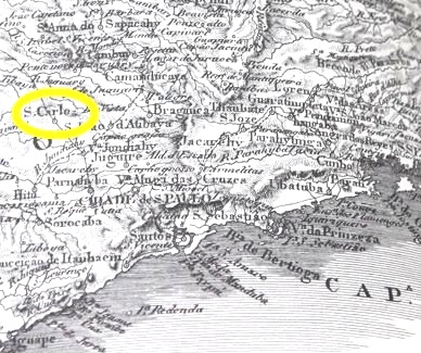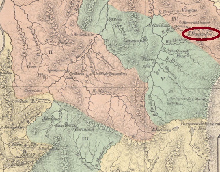
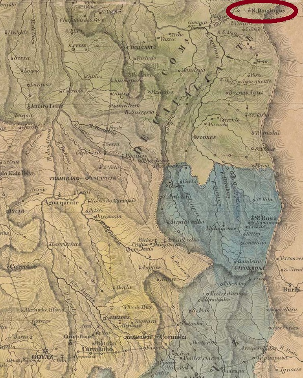
São Domingos is one of those localities in Brazilian Midwest whose relatively long history presents plenty of gaps. Official records are rare, because state structure has remained precarious for centuries. It was situated almost 750 km northeast of the former province capital Goyaz (today Goiás Velho) and became a district of the municipality of Arraias in July 1835. In October 1854 it emancipated as a villa in own municipality.
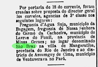
According to Nova Monteiro (Administrações e Agencias Postaes do Brasil Imperio, in Brasil Filatelico/RJ, 1934-5; Reprint SPP 1994-1999), the local post office originated in March 1829. However, Aureo G. Santos tells us that the office closed in January 1851 (Agências de Correio Criadas e Suprimidas 1851, 1855, 1856 e 1857, in Brasil Filatélico 181, 1977):

The post office would reopen only in 1874, according to the 1885 Imperial Mail Register (Tabella das Agencias do Correio do Imperio), although postal routes are reported to pass through São Domingos at least two years before. No imperial post cancel from this locality has been found until now.
São Domingos ist eine von diesen Ortschaften in der Mitte Brasiliens, deren vergleichsweise lange Geschichte viele Lücken aufweist. Offizielle Angaben über Verwaltung und öffentliches Leben sind selten, da viele staatliche Stellen vor Ort chronisch unterbesetzt geblieben sind. São Domingos lag fast 750 km nordöstlich der ehemaligen Provinzhauptstadt Goyaz (heute Goiás Velho) entfernt und wurde ein Distrikt im Município von Arraias im Juli 1835. Im Oktober 1854 wurde daraus eine Villa im eigenen Município.
Wie Nova Monteiro in Administrações e Agencias Postaes do Brasil Imperio (Brasil Filatelico/RJ, 1934-5; Reprint SPP 1994-1999) schreibt, gab es dort ab März 1829 ein Postamt. Gleichwohl berichtet Aureo G. Santos, dieses Postamt wurde im Januar 1851 geschlossen (Agências de Correio Criadas e Suprimidas 1851, 1855, 1856 e 1857, in Brasil Filatélico 181, 1977):

Die Agentur würde erst 1874 wieder eröffnen, wie im Verzeichnis der kaiserlichen Postämter (Tabella das Agencias do Correio do Imperio) von 1885 aufgelistet, obwohl Postrouten durch São Domingos mindestens zwei Jahre zuvor in Betrieb waren. Bisher konnte kein Poststempel aus dem Kaiserreich für diese Ortschaft gefunden werden.