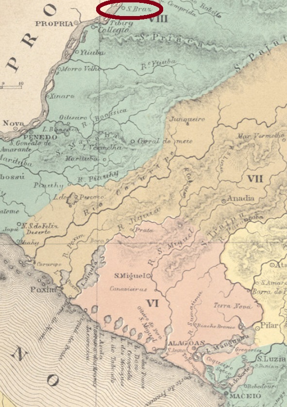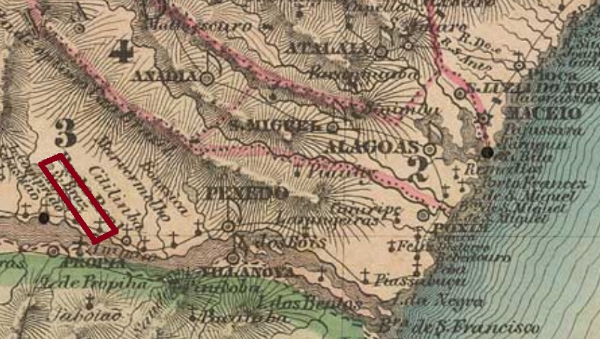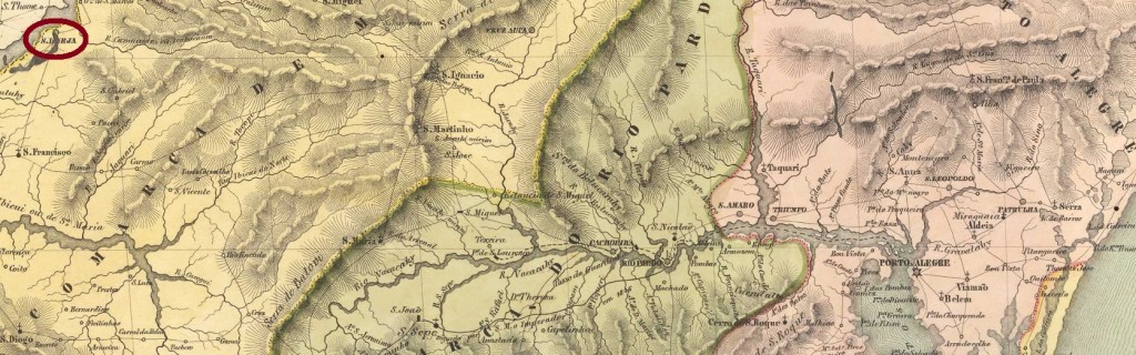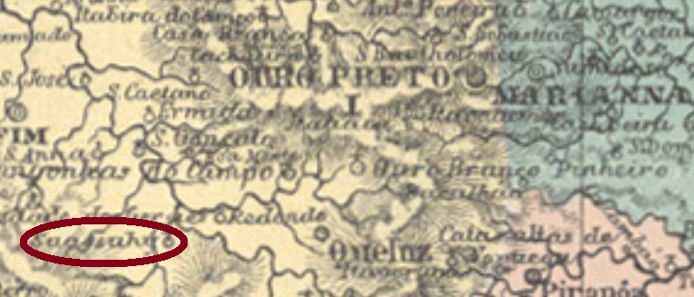
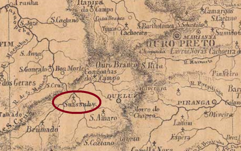
São Braz do Suassuhy (today written São Brás do Suaçuí) was since 1832 a freguesia in the municipality of Brumado, situated ca. 70 km southwest of the province capital Ouro Preto. Oddly enough, there are two Suaçuí Rivers in Minas Gerais, both quite away from this locality. In June 1850 (date not confirmed yet), it changed to the municipality of Queluz (today Conselheiro Lafaiete) and emancipated politically in December 1953.
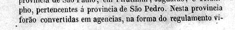
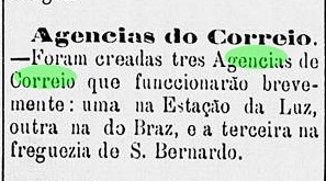
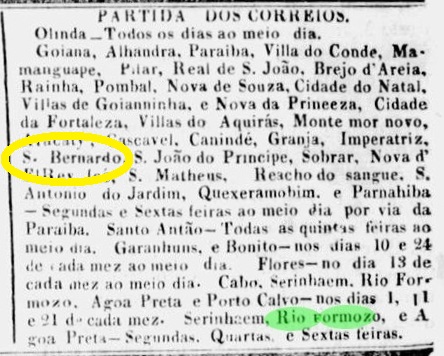
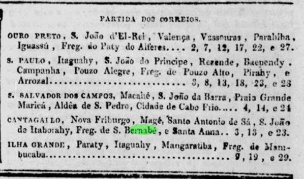
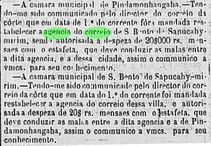
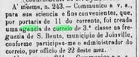
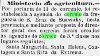
Not less than three dates for the creation of the local post office were found, indicating that it might have been closed a couple of times in-between. Paula Sobrinho (História Postal de Minas Gerais, Belo Horizonte, 1997) and the Postal Report for 1890 assert it took place in April 1871. The Imperial Mail Register (Tabella das Agencias do Correio do Imperio) of 1885 and the Postal Report for 1889 place a creation date in December 1875. Finally, a note in the Minas Press in June 1881 reports a reopening (restabelecimento) of the agency in June 1881:

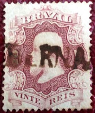
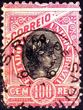
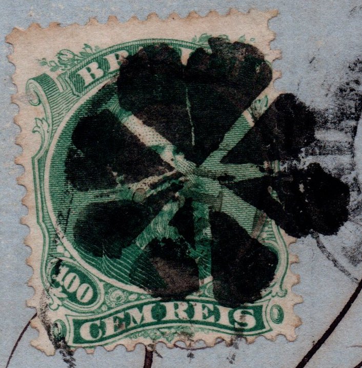
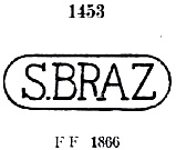
Two imperial cancels were found. SMG-2210a is certainly the oldest one and could have been used from the very first office opening, as presented by Paulo Ayres in Catálogo de Carimbos Brasil-Império (S. Paulo, 1937, 1942) under #1453:

It was followed by SMG-2210b (Coll. José A. Junges): a double circle with inscription S. BRAZ DO SUASSUHY above and a diamond ornament below, formed by four small diamonds. Used 1885-1892.
São Braz do Suassuhy (heute São Brás do Suaçuí geschrieben) war ab 1832 eine Freguesia im Município von Brumado, die etwa 70 km südwestlich der Provinzhauptstadt Ouro Preto entfernt lag. Es gibt heute zwar zwei Flüsse in Minas Gerais, die Suaçuí heißen, aber seltsamerweise liegen beide ziemlich weit weg von dieser Ortschaft. Im Juni 1850 (das Datum wird noch bestätigt) wechselte der Ort zum Município von Queluz (heute: Conselheiro Lafaiete) und erhielt seine politische Eigenständigkeit im Dezember 1953.
Drei verschiedene Daten fürs örtliche Postamt waren auffindbar, ein starkes Indiz dafür, dass es ein Paar Mal geschlossen wurde. Paula Sobrinho (História Postal de Minas Gerais, Belo Horizonte, 1997) und der Postbericht für 1890 schreiben, es entstand im April 1871. Das Verzeichnis der kaiserlichen Postämter (Tabella das Agencias do Correio do Imperio) von 1885 und das Postbericht für 1889 listen die Agentur ab December 1875 auf. Schließlich berichtet eine Pressenotiz aus Minas über eine Wiedererrichtung (restabelecimento) des Postamts im Juni 1881:
Zwei Poststempel der Kaiserzeit sind vorhanden. SMG-2210a ist sicher der älteste davon und war im Gebrauch wohl vom Anfang an. Er wurde uns bereits durch Paulo Ayres in seinem Catálogo de Carimbos Brasil-Império (S. Paulo, 1937, 1942) unter Nr. 1453 vorgestellt:
Ihm folgte SMG-2210b (Samml. José A. Junges): ein Doppelkreis mit der Inschrift S. BRAZ DO SUASSUHY oben und einem Ornament in Rautenform unten, das aus vier kleinen Rauten besteht. Gebraucht zwischen 1885 und 1892.