Other names: Imaculada Conceição do Morro da Garça
See also Conceição do Morro da Garça (CMG-0815)
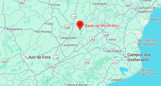
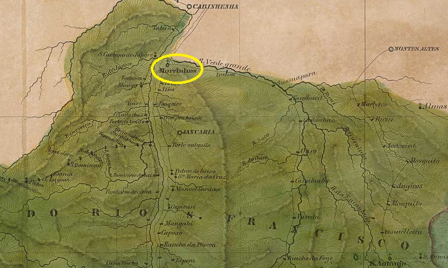
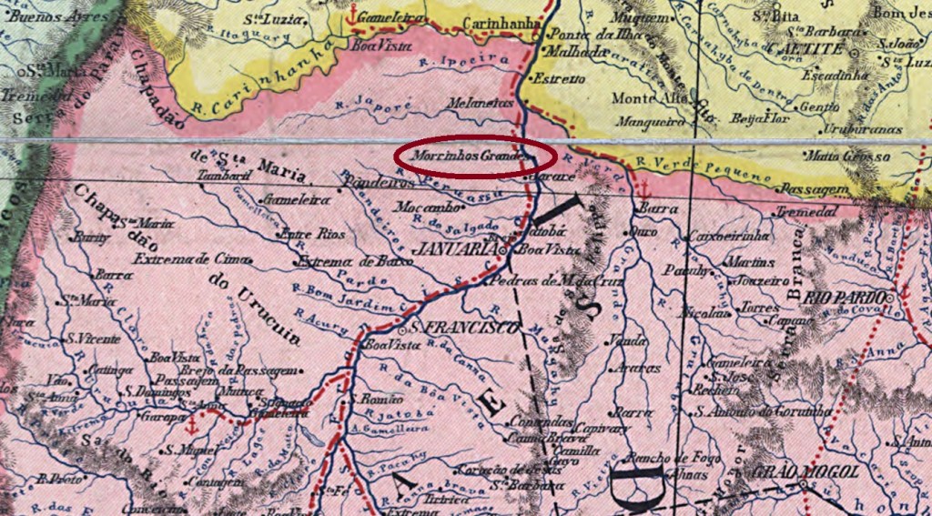
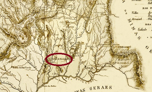
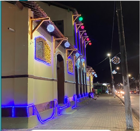
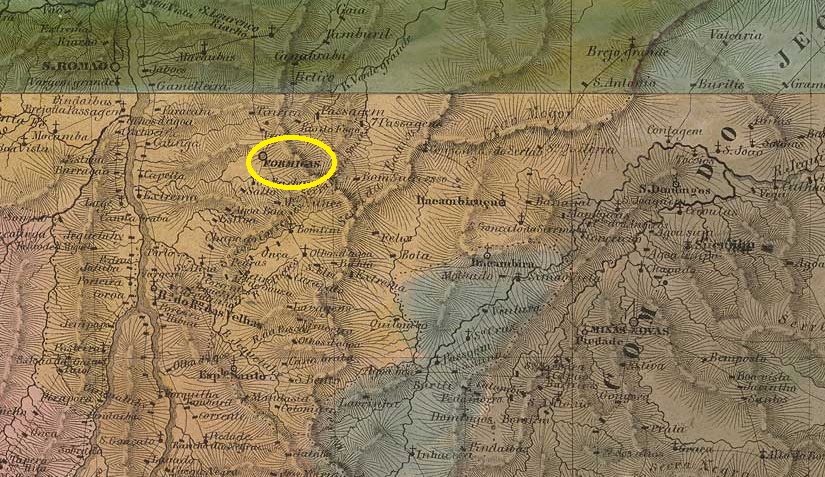
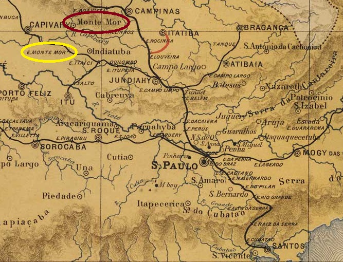
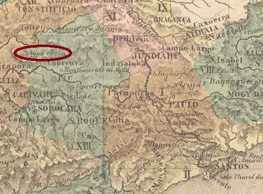
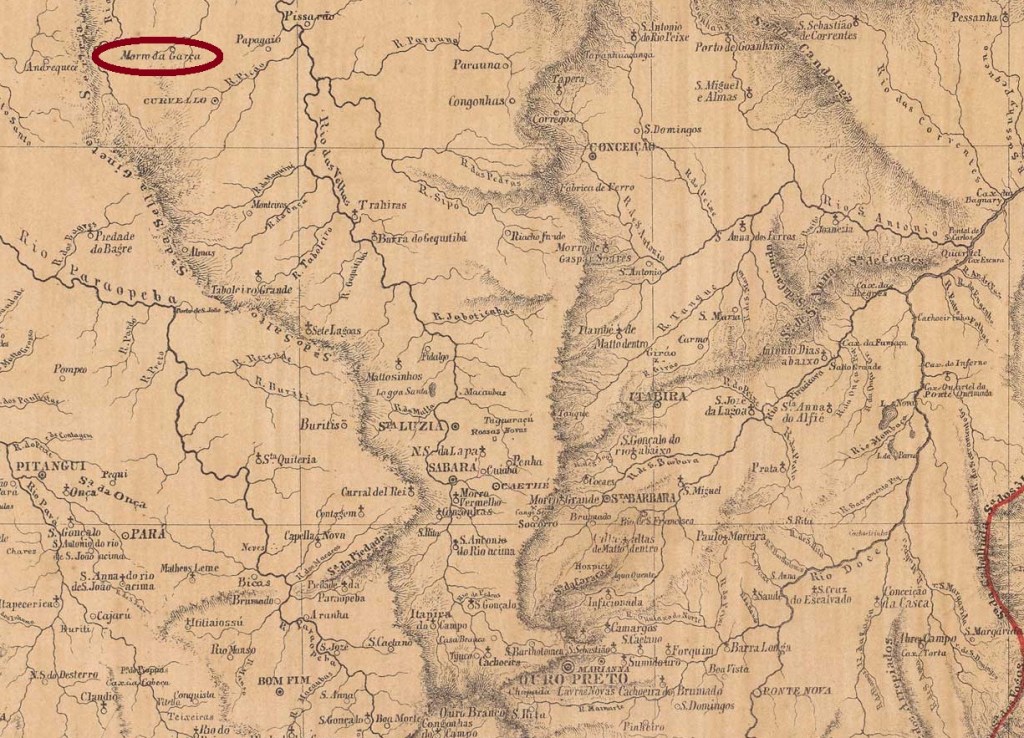
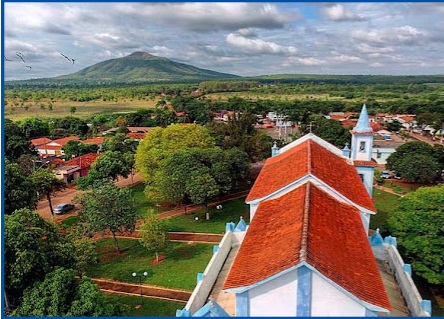
The chapel N. Sra. das Maravilhas do Morro da Garça was built as early as 1720. It belonged to the Vila de Curvelo and was located 300 kilometres north of the later provincial capital Ouro Preto. In January 1866 it became the Freguesia de Imaculada Conceição do Morro da Garça, and in December 1962 it was declared an autonomous município, now with the shortened place name Morro da Garça. The Morro da Garça (Heron Mountain) is a striking landmark of the city:

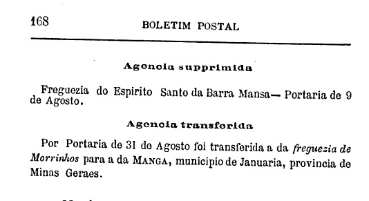
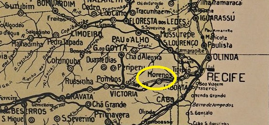
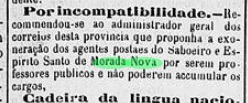
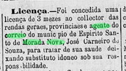
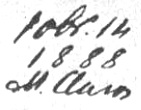
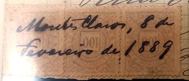
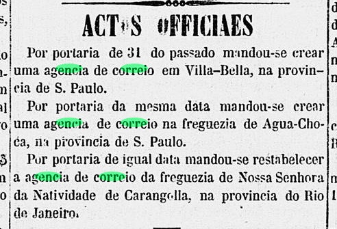
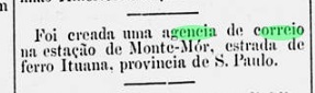
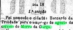
Two dates were found for the founding of the local post office that are so close to each other that they may belong together. Firstly in November 1883, as both Paula Sobrinho (História Postal de Minas Gerais, Belo Horizonte, 1997) and R. Koester (Carimbologia XIII and XXVII) write. Then in April 1884, as can be seen from the postal report (Relatorio dos Correios) for 1887. As the agency is not listed in the Directory of Imperial Post Offices (Tabella das Agencias do Correio do Imperio, Rio de Janeiro, 1885), it can be assumed that it was not put into operation until later. In fact, a first postal agent was mentioned in the regional press in August 1885:

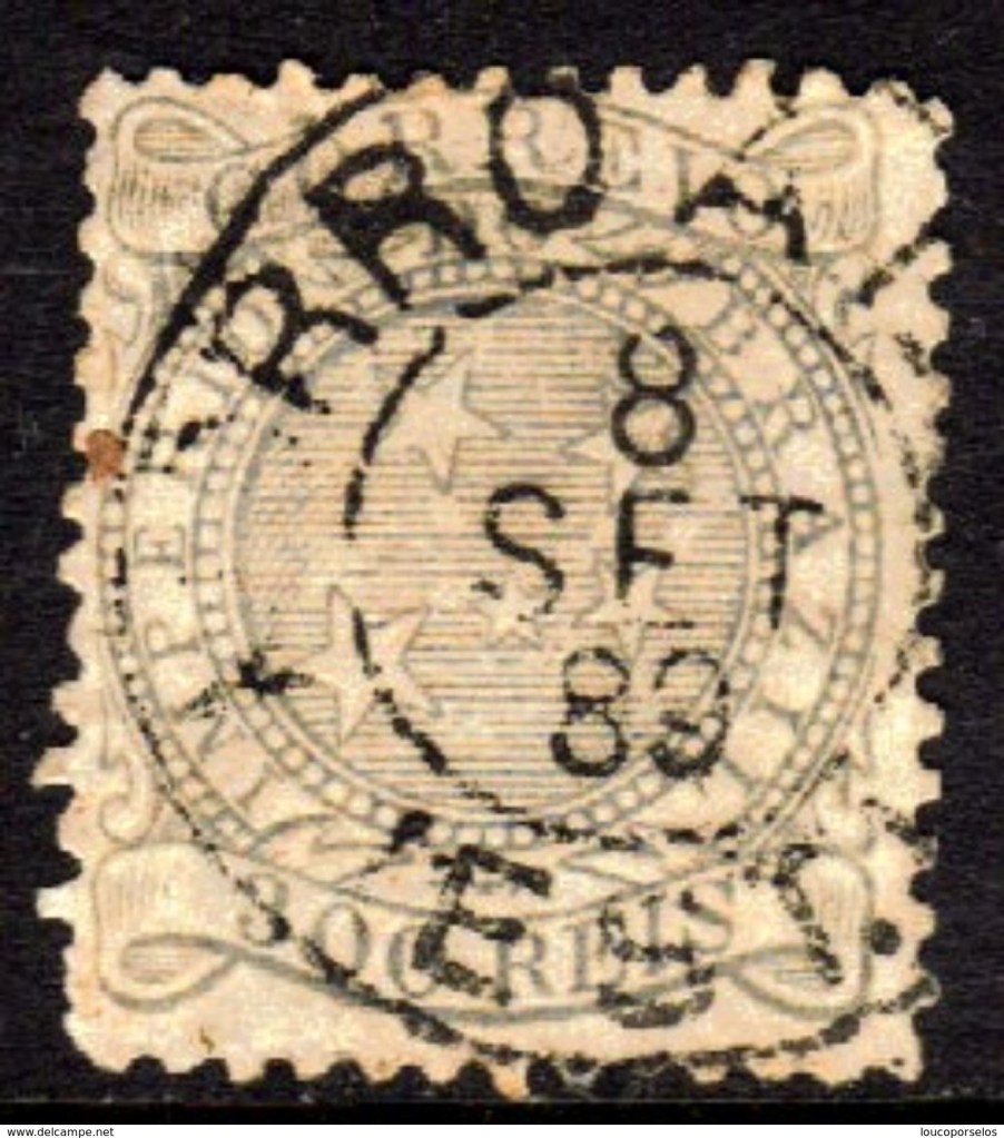
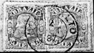
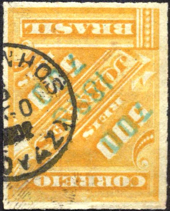
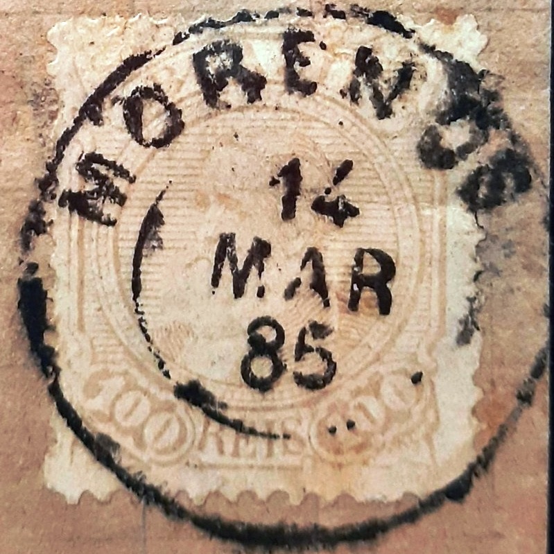
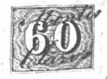
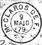
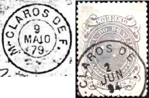
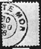
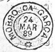
The imperial postmark is MMG-1660a (illustration by R. Koester, in Carimbologia XXVII):
Outros nomes: Imaculada Conceição do Morro da Garça
Veja também Conceição do Morro da Garça (CMG-0815)
A capela de N. Sra. das Maravilhas do Morro da Garça foi construída já em 1720. Pertencia à Vila de Curvelo e localizava-se a 300 quilômetros ao norte da futura capital da província, Ouro Preto. Em janeiro de 1866, tornou-se a Freguesia de Imaculada Conceição do Morro da Garça e, em dezembro de 1962, tornou-se município autônomo, agora com o nome abreviado de Morro da Garça. Esse Morro da Garça é um marco típico da localidade:

Foram encontradas duas datas para a criação da agência postal local, muito próximas uma da outra. Primeiro, em novembro de 1883, como escrevem Paula Sobrinho (História Postal de Minas Gerais, Belo Horizonte, 1997) e R. Koester (Carimbologia XIII e XXVII). Depois, em abril de 1884, como pode ser visto no Relatorio dos Correios para 1887. Como a agência não está listada na Tabella das Agencias do Correio do Imperio (Rio de Janeiro, 1885), pode-se presumir que ela só entrou em operação mais tarde. De fato, um primeiro agente postal foi mencionado na imprensa regional em agosto de 1885:
O carimbo postal imperial é MMG-1660a (fig. R. Koester, em Carimbologia XXVII):


Andere Namen: Imaculada Conceição do Morro da Garça
Siehe auch Conceição do Morro da Garça (CMG-0815)
Die Kapelle N. Sra. das Maravilhas do Morro da Garça wurde bereits 1720 erbaut. Sie gehörte zur Vila de Curvelo und lag 300 km nördlich der späteren Provinzhauptstadt Ouro Preto. Im Januar 1866 wurde es zur Freguesia de Imaculada Conceição do Morro da Garça, und im Dezember 1962 wurde es zum autonomen Município ernannt, nun unter dem verkürzten Ortsnamen Morro da Garça. Der Morro da Garça (Reiherberg) ist ein markantes Wahrzeichen der Stadt:
Für die Gründung des örtlichen Postamtes wurden zwei Daten gefunden, die so nahe beieinander liegen, dass sie möglicherweise zusammengehören. Zuerst im November 1883, wie sowohl Paula Sobrinho (História Postal de Minas Gerais, Belo Horizonte, 1997) als auch R. Koester (Carimbologia XIII und XXVII) schreiben. Dann im April 1884, wie aus dem Postbericht (Relatorio dos Correios) für 1887 hervorgeht. Da die Agentur nicht im Verzeichnis der kaiserlichen Postämter (Tabella das Agencias do Correio do Imperio, Rio de Janeiro, 1885) aufgeführt ist, kann davon ausgegangen werden, dass sie erst später in Betrieb genommen wurde. Tatsächlich wurde ein erster Postagent im August 1885 in der regionalen Presse erwähnt:

Der kaiserliche Poststempel ist MMG-1660a (Abb. R. Koester, in Carimbologia XXVII):