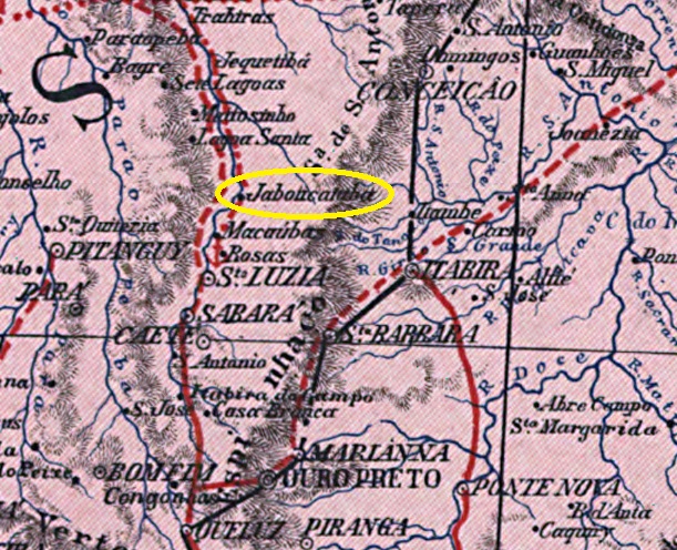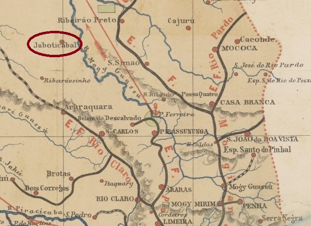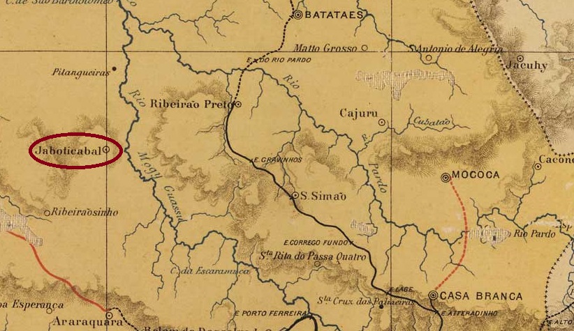
Other names: Conceição da Parahyba
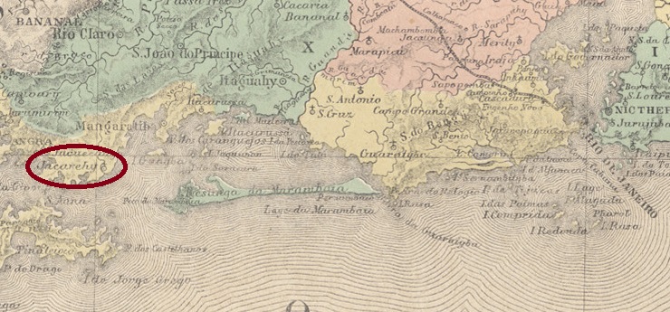
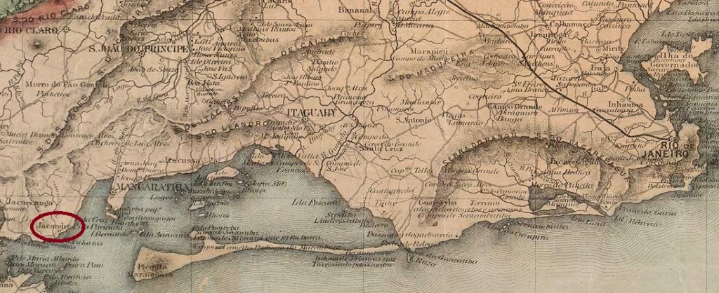
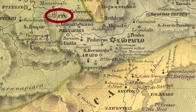
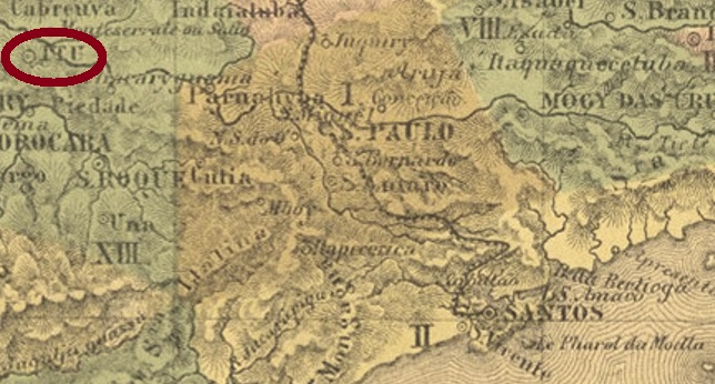
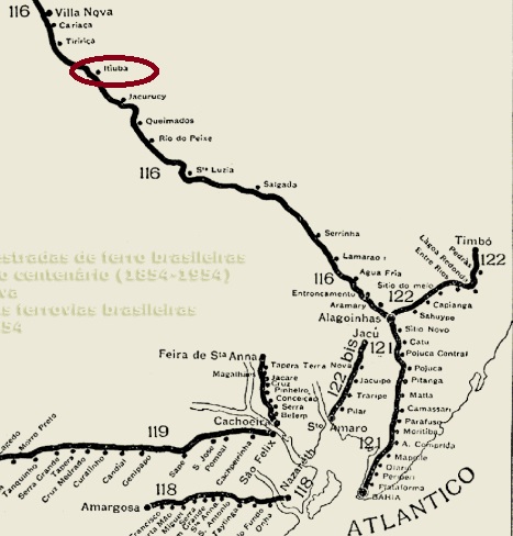
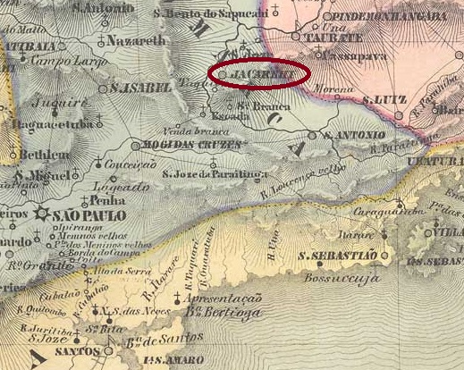
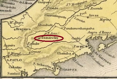
A settlement N. Sra. da Conceição da Parahyba, which belonged to the Vila de Mogy das Cruzes and was located on the east bank of the Paraíba do Sul, 80 km north-east of the later provincial capital of São Paulo, has been documented since 1652. It was probably renamed Conceição do Jacarehy when it was elevated to a vila in November 1653 and has been a town since April 1849 (as it is spelt today).
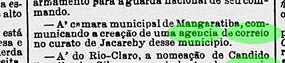
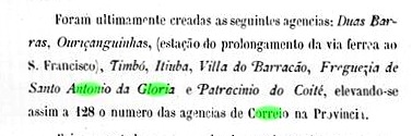
Three periods of operation have been established for the local post office. The first is said to have started in September 1827, according to the regional press:

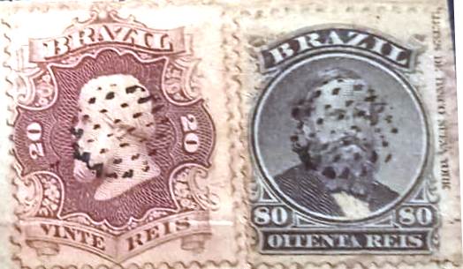
Accordingly, the post office was founded by the government and the economic elite of the province of São Paulo on their own initiative. The imperial postal service began in 1844, as can be read in the directory of imperial post offices (Tabella das Agencias do Correio do Imperio, Rio de Janeiro, 1885). The third founding date of the postal agency in December 1864 was given by the philatelist Mário Celso Orsi Jr, unfortunately without a source.
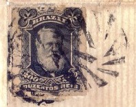
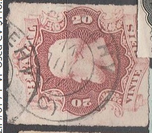
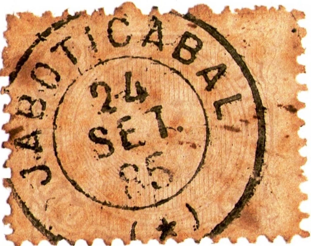
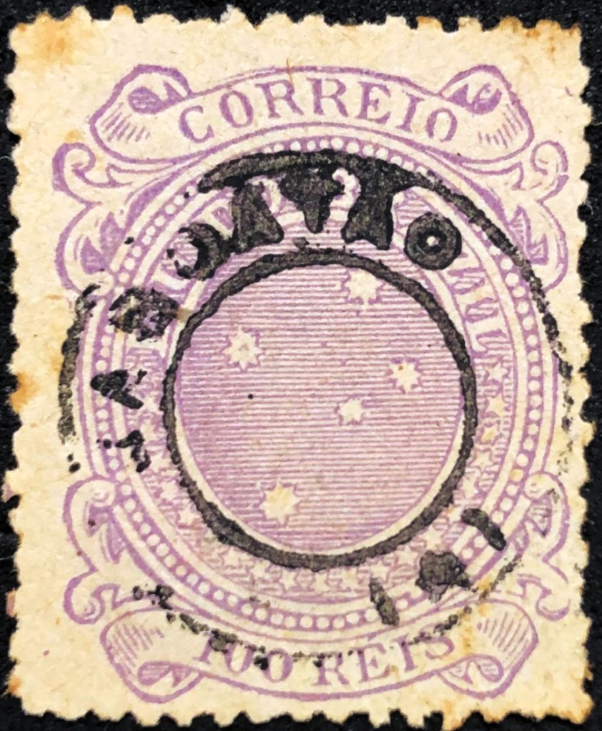
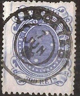
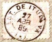
The oldest postmarks to date are similar, as can be seen. JSP-0680a (fig. Henrique B. Ferreira) also occurs in brown and red, while JSP-0680b in P. Ayres Catálogo de Carimbos Brasil-Império (S. Paulo, 1937, 1942) received the no. 1146:

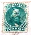
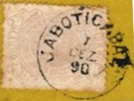
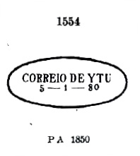
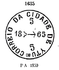
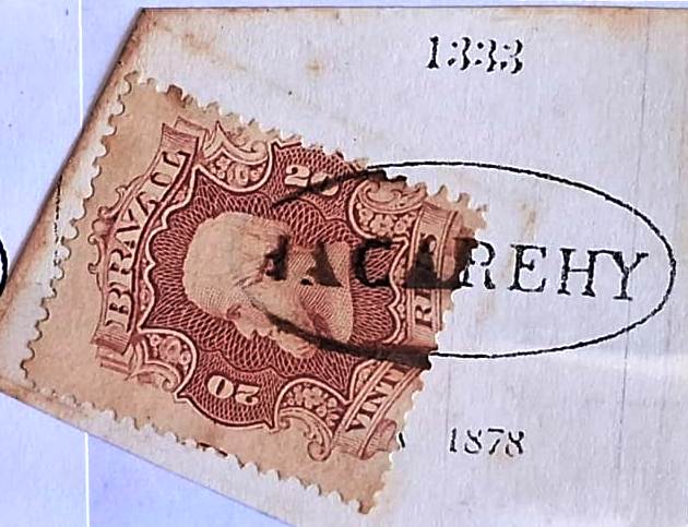
Then came JSP-0680c, also known by P. Ayres, this time under no. 1333:
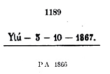
This was followed by the French type JSP-0680d (coll. Fuad Ferreira Fo.):

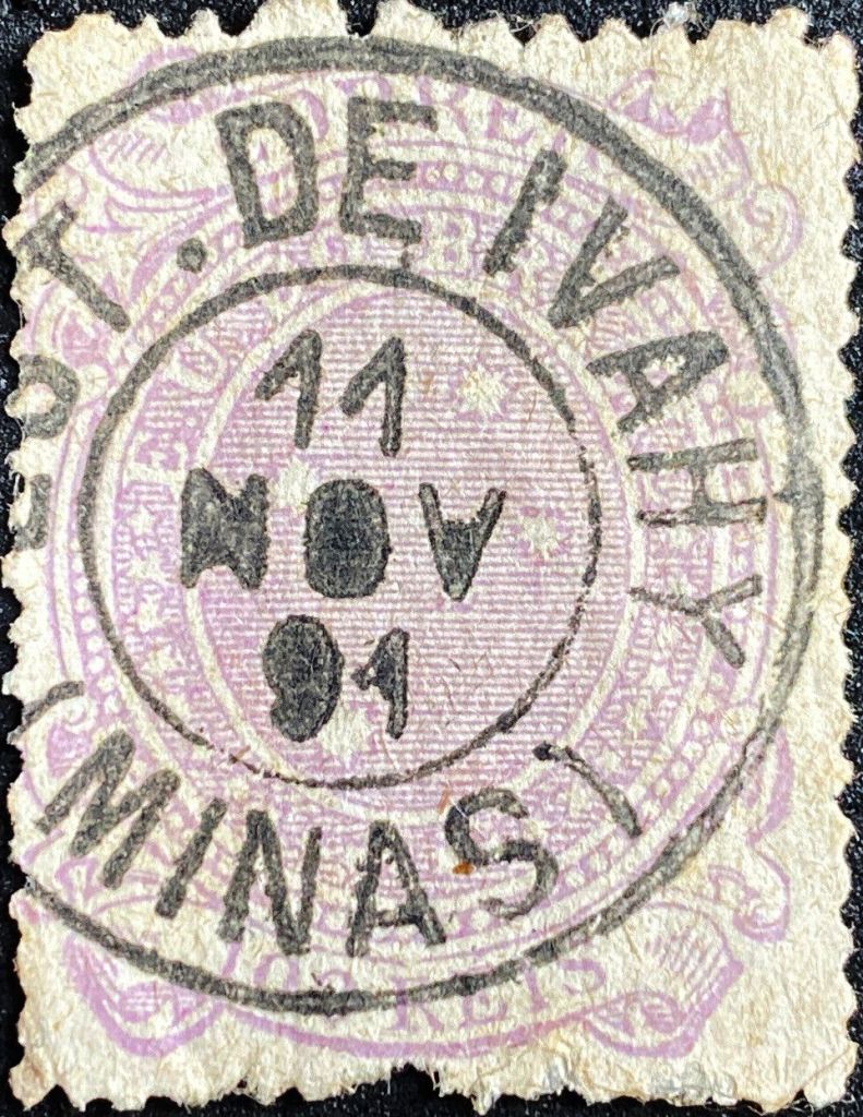
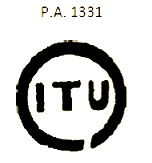
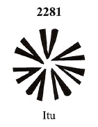
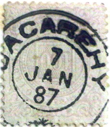
At the end of the Empire, the double circle JSP-0680e (fig. R. Koester in Carimbologia XXV) with the typical ornament at the bottom also appeared:
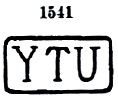
James Dingler and Klerman W. Lopes have listed three mute cancels of Jacarehy in Mute Cancellations of the Brazil Empire/Carimbos Mudos do Brasil Império (Brazil Philatelic Association, Rio de Janeiro, 2000):
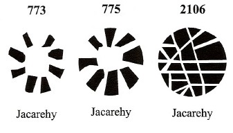
Another mute cancellation is shown by Rodrigo Baldassare:

Andere Namen: Conceição da Parahyba
Seit 1652 ist eine Siedlung N. Sra. da Conceição da Parahyba belegt, die zur Vila de Mogy das Cruzes gehörte und am Ostufer des Paraíba do Sul, 80 km nordöstlich der späteren Provinzhauptstadt São Paulo, lag. Die Umbenennung in Conceição do Jacarehy erfolgte wahrscheinlich bei der Erhebung zur Vila im November 1653. Seit April 1849 ist Jacareí (wie es heute geschrieben wird) eine Stadt.
Für das örtliche Postamt wurden drei Betriebszeiten festgestellt. Die erste soll im September 1827 begonnen haben, wie aus der regionalen Presse hervorgeht:

Demnach wurde die Post von der Regierung und der wirtschaftlichen Elite der Provinz São Paulo in Eigenregie gegründet. 1844 begann der kaiserliche Postdienst, wie im Verzeichnis der kaiserlichen Postämter (Tabella das Agencias do Correio do Imperio, Rio de Janeiro, 1885) nachzulesen ist. Das dritte Gründungsdatum der Postagentur im Dezember 1864 wurde von dem Philatelisten Mário Celso Orsi Jr. angegeben, leider ohne Quellenangabe.
Die bisher ältesten Poststempel ähneln sich, wie man sieht. JSP-0680a (Abb. Henrique B. Ferreira) kommt auch in braun und rot vor, während JSP-0680b in P. Ayres Catálogo de Carimbos Brasil-Império (S. Paulo, 1937, 1942) die Nr. 1146 erhielt:


Danach kam JSP-0680c, ebenfalls durch P. Ayres, diesmal unter Nr. 1333, bekannt:

Es folgte der französische Typ JSP-0680d (Samml. Fuad Ferreira Fo.):
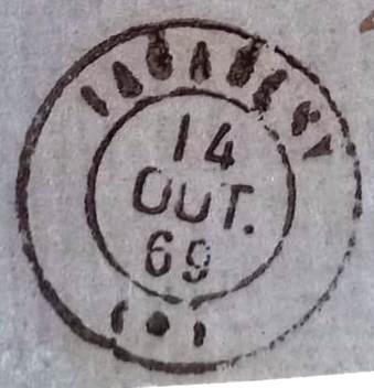
Am Ende des Kaiserreichs erschien auch der Doppelkreis JSP-0680e (Abb. R. Koester in Carimbologia XXV) mit dem typischen Ornament unten:

James Dingler und Klerman W. Lopes haben in Mute Cancellations of the Brazil Empire/Carimbos Mudos do Brasil Império (Brazil Philatelic Association, Rio de Janeiro, 2000) drei stumme Stempel von Jacarehy aufgeführt:

Ein weiterer stummer Stempel zeigt Rodrigo Baldassare: