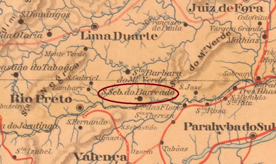
See also Tres Barras (TSP-1440)
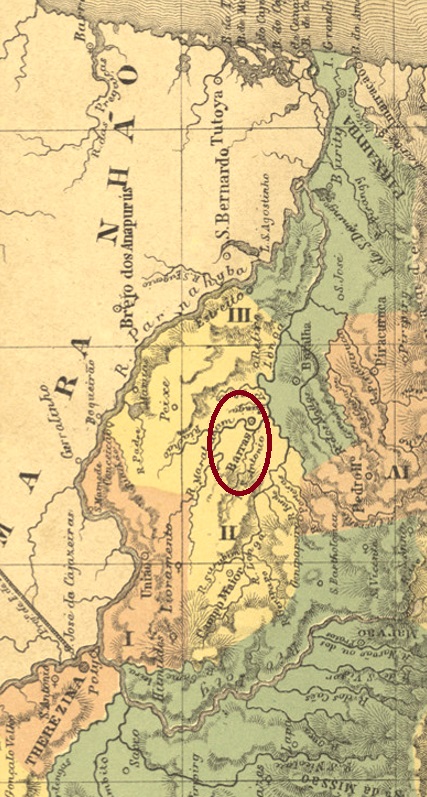
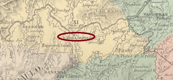
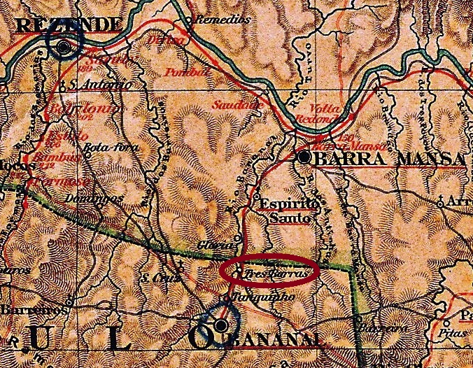
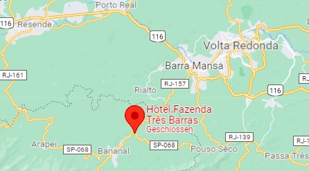
A barreira was a barrier on trunk roads where tax or toll was collected. The Barreira das Tres Barras, as R. Koester tells us in Carimbologia III, was located at the confluence of three streams (Turvo, Agua Comprida and Pirapetinga) with the Bananal River. Tres Barras was also the name of the fazenda 500 metres away, which today is a hotel. Bananal was also the name of the municipality responsible for this place, located 320 km northeast of the provincial capital São Paulo.
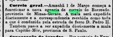
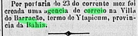
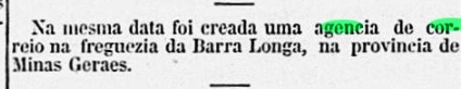
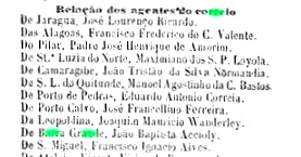
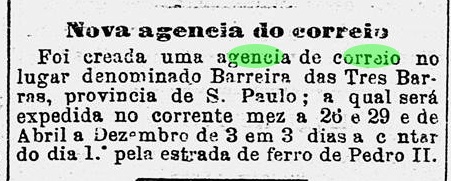
A post office at this barreira was established in March 1876, as reported by the Rio press:
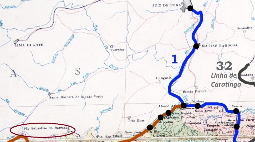
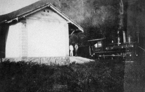
In October 1888, a station of the E.F. do Bananal railway company was inaugurated there. The railway line passed to the E.F. Central do Brasil in 1918 and remained in their possession (apart from a few months in 1931 with the E.F. Oeste de Minas) until it was closed in 1964. The station has long since been demolished (estacoesferroviarias.com.br).
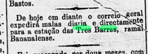
From May 1889, the Tres Barras station also received the mail bags for the town:
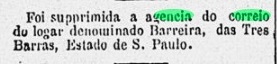
This made the old post office redundant, and it closed in December of that year:
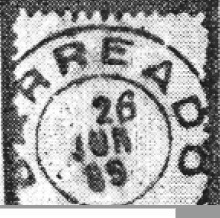
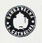
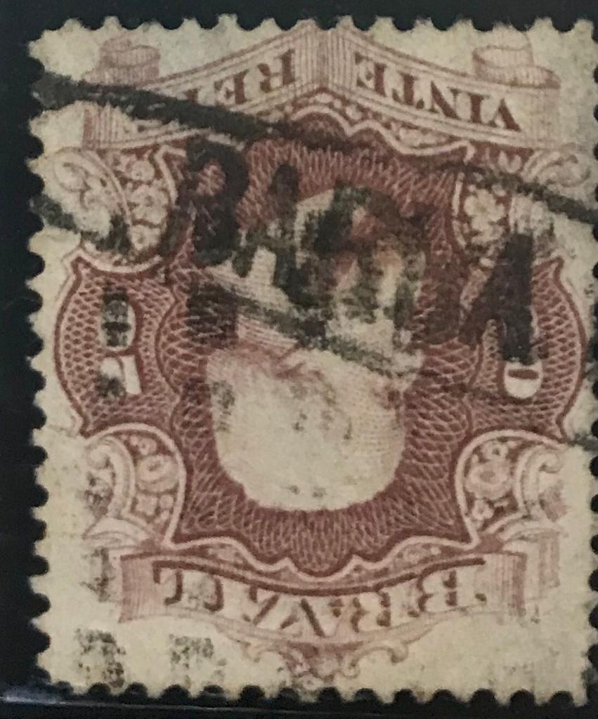
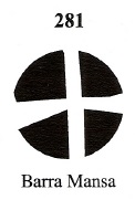
The first postmark was BSP-0105a, already presented as TSP-1440a (Col. Fuad Ferreira Fo.): a French type, with the inscription B. DAS TRES BARRAS at the top and the star between brackets at the bottom. Dates in the middle from 1877ff to 1885.
Siehe auch Tres Barras (TSP-1440)
Eine Barreira war eine Schrankstelle auf Fernstraßen, wo Steuer oder Maut eingetrieben wurde. Die Barreira das Tres Barras lag, wie uns R. Koester in Carimbologia III erzählt, an der Mündung von drei Bächen (Turvo, Agua Comprida und Pirapetinga) in den Bananal-Fluss. Tres Barras hieß auch die 500 Meter entfernte Fazenda, die heute als Hotel fungiert. Bananal hieß auch die zuständige Gemeinde für diesen Ort, 320 km nordöstlich von der Provinzhauptstadt São Paulo gelegen.
Ein Postamt an dieser Barreira entstand im März 1876, wie die Presse aus Rio berichtet:

Im Oktober 1888 wurde dort ein Bahnhof der E.F. do Bananal Bahngesellschaft eingeweiht. Die Bahnlinie ging 1918 zur E.F. Central do Brasil über und blieb in deren Besitz (abgesehen von ein paar Monaten 1931 bei der E.F. Oeste de Minas) bis zur Stilllegung 1964. Der Bahnhof ist längst abgerissen worden (estacoesferroviarias.com.br).

Ab Mai 1889 erhielt der Bahnhof Tres Barras auch die Postsäcke für den Ort:

Dadurch wurde das alte Postamt überflüssig und schloss im Dezember d. Js. zu:

Der erste Poststempel war BSP-0105a, der bereits als TSP-1440a (Samml. Fuad Ferreira Fo.) vorgestellt wurde: ein französischer Typus, mit der Inschrift B. DAS TRES BARRAS oben und dem Stern zwischen Klammern unten. Daten in der Mitte von 1877ff bis 1885.