Other names: N. Sra. do Patrocinio do Capivari de Cima, Monte-Mor
See also Monte-Mor (R. Koester: Carimbologia XXVII)
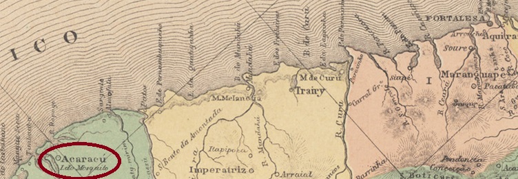
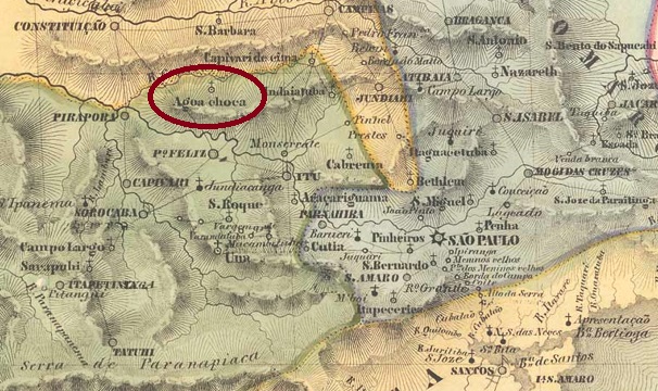
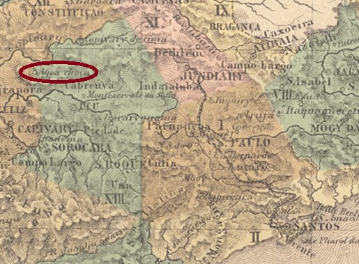
Around 1829, the settlement of N. Sra. do Patrocínio do Capivari de Cima was established, situated on the northern bank of the Capivari River, 120 km northwest of the future provincial capital São Paulo. In August 1832, the place was elevated to a freguesia with the strange name of Agua Choca (Rotten Water), which belonged to the Município of Itu. It was not until March 1871 that the name was changed again, this time as Vila of Monte-Mor (Big Mountain).
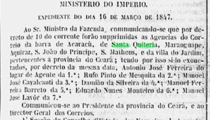
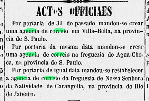
Two years of origin were found for the local post office. Firstly in 1854, as found out by philatelist Mario Celso Orsi Jr. Then in March 1865, as reported by the Rio press:

So far no imperial postmark has been seen under this place name. For postmarks with Monte-Mor see Koester, Carimbologia XXVII.
Andere Namen: N. Sra. do Patrocinio do Capivari de Cima, Monte-Mor
Siehe auch Monte-Mor (R. Koester: Carimbologia XXVII)
Um 1829 entstand die Siedlung von N. Sra. do Patrocínio do Capivari de Cima, die am Nordufer des Flusses Capivari lag, 120 km nordwestlich der künftigen Provinzhauptstadt São Paulo entfernt. Im August 1832 wurde der Ort zu einer Freguesia erhoben, die den merkwürdigen Namen Agua Choca (Verfaultes Wasser) trug und dem Município von Itu angehörte. Erst im März 1871 wurde der Name wieder geändert, diesmal als Vila von Monte-Mor (Großer Berg).
Zwei Entstehungsjahre wurden fürs örtliche Postamt gefunden. Erstmals 1854, wie vom Philatelisten Mario Celso Orsi Jr. Ermittelt. Dann im März 1865, wie die Presse aus Rio mitteilte:
Bisher war kein kaiserlicher Poststempel unter diesem Ortsnamen zu sehen. Für Stempel mit Monte-Mor siehe Koester, Carimbologia XXVII.