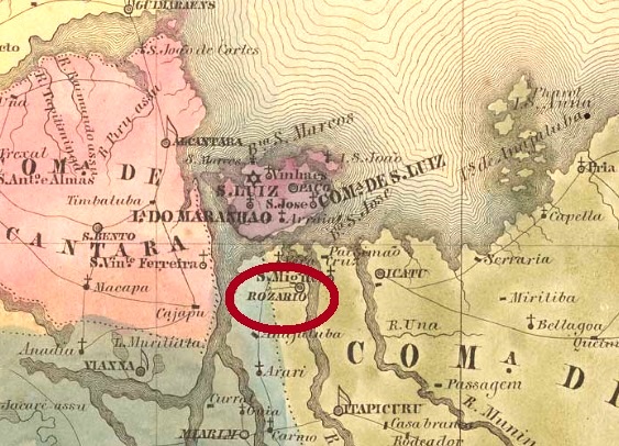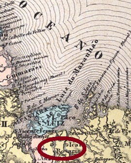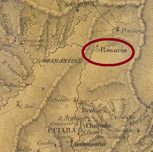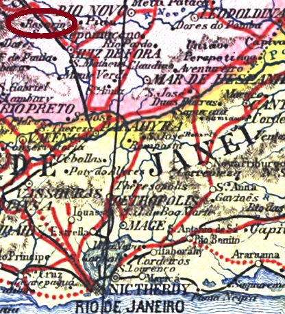
Other name: Rozario (Rosario) do Catete (Cattete)
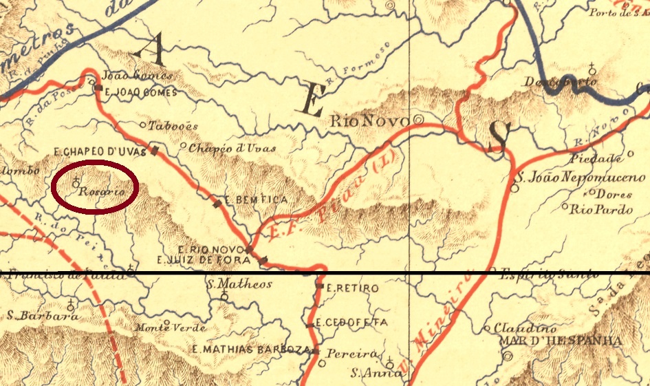
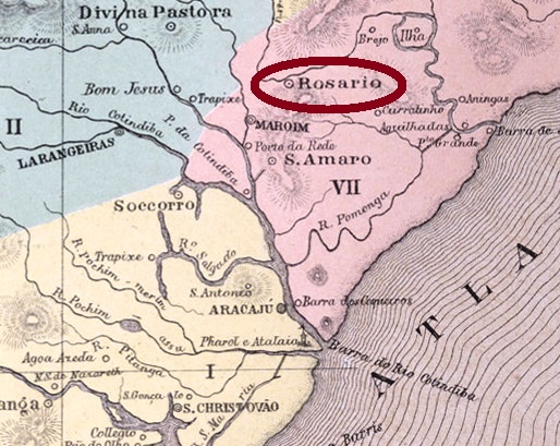
The district of Nossa Senhora do Rosario do Catete was founded in October 1831 in the municipality of Santo Amaro, ca. 50 km north of the early province capital São Cristóvão. In March 1836 it ascended to a Villa, and in July 1932, to the town of Rosario. The old name Rosario do Catete returned finally in December 1943.
Nova Monteiro (Administrações e Agencias Postaes do Brasil Imperio, in Brasil Filatelico/RJ, 1934-5; Reprint SPP 1994-1999) lists this post office with creation date on November 8, 1867, but the Imperial Mail Registers (Tabellas das Agencias do Correio do Imperio) of 1859 and 1885 report the year 1853. This would imply this post office was closed in the meantime.
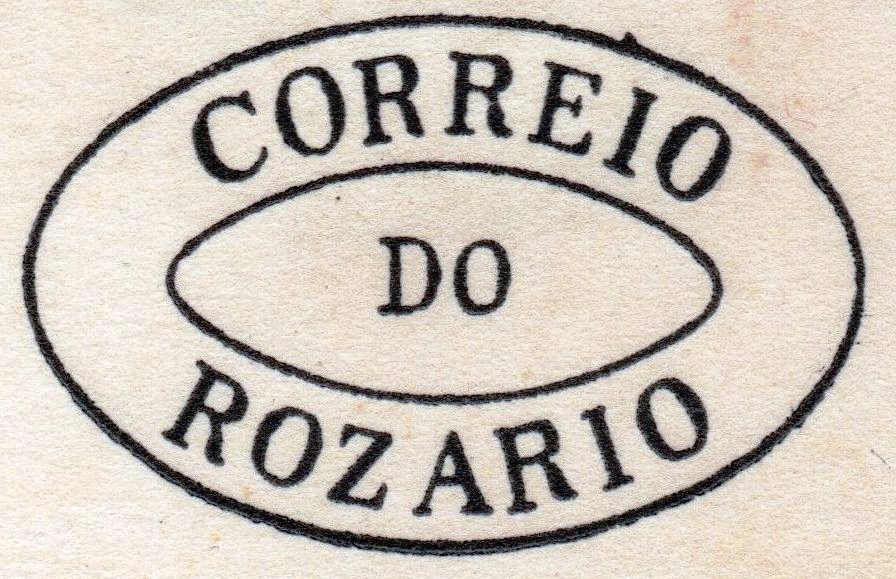
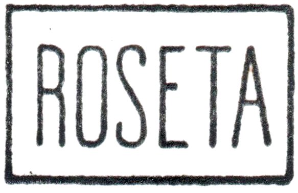
Unfortunately, no early cancellation from this agency could be found to date. The only 19th century cancel, RSE-0145a (Coll. José A. Junges), could be already republican, for the dates are between 1895 and 1901. It has a double circle with the inscriptions ROZARIO above and (SERGIPE) below, with the date in the centre.

Der Distrikt von Nossa Senhora do Rosario do Catete wurde im Oktober 1831 im Município von Santo Amaro gegründet und lag etwa 50 km nördlich der ehemaligen Provinzhauptstadt São Cristóvão. Im März 1836 stieg er zur Villa auf und im Juli 1932 zur Stadt Rosário. Der alte Ortsname Rosário do Catete kehrte dann im Dezember 1943 zurück.
Nova Monteiro (Administrações e Agencias Postaes do Brasil Imperio, in Brasil Filatelico/RJ, 1934-5; Reprint SPP 1994-1999) listet dieses Postamt mit Gründungsdatum 8. November 1867 auf, aber die Verzeichnisse der kaiserlichen Postämter (Tabellas das Agencias do Correio do Imperio) aus 1859 und 1885 haben 1853 als Gründungsjahr. Das würde bedeuten, das Postamt wurde zwischendurch geschlossen.
Leider wurde bisher keine frühe Abstempelung aus dieser Agentur gefunden. Der einzige Stempel aus dem 19. Jahrhundert, RSE-0145a (Samml. José A. Junges), könnte bereits republikanisch sein, da er Jahrgänge von 1895 bis 1901 vorweist. Er hat einen Doppelkreis mit den Inschriften ROZARIO oben und (SERGIPE) unten, dazu das Datum in der Mitte.