Categories
Carimbologia Q-R

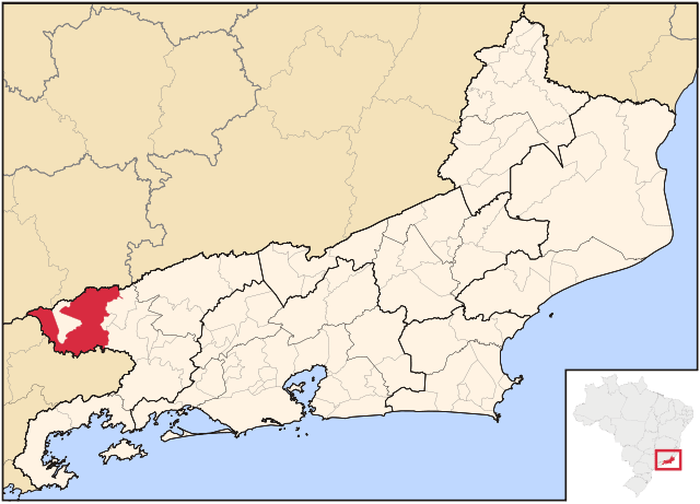
Resende, Rio de Janeiro (RRJ-0825)

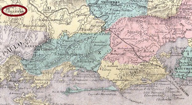
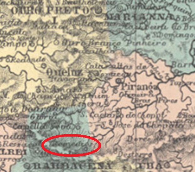
Atlas do Imperio do Brasil, 1868

Text updated on September 26, 2021

Resende (or Rezende) was founded as the Freguesia de Nossa Senhora da Conceição do Campo Alegre da Parahyba Nova in January 1756 west from the imperial capital, on the Parahyba River, near the border to the São Paulo province. It must have been a strategically important site, for the small village grew faster than average, and today it is famous in the whole country due to the Military Academy, founded 1792. Resende acquired the villa status as early as 1801, and since 1841 it is a city.

According to Nova Monteiro (Administrações e Agências Postais do Brasil Império – 1798/1869) the local post office opened in 1829. It must have been very active from the beginning on, for there were about eight different pre-philatelic (i.e. used by 1843) cancels:

RRJ-0825a (RHM P-RJ-28) Used between 1830 and 1836.
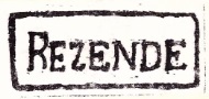
RRJ-0825b (P. Ayres #24/1942) Used between 1835 and at least 1843.
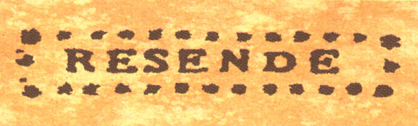
RRJ-0825c (RHM P-RJ-29) Used between 1836 and 1838.

RRJ-0825d (RHM P-RJ-30) Used between 1838 and 1840.

RRJ-0825e (RHM P-RJ-31) Used in 1841.

P. Ayres/1942 #23 (RHM P-RJ-32), used in 1843 ff, is probably the same as

RRJ-0825f (HBF-R1)
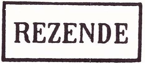
RRJ-0825g (P. Ayres 1430a, HBF-R3) Used in 1843ff.
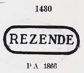
RRJ-0825h is also known as P. Ayres # 1430. Used from ca. 1843 till 1873.

RRJ-0825i corresponds to P. Ayres #1590. Used from ca.1850 till 1876.

RRJ-0825j (Coll. José A. Junges) is a French type. Used with REZENDE and dates in French between 1871 and 1884.
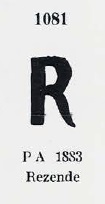
RRJ-0825k is known as P. Ayres #1081. Used from ca. 1876 until 1884.

RRJ-0825l is a railroad cancel depicted in Brazil Filatélico #104. Used ca. 1878 ff.

RRJ-0825m (Coll. José A. Junges) is probably a variant to RRJ-0825j, but now the date is written in Portuguese. Used between 1881 and 1885.

RRJ-0825n (Coll. José A. Junges) is similar to before, but now the REZENDE letters are slightly bigger,  the year smaller, and there is no star. Known in 1883.

RRJ-0825o (Coll. José A. Junges) has a double circle with inscription RESENDE inside, a horizontal rhombus formed by four small rhombuses below, and the date within the inner circle. Used from ca. 1885 until 1895.

RRJ-0825p (Coll. José A. Junges) might be republican. It presents a double circle with inscription REZENDE above, a cross with serifs below and the date inside. Found by now between 1890 and 1900.

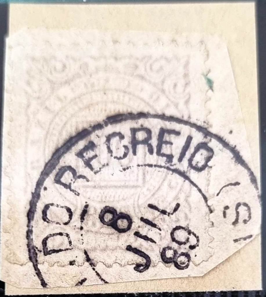
RRJ-0825q (Col. Alexandre Andrade) appeared with dates of 1890 and 1891 after the publication of Carimbologia Q-R, so its image is presented here:
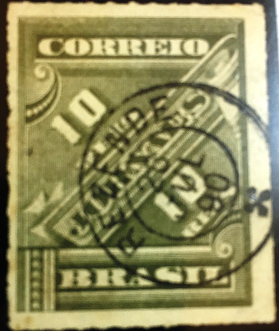
RRJ-0825q (A. Andrade)
Raphael Lorenzeto de Abreu (CC BY-SA)

Textaktualisierung vom 26.09.2021

Resende (oder Rezende) wurde als Freguesia de Nossa Senhora da Conceição do Campo Alegre da Parahyba Nova im Januar 1756 am Fluss Parahyba nah an der Grenze zu São Paulo gegründet. Es dürfte eine strategisch eminent wichtige Lage gewesen sein, denn die Ortschaft wuchs merklich schneller als der Durchschnitt. Heute ist Resende landesweit durch eine Militärakademie bekannt, die 1792 entstanden ist. Resende erhielt den Villa-Status bereits in 1801, und es ist seit 1841 eine Stadt.

Wie Nova Monteiro (Administrações e Agências Postais do Brasil Império – 1798/1869) berichtet, wurde das örtliche Postamt in 1829 eröffnet. Der Postverkehr muss von Beginn an besonders rege gewesen sein, da man noch in der Vorphila-Zeit – also bis 1843 – bereits ca. acht verschiedene Abstempelungen zählen kann.

RRJ-0825a (RHM P-RJ-28). Verwendet zwischen 1830 und 1836.
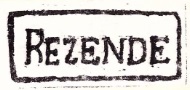
RRJ-0825b (P. Ayres Nr. 24/1942) Zwischen 1835 und zumindest 1843 verwendet.
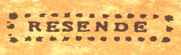
RRJ-0825c (RHM P-RJ-29) Zwischen 1836 und 1838 verwendet.

RRJ-0825d (RHM P-RJ-30) Zwischen 1838 und 1840 verwendet.

RRJ-0825e (RHM P-RJ-31) Gefunden in 1841.

P. Ayres Nr.23/1942 (RHM P-RJ-32), gefunden in 1843 ff, ist vielleicht identisch mit:

RRJ-0825f (HBF-R1)
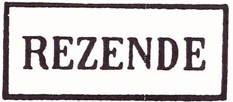
RRJ-0825g (P. Ayres Nr. 1430a, HBF-R3) Verwendet in 1843ff.
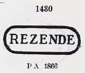
RRJ-0825h entspricht P. Ayres Nr. 1430. Verwendet von ca. 1843 bis 1873.

RRJ-0825i entspricht P. Ayres Nr. 1590. Verwendet von ca.1850 bis 1876.

RRJ-0825j (Samml. José A. Junges) ist ein “französischer-Typus”. Mit Inschrift REZENDE, trägt das Datum auf Französisch, zwischen 1871 und 1884.
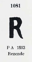
RRJ-0825k ist als P. Ayres Nr. 1081 bekannt. Verwendet von ca. 1876 bis 1884.

RRJ-0825l ist eine Eisenbahn-Abstempelung, wie in Brazil Filatélico Nr. 104 abgebildet. Verwendet ca. 1878 ff.

RRJ-0825m (Samml. José A. Junges) ist vermutlich eine Variante zu RRJ-0825j, nun aber steht das Datum auf Portugiesisch. Verwendet zwischen 1881 und 1885.

RRJ-0825n (Samml. José A. Junges) ist ähnlich wie der Vorgägnger, aber nun sieht man REZENDE etwas größer,  das Jahr dafür kleiner, und der Stern ist nun verschwunden. Bekannt in 1883.

RRJ-0825o (Samml. José A. Junges) hat einen Doppelkreis mit Inschrift RESENDE (oben), eine waagerechte Raute, die durch vier kleine Rauten gebildet wird (unten), und das Datum im Innenkreis. Benutzt von ca. 1885 bis 1895.

RRJ-0825p (Samml. José A. Junges) könnte bereits republikanisch sein. Er hat einen Doppelkreis mit Inschrift REZENDE oben, eine Kreuzverzierung mit Serifen unten und das Datum im Innenkreis. Bisher zwischen 1890 und 1900 gefunden.

RRJ-0825q (Col. Alexandre Andrade) erschien mit Daten aus 1890 und 1891 nach der Veröffentlichung von Carimbologia Q-R. Darum wird hier abgebildet:
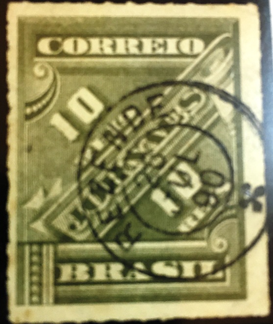
RRJ-0825q (A. Andrade)
Categories
Carimbologia Q-R

Remédios, Minas Gerais (RMG-2090)

Atlas do Imperio do Brasil, 1868

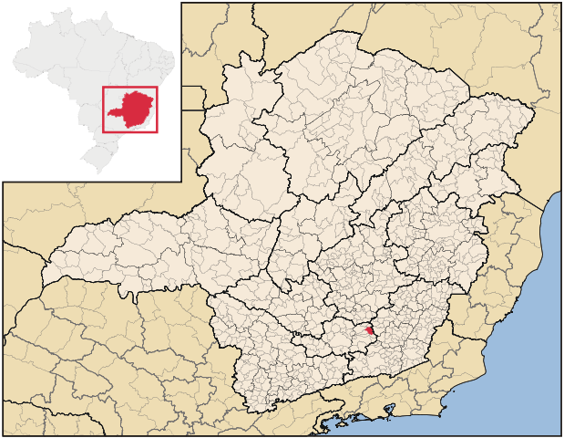
Within eight decades, this locality has been given four different names. Beginning in 1870 as the freguesia of Nossa Senhora de Remédios, which belonged to Piranga, it was called just Remedios between 1873 and 1943. Then it turned to Angoritaba, which means in the Indian language “a place of spiritual comfort”, before becoming the município of Senhora de Remédios in 1953, when it emancipated from Barbacena.

According to Paula Sobrinho (História Postal de Minas Gerais, Belo Horizonte, 1997), the local post office was created in March 1879. Two imperial postmarks are known. RMG-2090a (Coll. José A. Junges) is a manuscript cancel, the unique exemplar of which is dated October 1884. Then follows RMG-2090b (Coll. José A. Junges), a double circle with REMEDIOS inscription (above), a diamond ornament formed by four rhombuses (below), and the date within the inner circle. Copies found between 1885 and 1894.

Raphael Lorenzeto de Abreu (CC BY-SA)

Binnen gut 80 Jahren hat diese Gemeinde vier Namen verpasst bekommen. Gegründet als die Freguesia von Nossa Senhora de Remédios, unterstellt dem Bezirk Piranga, sie wurde lediglich Remedios zwischen 1873 und 1943 genannt. Dann hieß sie Angoritaba, eine Bezeichnung in der Indianersprache, die „Ort des geistlichen Trosts“ heißt. Und seit 1953 wurde sie nach der Loslösung von Barbacena der Município von Senhora dos Remédios.

Gemäß Paula Sobrinho (História Postal de Minas Gerais, Belo Horizonte, 1997) wurde das Ortspostamt im März 1879 ins Leben gerufen. Zwei kaiserliche Entwertungen sind überliefert. RMG-2090a (Samml. José A. Junges) ist eine handschriftliche Entwertung, deren einzig bekanntes Exemplar das Datum Oktober 1884 trägt. Es folgt RMG-2090b (Samml. José A. Junges), ein Doppelkreis mit der Inschrift REMEDIOS (oben), dazu eine Verzierung in Rautenform, die wiederum durch 4 kleinere Rauten gebildet wird (unten), und das Datum im Innenkreis. Exemplare zwischen 1885 und 1894 gefunden.

Categories
Carimbologia Q-R

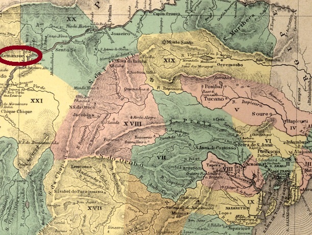
Remanso de Pilão Arcado, Bahia (RBA-0800)

Atlas do Imperio do Brazil, 1868

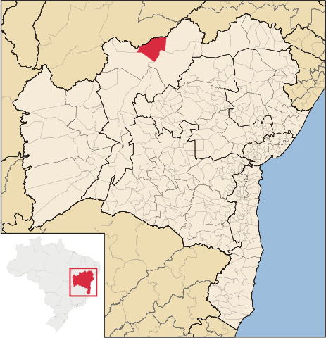
Literally, this old village in northern Bahia on the São Francisco River means “Curved Pestle Backwater”. Brazilian Geographical and Statistics Institute (IBGE) tries to explain this odd denomination by telling us the legend after which long time ago an Indian pestle had been found on a spot where the river makes a large curve, therefore flowing quite slowly.

But also the history of the actual municipality of Remanso originates eventual confusion, for some miles upstream there was the village of Pilão Arcado, now a município as well. Both villages were districts of Xique-Xique and Juazeiro. Pilão Arcado was given the Villa status in 1810, whereas Remanso became a Villa only in 1857.  At this occasion, it took over Pilão Arcado as a district, and this situation remained until 1890, when Pilão Arcado was made a Villa again.

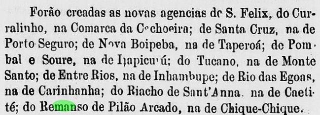
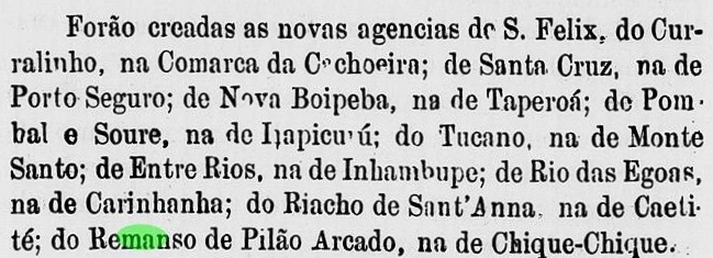
Apparently, both villages inaugurated their post offices in the same year. Koester (Carimbologia XXXI) gives 1875 as the creation year for the Pilão Arcado agency, whereas the Bahia government report for 1876 list among others also a new agency in Remanso:

Relatorio do Conselho Interino do Governo da Bahia, 1876

Since by now no Remanso cancel has been found, possibly both agencies were the same (named Pilão Arcado), considering that in 1875 both villages were still unified.

Raphael Lorenzeto de Abreu (CC BY-SA)

Der Name dieses alten Dorfs im Norden Bahias am Rio São Francisco bedeutet buchstäblich „Rückstau des Gebogenen Stößels“. Die brasilianische Behörde für Geografie und Statistik (IBGE) versucht diese merkwürdige Bezeichnung mit einer Legende zu erklären; folglich wurde vor langer Zeit ein indianischer Stößel an einer breiten Flusskurve gefunden, wo das Wasser zu stehen schien.

Die Geschichte des jetzigen Remanso – heute ein Município – kann ebenfalls Verwirrung verursachen, da sich einige Kilometer stromaufwärts die Gemeinde Pilão Arcado befindet, nun auch ein Município. Beide Ortschaften gehörten früher mal zu Xique-Xique, mal zu Joazeiro. Pilão Arcado wurde eine Villa bereits in 1810, während Remanso diesen Status erst in 1857 erhielt, dabei aber wurde Pilão Arcado ein Distrikt vom Nachbar. Diese Situation blieb unverändert bis 1890, als aus Pilão Arcado wieder eine eigenständige Villa wurde.

Scheinbar haben beide Gemeinden ihre Postämter im selben Jahr bekommen. Laut Koester (Carimbologia XXXI) entstand die Agentur in Pilão Arcado in 1875, während im Jahresbericht für 1876 des provisorischen Regierungsrats für die Provinz Bahia auch ein neues Postamt u.a. für Remanso aufgelistet wird:      

Relatorio do Conselho Interino da Governo da Bahia, 1876

Da bisher kein kaiserlicher Stempel für Remanso gefunden wurde – im Gegensatz zu Pilão Arcado – könnte es aber auch sein, dass lediglich ein Postamt bestand, denn in 1875 waren beide Gemeinden noch vereinigt.

Categories
Carimbologia Q-R

Remanso (Train station/Bahnhof), São Paulo (RSP-1065)

Cia. Paulista

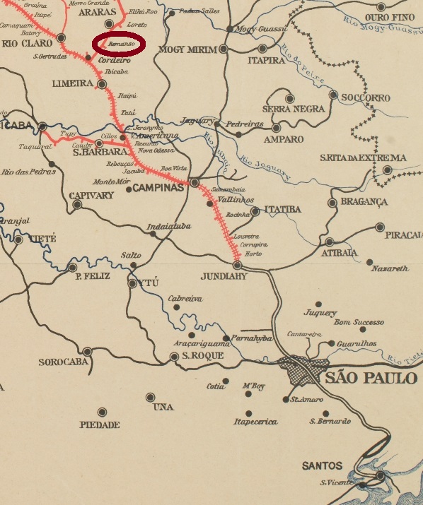
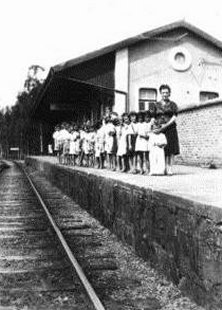
The Remanso train station was built in 1884 by the Cia. Paulista de Estradas de Ferro (Descalvado branch) near Araras, about 180 km northwest from São Paulo. We ignore when the station post office was created, but it started operations on September 6, 1888:

Correio Paulistano, September 6, 1888

From 1971 the railway went under control of the FEPASA and remained active until 1998. Now is the station building demolished, and the rails have been removed. No postal cancel from the early period could be found.

Luiz Gonzaga S. Ferreira (estacoesferroviarias.com.br)

Der Bahnhof Remanso wurde in 1884 durch die Cia. Paulista de Estradas de Ferro (Descalvado-Abzweigung) bei Araras, etwas 180 km nordwestlich von São Paulo. Wir wissen zwar noch nicht, wann das Bahnhpofspostamt entstanden ist, aber es wurde am 6. September 1888 in Betrieb genommen:

Correio Paulistano, 6.9.1888

Ab 1971 wurde die Linie von der FEPASA übernommen, die sie auch aktiv bis 1988 erhielt. Nun ist das Bahnhofsgebäude längst abgerissen, und die Gleise gibt es auch nicht mehr. Bisher konnte keine Postabstempelung der früheren Zeit gefunden werden.

Categories
Carimbologia Q-R

Registro do Parahybuna, Rio de Janeiro (RRJ-3930)

Registro do Parahybuna (iepha.mg.gov.br)

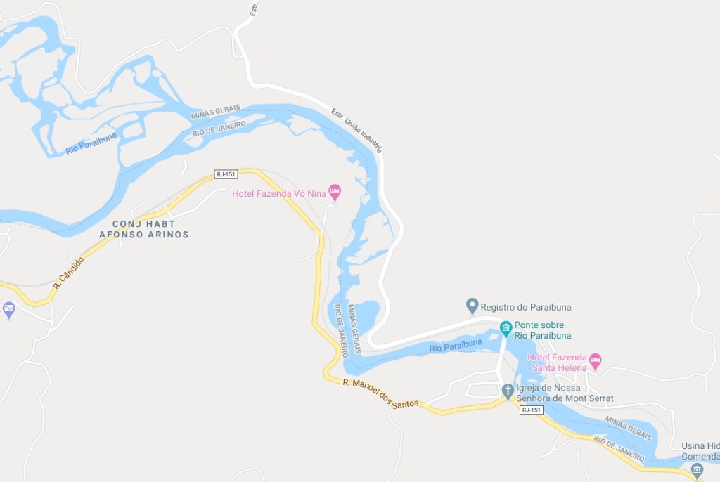
The Parahybuna (now written Paraibuna) River flows from the mountains of the Zona da Mata region in Minas Gerais towards south, where it meets the Rio Preto at the border to the state of Rio de Janeiro. Then it turns east along the same border until the confluence into the Parahyba River (now Paraíba do Sul), near Tres Rios. The Registro do Parahybuna was built in 1723 at the beginning of this borderline on the north side of the river, i.e. in Minas Gerais, but all sources state it was administrated by the Rio province. This construction – together with a bridge from the 19th century which exists still today – has made possible a new commercial road (Caminho Novo) between Minas Gerais and Rio de Janeiro.

But there is another Paraibuna River in the state of São Paulo. This one emerges near Cunha and goes west until it meets the Paraitinga River in the municipality of Paraibuna. Both rivers merge into the Paraíba do Sul River. Shortly after, near Jacareí, the bigger river turns spectacularly towards east, to cross the border to the state of Rio de Janeiro, where it meets the Paraibuna River from Minas described above.

This odd situation contributed to a pretty confusion among the researchers who looked for its post offices. The Guia do Correio do Brasil of 1856 has a Parahibuna agency in Rio de Janeiro and other one in São Paulo. The Guia Postal do Imperio (1880) lists only a Parahybuna post office in São Paulo. Nova Monteiro names a Parahibuna in the Rio Province (agency created on March 26, 1840) and another one in São Paulo. Paula Sobrinho reports a Paraibuna train station of the E.F. Dom Pedro II in Minas Gerais (installed in 1874), which is confirmed by Ralph Giesbrecht. Reinhold Koester tells us about a Parahybuna post office in São Paulo (established 1844), a second one in Rio de Janeiro (which he supposed to be that one listed in 1856) and a third one at the train station in Minas Gerais. Besides, he also mentions an office called Ponte do Paraibuna, which would be identical to Registro do Paraibuna in Rio de Janeiro. Paulo Novaes (agenciaspostais.com.br) presents three post offices almost on the same spot: Registro do Paraibuna (from 1840 until ca. 1867, closed between 1846 and 1847), Paraibuna train station (which followed from 1875 till 1886), and Monte Serrat, created 1886 on the other side of the river to substitute the former. And finally, Wittig & Wittig list three Parahybunas (in MG, RJ and SP), an additional Parahibuna in RJ (identical to a former one) and Ponte do Parahybuna, also in RJ.

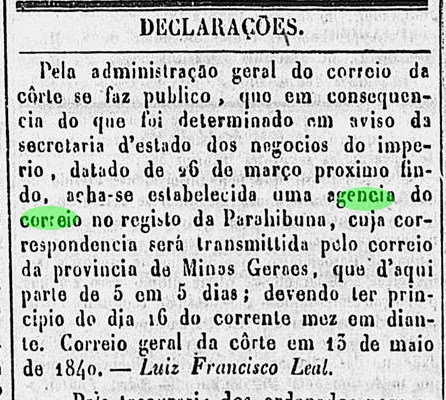
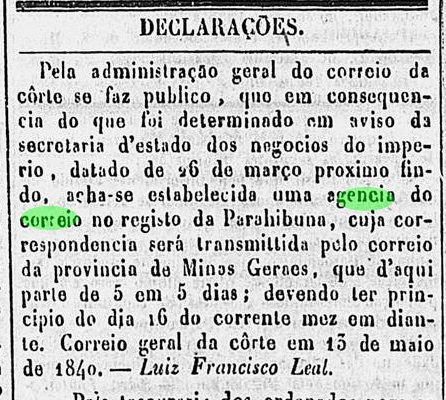
An extensive research in the local press brought us some hints to elucidate this issue. First of all, we could confirm the earliest date of the creation of a postal agency in the Registro building:


Diario do Rio de Janeiro, May 14, 1840

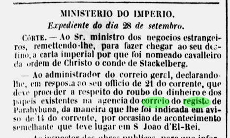
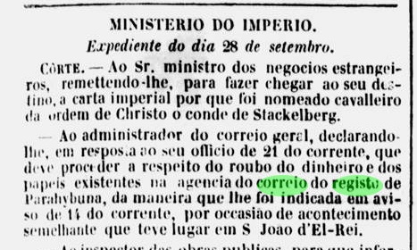
But two years later, the bridge was set in fire in the turmoil of the Liberal Revolution, and robbers stole money and documents from the post office:

Jornal do Commercio, October 10, 1842

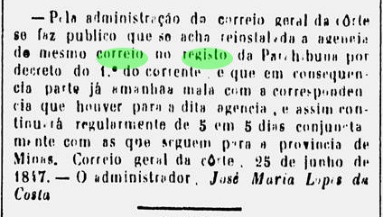
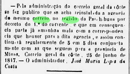
It took certainly long to rebuild the bridge, and eventually the agency had to close, for it was reopened in 1847:

Diario do Rio de Janeiro, June 26, 1847

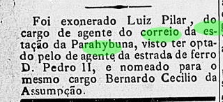
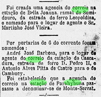
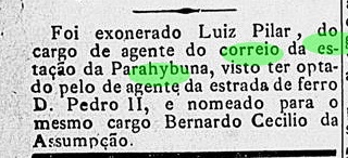
The opening of the train station just beside the Registro in 1874 eventually caused an opening of an additional post office at the station, or the Registro agency has simply moved to the station. Although Paulo Novaes claims that this office has opened already in 1875, the earliest press notice about a station post agency was found only in 1883:

Gazeta da Tarde, November 9, 1883

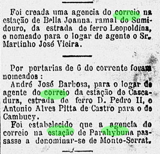
In 1886, the station post office was renamed as Monte Serrat, as stated by Novaes:

Gazeta de Noticias, November 13, 1886

However, it is still now uncertain whether the post office at the Registro has closed due to the other station office nearby, or – oddly enough – both offices kept on working side by side for a while, since the Registro office has been referred even after the train station was built:

Almanak Laemmert, 1881

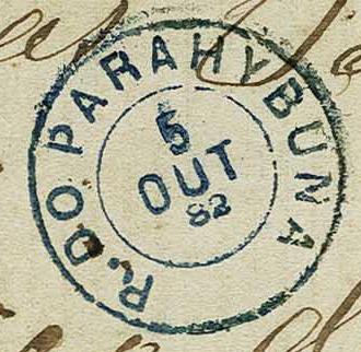
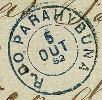
And the only known cancellation from there (RRJ-3930a, Corinphila auctions, Switzerland) also brings a mystery to unravel:

RRJ-3930a, Corinphila Zurich, Auction 237

Is the first letter a real R, or just a P which was turned to an R by hand? And the date of 1882 clearly contradicts Novaes, who indicates the closing of the Registro post office around 1867.

Google Maps

Der Parahybuna (heute Paraibuna geschrieben) ist ein Fluss, der aus dem Gebirge der Zona da Mata in Minas Gerais entspringt. Von dort fließt er in Richtung Süden, bis zur Grenze zu Rio de Janeiro, wo er den Rio Preto empfängt. Dann fließt er weiter entlang der Grenze, bis zu seiner Einmündung in den Fluss Parahyba do Sul (heute: Paraíba), nahe der Stadt Três Rios.

Der Registro do Parahybuna wurde 1723 am Anfang dieser Grenzstrecke am Nordufer, also in Minas Gerais, gebaut, aber alle Quellen behaupten, dass der Registro von Rio aus verwaltet wurde. Wie es dem auch sei, dieser Bau – zusammen mit einer im 19. Jahrhundert entstandenen  Brücke, die bis heute existiert – hat einen neuen Handelsweg (Caminho Novo) zwischen Minas Gerais und Rio de Janeiro ermöglicht.

Doch gibt es einen zweiten Paraibuna-Fluss im Staat São Paulo. Dieser entspringt nah am Städtchen Cunha, fließt dann westwärts, bis er den Paraitinga-Fluss im Gebiet des heutigen Paraibuna-Município trifft. Nach dieser Mündung heißt der Fluss Paraíba do Sul, und kurz darauf, bei Jacareí, macht dieser groß gewordener Fluss eine spektakuläre Kurve nach Osten, um die Grenze zu Rio zu überqueren, wo er danach den anderen, oben beschriebenen Paraibuna-Fluss empfängt.

Diese etwas vertrackte Lage verursachte eine schöne Konfusion unter den Forschern auf deren Suche nach Postämtern. Der Guia do Correio do Brasil von 1856 hat ein Parahibuna-Postamt in Rio de Janeiro und ein anderes in São Paulo. Der Guia Postal do Imperio (1880) nennt lediglich ein Parahybuna-Postamt in São Paulo. Nova Monteiro listete einmal Parahibuna in der Rio Provinz (Postamt am 26. März 1840 entstanden) und einmal in São Paulo. Paula Sobrinho berichtet über einen Bahnhof Paraibuna der E.F. Dom Pedro II in Minas Gerais (in 1874 eingeweiht), was durch Ralph Giesbrecht bestätigt wird. Reinhold Koester erzählt uns über ein Parahybuna-Postamt in São Paulo (entstanden in 1844), ein weiteres in Rio de Janeiro (das er glaubt, identisch zu sein mit dem im GCB/1856 erwähnt) und ein drittes an einem Bahnhof in Minas Gerais. Dazu gab er eine Agentur zur Protokoll, die Ponte do Paraibuna hieß, und identisch mit Registro do Paraibuna in Rio de Janeiro sein sollte. Paulo Novaes (agenciaspostais.com.br) stellt gleich drei Postämter fast im gleichen Ort: Registro do Paraibuna (von 1840 bis ca. 1867, aber zwischen 1846 und 1847 geschlossen), Bahnhof Paraibuna (als Nachfolge-Postamt,von 1875 bis 1886), und Monte Serrat, in 1886 auf der Südseite des Flusses gegründet, um das Bahnhofspostamt zu ersetzen. Zu guter Letzt, Wittig & Wittig listen drei Parahybunas (in MG, RJ und SP), ein zusätzliches Parahibuna in RJ (das identisch mit dem Rio-Parahybuna sein soll) und Ponte do Parahybuna, auch in RJ.

Nach einer langen Recherche in der lokalen Presse kamen einige Daten zu Tage, die zur Klärung des Falls beitragen können. Zunächst können wir das früheste Datum zur Postamtentstehung im Registro-Gebäude bestätigen:

Diario do Rio de Janeiro, 14.05.1840

Schon zwei Jahre später wurde die Brücke im Aufruhr der Liberalen Revolution in Brand gesetzt, und Diebe haben Geld und Dokumente aus dem Postamt gestohlen:

Jornal do Commercio, 10.10.1842

Der Wiederaufbau der Brücke hat sicherlich lange gebraucht. Zwischendurch war das Postamt geschlossen, denn eine Wiedereröffnung fand in 1847 statt:

Diario do Rio de Janeiro, 26.06.1847

Der Bau der Eisenbahnstation gleich neben dem Registro in 1874 hat wahrscheinlich ein weiteres Postamt verursacht. Auch wenn Paulo Novaes das Eröffnungsjahr 1875 nennt, die bisher früheste Pressenotiz darüber stammt aus dem Jahr 1883:

Gazeta da Tarde, 09.11.1883

In 1886 wurde dieses Bahnpostamt in Monte Serrat umbenannt, wie Novaes angegeben hatte:

Gazeta de Noticias, 13.11.1886

Dennoch ist es bisher unklar, ob die Agentur im Registro wegen des neuen Bahnhofspostamtes geschlossen wurde (und, wenn ja, wann genau?), oder ob beide Büros für eine Übergangszeit parallel in Betrieb waren. Denn auch einige Jahre nach der Ankunft des Bahnhof wurde der Registro als Postadresse erwähnt:

Almanak Laemmert, 1881

Und auch der einzige überlieferte Registro-Stempel (RRJ-3930a, Corinphila, Zürich) bringt gleich einen Rätsel mit:

Corinphila, Zürich, Auktion 237

Ist der erste Buchstabe wirklich ein R, oder einfach ein P, der per Hand zu R umgeschreiben wurde? Und das Datum (1882) steht in direkter Widerspruch zu Novaes, der „ca.1867“ für die Schliessung des Registro-Postamts angibt.

Categories
Carimbologia Q-R

Registro das Flores, Rio de Janeiro (RRJ-2153)

Mapa Postal, 1888 (agenciaspostais.com.br)

Text updated on October 19, 2026

In the Brazilian Empire, a ‘Registro’ was a tax authority stationed along major routes – be they rivers or footpaths – and tasked with collecting the statutory transport tax on goods such as agricultural and mining products, as well as on slaves.

On routes with heavy goods traffic, the demand for supervisory staff, as well as for their accommodation and meals, was correspondingly higher. This led to the emergence of many settlements. The most important of these is probably Registro, which has been an independent municipality in the state of São Paulo since 1944.

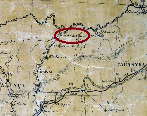
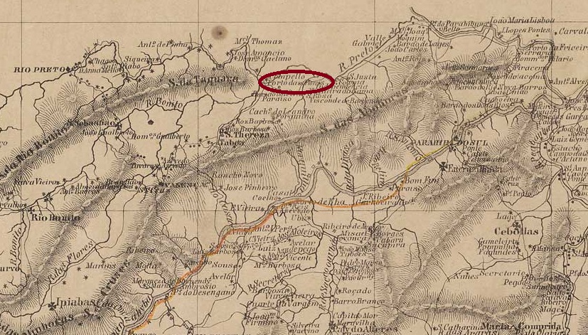
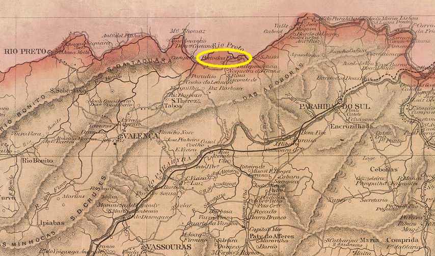
Registro das Flores was built at the mouth of the river of the same name where it flows into the Rio Preto near Valença, 180 km north of the capital, Rio de Janeiro. The town was then still called Porto das Flores, but was renamed Manuel Duarte in 1943 and is now a district of the municipality of Rio das Flores.

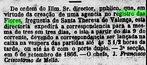
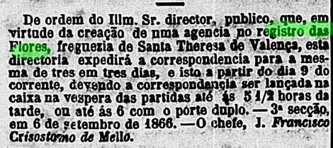
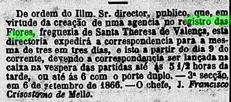
In September 1866, a post office was established, but it was closed by 1879 as it was not listed in the Imperial Postal Guide (Guia Postal do Império, Rio de Janeiro, 1880).

Correio Mercantil, September 7, 1866

To date, no imperial postmark from Registro das Flores has been found.

Bellegard-Niemeyer: Carta Corographica da Provincia do Rio de Janeiro, 1867

Texto atualizado em 19 de outubro de 2026

No Império do Brasil, um registro era uma autoridade fiscal encarregada, em rotas importantes — fossem rios ou trilhas —, de cobrar o imposto legal de transporte sobre mercadorias, como produtos agrícolas ou minerados, mas também sobre escravos.

Em rotas com intenso tráfego de mercadorias, a demanda por pessoal de fiscalização, bem como por alojamento e alimentação para esses funcionários, era correspondentemente maior. Isso levou ao surgimento de muitos povoados. O mais importante deles é, sem dúvida, Registro, que desde 1944 é um município autônomo no estado de São Paulo.

Registro das Flores foi construída na foz do rio de mesmo nome, onde este deságua no Rio Preto, próximo a Valença, 180 km ao norte da capital, Rio de Janeiro. Na época, o local ainda se chamava Porto das Flores, mas foi renomeado como Manuel Duarte em 1943 e hoje é um distrito do município de Rio das Flores.

Em setembro de 1866, foi inaugurada uma agência dos correios, que, no entanto, foi fechada em 1879, pois não constava no Guia Postal do Império (Rio de Janeiro, 1880).

Correio Mercantil, 7 de setembro de 1866

Até o momento, não foi encontrado nenhum carimbo postal imperial de Registro das Flores.

Colton & Colton: Provincia do Rio de Janeiro, 1866

Textaktualisierung am 19. Oktober 2026

Im Kaiserreich Brasilien war ein Registro eine fiskalische Behörde, die auf wichtigen Routen – seien es Flüsse oder Trampelpfade – damit beauftragt war, die gesetzliche Transportsteuer auf Waren wie landwirtschaftliche oder Bergbauprodukte, aber auch auf Sklaven einzukassieren.

Auf Wegen mit regem Warenverkehr war die Nachfrage nach Aufsichtspersonal sowie dessen Unterkunft und Verpflegung entsprechend höher. Dadurch entstanden viele Siedlungen. Die wichtigste davon ist wohl Registro, das seit 1944 ein eigenständiger Município im Bundesstaat São Paulo ist.

Registro das Flores wurde an der Mündung des gleichnamigen Flusses in den Rio Preto nahe Valença, 180 km nördlich der Hauptstadt Rio de Janeiro erbaut. Der Ort hieß damals noch Porto das Flores, wurde aber 1943 in Manuel Duarte umbenannt und ist heute ein Distrikt der Gemeinde Rio das Flores.

Im September 1866 wurde ein Postamt ins Leben gerufen, das jedoch bis 1879 geschlossen wurde, da es nicht im kaiserlichen Postführer (Guia Postal do Império, Rio de Janeiro, 1880) aufgeführt wurde.

Correio Mercantil, 7. September 1866

Bisher konnte kein kaiserlicher Poststempel aus Registro das Flores gefunden werden.

Categories
Carimbologia Q-R

Regeneração, Piauí (RPI-0140)

Atlas do Imperio do Brasil, 1868

Text updated on October 19, 2026

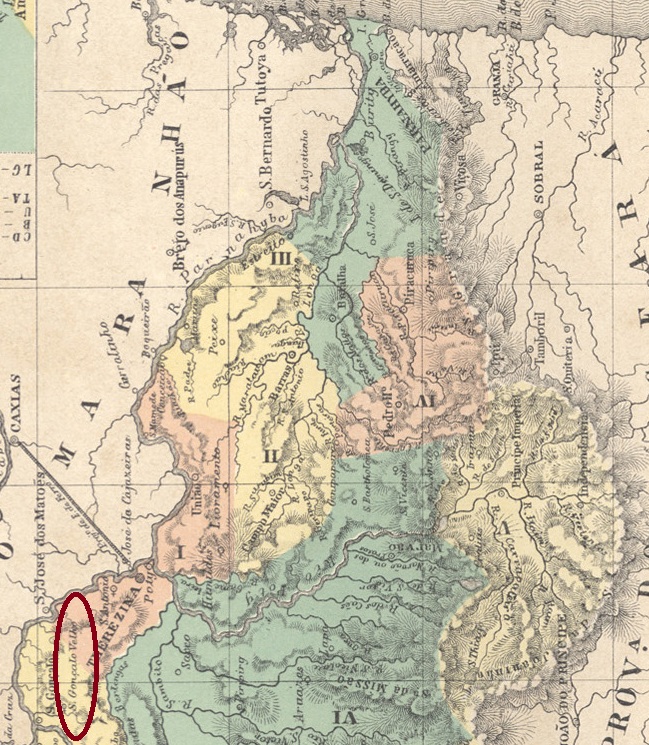
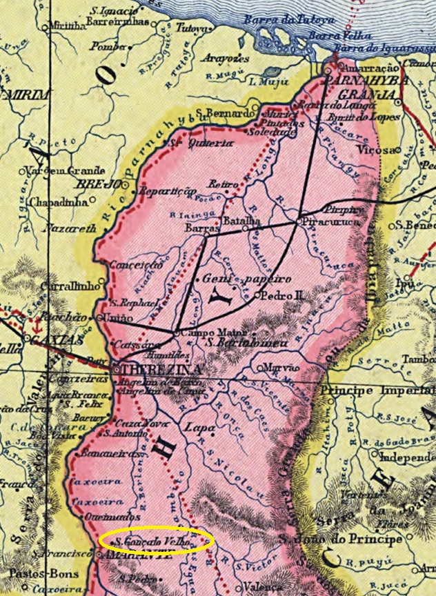
Other names: São Gonçalo, São Gonçalo Velho, S. Gonçalo da Regeneração

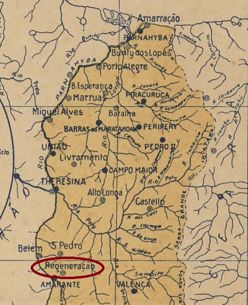
Regeneração is situated on the north bank of the Rio Mulato (formerly the Riacho do Coco) and has a long history that is directly linked to the present-day town of Amarante. The town lies 140 km south of the provincial capital, Teresina. In September 1801, it became the parish of S. Gonçalo do Amarante, which belonged to the Vila de Oeiras. In July 1832, it was itself elevated to the status of a vila. From September 1851, a large part of the population, together with the local administration, relocated 20 kilometres further west, near the River Parnaíba. The new settlement was named Amarante, whilst the old town was renamed São Gonçalo Velho in August 1860 and S. Gonçalo da Regeneração in August 1871. Both municipalities shared the same patron saint: the Portuguese Gonçalo de Amarante, who is venerated as a saint in both Portugal and Brazil, although his canonisation process remains unfinished to this day.

Regeneração became a ‘vila’ within its own municipality in June 1875, but lost this status in June 1931 when it became part of the district of Amarante. Since February 1934, Regeneração has once again been a municipality, and since March 1938, a town.

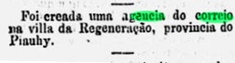
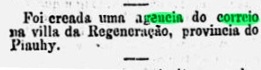
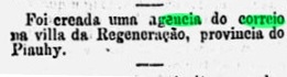
The biennial report for 1883–1884 by the President of the Province of Piauhy first mentioned a postal route between Amarante and Regeneração, although a post office in Regeneração was not established until April 1887, as reported by the press in Rio de Janeiro:

O Paiz/RJ, 30 April 1887

To date, no imperial postmark from Regeneração has been found.

Carta da Republica dos Estados Unidos do Brazil, 1892

Texto atualizado em 19 de outubro de 2026

Outros nomes: São Gonçalo, São Gonçalo Velho, S. Gonçalo da Regeneração

Regeneração fica na margem norte do Rio Mulato (antigo Riacho do Coco) e possui uma longa história intimamente ligada à atual cidade de Amarante. A cidade fica a 140 km ao sul de Teresina, capital da província. Em setembro de 1801, tornou-se a paróquia de S. Gonçalo do Amarante, que pertencia à Vila de Oeiras. Em julho de 1832, ganhou o status de vila. A partir de setembro de 1851, grande parte da população, juntamente com a administração, mudou-se 20 quilômetros mais a oeste, nas proximidades do rio Parnaíba. O novo povoado recebeu o nome de Amarante, enquanto o antigo local foi renomeado como São Gonçalo Velho em agosto de 1860 e, em agosto de 1871, como São Gonçalo da Regeneração. Ambas localidades tinham o mesmo padroeiro: o português Gonçalo de Amarante, venerado como santo tanto em Portugal quanto no Brasil, embora seu processo de canonização ainda não tenha sido concluído até hoje.

Regeneração tornou-se vila em seu próprio município em junho de 1875, mas perdeu esse status em junho de 1931, quando passou a ser distrito de Amarante. Desde fevereiro de 1934, Regeneração é novamente um município e, desde março de 1938, uma cidade.

No relatório bienal de 1883–1884 do presidente da província do Piauí, foi mencionada pela primeira vez uma linha postal entre Amarante e Regeneração, embora só em abril de 1887 tenha sido criada uma agência dos correios em Regeneração, conforme noticiou a imprensa do Rio de Janeiro:

O Paiz/RJ, 30/04/1887

Até o momento, não foi encontrado nenhum carimbo postal imperial de Regeneração.

Arthur D. Ribeiro: Estado do Piauhy, 1924

Textaktualisierung am 19. Oktober 2026

Andere Namen: São Gonçalo, São Gonçalo Velho, S. Gonçalo da Regeneração

Regeneração liegt am Nordufer des Rio Mulato (früher Riacho do Coco) und hat eine lange Geschichte, die unmittelbar mit der heutigen Stadt Amarante verbunden ist. Die Stadt liegt 140 km südlich der Provinzhauptstadt Teresina. Im September 1801 wurde sie zur Pfarrei S. Gonçalo do Amarante, die zur Vila de Oeiras gehörte. Im Juli 1832 stieg sie selbst zur Vila auf. Ab September 1851 siedelte ein großer Teil der Bevölkerung nebst Verwaltung 20 Kilometer weiter westlich in der Nähe des Parnaíba-Flusses um. Die Neusiedlung wurde Amarante genannt, während der alte Ort im August 1860 zu São Gonçalo Velho und im August 1871 zu S. Gonçalo da Regeneração umbenannt wurde. Beide Gemeinden hatten denselben Schutzheiligen: den Portugiesen Gonçalo de Amarante, der sowohl in Portugal als auch in Brasilien als Heiliger verehrt wird, obwohl sein Kanonisationsprozess bis heute nicht abgeschlossen ist.

Regeneração wurde im Juni 1875 zur Vila im eigenen Município, verlor diesen Status jedoch im Juni 1931, als sie zum Distrito von Amarante wurde. Seit Februar 1934 ist Regeneração erneut ein Município und seit März 1938 eine Stadt.

Im zweijährlichen Bericht für 1883–1884 des Präsidenten der Provinz Piauhy wurde eine Postlinie zwischen Amarante und Regeneração erstmals erwähnt, obwohl erst im April 1887 ein Postamt in Regeneração entstand, wie die Presse aus Rio de Janeiro meldete:

O Paiz/RJ, 30.04.1887

Bisher konnte kein kaiserlicher Poststempel aus Regeneração gefunden werden.

Categories
Carimbologia Q-R

Redempção, São Paulo (RSP-1060)

Monteiro e Oliveira: Mapa do Estado de São Paulo, 1927

Text updated on 18 October 2026

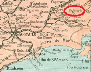
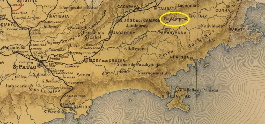
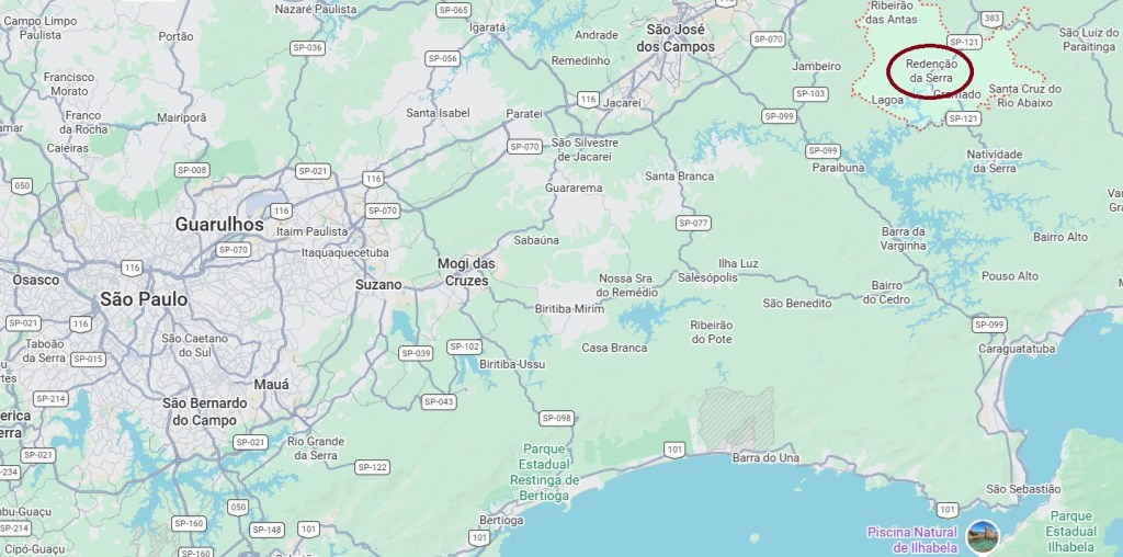
The former village of Redempção was situated near the northern bank of the Paraitinga River, some 160 kilometres east of the provincial capital, São Paulo. It emerged from the parish of Santa Cruz de Paiolinho, which had belonged to Taubaté until 1877, when it became independent. Thereafter, local leaders campaigned vigorously for the gradual emancipation of the slaves. In May 1934, Redenção (the current spelling) was downgraded to a district of the Município de Jambeiro, but regained its political autonomy in January 1936. Since 1944, the small municipality has been known as Redenção da Serra and takes great pride in the fact that it freed all its slaves as early as February 1888 – three months ahead of the official date in the Empire. Nevertheless, the town had to relocate in the 1970s, as did its neighbour Natividade da Serra, as the original settlements were flooded by the huge dam on the Paraibuna and Paraitinga rivers.

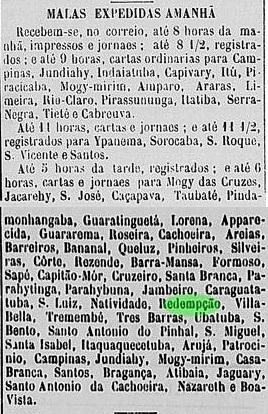
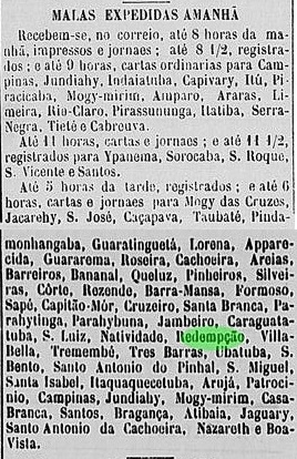
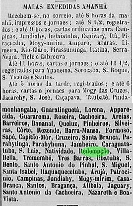
As can be seen from the directory of imperial post offices (Tabella das Agências do Correio do Império, Rio de Janeiro, 1885), there had been a post office there since 1878. The earliest known report on the local postal service in the regional press dates from 1879:

Jornal da Tarde, August 12, 1879

The first postmark was the French type RSP-1060a (José A. Junges collection), bearing the inscription ‘REDEMPÇÃO’ at the top and a small star in brackets at the bottom, with the date inside. Used at least until 1890. This was followed by RSP-1060b (collection of José A. Junges), which is very similar to its predecessor but has slightly larger letters. The bracket at the bottom no longer contains the star. Dates recorded to date: 1889 to 1896.

J.M. Ribeiro Lisboa: Provincia de São Paulo, 1884

Atualização do texto em 18 de outubro de 2026

A antiga localidade de Redempção ficava próxima à margem norte do rio Paraitinga, a cerca de 160 quilômetros a leste da capital provincial, São Paulo. Ela surgiu da paróquia de Santa Cruz de Paiolinho, que pertenceu a Taubaté até 1877, antes de se tornar autônoma. Posteriormente, os líderes locais empenharam-se fortemente pela libertação gradual dos escravos. Em maio de 1934, Redenção (grafia atual) foi rebaixada a distrito do município de Jambeiro, mas recuperou sua autonomia política em janeiro de 1936. Desde 1944, o pequeno município chama-se Redenção da Serra e tem muito orgulho de ter libertado todos os escravos já em fevereiro de 1888 — ou seja, três meses antes da data oficial no Império. No entanto, na década de 1970, a localidade teve que se mudar, assim como sua vizinha Natividade da Serra, pois os assentamentos originais foram inundados pela gigantesca barragem dos rios Paraibuna e Paraitinga.

Conforme consta da Tabela das Agências do Correio do Império (Rio de Janeiro, 1885), havia uma agência dos Correios no local desde 1878. A notícia mais antiga até então sobre o serviço postal local na imprensa regional data do ano de 1879:

Jornal da Tarde, August 12, 1879

O primeiro carimbo postal foi o modelo francês RSP-1060a (coleção de José A. Junges), com a inscrição “REDEMPÇÃO” na parte superior e uma pequena estrela entre parênteses na parte inferior, além da data no interior. Utilizado pelo menos até 1890. Seguiu-se o RSP-1060b (coleção de José A. Junges), muito semelhante ao seu antecessor, mas com letras um pouco maiores. O parêntese na parte inferior perdeu a estrela. Dados até o momento: 1889 a 1896.

Google Maps

Textaktualisierung am 18. Oktober 2026

Die ehemalige Ortschaft Redempção lag nahe dem Nordufer des Paraitinga, rund 160 Kilometer östlich der Provinzhauptstadt São Paulo. Sie ging aus der Pfarrei Santa Cruz de Paiolinho hervor, die bis 1877 zu Taubaté gehörte, bevor sie sich selbstständig machte. Danach setzten sich die Lokalführer stark für die allmähliche Befreiung der Sklaven ein. Im Mai 1934 wurde Redenção (aktuelle Schreibweise) zu einem Distrikt des Município de Jambeiro herabgestuft, erlangte jedoch im Januar 1936 die politische Eigenständigkeit wieder. Seit 1944 heißt der kleine Município Redenção da Serra und ist recht stolz darauf, bereits im Februar 1888 – und damit drei Monate vor dem offiziellen Termin im Kaiserreich – alle Sklaven freigelassen zu haben. Dennoch musste der Ort in den Siebzigerjahren umziehen, ebenso wie sein Nachbar Natividade da Serra, da die ursprünglichen Siedlungen durch den riesigen Staudamm der Flüsse Paraibuna und Paraitinga überflutet wurden.

Wie aus dem Verzeichnis der kaiserlichen Postämter (Tabella das Agências do Correio do Império, Rio de Janeiro, 1885) hervorgeht, gab es dort ein Postamt seit 1878. Die bisher älteste Meldung über das lokale Postwesen in der regionalen Presse stammt aus dem Jahr 1879:

Jornal da Tarde, 12. August 1879

Der erste Poststempel war der französische Typ RSP-1060a (Samml. José A. Junges), mit der Inschrift REDEMPÇÃO oben und dem kleinen Stern in Klammern unten, dazu das Datum im Inneren. Verwendet mindestens bis 1890. Es folgte RSP-1060b (Samml. José A. Junges), der seinem Vorgänger sehr ähnlich ist, aber etwas größere Buchstaben hat. Die Klammer unten hat den Stern verloren. Bisherige Daten: 1889 bis 1896.

Categories
Carimbologia Q-R

Redempção, Ceará (RCE-0267)

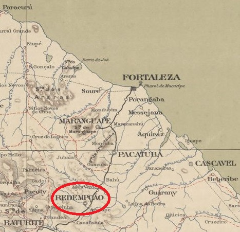
Serviço Geológico e Mineralógico do Brasil, 1910

Text update on October 16, 2026

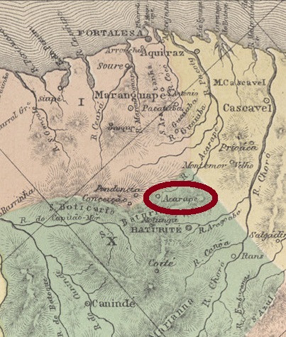
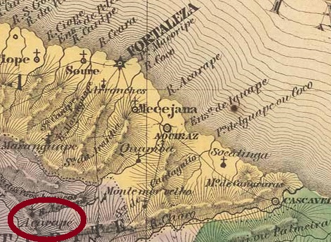
See also Acarape (ACE-0010)

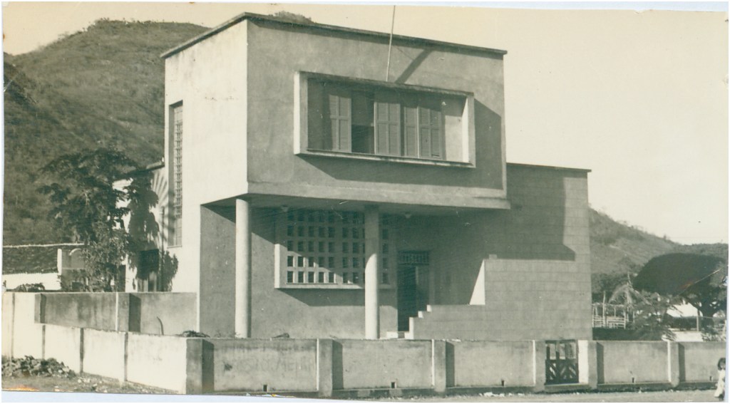
The Freguesia of N. Sa. da Conceição do Acarape was founded in March 1842 in the Villa of Baturité and was located on the north bank of the Acarape River, 65 km south of the provincial capital Fortaleza. The word Acarape comes from the Tupi language and means way of the Acarás (a fish of the Cichlidae family). In December 1868, the place was elevated to the status of a villa, and since August 1889 it has been the town of Redempção (now spelled Redenção). The renaming is a reminder that this was the first locality in Brazil to abolish slavery. This took place on 1 January 1883, more than five years before the rest of the country.

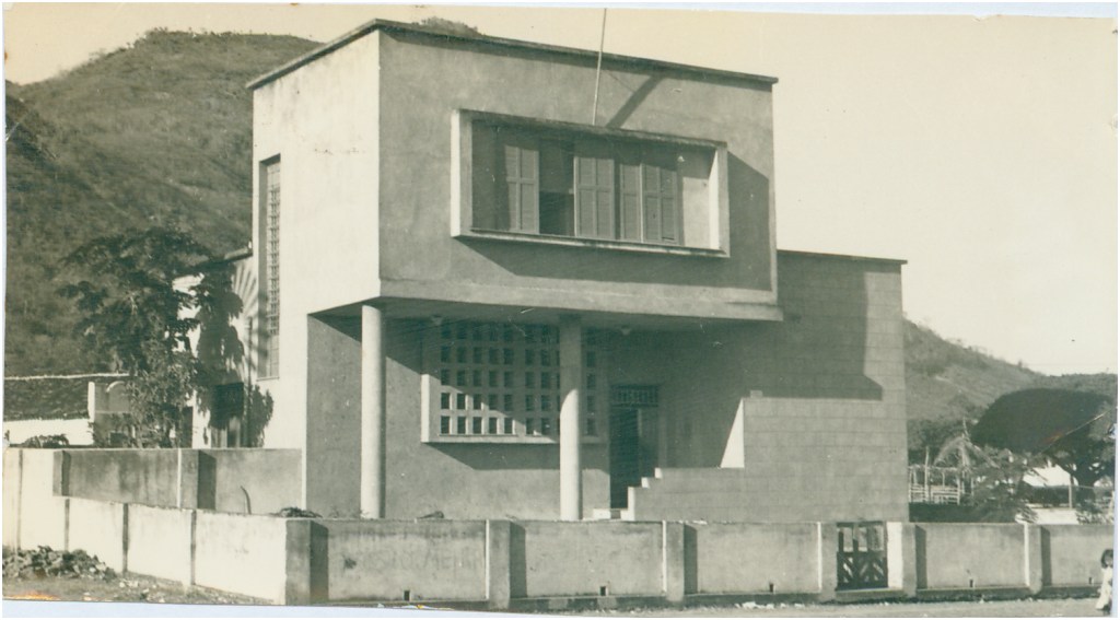
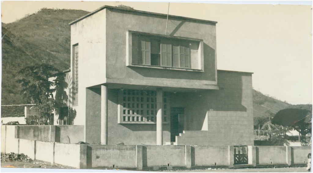
Redenção post office (ca. 1960, IBGE)

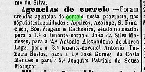
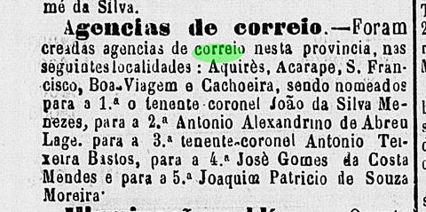
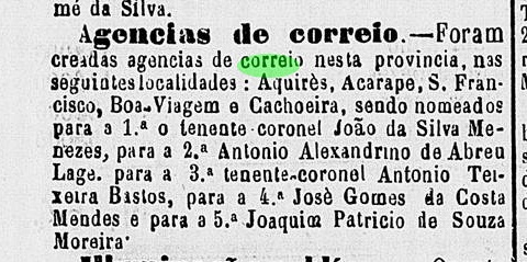
The local post office was established in the first half of 1872, according to the regional press:

Cearense, July 4, 1872

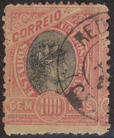
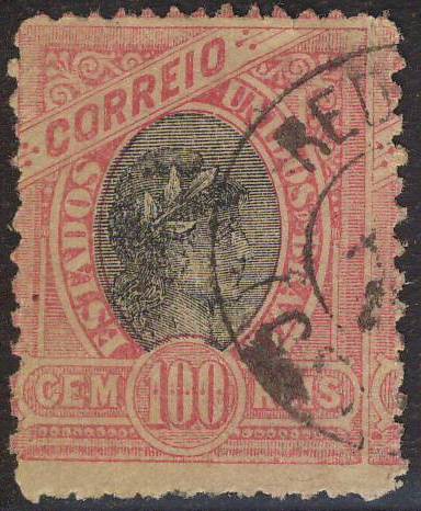
Meanwhile, two postmarks featuring Redempção have been found for the 19th century: RCE-0267a (Coll. FM) and RCE-0267b (image from the Internet):

RCE-0267a (FM) 1896
RCE-0267b (EB) 1890-1892

For cancellations from Acarape see ACE-0010

Atlas do Imperio do Brazil, 1868

Texto atualizado em 16 de outubro de 2026

Veja também Acarape (ACE-0010)

A freguesia de N. Sa. da Conceição do Acarape foi fundada em março de 1842 na Vila de Baturité e estava localizada na margem norte do rio Acarape, 65 km ao sul da capital da província, Fortaleza. A palavra Acarape vem da língua tupi e significa caminho dos Acarás (um peixe da família Cichlidae). Em dezembro de 1868, o local foi elevado a vila, e desde agosto de 1889 é a cidade de Redempção (hoje escrito Redenção). A renomeação lembra que esta foi a primeira localidade no Brasil a abolir a escravidão. Isto ocorreu em 1 de janeiro de 1883, mais de cinco anos antes do resto do país.

Agência postal de Redenção (ca. 1960, IBGE)

Os correios locais foram estabelecidos no primeiro semestre de 1872, de acordo com a imprensa regional:

Cearense, 4 de julho de 1872

Entrementes, dois carimbos foram encontrados com o topônimo Redempção para o século 19: RCE-0267a (Col. FM) e RCM-0267b (imagem da internet)

RCE-0267a (FM) 1896
RCE-0267b (EB) 1890-1892

Para carimbos com Acarape veja ACE-0010.

Villiers de lÌle Adam: Carta (…) da Provincia do Ceara, 1849

Textaktualisierung am 16. Oktober 2026

Siehe auch Acarape (ACE-0010)

Die Freguesia von N. Sa. da Conceição do Acarape wurde im März 1842 in der Villa von Baturité gegründet und lag am Nordufer des Flusses Acarape, 65 km südlich der Provinzhauptstadt Fortaleza entfernt. Das Wort Acarape kommt aus der Tupi-Sprache und bedeutet Weg der Acarás (ein Fisch der Familie Cichlidae). Im Dezember 1868 wurde der Ort zur Villa erhoben, und seit August 1889 ist es die Stadt Redempção (heute Redenção geschrieben). Die Umbenennung erinnert daran, dass diese die erste Ortschaft Brasiliens war, die die Sklaverei abgeschafft hat. Dies fand am 1.1.1883 statt, und damit gut fünf Jahre vor dem Rest des Landes.

Postamt Redenção (ca. 1960, IBGE)

Das örtliche Postamt entstand in der ersten Hälfte des Jahres 1872, wie die Regionalpresse berichtet:
Cearense, 04.07.1872

Inzwischen fanden sich zwei Posttempel mit dem Ortsnamen Redempção im 19. Jahrhundert: RCE-0267a (Samml. FM) und RCE-0267b (Abb. aus dem Internet):
RCE-0267a (FM) 1896
RCE-0267b (EB) 1890-1892

Für Poststempel mit Acarape siehe ACE-0010.

Categories
Carimbologia Q-R

Recreio (train station/Estação/Bahnhof), Minas Gerais (RMG-3575)

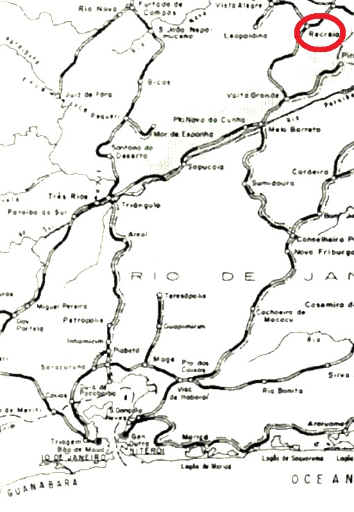
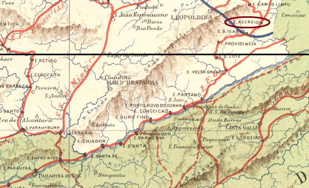
E. F. Leopoldina, 1898

Text update on October 15, 2026

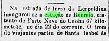
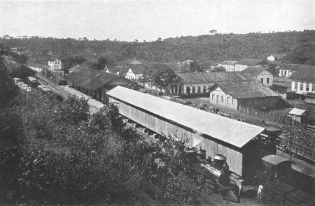
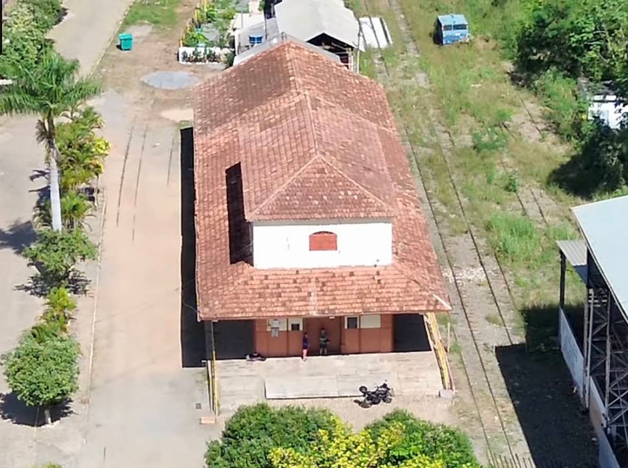
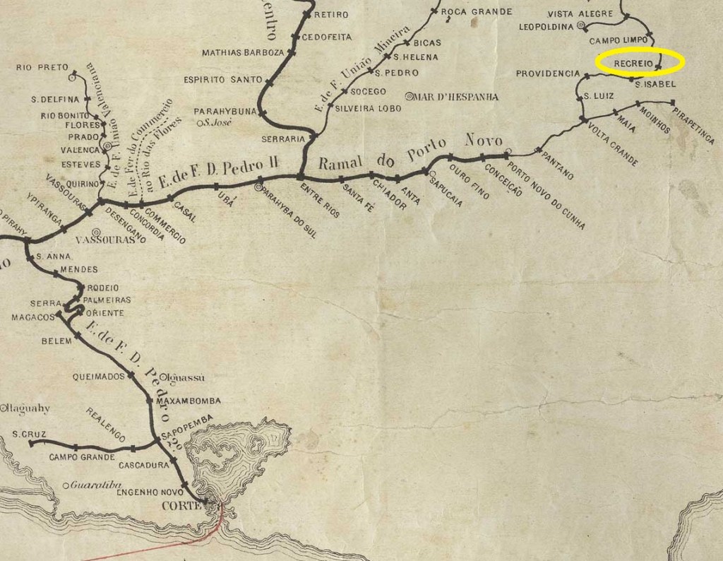
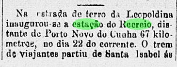
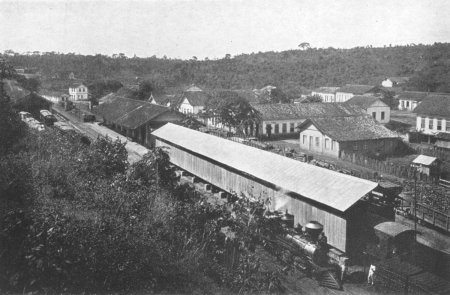
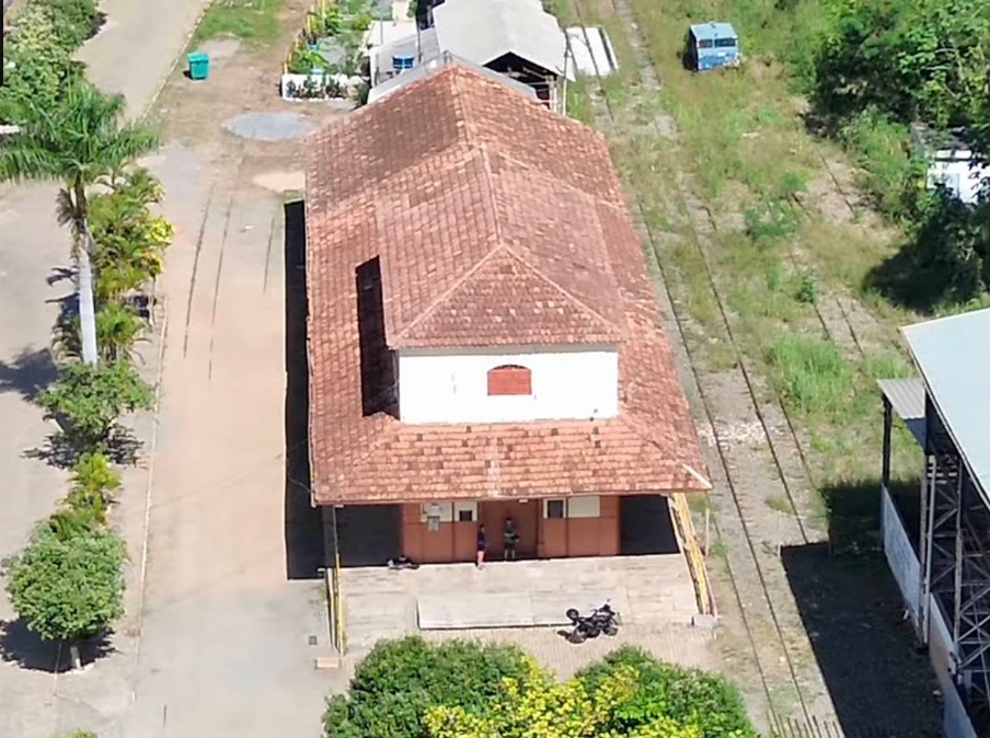
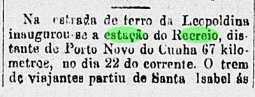
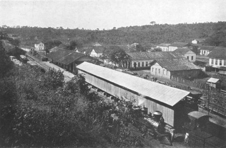
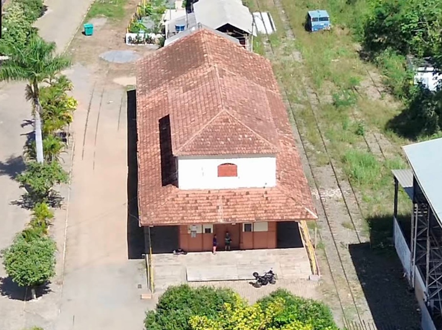
Recreio was an E.F. Leopoldina train station of the Muriahé branch, which from 1885 on should link the Manhuassu Line to São Paulo de Muriahé, in the province of Minas Gerais. From 1975 to 1996 it belonged to the Rede Ferroviária Federal. Then it went out of service, only the railroad tracks survived. The station was inaugurated in May 1876, as noticed by the press from Rio:

Gazeta de Notícias, Rio de Janeiro, May 25, 1876
In 1913 (Photo on estacoesferroviarias.com.br)
In May 2026 (Photo: Marcos B. Barroso, on Google Maps)

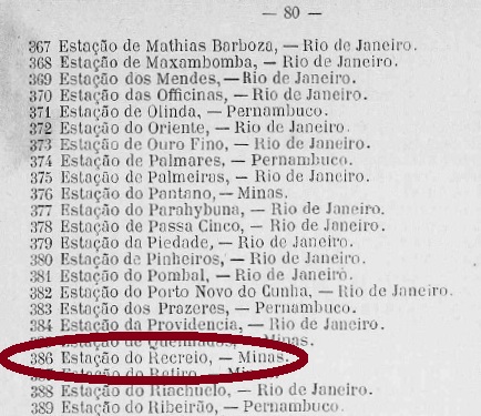
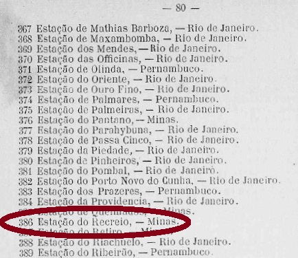
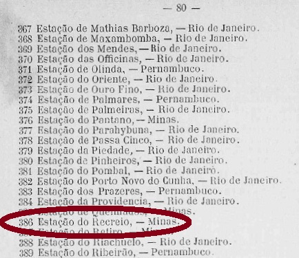
There is a controversy about when the station post office was created. Paula Sobrinho (História Postal de Minas Gerais, Belo Horizonte, 1997) states it took place on July 15, 1881, whereas the Guia Postal do Império of 1880 cites a post office at the Recreio station with agency number 386, which would lead to an earlier date:

Guia Postal do Imperio, 1880

This second hypothesis is corroborated by the presence of two early cancels and another press notice. The first cancel would be RMG-3575a (Coll. Dieter Kerkhoff), which corresponds to # 1429 by Paulo Ayres, and is found on many copies of the Dom Pedro issues from 1866 until 1878:

RMG-3575a (P.A. 1429) 1877ff

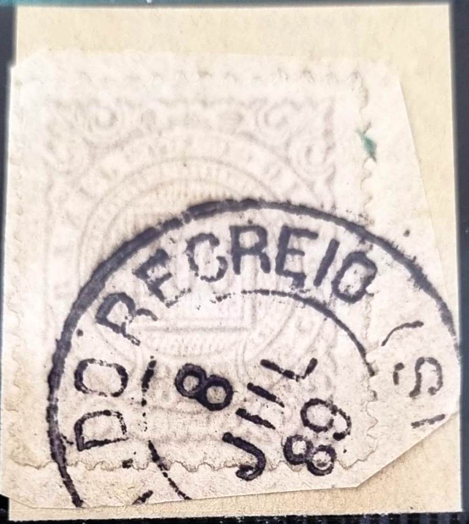
The second early cancel from the Recreio station, RMG-3575b (Coll. José A. Junges) has a double circle with a RECREIO inscription (above) and the date inside. On the Junges’ copy (100 Réis from the D. Pedro issue of 1877) the date was August 26, 1881, one month later than Paula Sobrinho’s given date for the office creation. Since it is quite unlikely the use of two different postal cancels at the same time in such a small office, this would be an argument for an earlier start date of this post office.

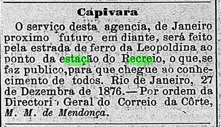
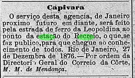
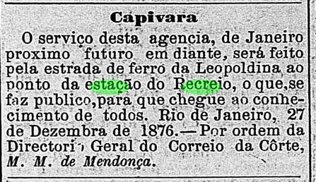
Besides, this press notice also reinforces the hypothesis of the earlier date:

O Globo, Rio de Janeiro, January 9, 1877

“From next January on, the postal services of the Capivara agency will proceed through the Recreio station of the Leopoldina Railway. This is herewith made public. Rio de Janeiro, December 27, 1876. On behalf of the General Directory of the Imperial Mail, (signed) M. M. de Mendonça.”

Considering that the postal traffic to and from the Capivara agency (now: Palma, established December 1873) was made from January 1877 on through the Recreio station, it is quite probable that the station office was created soon afterwards.

Four other Recreio cancels follow: RMG-3575c (Coll. José A. Junges) was found in blue on D. Pedro issues of 1884 (also in bisect). It only consists of a double circle with the inscription RECREIO (above). No date provided. RMG-3575d (Coll. José A. Junges) is similar to the former, but now found in black, with dates between 1884 and 1886. On RMG-3575e (Coll. José A. Junges), the date disappears again and the inner circle is completely blackened. Found on a 1885 issue. On RMG-3575f (Coll. Márcio Protzner) the double circle is somewhat larger, the inscriptions are EST. DO RECREIO above, (MINAS) below. Found until now with dates between 1889 and 1895.

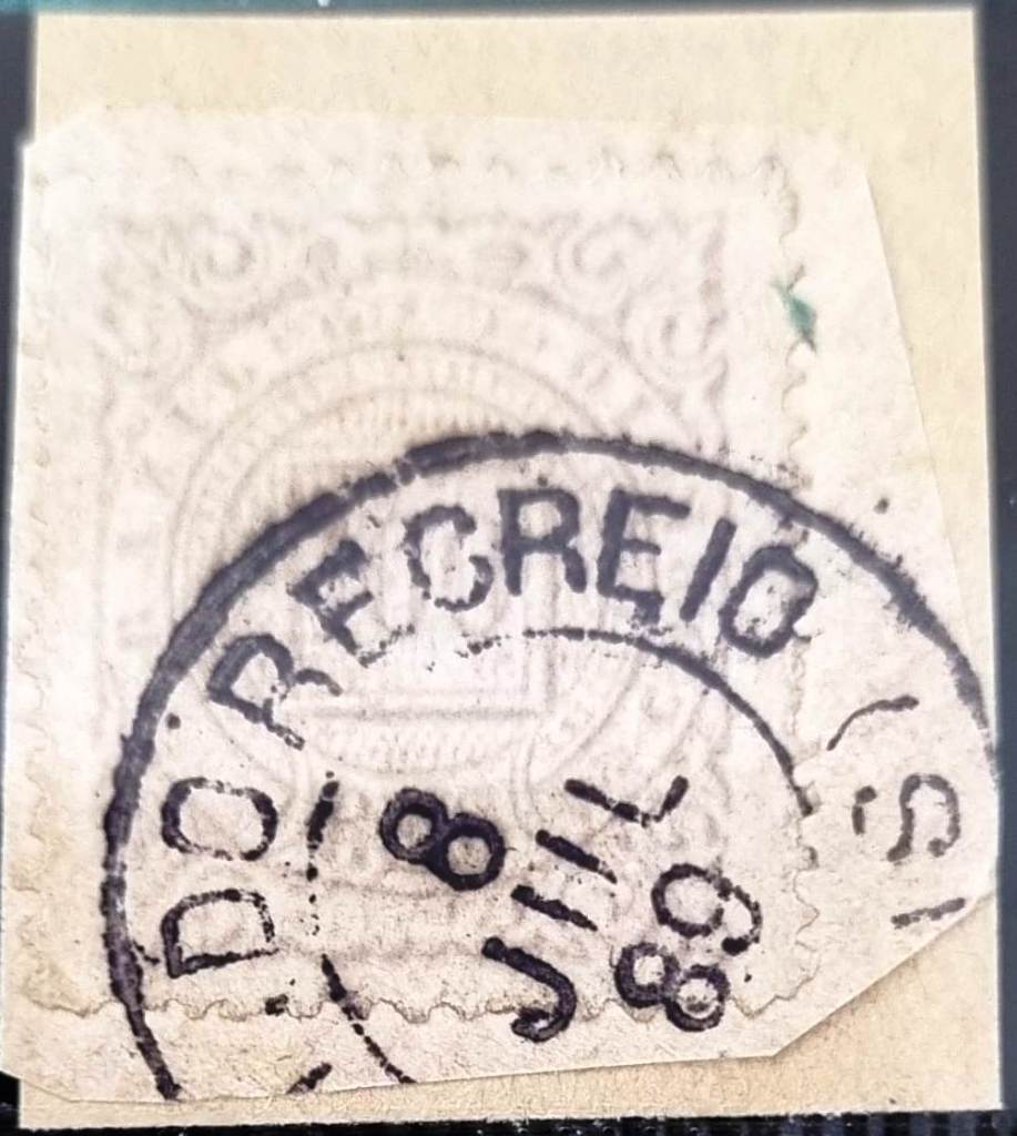
In the meantime, another postmark from this station has been recorded: RMG-3575g (Fig. Márcio Duarte) was found bearing a date from the end of the Empire:

RMG-3575g (MD) 1889
Estações (…) de São Paulo, Rio de Janeiro e Minas Geraes, 1880

Texto atualizado em 15 de outubro de 2026

Recreio era uma estação da Estrada de Ferro Leopolina, Ramal de Muriaé, que a partir de 1885 ligaria a Linha de Manhuaçu a São Paulo de Muriaé, na província de Minas Gerais. De 1975 a 1996, a linha passou a pertencer à Rede Ferroviária Federal. Depois de desativada, só restaram os trilhos. A estação foi inaugurada em maio de 1876, conforme registrado pela imprensa fluminense.

Gazeta de Noticias, 25 de maio de 1876
Em 1913 (foto: estacoesferroviarias.com.br)
Em maio de 2026 (Foto: Marcos B. Barroso, em Google Maps)

Há uma controvérsia sobre a data da criação da agência postal da estação. Paula Sobrinho (História Postal de Minas Gerais, Belo Horizonte, 1997) afirma que esta se deu em 15 de julho de 1881, enquanto o Guia Postal do Império de 1880 cita uma agência postal na estação do Recreio sob número 386, o que nos levaria a uma data anterior.

Guia Postal do Império, 1880

Esta segunda hipótese é reforçada pela presença de dois carimbos antigos e de outra nota da imprensa. O primeiro dos carimbos seria RMG-3575a (Col. Dieter Kerkhoff), que corresponde ao carimbo número 1429 de Paulo Ayres, e é encontrado em muitos exemplares, dos Dom Pedro de barba preta de 1866 até 1878:

RMG-3575a (P. A. 1429) 1879ff

O segundo carimbo da estação de Recreio, RMG-3575b (Col. José A. Junges) tem um círculo duplo com a inscrição RECREIO (acima) e a data dentro do círculo interno. No exemplar de Junges (um 100 Réis da emissão D. Pedro de 1877), a data do carimbo era de 26 de agosto de 1881, ou seja, um mês depois da data indicada por Paula Sobrinho para a criação da agência. Como não seria provável a utilização paralela de dois carimbos diferentes numa agência de reduzidas proporções, isto seria um indício indireto para uma data de criação mais antiga da mesma.

A nota da imprensa que reforça a hipótese da data mais antiga é esta:

O Globo, Rio de Janeiro, 9 de Janeiro de 1877

Considerando-se que o tráfego postal de e para a agência de Capivara (agência criada em 1873, hoje chamada Palma) se deu pela estação de Recreio,  seria bastante plausível a existência de uma agêcncia postal por esta última também.

Seguem mais quatro carimbos de Recreio: RMG-3575c (Col. José A. Junges) foi encontrado em tinta azul em emissões de D. Pedro de 1884 (também bissetos. Consote apenas nim duplo círculo com a inscrição RECREIO (acima). Nenhuam data indicada. RMG-3575d (Col. José A. Junges) é asimilar ao anterior, mas agora em cor preta, mostrando datas de 1884 a1886. Em RMG-3575e (Col. José A. Junges), a data desaparece novamente, e o circulo interno é completamente preto. Encontrado numa emissão de 1885. Em RMG-3575f (Col. Marcio Protzner) o duplo círculo é um pouco maior, e contém as inscrições EST. DO RECREIO acima, (MINAS) abaixo, e a data está dentro do círculo interno. Encontrado até agora com datas entre 1889 e 1895.

Entrementes, foi registrado mais um carimbo postal dessa estação: o RMG-3575g (Fig. Márcio Duarte) foi encontrado com uma data do final do Império:

RMG-3575g (MD) 1889
E.F. Central do Brasil, 1890

Textaktualisierung am 15. Oktober 2026

Der Bahnhof Recreio lag an der Estrada de Ferro Leopoldina in der Provinz Minas Gerais. Die sogenannte Muriaé-Abzweigung verband die Manhuassu-Linie mit São Paulo de Muriaé. Von 1975 bis 1996 gehörte die Linie zur Rede Ferroviária Federal. Seit 1996 ist die Strecke stillgelegt, übrig geblieben sind nur die Bahnschienen. Wie die Presse aus Rio mitteilte, wurde der Bahnhof im Mai 1876 eingeweiht:

Gazeta de Noticias, Rio de Janeiro, 25.05.1876
Im Jahr 1913 (Foto auf estacoesferroviarias.com.br)
Im Mai 2026 (Foto: Marcos B. Barroso, auf Google Maps)

Über das Entstehungsdatum des Bahnhofspostamtes sind die Quellen uneinig. Paula Sobrinho (História Postal de Minas Gerais, Belo Horizonte, 1997) gibt den 15.07.1881 an, während der Guia Postal do Império von 1880 ein Postamt am Bahnhof Recreio mit Nr. 386 führt, was ein Indiz für ein früheres Datum ist:

Guia Postal do Imperio, 1880

Diese zweite Datumsalternative wird unterstützt durch das Vorhandensein von zwei frühen Stempeln und einer Pressenotiz. Der erste Stempel wäre RMG-3575a (Samml. Dieter Kerkhoff); er entspricht Nr. 1429 von Paulo Ayres und wird auf vielen Marken der Dom Pedro-Ausgaben von 1866 bis 1878 überliefert:

RMG-3575a, Paulo Ayres Nr. 1429

Der zweite frühe Stempel aus dem Recreio-Bahnhof, RMG-3575b (Samml. José A. Junges) hat einen Doppelkreis mit der Inschrift RECREIO (oben) und dem Datum in Inneren. Auf dem Exemplar der Sammlung Junges – einem 100 Réis aus der D. Pedro-Ausgabe von 1877 –ist als Datum 26. August 1881 zu lesen, gut ein Monat nach dem durch Paula Sobrinho angegebenen Enstehungsdatum. Da das Vorhandensein von zwei unterschiedlichen amtlichen Poststempeln zur gleichen Zeit in einem so kleinen Amt ziemlich unwahrscheinlich ist, wäre das ein weiterer indirekter Hinweis auf ein früheres Entstehungsdatum.

Auch diese Pressenotiz mag zur Klärung des Sachverhalts beitragen:

O Globo, Rio de Janeiro, 09.01.1877

« Vom nächsten Januar an werden die Postdienste der Agentur Capivara durch den Bahnhof Recreio auf der Estrada de Ferro Leopoldina durchgeführt. Hiermit zur allgemeinen Kenntnis bekannt gegeben. Rio de Janeiro, 27. Dezember 1876. Im Auftrag der Hofpostgeneraldirektion, (gez.) M. M. de Mendonça.“

Sollte die Post von und nach dem Postamt Capivara (heute: Palma, Postagentur seit 1873) ab Januar 1877 tatsächlich durch den Bahnhof Recreio abgewickelt worden sein, wäre es folgerichtig, dass auch hier bald darauf ein Postamt entstanden ist.

Es folgen vier weitere Recreio-Stempel: RMG-3575c (Samml. José A. Junges) ist in blauer Farbe auf einigen Dom-Pedro-Ausgaben von 1884 – auch halbiert – bekannt: ein Doppelkreis und die Inschrift RECREIO (oben), sonst nichts, auch kein Datum. RMG-3575d (Samml. José A. Junges) ist ähnlich wie vor, nun aber in Schwarz und mit Jahresdaten zwischen 1884 und 1886 anzutreffen. Bei RMG-3575e (Samml. José A. Junges) verschwindet das Datum abermals, und der Innenkreis wird komplett geschwärzt. Gefunden auf Marken zwischen 1878 und 1885. Auf RMG-3575f (Samml. Marcio Protzner) ist der Doppelkreis etwas größer, die Inschriften lauten EST. DO RECREIO oben, (MINAS) unten, und das Datum steht in Inneren. Bisher mit Daten zwischen 1889 und 1895 gefunden.

Inzwischen ist ein weiterer Poststempel aus diesem Bahnhof erfasst: RMG-3575g (Abb. Márcio Duarte) wurde mit einem Datum aus dem Ende des Kaiserreichs gefunden:

RMG-3575g (MD) 1889