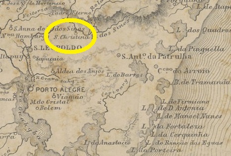
The district of Santa Christina do Pinhal was created in May 1893 on the south bank of the Sinos River in the municipality of Taquara do Mundo Novo (today just Taquara). The Imperial Mail Guide (Guia Postal do Império do Brazil) of 1880 lists the freguesia with 5.648 inhabitants, an amazing number, if compared to the ca. 1.700 people counted by the IBGE in 2000. Since May 1982 is Santa Cristina a district of the municipality of Parobé, situated over 70 km northeast of the capital Porto Alegre.
According to the Imperial Mail Register (Tabella das Agencias do Correio do Imperio) of 1885, the local post office was created in 1871. Two cancels have appeared to date. SRS-0385a (Coll. José A. Junges) has a double circle with the inscription SANTA CHRISTINA above. The date of the sole exemplar is 1881, in the centre. SRS-0385b (Coll. José A. Junges) features the same as before, but now the inscription is S. CHRISTINA and there is an unidentified ornament below. The only copy is dated 1887.
Carta da Republica dos Estados Unidos do Brazil, 1892
Anderer Name : Santa Christina do Pinhal
Der Distrikt von Santa Christina do Pinhal bestand seit Mai 1893 im Município von Taquara do Mundo Novo (heute : Taquara) am Südufer des Flusses Sinos, über 70 km nordöstlich der kaiserlichen Provinzhauptstadt Porto Alegre entfernt. Der Postführer (Guia Postal do Império do Brazil) aus 1880 listete die Freguesia noch mit 5.648 Einwohner auf, eine erstaunliche Zahl, wenn wir die 1.700 Seelen betrachten, die der IBGE 2000 gezählt hat. Seit Mai 1982 ist Santa Cristina ein Distrikt des Município von Parobé.
Laut Verzeichnis der kaiserlichen Postämter (Tabella das Agencias do Correio do Imperio) aus 1885 entstand diese Agentur im Jahr 1871. Zwei Stempel aus der Kaiserzeit sind überliefert. SRS-0385a (Samml. José A. Junges) hat einen Doppelkreis mit der Inschrift SANTA CHRISTINA oben. Das Datum ist in der Mitte, das einzig bekannte Exemplar wurde 1881 verwendet. SRS-0385b (Samml. José A. Junges) ist ähnlich wie der Vorgänger, aber hier lautet die Inschrift S. CHRISTINA, und es gibt und ein unbestimmtes Ornament unten. Das einzige Exemplar ist 1887 datiert.
Villiers de l’Ile Adam: Carta (…) da Provincia de Minas Geraes (1849)
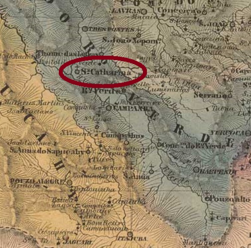
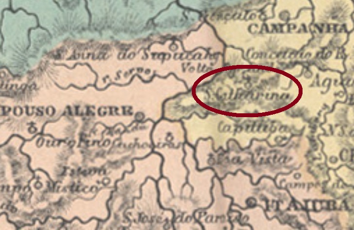
Santa Catharina, situated over 400 km southwest from the province capital Ouro Preto, was since May 1822 through royal license (Alvará Real) subordinated to Santa Rita do Sapucahy. In September 1923 it acquired the political independence as a municipality, which changed the toponym to Natércia in December 1953.
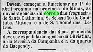
According to Paula Sobrinho (História Postal de Minas Gerais, Belo Horizonte, 1997), the local post office was created in October 1877, but operations started apparently only in the following year, as reported by the Rio press:
Gazeta de Noticias, Rio de Janeiro, March 20, 1878
Copies of the only known imperial cancel have dates between 1885 and 1890. SMG-2820a (Coll. José A. Junges) has a double circle with the inscriptions SANTA CATHARINA above and (MINAS) below. Dates in the centre.
Atlas do Imperio do Brasil, 1868
Der Distrikt von Santa Catharina lag über 400 km südwestlich von der Provinzhauptstadt Ouro Preto entfernt und war seit Mai 1822 durch königliche Verfügung (Alvará Real) Santa Rita do Sapucahy unterstellt. Im September 1923 stieg der Ort zu eigenem Município auf, der seit Dezember 1923 den Namen Natércia trägt.
Laut Paula Sobrinho (História Postal de Minas Gerais, Belo Horizonte, 1997) wurde das örtliche Postamt schon im Oktober 1877 ins Leben gerufen, dennoch startete der Betrieb scheinbar erst im darauf folgenden Jahr, wie die Presse aus Rio berichtet:
Gazeta de Noticias, Rio de Janeiro, 20. März, 1878
Vom einzig bekannten Stempel aus der Kaiserzeit gibt es Jahreszahlen zwischen 1885 und 1890. SMG-2820a (Samml. José A. Junges) hat einen Doppelkreis mit den Inschriften SANTA CATHARINA oben und (MINAS) unten. Die Daten sind in der Mitte.
Villiers de l’Ile Adam: Carta (…) da Provincia de São Paulo, 1847
Print version update, on October 19, 2021
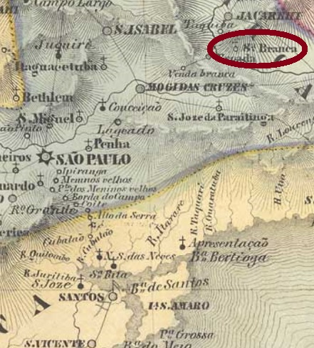
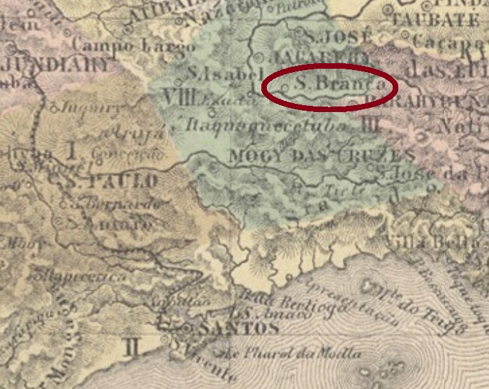
Santa Branca was since February 1841 a district of the municipality of Jacarehy, situated on the south bank of the Paraíba do Sul River, less than 100 km east of the province capital São Paulo. In March 1856 it ascended to a villa with own municipality.
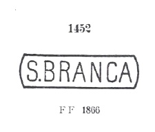
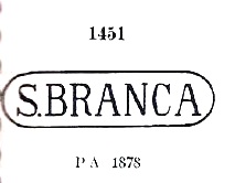
According to Nova Monteiro (Administrações e Agencias Postaes do Brasil Imperio, in Brasil Filatelico/RJ, 1934-5; Reprint SPP 1994-1999) the post office was created in August 1854. There is clearly a problem with the images of the earliest cancels from this village: Paulo Ayres (Catálogo de Carimbos Brasil- Império, S. Paulo, 1937, 1942) lists two of them under # 1451 and 1452. The first one was allegedly found from the 1878 emissions on (D. Pedro issue with white beard), the second from the 1866 emissions on (D. Pedro with black beard):
Paulo Ayres # 1451Paulo Ayres #1452
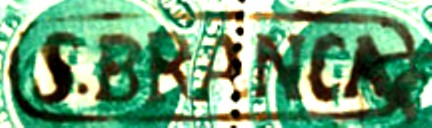
Indeed, the earliest examples found for this cancel were used already in the “numeral” issues (from 1850 on), and their images differ considerably from both Ayres’ examples. Here the best image found for SSP-1275a, which was found on stamps dated between 1854 and at least 1878 (image from Antonio Torres auctions):
SSP-1275a
The letter S and the following dot are quite different from both Paulo Ayres versions, else than further variations in letters and frame. Since we haven’t seen any example confirming either # 1451 or 1452 by P. Ayres, we can’t consider these images yet.
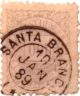
A second imperial cancel from Santa Branca, SSP-1275b (coll. José A. Junges), was found on pieces dated between 1882 and 1891. There is here a double circle with the inscription SANTA BRANCA above and the date in the centre. From the Fuad Ferreira Fo. collection comes a third cancel from there: SSP-1275c is a French type, which is reproduced here since it does not appear in Carimbologia S1:
SSP-1275c (FF), 1889Atlas do Imperio do Brasil,, 1868
Aktualisierung der Printausgabe am 19. Oktober 2021
Santa Branca war seit Februar 1841 ein Distrikt des Município von Jacarehy, der am Südufer des Flusses Paraíba do Sul, unter 100km östlich der Provinzhauptstadt São Paulo entfernt lag. Im März 1856 wurde daraus eine Villa im eigenen Município.
Laut Nova Monteiro (Administrações e Agencias Postaes do Brasil Imperio, in Brasil Filatelico/RJ, 1934-5; Reprint SPP 1994-1999) entstand das örtliche Postamt im August 1854. Es gibt allerdings ein Problem mit den ersten Stempeln dieser Ortschaft: Paulo Ayres (Catálogo de Carimbos Brasil-Império, S. Paulo, 1937, 1942) listet zwei davon unter den Nummern 1451 und 1452. Der erste wurde angeblich ab den Dom Pedro Ausgaben von 1878 (mit weißem Bart) gefunden, während Nr. 1452 ab den D. Pedro-Ausgaben v. 1866 (mit schwarzem Bart) einzutreffen ist:
P: Ayres Nr. 1451P. Ayres Nr. 1452
Tatsächlich wurden die frühen Beispiele dieses Stempels bereits ab den Numeral-Ausgaben (den so genannten Katzenaugen) gebraucht, und ihre Abbildungen weisen erhebliche Unterschiede gegenüber Ayres’ Beispielen auf. Hier die bisher deutlichste Abbildung von SSP-1275a , anzutreffen zwischen 1854 und mindestens 1878 (Abb. Alberto Torres Auktionen).
SSP-1275a (AT)
Die Buchstabe S und der darauf folgende Punkt sind deutlich anders, als von Ayres angegeben, abgesehen von weiteren Abweichungen in Buchstaben und Rahmen. So lange keine passenden Beispiele von Ayres Nr. 1451 oder 1452 auftauchen, bleiben beide Stempel fürs Erste außen vor.
Ein zweiter Santa Branca-Stempel aus der Kaiserzeit, SSP-1275b (Samml. José A. Junges) wurde auf Marken mit Daten zwischen 1882 und 1891 gefunden. Hier haben wir deinen Doppelkreis mit der Inschrift SANTA BRANCA oben und dem Datum in der Mitte. Aus der Sammlung Fuad Ferreira Fo. stammt ein dritter Stempel von dort: SSP-1275c ist ein französischer Typ, der hier abgebildet ist, da er nicht in Carimbologia S1 erschienen ist:
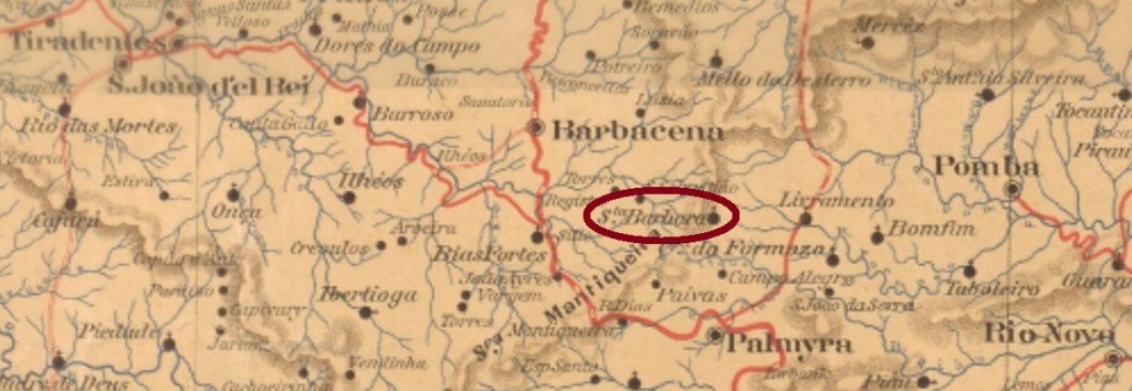
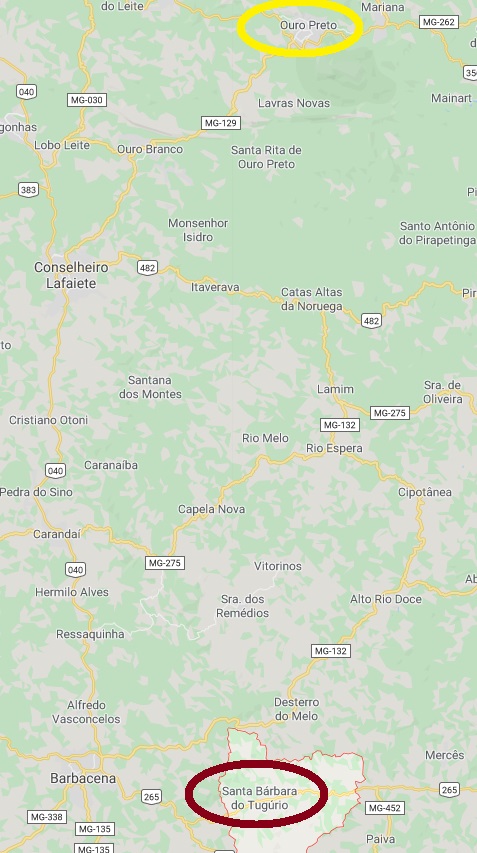
Tugúrio is neither a river nor a mountain, but rather an ancient Fazenda, which gave his name to the district of Santa Barbara, created in March 1839 in the municipality of Barbacena, over 150 km south of the province capital Ouro Preto. It was declared a Curato in November 1866, and was called Tugúrio from December 1938 until December 1962, when it ascended to the actual municipality of Santa Bárbara do Tugúrio.
According to Paula Sobrinho (História Postal de Minas Gerais, Belo Horizonte, 1997), the local post office was created in April 1885. One early cancel is known: SMG-2815a (Coll. Karlheinz Wittig) has a double circle with the inscriptions S.BARBARA DO TUGURIO above and (MINAS) below. Dates in the centre were found for the years 1890 and 1892.
Google Maps
Tugúrio ist weder ein Fluss noch ein Berg, aber so hieß eine Fazenda, die im März 1839 ihren Namen dem Distrikt von Santa Barbara im Município von Barbacena gab und über 150 km südlich der Provinzhauptstadt Ouro Preto entfernt lag. Im November 1866 wurde er zu einem Curato, und vom Dezember 1938 bis Dezember 1962 war sein Name zu Tugúrio vereinfacht. Dann wurde er zum aktuellen Município von Santa Bárbara do Tugúrio.
Laut Paula Sobrinho (História Postal de Minas Gerais, Belo Horizonte, 1997) gibt es dort ein Postamt seit April 1885. Ein einziger früher Stempel ist bekannt: SMG-2815a (Samml. Karlheinz Wittig) hat eine Doppelkreis mit den Inschriften S.BARBARA DO TUGURIO oben und (MINAS) unten. Die Daten in der Mitte weisen auf die Jahre 1890 und 1892 auf.
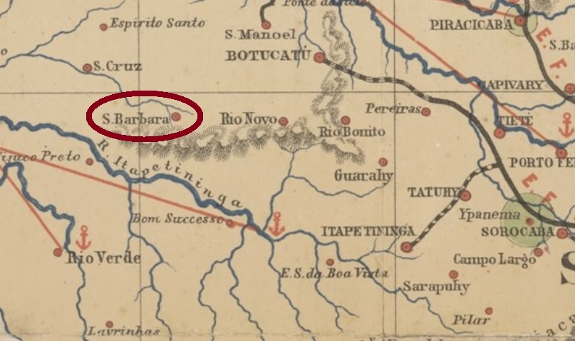
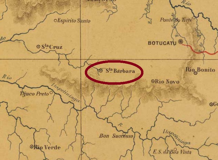
Santa Barbara do Rio Pardo is the ancient district of São Domingos, created in April 1858 in the municipality of Botucatu, near 300 km west of the province capital São Paulo. In June 1868 it switched to the municipality of Lençóis and acquired the political emancipation as the Villa de Santa Barbara in April 1876. In December 1906 it became a town, and since June 1978 it is called the municipality of Águas de Santa Bárbara.
According to the Imperial Mail Register (Tabella das Agencias do Correio do Imperio) of 1885, the local post office was created in 1877. Only one imperial cancel is known, dated 1890. SSP-1270a (Coll. José A. Junges) is a French-type and has a double circle with the inscription S.BARBARA DO RIO PARDO above and the typical star in parentheses below. The date is in the centre.
Joaquim M.R. Lisboa: Mappa da Provincia de São Paulo, 1884
Santa Barbara do Rio Pardo ist der ehemalige Distrikt von São Domingos, der im April 1858 im Município von Botucatu gegründet wurde und fast 300 km westlich der früheren Provinzhauptstadt São Paulo liegt. Im Juni 1868 wechselte der Distrikt zum Bezirk Lençóis, und im April 1876 wurde daraus die Villa de Santa Barbara. Im Dezember 1906 kam der Stadtstatus dazu, und seit Juni 1978 heißt dieser Município Águas de Santa Bárbara.
Laut dem Verzeichnis der kaiserlichen Postämter (Tabella das Agencias do Correio do Imperio) aus 1885 entstand 1877 das örtliche Postamt. Nur ein Stempel der Kaiserzeit ist überliefert, datiert 1890. SSP-1270a (Samml. José A. Junges) ist ein „französischer Typ“ und hat einen Doppelkreis mit der Inschrift S.BARBARA DO RIO PARDO oben und den typischen Stern in Klammern unten, dazu das Datum in der Mitte.
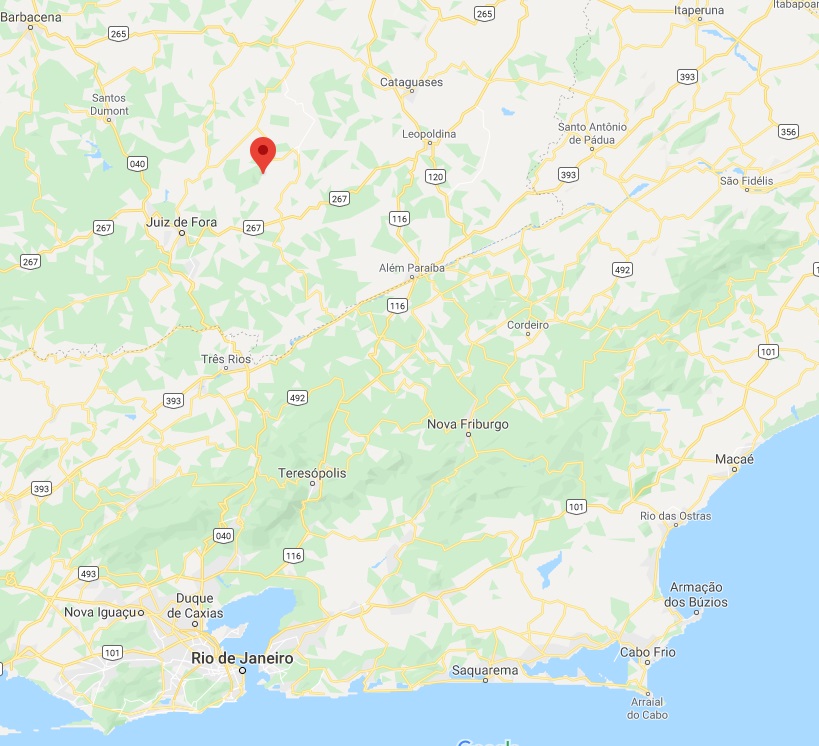
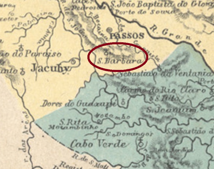
Santa Barbara do Rio Novo was made a district of the municipality of São João Nepomuceno in November 1875, and is situated about 270 km south of the early province capital Ouro Preto. In September 1882 the toponym was simplified to Santa Barbara, and in September 1923 the name changed again, to Carlos Alves.
According to Paula Sobrinho (História Postal de Minas Gerais, Belo Horizonte, 1997), the local post office was created in December 1879. One imperial cancel is known. SMG-2810a (Coll. José A. Junges) has a double circle with the inscription S.BARBARA DO RIO NOVO above and a diamond ornament below, which is formed by four small arrows. The dates in the centre were found for the period 1885-1887.
Google Maps
Santa Barbara do Rio Novo wurde im November 1875 ein Distrikt des Município von São João Nepomuceno und liegt ca. 270 km südlich der ehemaligen Provinzhauptstadt Ouro Preto entfernt. Im September 1882 wurde der Ortsname auf Santa Barbara vereinfacht, und seit September 1923 heißt der Distrikt Carlos Alves.
Laut Paula Sobrinho (História Postal de Minas Gerais, Belo Horizonte, 1997) gibt es das örtliche Postamt seit Dezember 1879. Ein Stempel der Kaiserzeit ist überliefert. SMG-2810a (Samml. José A. Junges) hat einen Doppelkreis mit der Inschrift S.BARBARA DO RIO NOVO oben und einem rautenförmigen Ornament unten, das aus vier kleinen Pfeilen besteht. Die Daten in der Mitte zeigten bisher den Zeitraum 1885-1887.
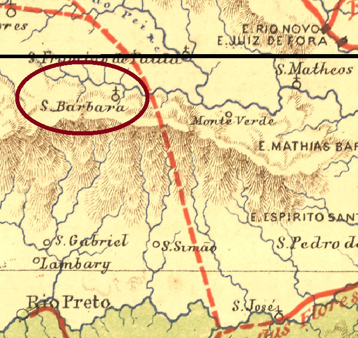
Santa Barbara do Monte Verde was founded in April 1841 as a district of the municipality of Rio Preto, round 300 km south of the province capital Ouro Preto. It remained in this status until political emancipation in December 1995. This calm history reflects itself through the population: the Postal Guide (Guia Postal) of 1880 lists this freguesia with exactly 3.172 inhabitants, and the official Brazilian Geographic and Statistics Institute (IBGE) estimated a population of 3.150 for the whole municipality in 2019.
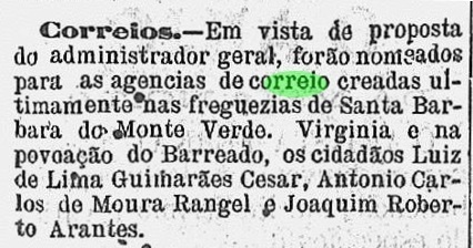
According to Paula Sobrinho (História Postal de Minas Gerais, Belo Horizonte, 1997) the local post office was founded in December 1878. The first clerk was soon announced in the press:
A Actualidade, January 25, 1879
It seems that the early inhabitants were not very fond of writing letters, for no postal cancel from the Empire has been found to date.
Estrada de Ferro Central do Brasil, 1890
Der Distrikt von Santa Barbara do Monte Verde wurde im April 1841 im Bezirk von Rio Preto gegründet und lag rund 300 km südlich der Provinzhauptstadt Ouro Preto entfernt. Es blieb bei diesem politischen status quo bis Dezember 1995, als der Município von Santa Barbara do Monte Verde entstand. Dieser ruhige Geschichtsverlauf spiegelt sich durch die Entwicklung der Einwohnerzahl wieder: der Postführer (Guia Postal) von 1880 listet diese Freguesia mit genau 3.172 Einwohnern auf, und für 2019 schätzte das Brasilianische Institut für Geografie und Statistik (IBGE) eine Bevölkerung mit 3.150 Seelen für den ganzen Município.
Laut Paula Sobrinho (História Postal de Minas Gerais, Belo Horizonte, 1997) entstand das örtliche Postamt im Dezember 1878. Der erste Postalgestellte wurde bald darauf in der regionalen Presse vorgestellt:
A Actualidade, 25. Januar 1879
Scheinbar waren die früheren Bewohner keine eifrigen Briefschreiber, da bisher keine Postabstempelung aus dem Kaiserreich zutage gekommen ist.
Villiers de l’Ile Adam: Carta (…) da Provincia de Minas Geraes, 1849
Other names: Santa Barbara, Guaranésia
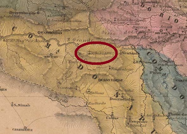
The former district of Santa Barbara was founded in April 1838 in the municipality of Jacuhy, more than 500 km southwest of the province capital Ouro Preto. In December 1873 the name was changed to Santa Barbara das Canoas, probably to avoid confusion with the older and more important Santa Barbara in Minas Gerais (SMG-2795). In September 1901, already in the republic, it acquired an own municipality as the Villa of Guaranésia. This name is apparently a construction of the tupi Guara (bird) and the Greek νησί (island).
According to Paula Sobrinho (História Postal de Minas Gerais, Belo Horizonte, 1997), the local post office was created in November 1878. This year is confirmed by the Imperial Mail Register (Tabella das Agencias do Correio do Imperio) of 1885. One cancel from the Empire is known: SMG-2800a (Coll. José A. Junges) has a double circle with the inscription STA BARBARA DAS CANOVAS (sic) above and a diamond ornament below, which is formed by four small diamonds. The dates in the centre were found for the years 1889-1898.
Atlas do Imperio do Brasil, 1868
Andere Namen: Santa Barbara, Guaranésia
Der ehemalige Distrikt von Santa Barbara wurde im April 1838 im Município von Jacuhy gegründet und lag über 500 km südwestlich von der Provinzhauptstadt Ouro Preto entfernt. Im Dezember 1873 wurde der Name auf Santa Barbara das Canoas geändert, wohl um Verwechslungen mit dem älteren und wichtigeren Ort Santa Barbara in Minas Gerais (SMG-2795) zu vermeiden. Im September 1901, bereits in der Republik, stieg die Ortschaft zum eigenen Município unter dem Namen Guaranésia auf. Das Wort ist scheinbar ein Konstrukt mit dem tupi Guara (Vogel) und dem griechischen νησί(Insel).
Laut Paula Sobrinho (História Postal de Minas Gerais, Belo Horizonte, 1997) wurde das örtliche Postamt im November 1878 ins Leben gerufen. Dieses Jahr wird durch das Verzeichnis der kaiserlichen Postämter (Tabella das Agencias do Correio do Imperio) aus 1885 bestätigt. Wir kennen einen Stempel aus der Kaiserzeit: SMG-2800a (Samml. José A. Junges) hat einen Doppelkreis mit der Inschrift STA BARBARA DAS CANOVAS (sic) oben und einem rautenförmigen Ornament unten, das aus vier kleinen Rauten besteht. Die Daten in der Mitte stammen aus dem Zeitraum 1889-1898.
Villiers de l’Ile Adam: Carta (…) da Provincia de São Paulo, 1847
This very special story deals with a train station which, after its political emancipation, has now an own municipality, which is bigger than the original locality. Since both places have a common history and their cancels must have very similar inscriptions, they will be presented here together.
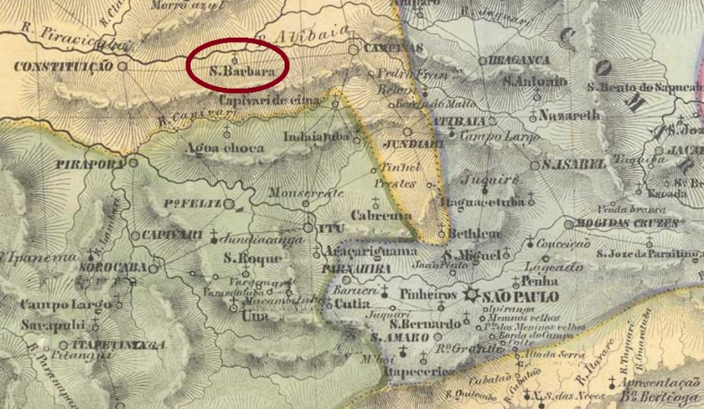
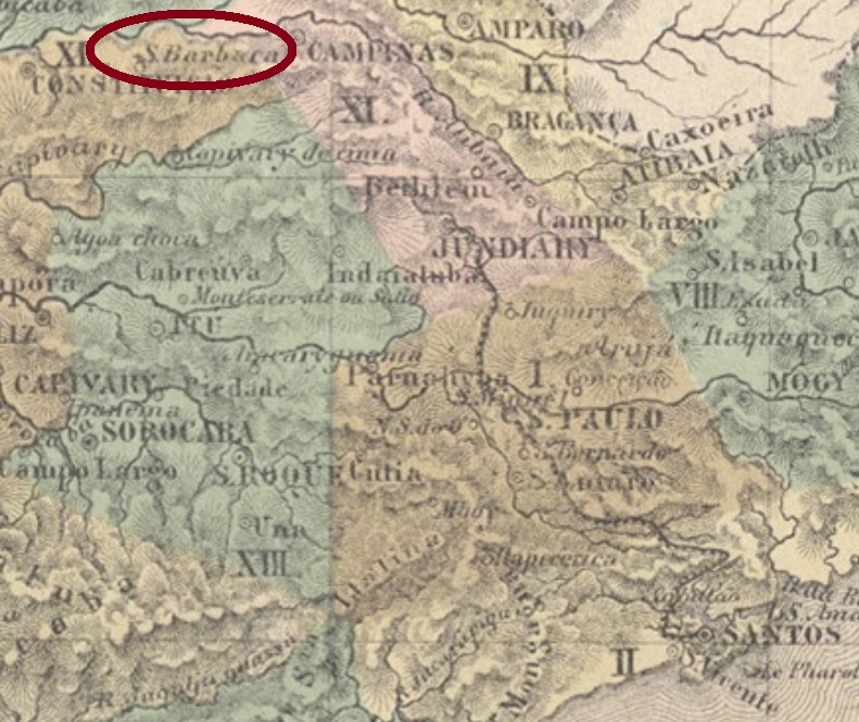
The freguesia of Santa Barbara de Macahubas was created in February 1842 in the former municipality of Constituição (the actual Piracicaba), ca. 140 km northwest of the province capital São Paulo. Two years long, between 1844 and 1846, it belonged to Campinas, before returning to Constituição. In June 1869 it ascended to a Villa, in December 1906, to a town, and since November 1944 it is called the municipality of Santa Bárbara d’Oeste.
According to Nova Monteiro (Administrações e Agencias Postaes do Brasil Imperio, in Brasil Filatelico/RJ, 1934-5; Reprint SPP 1994-1999), the post office was created in September 1864, which can be confirmed by the press note:
Correio Paulistano, October 9, 1864
Up to date, no imperial cancel has been safely identified as from Santa Barbara/SP, but possibly one of the cancels now attributed to Santa Barbara in Minas Gerais (SMG-2795) may change to this locality, as researches progress.
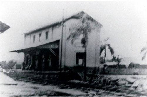
Ca.1890 (Photo: Wanderley Duck, apud estacoesferroviarias.com.br)
In August 1875, the Companhia Paulista de Estradas de Ferro inaugurated the Santa Barbara train station ca. 10 km east of the locality, situated already in the municipality of Campinas near the Quilombo River (Ribeirão), an affluent to the Piracicaba River. The region had at that time coffee and sugar cane plantations run not only by slave work, but also by immigrants from Alabama and Georgia, who had left the USA after the Civil War defeat. The settlement grew fast, and soon it was called the Americana station, which became the district of Villa Americana in July 1904 and acquired an own municipality in November 1924. Since November 1938 it is the municipality of Americana. The railroad remained in the Cia. Paulista until 1971, when it passed to the FEPASA-Railway. After operation shutdown in 1998, it belonged to the Ferroban and ALL companies, serving sporadic tourist trips. (estacoesferroviarias.com.br)
The search for the station post office has brought controversial data. The Imperial Mail Register (Tabella das Agencias do Correio do Imperio) of 1885 lists this agency with year 1877, but the station post office was indeed active as soon as November 1875, according to the São Paulo press:
Correio Paulistano, November 11, 1875
Further press notes report, nevertheless, that the local mail service has struggled with several problems: by January 1877 the station office has been closed, and the mail went by courier from the station to the Villa of Santa Barbara:
Correio Paulistano, January 10, 1877
If we assume that this post office could be reopened the same year, this would confirm the given date by the 1885 Register as a restart year. Two different cancels have been found: SSP-1266a (Coll. José A. Junges) has a double circle with the inscription EST. DE S.ͭ BARBARA above and an open diamond ornament below. The dates in the centre are from the period 1884-1891. The following cancel, SSP-1266b (image from the internet) might be already republican, for the sole seen copy is dated 1895. It shows a double circle with the inscriptions EST. DE STA BARBARA above and (S.PAULO) below, with the date in the centre.
Hier haben wir mit dem besonderen Fall einer Bahnstation zu tun, die im Laufe der Zeit so gewachsen ist, dass sie inzwischen politisch unabhängig und größer als die Ortschaft wurde, der sie angehörte. Da aber beide Ortschaften eine gemeinsame Geschichte – und wohl auch sehr ähnliche Poststempel – haben, werden sie hier zusammen besprochen.
Die Freguesia von Santa Barbara de Macahubas wurde im Februar 1842 im ehemaligen Município von Constituição (heute: Piracicaba) gegründet, ca. 140 km nordwestlich von der Provinzhauptstadt São Paulo entfernt. Zwischen 1844 und 1846 gehörte sie zum Município von Campinas, bevor sie wieder nach Constituição zurück kehrte. Im Juni 1869 stieg sie zur Villa auf, im Dezember 1906 wurde sie eine Stadt, und seit November 1944 heißt sie der Município von Santa Bárbara d’Oeste.
Laut Nova Monteiro (Administrações e Agencias Postaes do Brasil Imperio, in Brasil Filatelico/RJ, 1934-5; Reprint SPP 1994-1999) entstand das örtliche Postamt im September 1864, was die Regionalpresse bestätigen kann:
Correio Paulistano, 9. Oktober 1864
Bisher konnte kein Poststempel zweifelsfrei Santa Barbara/SP zugeordnet werden, aber möglicherweise könnte ein Stempel, der noch bei Santa Barbara in Minas Gerais (SMG-2795) aufgelistet wurde, doch nach São Paulo wechseln, falls die Recherchen dies ergeben.
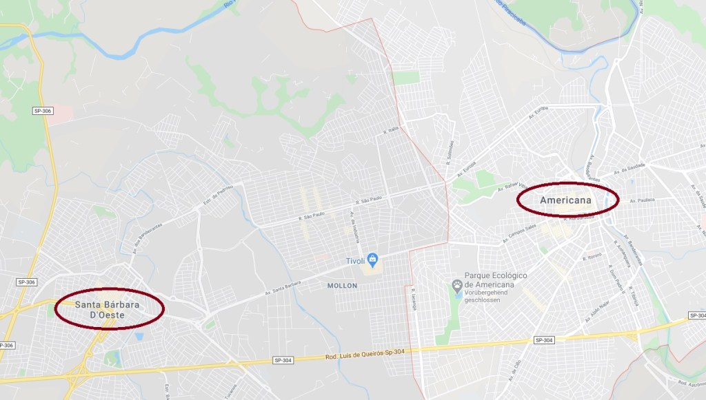
GoogleMaps
Im August 1875 wurde der Bahnhof Santa Barbara durch die Companhia Paulista de Estradas de Ferro eingeweiht, der ca.10 km östlich der Ortschaft lag, schon im Município von Campinas, am Westufer des Flusses Quilombo (Ribeirão Quilombo), der ein Zufluss des Piracicaba ist. In der Gegend waren fast nur Kaffee- und Zuckerrohrplantagen, die nicht nur durch Sklavenarbeit gehalten wurden, sondern auch durch Einwanderer aus Alabama und Georgia, die nach der Bürgerkrieg-Niederlage der USA-Südstaaten nach Brasilien geflohen waren. Die Siedlung um den Bahnhof wuchs rasch, und bald hieß er der Americana- Bahnhof, der im Juli 1904 der Distrikt von Villa Americana und im November 1924 ein Município wurde. Seit November 1938 heißt der Município Americana. Die Bahnlinie blieb im Besitz der Cia. Paulista bis 1971, danach wechselte sie zur FEPASA. Nach Betriebsende 1998, ging sie zur Ferroban und später zur ALL-Gesellschaften. Heute dient die Bahnstrecke nur Touristenfahrten (estacoesferroviarias.com.br).
Die Suche nach dem Gründungsdatum des Bahnhofspostamts brachte widersprüchliche Angaben. Das Verzeichnis der kaiserlichen Postämter (Tabella das Agencias do Correio do Imperio) von 1885 listet diese Agentur mit Gründungsjahr 1877 auf. Dennoch war dieses Postamt bereits im November 1875 aktiv, wie aus der Regionalpresse in São Paulo hervorgeht:
Correio Paulistano, 11. November 1875
Späteren Pressemeldungen zufolge hatte aber der Postdienst vor Ort mit erheblichen Problemen zu kämpfen. Im Januar 1877 war das Bahnhofspostamt wieder geschlossen, und die Postsendungen mussten per Stafetten vom Bahnhof zur Villa von Santa Barbara befördert werden:
Correio Paulistano, 10. Januar 1877
Sollte das Bahnhofspostamt im gleichen Jahr wieder geöffnet worden sein, dann wäre die Jahresangabe 1877 vom Postämter-Verzeichnis aus 1885 eher die Bestätigung des Neuanfangs. Zwei verschiedene Stempel aus der Zeit wurden gefunden: SSP-1266a (Samml. José A. Junges) hat einen Doppelkreis mit der Inschrift EST. DE S.ͭ BARBARA oben und einem Ornament unten, das eine offene Raute darstellt. Die Daten in der Mitte stammen aus dem Zeitraum 1884-1891. Der folgende Stempel, SSP-1266b (Abb. aus dem Internet) könnte bereits republikanisch sein, da das einzig bekannte Exemplar aus dem Jahr 1895 kommt. Er zeigt einen Doppelkreis mit den Inschriften EST. DE STA BARBARA oben und (S.PAULO) unten, dazu das Datum in der Mitte.
Villiers de l’Ile Adam: Carta (…) da Provincia de Minas Geraes, 1849
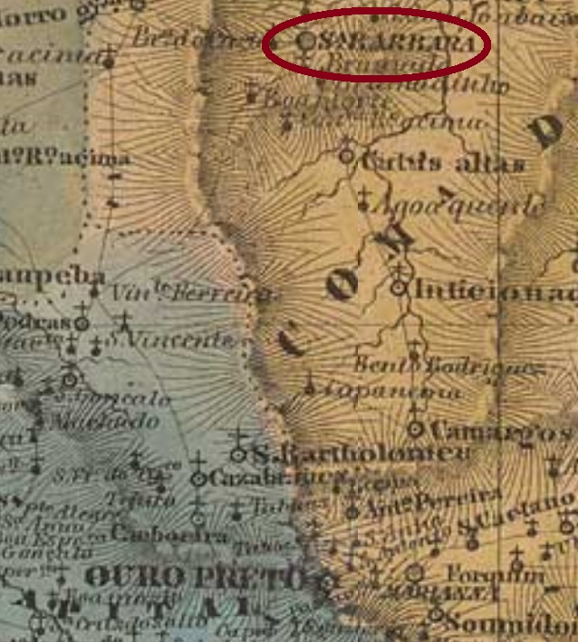
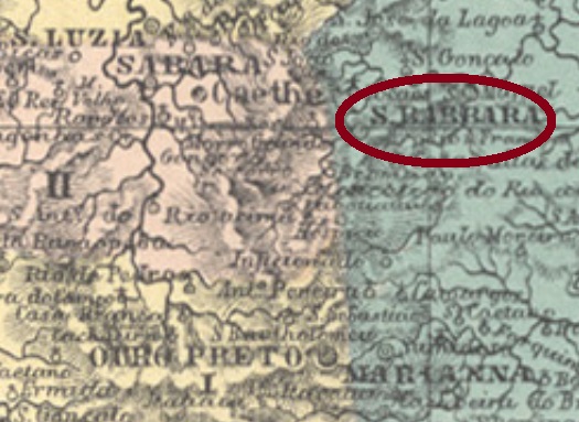
Santa Barbara was from the beginning of the 18th century a village (arraial) subordinated to Marianna, located less than 80 km north of the province capital Ouro Preto. In February 1724 it was declared a district through royal license (Alvará Real), in March 1839 it ascended to a villa in own municipality, and has since June 1858 the town status. It must have been much more important at the end of the 19th century than now, for the number of inhabitants has considerably shrunk since then.
Both Nova Monteiro (Administrações e Agencias Postaes do Brasil Imperio, in Brasil Filatelico/RJ, 1934-5; Reprint SPP 1994-1999) and Paula Sobrinho (História Postal de Minas Gerais, Belo Horizonte, 1997) agree on the date of creation of the post office on March 7, 1840. Since there is another Santa Barbara post office in São Paulo (SSP-1265, with creation year 1864), possibly there can be some change in cancel attributions.
Three imperial cancels, one mute cancel and one manuscript cancelling are known for Santa Barbara in Minas Gerais. SMG-2795a (Coll. José A. Junges) is surely the oldest one, having been found in red on a letter dated 1857. It has a double circle with the inscription VI(LLA DE) S. BARBARA and a handwritten date in the centre. It is followed by a manuscript cancel texted Sta.Barbara over the date (dd-mm-yy), which is eventually accompanied by a mute recut circle cancellation. The written dates are between 1867 and 1871. SMG-2795b (Coll. José A. Junges) has a double circle with the inscription SANTA BARBARA above and (I) below. Dates in the centre were found between 1881 and 1887. The last imperial cancel, SMG-2795c (Coll. José A. Junges), is similar to the former, but here there is a (2) between circles below. Since the form of this numeral appears in two variants, eventually one of them could be a cancel from the São Paulo office. Dates within the period 1878-1892.
Atlas do Imperio do Brasil, 1868
Santa Barbara war seit Anfang des 18. Jahrhunderts ein Dorf (Arraial), das dem Bezirk Marianna zugeordnet war und weniger as 80 km von der Provinzhauptstadt Ouro Preto entfernt lag. Im Februar 1724 stieg die Siedlung durch königliche Verfügung (Alvará Real) zu einem Distrikt auf, im März 1839 wurde sie zur Villa erklärt, und ab Juni 1858 war sie eine Stadt. Im 19. Jahrhundert muss Santa Barbara eine wesentlichere Rolle gespielt haben als heutzutage, denn seitdem ist die Einwohnerzahl des Orts merklich gesunken.
Sowohl Nova Monteiro (Administrações e Agencias Postaes do Brasil Imperio, in Brasil Filatelico/RJ, 1934-5; Reprint SPP 1994-1999) als auch Paula Sobrinho (História Postal de Minas Gerais, Belo Horizonte, 1997) sind sich darüber einig, dass das örtliche Postamt am 7. März 1840 entstanden sei. Da es in São Paulo eine weitere Ortschaft gleichen Namens gab (SSP-1265, Postamt seit 1864), könnte evtl. ein Stempel falsch zugeordnet sein.
Aus Santa Barbara sind im Kaiserreich drei normale Stempel, ein stummer Stempel und eine handschriftliche postalische Entwertung bekannt. SMG-2795a (Samml. José A. Junges) ist sicherlich die früheste Entwertung, denn sie wurde auf einem Brief d. J. 1857 gefunden: ein Doppelkreis mit der Inschrift (in rot) VI(LLA DE) S. BARBARA, dazu ein handgeschriebenes Datum in der Mitte. Darauf folgt eine handschriftliche Entwertung mit dem Text Sta. Barbara über dem Datum (TT-MM-JJ), die manchmal von einem stummen Stempel begleitet wird. Dieser ist kreisförmig und mehrmals radial beschnitten. Die Daten schwanken zwischen 1867 und 1871. SMG-2975b (Samml. José A. Junges) ha einen Doppelkreis mit der Inschrift SANTA BARBARA oben und (I) unten. Die Daten in der Mitte wurden für die Zeit zwischen 1881 und 1887 gefunden. Der letzte Stempel der Kaiserzeit, SMG-2795c (Samml. José A. Junges), ist ähnlich wie sein Vorgänger, aber hier ist die Zahl (2) unten zwischen den Kreisen. Da die Form der Ziffer 2 zwei Varianten aufweist, könnte eine davon einem Stempel aus São Paulo gehören. Daten zwischen 1878 und 1892.