Categories
Carimbologia A-B

Alagoas, Alagoas (AAL-0010)

Atlas do Imperio do Brasil, 1868

Text update of March 21, 2025

Other names: Magdalena, Marechal Deodoro (1939)

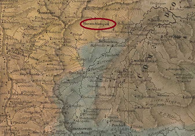
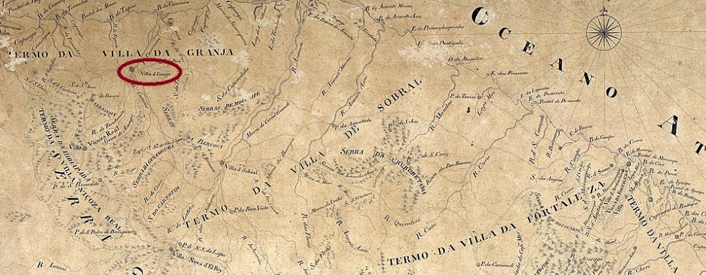
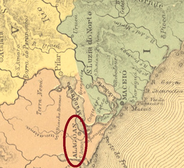
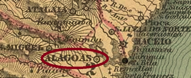
The history of this locality began around 1633, when the settlement called Magdalena was established, which was declared a villa just three years later. In March 1823, the name was changed to N. Sra. da Conceição das Alagoas, when the place – now as a town – became the provincial capital. The rather inconvenient location on the southern shore of Lake Manguaba was probably the deciding factor in 1839 to move the capital to Maceió, which was 30 km further northeast with better transport links. A long period of decadence followed, until in November 1939 the old town of Alagoas became the Município of Marechal Deodoro. The name celebrates Manuel Deodoro da Fonseca (1827-1892), the first president of the Brazilian Republic, who was born there.  

Three dates of origin for the local post office have been found, all from the capital period. Aldo Cardoso (Contribuição para a História dos Correios de Alagoas, Maceió, 1969) gives October 1827, while the Imperial Post Office Directory (Tabella das Agencias do Correio do Imperio, Rio de Janeiro, 1885) lists the year 1829. And Nova Monteiro gives November 1834 in Administrações e Agencias Postaes do Brasil Imperio (Brasil Filatelico/RJ, 1934-5; Reprint SPP 1994-1999).

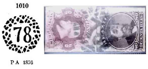
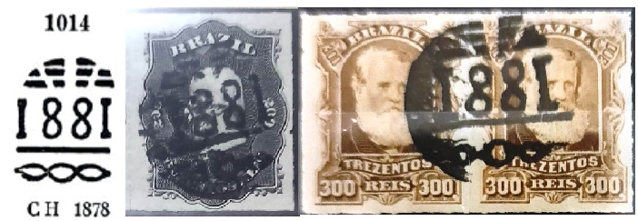
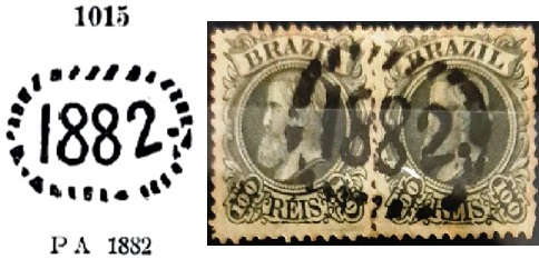
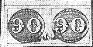
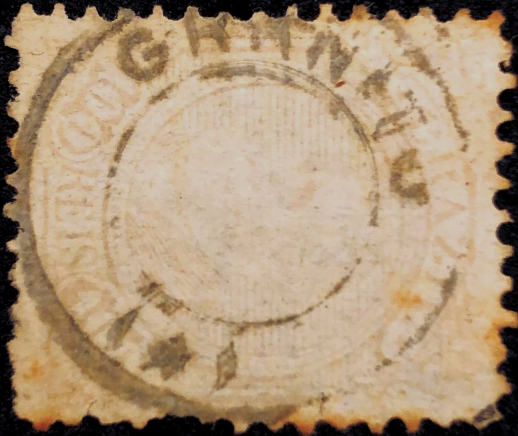
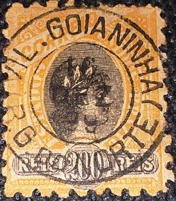
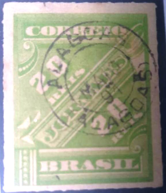
We do not know of any Alagoas postmarks from the provincial capital period. The oldest cancel to date is AAL-0010b (coll. Fuad Ferreira Fo.) and apparently bears the inscription ALAGOA, which would presumably be the old spelling of the city:

AAL-0010b (FF) 1850ff

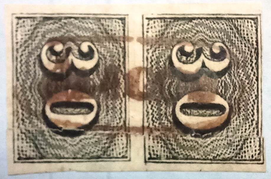
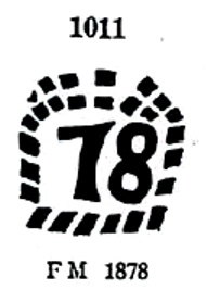
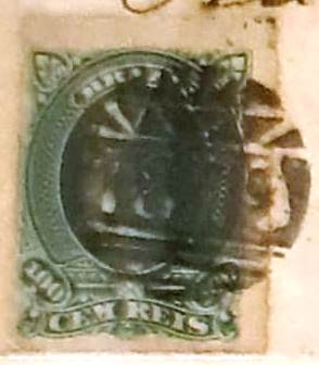
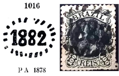
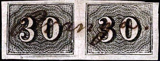
It was followed by the rare French type AAL-0010c (coll. Fuad Ferreira Fo.):

AAL-0010c (FF) 1877

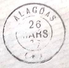
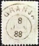
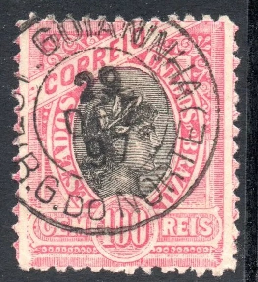
This was followed by the double circle AAL-0010d (coll. José A. Junges):

AAL-0010d (JJ)

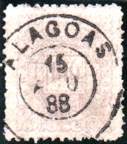
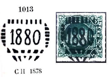
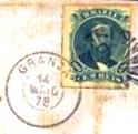
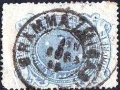
AAL-0010e (coll. Denis Forte) dates from the beginning of the Republic:

AAL-0010e (DFo) 1891-1895
Villiers de l’Ile Adam: Carta (…) das Provincias de Pernambuco, Alagoas e Sergipe, 1848

Textaktualisierung am 21. März 2025

Andere Namen: Magdalena, Marechal Deodoro (1939)

Die Geschichte dieser Ortschaft fing um 1633 an, als die Siedlung namens Magdalena entstand, die bereits drei Jahre später zur Villa erklärt wurde. Im März 1823 wurde der Name zu N. Sra. da Conceição das Alagoas geändert, als der Ort – nun als Stadt – Provinzhauptstadt wurde. Die eher ungünstige Lage am Südufer des Manguabasees war wohl 1839 ausschlaggebend, um die Hauptstadt nach Maceió zu verlegen, die 30 km weiter nordöstlich mit besserer Verkehrsanbindung lag. Es folgte eine lange Periode der Dekadenz, bis im November 1939 aus dem alten Ort Alagoas der Município von Marechal Deodoro wurde. Der Name erinnert an Manuel Deodoro da Fonseca (1827-1892), den ersten Präsidenten der brasilianischen Republik, der dort geboren wurde.   

Drei Entstehungstermine fürs örtliche Postamt wurden gefunden, alle aus der Hauptstadtzeit. Aldo Cardoso (Contribuição para a História dos Correios de Alagoas, Maceió, 1969) schreibt dafür den Oktober 1827. Im Verzeichnis der kaiserlichen Postämter  (Tabella das Agencias do Correio do Imperio, Rio de Janeiro, 1885) wird das Jahr 1829 angegeben. Und Nova Monteiro nennt den November 1834 in Administrações e Agencias Postaes do Brasil Imperio (Brasil Filatelico/RJ, 1934-5; Reprint SPP 1994-1999).

Alagoas-Poststempel aus der Zeit als Provinzhauptstadt kennen wir nicht. Der bisher älteste Stempel ist AAL-0010b (Samml. Fuad Ferreira Fo.), er trägt scheinbar die Inschrift ALAGOA, was vermutlich die alte Schreibweise der Stadt wäre:

AAL-0010b (FF) 1850ff

Ihm folgte der seltene französische Typ AAL-0010c (Samml. Fuad Ferreira Fo.):

AAL-0010c (FF) 1877

Danach kam der Doppelkreis AAL-0010d (Samml. José A. Junges):

AAL-0010d (JJ)

Aus dem Beginn der Republik stammt AAL-0010e (Samml. Denis Forte):

AAL-0010e (DFo) 1891-1895
Categories
Carimbologia C-D

Campestre, Minas Gerais (CMG-0505)

Atlas do Imperio do Brasil, 1868

The Freguesia de N. Sra.do Carmo do Campestre was founded in April 1840, belonged to the Vila de Caldas and was situated on the Ribeirão Campestre, a tributary of the Rio do Peixe, 450 km southwest of the provincial capital Ouro Preto. It was elevated to the status of a vila in its own município in August 1911 and has been called Campestre for short since September 1923.

According to the postal report (Relatorio Postal) for 1887, there had been a post office there since February 1872. The oldest postmark is CMG-0505a and was registered in the Catálogo de Carimbos Brasil-Império by Paulo Ayres (S. Paulo, 1937, 1942) under No. 1134:

CMG-0505a (P.A. 1134) 1872ff

It was followed by CMG-0505b, (image by Marcio Duarte):

CMG-0505b (MD) 1888

The next cancel could already be republican, because the dates of CMG-0505c (fig. from the internet) range from 1894 to 1896:

CMG-0505c (EB) 1894-1896
Villiers de l’Ile Adam: Carta (…) da Provincia de Minas Geraes, 1849

Die Freguesia de N. Sra.do Carmo do Campestre wurde im April 1840 gegründet, gehörte zur Vila de Caldas und lag am Ribeirão Campestre, einem Nebenfluss des Rio do Peixe, 450 km südwestlich der Provinzhauptstadt Ouro Preto. Sie wurde im August 1911 zur Vila im eigenen Município erhoben und heißt seit September 1923 abgekürzt Campestre.

Wie aus dem Postbericht (Relatorio Postal) für 1887 hervorgeht, gab es dort ein Postamt seit Februar 1872. Der älteste Poststempel ist CMG-0505a und wurde im Catálogo de Carimbos Brasil-Império von Paulo Ayres (S. Paulo, 1937, 1942) unter der Nr. 1134 registriert:

CMG-0505a (P.A. 1134) 1872ff

Ihm folgte CMG-0505b (Abb. Marcio Duarte):

CMG-0505b (MD) 1888

Der nächste Stempel dürfte bereits republikanisch sein, denn die Daten von CMG-0505c (Abb. aus dem Internet) reichen von 1894 bis 1896:

CMG-0505c (EB) 1894-1896
Categories
Carimbologia E-G

Grão Mogor, Minas Gerais (GMG-1270)

Villiers de l’Ile Adam: Carta (…) da Provincia de Minas Geraes, 1849

Other names: Serrinha, Sto. Antonio do Itacambirussú da Serra do Grão Mogor, Grão Mogol

The village was called Serrinha from around 1781, belonged to the Vila do Príncipe (later: Serro) and was located on the west bank of the Ribeirão do Inferno, 660 km north of the later provincial capital Ouro Preto. In April 1840, it was granted to the Vila de Montes Claros as a freguesia with the impressive name of Santo Antonio do Itacambirassu da Serra de Grão Mogol. In March 1849, Grão Mogor became an independent Vila and in May 1858 a town, which today is spelt Grão Mogol.

The reasons for this place name are not officially documented. However, as the region was known and sought after for its large diamond deposits (around 1890, the population was around twice as high as it is today), a connection with the legendary diamond Great Mogul, which was found in India around 1650, is obvious.

Two dates have been found for the creation of the local post office: Both Paula Sobrinho (História Postal de Minas Gerais, Belo Horizonte, 1997) and R. Koester (Carimbologia XX) give January 1846, but the Directory of Imperial Post Offices (Tabella das Agencias do Correio do Imperio, Rio de Janeiro, 1885) gives the year 1845.

Unfortunately, the oldest postmark to date is not the first. GMG-1270b (illustration from the Internet) is known with dates from 1878 to at least 1894:

GMG-1270b (EB) 1878-1901

Grão Mogor produced a beautiful series of not so mute cancellations, that indicate the respective year of use:

1878 (P.A. 1010 – fig. from the Fuad Ferreira Fo. collection)
1878 (P.A. 1011)
1879 (Coll. C. Papazoglu/Fuad Ferreira Fo.)
1880 (P.A. 1013 – from the Fuad Ferreira Fo. coll.)
1881 (P.A. 1014 – Coll. Fuad Ferreira Fo./ C. Papazoglu)
1882 (P.A. 1015 – Coll. C. Papazoglu)
1882 (P.A. 1016 – Coll. Fuad Ferreira Fo.)
Provincia de Minas Geraes, 1873

Andere Namen: Serrinha, Sto. Antonio do Itacambirussú da Serra do Grão Mogor, Grão Mogol

Der Ort hieß ab ca. 1781 Serrinha, gehörte zur Vila do Príncipe (später: Serro) und lag am Westufer des Ribeirão do Inferno, 660 km nördlich der späteren Provinzhauptstadt Ouro Preto. Im April 1840 wurde sie der Vila de Montes Claros als Freguesia mit dem eindrucksvollen Namen Santo Antonio do Itacambirassu da Serra de Grão Mogol zugesprochen. Im März 1849 wurde Grão Mogor eine unabhängige Vila und im Mai 1858 eine Stadt, die heute Grão Mogol geschrieben wird.

Die Gründe für diesen Ortsnamen sind nicht offiziell belegt. Da die Region jedoch für ihre großen Diamantenvorkommen bekannt und begehrt war (um 1890 war die Einwohnerzahl etwa doppelt so hoch wie heute), liegt ein Zusammenhang mit dem legendären Diamanten Großmogul nahe, der um 1650 in Indien gefunden wurde.

Für die Gründung des örtlichen Postamtes sind zwei Daten gefunden worden: Sowohl Paula Sobrinho (História Postal de Minas Gerais, Belo Horizonte, 1997) als auch R. Koester (Carimbologia XX) geben Januar 1846 an, das Verzeichnis der kaiserlichen Postämter (Tabella das Agencias do Correio do Imperio, Rio de Janeiro, 1885) nennt jedoch das Jahr 1845.

Der bisher älteste Poststempel ist leider nicht der erste. GMG-1270b (Abb. aus dem Internet) ist mit Daten von 1878 bis mindestens 1894 bekannt:

GMG-1270b (EB) 1878-1894ff

Aus Grão Mogor stammt eine schöne Reihe von halbstummen Stempeln, die auf das jeweilige Verwendungsjahr hinweisen:

1878 (P.A. 1010 – Abb. aus der Sammlung Fuad Ferreira Fo.)
1878 (P.A. 1011)
1879 (Samml. C. Papazoglu/Fuad Ferreira Fo.)
1880 (P.A. 1013 – Abb. aus der Sammlung Fuad Ferreira Fo.)
1881 (P.A. 1014 – Samml. Fuad Ferreira Fo./ C. Papazoglu)
1882 (P.A. 1015 – Samml. C. Papazoglu)
1882 (P.A. 1016 – Samml. Fuad Ferreira Fo.)
Categories
Carimbologia E-G

Granja, Ceará (GCE-0145)

Carta da Capitania do Ceará, 1818

Other names: Macavoqueira, Santa Cruz do Corearú

From August 1757, the locality was the Freguesia de Macavoqueira, which belonged to the Vila de Sobral and was located on the west bank of the Coreaú, 330 kilometres west of the later provincial capital Fortaleza. In June 1776 it became the Vila de S. José da Granja, and a town in November 1854.

R. Koester writes in Carimbologia XX that there had been a post office there since March 1846. The oldest postmark to date is GCE-0145a (fig. R. Koester, op. cit.).

GCE-0145a (RK) 1846-1888ff

This was followed by the double circle GCE-0145b (illustration from the Internet):

GCE-0145b (EB) ca. 1878-1888

Koester also shows the postmark with the imperial seal GCE-0145c:

GCE-0145c (RK)

A handwritten cancellation from Granja is known through Claudio Neumann:

1850ff (CN)

James Dingler and Klerman W. Lopes have included two mute cancellations from there in Mute Cancellations of the Brazil Empire / Carimbos Mudos do Brasil Império (Brazil Philatelic Association, Rio de Janeiro, 2000):

BPA 931 – 1355 (1879)

Another silent cancellation comes from the Internet:

1878 (EB)
Villiers de l’Ile Adam: Carta (…) da Provincia do Ceará, 1849

Andere Namen: Macavoqueira, Santa Cruz do Corearú

Der Ort war seit August 1757 die Freguesia de Macavoqueira, die zur Vila de Sobral gehörte und am Westufer des Coreaú lag, 330 km westlich der späteren Provinzhauptstadt Fortaleza. Im Juni 1776 wurde sie zur Vila de S. José da Granja und im November 1854 zur Stadt.

R. Koester schreibt in Carimbologia XX, dass es dort seit März 1846 ein Postamt gab. Der bisher älteste Poststempel ist GCE-0145a (Abb. R. Koester, op. cit.).

GCE-0145a (RK) 1846-1888ff

Es folgte der Doppelkreis GCE-0145b (Abb. aus dem Internet):

GCE-0145b (EB) ca. 1878-1888

Koester zeigt auch den Poststempel mit dem kaiserlichen Siegel GCE-0145c:

GCE-0145c (RK)

Eine handschriftliche Entwertung aus Granja ist von Claudio Neumann bekannt:

1850ff (CN)

James Dingler und Klerman W. Lopes haben in Mute Cancellations of the Brazil Empire / Carimbos Mudos do Brasil Império (Brazil Philatelic Association, Rio de Janeiro, 2000) zwei stumme Abstempelungen von dort aufgenommen:

BPA 931 – 1355 (1879)

Ein weiterer stummer Stempel stammt aus dem Internet:

1878 (EB)
Categories
Carimbologia E-G

Granito, Pernambuco (GPE-0295)

Carta Corographica da Provincia de Pernambuco, 1880

The chapel N. Sra. do Bom Conselho de Granito, built in 1859, belonged to the Vila de Exú and was located on the west bank of the Riacho da Brígida, 590 kilometres west of the provincial capital Recife. In April 1863 Granito became a Vila and in July 1909 a town. In March 1938, Granito was downgraded to a district of the Município de Bodocó, but regained the status of a Município in December 1963.

As Nova Monteiro writes in Administrações e Agencias Postaes do Brasil Imperio (Brasil Filatelico/RJ, 1934-5; reprint SPP 1994-1999), there had been a post office there since June 1865, a statement confirmed by the press in Rio with the comment that it was the transfer of the post office from Exu to Granito at that time:

Correio Mercantil/RJ, 11/06/1865

The oldest postmark to date is probably not the first: GPE-0295b (fig. Roberto Assef Jr.) was first found on D. Pedro of 1883:

GPE-0295b (RA) 1883ff-1897ff
Atlas do Imperio do Brasil, 1868

Die 1859 erbaute Kapelle N. Sra. do Bom Conselho de Granito gehörte zur Vila de Exú und lag am Westufer des Riacho da Brígida, 590 km westlich der Provinzhauptstadt Recife. Im April 1863 wurde Granito zur Vila und im Juli 1909 zur Stadt erhoben. Im März 1938 wurde Granito zum Distrikt des Município de Bodocó herabgestuft, erhielt aber im Dezember 1963 wieder den Status eines Município.

Wie Nova Monteiro in Administrações e Agencias Postaes do Brasil Imperio (Brasil Filatelico/RJ, 1934-5; Reprint SPP 1994-1999) schreibt, gab es dort seit Juni 1865 ein Postamt, eine Angabe, die von der Presse in Rio mit dem Hinweis bestätigt wird, dass es sich damals um die Verlegung des Postamtes von Exu nach Granito handelte:

Correio Mercantil/RJ, 11.06.1865

Der bisher älteste Stempel ist wahrscheinlich nicht der erste: GPE-0295b (Abb. Roberto Assef Jr.) wurde erst auf D. Pedro von 1883 gefunden:

GPE-0295b (RA) 1883ff-1897ff
Categories
Carimbologia E-G

Gramma, Minas Gerais (GMG-1260)

Estado de Minas Geraes, 1910

Other names: Santo Antonio do Grama

Santo Antonio do Gramma had been a distrito of the Vila de Ponte Nova, 130 kilometres east of the provincial capital Ouro Preto, since July 1868. In July 1889, the village was incorporated into the Vila de Abre Campo as a freguesia and in September 1923 it became a distrito of the Município de Rio Casca. Since December 1953, Santo Antonio do Grama (as it is written today) has been an independent município.

R. Koester (Carimbologia XX) and Paula Sobrinho (História Postal de Minas Gerais, Belo Horizonte, 1997) unanimously report that there had been a post office there since October 1881. This is confirmed by the press in Rio:

Gazeta da Tarde/RJ, 11/10/1881

The oldest postmark to date is GMG-1260a (image from the Internet):

GMG-1260a (EB) 1885-1890ff

Two similar looking mute cancellations from Gramma were registered by James Dingler and Klerman W. Lopes in Mute Cancellations of the Brazil Empire/Carimbos Mudos do Brasil Império (Brazil Philatelic Association, Rio de Janeiro, 2000):

BPA 2541 (1881ff) – 2542
Google Maps

Andere Namen: Santo Antonio do Grama

Santo Antonio do Gramma war seit Juli 1868 ein Distrito der Vila de Ponte Nova, 130 km östlich der Provinzhauptstadt Ouro Preto gelegen. Im Juli 1889 wurde der Ort als Freguesia in die Vila de Abre Campo eingegliedert und im September 1923 ein Distrito des Município de Rio Casca. Seit Dezember 1953 ist Santo Antonio do Grama (wie es heute geschrieben wird) ein eigenständiges Município.

R. Koester (Carimbologia XX) und Paula Sobrinho (História Postal de Minas Gerais, Belo Horizonte, 1997) berichten übereinstimmend, dass es dort seit Oktober 1881 ein Postamt gab. Dies wird von der Presse in Rio bestätigt:

Gazeta da Tarde/RJ, 11.10.1881

Der bisher älteste Poststempel ist GMG-1260a (Abbildung aus dem Internet):

GMG-1260a (EB) 1885-1890ff

Zwei ähnlich aussehende stumme Stempel aus Gramma wurden von James Dingler und Klerman W. Lopes in Mute Cancellations of the Brazil Empire /Carimbos Mudos do Brasil Império (Brazil Philatelic Association, Rio de Janeiro, 2000) registriert:

BPA 2541 (1881ff) – 2542
Categories
Carimbologia E-G

Goyo-En, Rio Grande do Sul (GRS-0175)

Estado do Rio Grande do Sul, 1891

Goyo-En is a word from the Guarani language and means large body of water. Since January 1857, it has also been a settlement of the Vila de Passo Fundo on the south bank of the Uruguay, 440 kilometres northwest of the provincial capital Porto Alegre. Strangely enough, old maps show Goyo-En on the north bank of the river – and thus in the province of Santa Catarina. And in fact, Gôyo-En has also been a district of the Município Chapecó in this state since around 1960. This means that there are settlements of the same name on both banks of the Uruguay.

Goyo-En in Rio Grande do Sul was assigned to the then newly founded Município de Erechim in April 1918, but has been part of the Município de Erval Grande since February 1959, as a district since March 1967.

Two creation dates have been found for the local post office. Once in January 1858, according to Nova Monteiro in Administrações e Agencias Postaes do Brasil Imperio (Brasil Filatelico/RJ, 1934-5; reprint SPP 1994-1999). Then again around 1862, as can be seen from R. Koester’s Carimbologia XX. A postal line between Guarapuava in the province of Paraná and Goyo-En was established in April 1862, as reported by the press in Rio:

Jornal do Commercio/RJ, 23/05/1862, (Report of April 30)

As the agency is neither mentioned in the postal guide (Guia Postal do Império do Brazil, Rio de Janeiro, 1880) nor in the list of imperial post offices (Tabella das Agencias do Correio do Imperio, Rio de Janeiro, 1885), it can be assumed that it was only of short duration. No imperial postmarks from Goyo-En are known to date.

Atlas do Imperio do Brasil, 1868

Goyo-En ist ein Wort aus der Sprache der Guarani und bedeutet großes Gewässer. Seit Januar 1857 ist es auch eine Siedlung der Vila de Passo Fundo am Südufer des Uruguay, 440 km nordwestlich der Provinzhauptstadt Porto Alegre. Merkwürdigerweise zeigen alte Karten Goyo-En am Nordufer des Flusses – und damit in der Provinz Santa Catarina. Und tatsächlich ist Gôyo-En seit etwa 1960 auch ein Bezirk des Município Chapecó in diesem Bundesstaat. Somit gibt es an beiden Ufern des Uruguay gleichnamige Siedlungen.

Goyo-En in Rio Grande do Sul wurde im April 1918 dem damals neu gegründeten Município de Erechim zugeteilt, gehört aber seit Februar 1959 zum Município de Erval Grande, seit März 1967 als Distrikt.

Für das örtliche Postamt wurden zwei Gründungsdaten gefunden. Einmal im Januar 1858, so Nova Monteiro in Administrações e Agencias Postaes do Brasil Imperio (Brasil Filatelico/RJ, 1934-5; Nachdruck SPP 1994-1999). Dann wieder um 1862, wie aus R. Koesters Carimbologia XX hervorgeht. Eine Postlinie zwischen Guarapuava in der Provinz Paraná und Goyo-En wurde im April 1862 eingerichtet, wie die Presse in Rio berichtete:

Jornal do Commercio/RJ, 23.05.1862 (Protokoll v. 30.04.)

Da die Agentur weder im Postführer (Guia Postal do Império do Brazil, Rio de Janeiro, 1880) noch im Verzeichnis der kaiserlichen Postämter (Tabella das Agencias do Correio do Imperio, Rio de Janeiro, 1885) erwähnt wird, ist davon auszugehen, dass sie nur von kurzer Dauer war. Bisher sind keine kaiserlichen Poststempel aus Goyo-En bekannt.

Categories
Carimbologia E-G

Goyanna, Pernambuco (GPE-0290)

Villiers de l’Ile Adam: Carta (…) das Provincias de Pernambuco, Alagoas e Sergipe, 1848

The Freguesia de N. Sra. do Rosário de Goyanna on the north bank of the Tracunhaém, 70 kilometres north of the later provincial capital of Recife, already existed in 1568. The village was subsequently elevated to the status of a vila twice, in January 1685 and October 1742, and Goiana (as it is now spelt) became a town in May 1840.

Two foundation dates for the local post office have been found. Firstly in March 1829, as Nova Monteiro writes in Administrações e Agencias Postaes do Brasil Imperio (Brasil Filatelico/RJ, 1934-5; reprint SPP 1994-1999). Then again in 1835, as noted in the Directory of Imperial Post Offices (Tabella das Agencias do Correio do Imperio, Rio de Janeiro, 1885). We do not know when the agency was closed in between, but it was active in December 1830, as can be seen from the regional press:

Diario de Pernambuco, 23/12/1830

The oldest postmark to date is GPE-0290a, of which R. Koester (Carimbologia XX) writes that it dates from the pre-philatelic period:

GPE-0290a (RK) ca. 1840

Later the French type GPE-0290c followed (fig. Koester, op.cit.):

GPE-0290c (RK) 1878ff-1890ff

GPE-0290d (fig. Koester) also appeared towards the end of the Empire:

GPE-0290d (RK) 1887-1889
Atlas do Imperio do Brasil, 1868

Die Freguesia de N. Sra. do Rosário de Goyanna am Nordufer des Tracunhaém, 70 Kilometer nördlich der späteren Provinzhauptstadt Recife, bestand bereits 1568. Das Dorf wurde in der Folge zweimal, im Januar 1685 und im Oktober 1742, zur Vila erhoben, und Goiana (wie es heute geschrieben wird) wurde im Mai 1840 zur Stadt.

Es wurden zwei Gründungsdaten für das örtliche Postamt gefunden. Erstens im März 1829, wie Nova Monteiro in Administrações e Agencias Postaes do Brasil Imperio (Brasil Filatelico/RJ, 1934-5; Nachdruck SPP 1994-1999) schreibt. Dann wieder im Jahr 1835, wie im Verzeichnis der kaiserlichen Postämter (Tabella das Agencias do Correio do Imperio, Rio de Janeiro, 1885) vermerkt. Wir wissen nicht, wann die Agentur dazwischen geschlossen wurde, aber sie war im Dezember 1830 aktiv, wie aus der regionalen Presse hervorgeht:

Diario de Pernambuco, 23/12/1830

Der bisher älteste Stempel ist GPE-0290a, von dem R. Koester (Carimbologia XX) schreibt, dass er aus der präphilatelistischen Zeit stammt:

GPE-0290a (RK) ca. 1840

Später folgte der französische Typ GPE-0290c (Abb. Koester, op.cit.):

GPE-0290c (RK) 1878ff-1890ff

GPE-0290d (Abb. Koester) erschien ebenfalls gegen Ende des Kaiserreichs:

GPE-0290d (RK) 1887-1889
Categories
Carimbologia E-G

Goyaninha (GRN-0075) – Goyaninha (train station/Bahnhof), Rio Grande do Norte (GRN-0076)

Atlas do Imperio do Brasil, 1868

Text update of December 26, 2024

The Freguesia de N. Sra dos Prazeres de Goyaninha was founded in August 1821 on the south bank of the Brandão, 60 kilometres south of the later provincial capital of Natal. In April 1833, it was promoted to a vila and in November 1928 to a town. The place name is said to have come from settlers from Goiana in Pernambuco.

As Nova Monteiro writes in Administrações e Agencias Postaes do Brasil Imperio (Brasil Filatelico/RJ, 1934-5; reprint SPP 1994-1999), there was a local post office since April 1818. The oldest postmark from this town so far is GRN-0075b (fig. R. Koester, in Carimbologia XX):

GRN-0075b (RK) 1889-1890

This was followed by GRN-0075c (fig. Luiz C. Fritzen), which bears the inscription VIL. for Villa:

GRN-0075c (LCF) 1899

In October 1882, a railway station of the E.F. Natal a Nova Cruz (Northern Line) railway company was opened there. The railway line changed hands three times: in 1902 to Great Western, in 1939 to Rede Ferroviaria do Nordeste and from 1975 until its closure in 1997 it belonged to Rede Ferroviária Federal S.A. (estacoesferroviarias.com.br). Today, the tracks and the station building are still there:

In July 2015 (Photo: Luiz Antonio F. Coutinho, on estacoesferroviarias.com.br)

As shown in the Directory of Imperial Post Offices (Tabella das Agencias do Correio do Imperio, Rio de Janeiro, 1885), there was a railway station post office since 1883. The oldest postmark of the railway station to date is GRN-0076a (Fig. Felipe Piccinini):

GRN-0076a (FP) 1897
Villiers de l’Ile Adam: Carta (…) das Provincias do Rio Grande do Norte e Parahiba, 1848

Textaktualisierung am 26.12.2024

Die Freguesia de N. Sra dos Prazeres de Goyaninha wurde im August 1821 gegründet und befand sich am Südufer des Brandão, 60 Kilometer südlich der späteren Provinzhauptstadt Natal. Im April 1833 wurde sie zu einer Vila und im November 1928 zur Stadt erhoben. Der Ortsname soll von Siedlern stammen, die aus Goiana in Pernambuco kamen.

Wie Nova Monteiro in Administrações e Agencias Postaes do Brasil Imperio (Brasil Filatelico/RJ, 1934-5; Nachdruck SPP 1994-1999) schreibt, gab es seit April 1818 ein örtliches Postamt. Der bisher älteste Poststempel aus dieser Stadt ist GRN-0075b (Abb. R. Koester, in Carimbologia XX):

GRN-0075b (RK) 1889-1890

Danach kam GRN-0075c (Abb. Luiz C. Fritzen), dieser trägt die Inschrift VIL. für Villa:

GRN-0075c (LCF) 1899

Im Oktober 1882 wurde hier ein Bahnhof der Eisenbahngesellschaft E.F. Natal a Nova Cruz (Nordlinie) eröffnet. Die Bahnlinie wechselte dreimal den Besitzer: 1902 an Great Western, 1939 an Rede Ferroviaria do Nordeste und von 1975 bis zu ihrer Schließung 1997 gehörte sie Rede Ferroviária Federal S.A. (estacoesferroviarias.com.br). Heute sind die Gleise und das Bahnhofsgebäude noch vorhanden:

Im Juli 2015 (Foto: Luiz Antonio F. Coutinho, auf estacoesferroviarias.com.br)

Wie aus dem Verzeichnis der kaiserlichen Postämter (Tabella das Agencias do Correio do Imperio, Rio de Janeiro, 1885) hervorgeht, gab es seit 1883 ein Bahnhofspostamt. Der bisher älteste Poststempel des Bahnhofs ist GRN-0076a (Abb. Felipe Piccinini):

GRN-0076a (FP) 1897

Categories
Carimbologia E-G

Gouvêa, Minas Gerais (GMG-1255)

Atlas do Imperio do Brasil, 1868

Sto. Antonio de Gouvêa had been a district of the Vila de Diamantina since April 1841, located between the Ribeirão do Chiqueiro and the Córrego Lava-Pés, 350 kilometres north of the provincial capital Ouro Preto. In November 1873, the locality was a vila for a day before it was given the status of a district again. Gouveia (as it is spelt today) has only been a município again since December 1953.

Paula Sobrinho (História Postal de Minas Gerais, Belo Horizonte, 1997) and R. Koester (Carimbologia XX) agree that there has been a post office there since November 1881. The oldest postmark to date is GMG-1255a (fig. R. Koester):

GMG-1255a (RK) 1881ff

It was followed by GMG-1255b (Ill. R. Koester, op. cit.):

GMG-1255b (RK) 1885-1887
Provincia de Minas Geraes, 1873

Sto. Antonio de Gouvêa war seit April 1841 ein Distrikt der Vila de Diamantina und lag zwischen dem Ribeirão do Chiqueiro und dem Córrego Lava-Pés, 350 km nördlich der Provinzhauptstadt Ouro Preto. Im November 1873 war der Ort für einen Tag eine Vila, bevor er wieder den Status eines Distrikts erhielt. Erst seit Dezember 1953 ist Gouveia (wie es heute geschrieben wird) wieder ein Município.

Paula Sobrinho (História Postal de Minas Gerais, Belo Horizonte, 1997) und R. Koester (Carimbologia XX) sind sich einig, dass es dort seit November 1881 ein Postamt gab. Der bisher älteste Stempel ist GMG-1255a (Abb. R. Koester):

GMG-1255a (RK) 1881ff

Es folgte GMG-1255b (Abb. R. Koester, op. cit.):

GMG-1255b (RK) 1885-1887